Bluewater, California
| Bluewater | |
|---|---|
| census-designated place | |
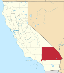
 Location in San Bernardino County and the state of California | |
 Bluewater Location in the United States | |
| Coordinates: 34°10′49″N 114°15′2″W / 34.18028°N 114.25056°WCoordinates: 34°10′49″N 114°15′2″W / 34.18028°N 114.25056°W | |
| Country |
|
| State |
|
| County | San Bernardino |
| Area[1] | |
| • Total | 1.34 sq mi (3.48 km2) |
| • Land | 0.89 sq mi (2.31 km2) |
| • Water | 0.45 sq mi (1.17 km2) 33.58% |
| Elevation | 367 ft (112 m) |
| Population (2010) | |
| • Total | 1,253 |
| • Estimate (2016)[2] | N/A |
| Time zone | UTC-8 (PST) |
| • Summer (DST) | UTC-7 (PDT) |
| ZIP code | 92363 |
| Area codes | 442/760 |
| FIPS code | 06-07172 |
| GNIS feature ID | 1867001 |
Bluewater is a census-designated place (CDP) in San Bernardino County, California, United States. The population was 172 at the 2010 census, down from 265 at the 2000 census.
Geography
Bluewater is located at 34°10′49″N 114°15′2″W / 34.18028°N 114.25056°W (34.180214, -114.250531).[3]
According to the United States Census Bureau, the CDP has a total area of 1.3 square miles (3.4 km2). 0.9 square miles (2.3 km2) of it is land and 0.5 square miles (1.3 km2) of it (33.58%) is water.
Climate
This area has a large amount of sunshine year round due to its stable descending air and high pressure. According to the Köppen Climate Classification system, Bluewater has a mild desert climate, abbreviated "Bwh" on climate maps.[4]
Demographics
| Historical population | |||
|---|---|---|---|
| Census | Pop. | %± | |
| U.S. Decennial Census[5] | |||
2010
The 2010 United States Census[6] reported that Bluewater had a population of 172. The population density was 128.1 people per square mile (49.5/km²). The racial makeup of Bluewater was 156 (90.7%) White (89.5% Non-Hispanic White),[7] 2 (1.2%) African American, 1 (0.6%) Native American, 0 (0.0%) Asian, 1 (0.6%) Pacific Islander, 9 (5.2%) from other races, and 3 (1.7%) from two or more races. Hispanic or Latino of any race were 11 persons (6.4%).
The Census reported that 172 people (100% of the population) lived in households, 0 (0%) lived in non-institutionalized group quarters, and 0 (0%) were institutionalized.
There were 112 households, out of which 5 (4.5%) had children under the age of 18 living in them, 36 (32.1%) were opposite-sex married couples living together, 4 (3.6%) had a female householder with no husband present, 3 (2.7%) had a male householder with no wife present. There were 6 (5.4%) unmarried opposite-sex partnerships, and 0 (0%) same-sex married couples or partnerships. 61 households (54.5%) were made up of individuals and 41 (36.6%) had someone living alone who was 65 years of age or older. The average household size was 1.54. There were 43 families (38.4% of all households); the average family size was 2.12.
The population was spread out with 8 people (4.7%) under the age of 18, 1 people (0.6%) aged 18 to 24, 9 people (5.2%) aged 25 to 44, 47 people (27.3%) aged 45 to 64, and 107 people (62.2%) who were 65 years of age or older. The median age was 70.4 years. For every 100 females, there were 107.2 males. For every 100 females age 18 and over, there were 102.5 males.
There were 592 housing units at an average density of 440.8 per square mile (170.2/km²), of which 104 (92.9%) were owner-occupied, and 8 (7.1%) were occupied by renters. The homeowner vacancy rate was 9.6%; the rental vacancy rate was 42.9%. 158 people (91.9% of the population) lived in owner-occupied housing units and 14 people (8.1%) lived in rental housing units.
According to the 2010 United States Census, Bluewater had a median household income of $37,875, with 4.1% of the population living below the federal poverty line.[8]
2000
As of the census[9] of 2000, there were 265 people, 158 households, and 85 families residing in the CDP. The population density was 290.4 inhabitants per square mile (112.4/km²). There were 644 housing units at an average density of 705.7 per square mile (273.2/km²). The racial makeup of the CDP was 98.1% White, 0.4% African American, 0.4% Native American, 1.1% from other races. Hispanic or Latino of any race were 1.5% of the population.
There were 158 households out of which 5.7% had children under the age of 18 living with them, 48.7% were married couples living together, 3.8% had a female householder with no husband present, and 45.6% were non-families. 41.8% of all households were made up of individuals and 29.1% had someone living alone who was 65 years of age or older. The average household size was 1.68 and the average family size was 2.16.
In the CDP, the population was spread out with 7.2% under the age of 18, 8.7% from 25 to 44, 27.5% from 45 to 64, and 56.6% who were 65 years of age or older. The median age was 67 years. For every 100 females, there were 96.3 males. For every 100 females age 18 and over, there were 95.2 males.
The median income for a household in the CDP was $18,750, and the median income for a family was $25,000. Males had a median income of $27,083 versus $17,250 for females. The per capita income for the CDP was $15,142. About 21.0% of families and 18.6% of the population were below the poverty line, including 73.3% of those under the age of eighteen and 2.8% of those sixty five or over.
Government
In the California State Legislature, Bluewater is in the 16th Senate District, represented by Republican Jean Fuller, and in the 33rd Assembly District, represented by Republican Jay Obernolte.[10]
In the United States House of Representatives, Bluewater is in California's 8th congressional district, represented by Republican Paul Cook.[11]
References
- ↑ "2016 U.S. Gazetteer Files". United States Census Bureau. Retrieved Jul 19, 2017.
- ↑ "Population and Housing Unit Estimates". Retrieved June 9, 2017.
- ↑ "US Gazetteer files: 2010, 2000, and 1990". United States Census Bureau. 2011-02-12. Retrieved 2011-04-23.
- ↑ Climate Summary for Bluewater, California
- ↑ "Census of Population and Housing". Census.gov. Retrieved June 4, 2016.
- ↑ "2010 Census Interactive Population Search: CA - Bluewater CDP". U.S. Census Bureau. Retrieved July 12, 2014.
- ↑ http://factfinder2.census.gov/faces/tableservices/jsf/pages/productview.xhtml?pid=DEC_10_DP_DPDP1. Missing or empty
|title=(help) - ↑ http://factfinder2.census.gov/faces/nav/jsf/pages/community_facts.xhtml#none. Missing or empty
|title=(help) - ↑ "American FactFinder". United States Census Bureau. Archived from the original on 2013-09-11. Retrieved 2008-01-31.
- ↑ "Statewide Database". Regents of the University of California. Retrieved April 6, 2015.
- ↑ "California's 8th Congressional District - Representatives & District Map". Civic Impulse, LLC.