Rocklin, California
| Rocklin, California | |
|---|---|
| City | |
| City of Rocklin | |
 Amtrak station and Chamber of Commerce, Rocklin | |
| Motto(s): "A Family Community"[1] | |
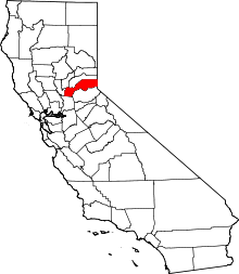
 Location in Placer County and the state of California | |
 Rocklin, California Location in the United States | |
| Coordinates: 38°48′0″N 121°14′48″W / 38.80000°N 121.24667°WCoordinates: 38°48′0″N 121°14′48″W / 38.80000°N 121.24667°W | |
| Country |
|
| State |
|
| County |
|
| Incorporated | February 24, 1893[2] |
| Government | |
| • Type | Council-manager system |
| • Mayor | Ken Broadway (I) |
| • State Senate | Ted Gaines (R) |
| • State Assembly | Kevin Kiley (R) |
| • U. S. Congress | Tom McClintock (R)[3] |
| Area[4] | |
| • Total | 19.60 sq mi (50.76 km2) |
| • Land | 19.55 sq mi (50.62 km2) |
| • Water | 0.05 sq mi (0.14 km2) 0.27% |
| Elevation | 249 ft (79 m) |
| Population (2010) | |
| • Total | 56,974 |
| • Estimate (2016)[5] | 62,787 |
| • Density | 3,212.43/sq mi (1,240.34/km2) |
| Demonym(s) | Rocklinite |
| Time zone | UTC-8 (PST) |
| • Summer (DST) | UTC-7 (PDT) |
| ZIP codes | 95677, 95765 |
| Area code(s) | 916 |
| FIPS code | 06-62364 |
| GNIS feature ID | 0277586 |
| Website |
www |
Rocklin is a city in Placer County, California located approximately 22 miles (35 km) from Sacramento, California, and about 6.1 miles (9.8 km) northeast of Roseville in the Sacramento metropolitan area. Besides Roseville, it shares borders with Granite Bay, Loomis and Lincoln. As of the 2010 census, Rocklin's population was 56,974.
History
Prior to the California Gold Rush the Nisenan Maidu occupied both permanent villages and temporary summer shelters along the rivers and streams which miners sifted, sluiced, dredged and dammed to remove the gold.[6] Explorer Jedediah Smith and a large party of American fur trappers crossed the Sacramento Valley in late April, 1827. The group saw many Maidu villages along the river banks.[6] Deprived of traditional foodstuffs, homesites and hunting grounds by the emigrants, the Nisenan were among the earliest California Indian tribes to disappear.[6]
During the 1850s, miners sluiced streams and rivers including Secret Ravine which runs through Rocklin. The piles of dredger tailings is still obvious today, between Roseville and Loomis southeast of Interstate 80.[7] Secret Ravine at the area now at the intersection of Ruhkala Road and Pacific Street was later mined for granite, some of which was used as the base course of the California Capitol Building in Sacramento, although the earliest recorded use of the rock was for Fort Mason at San Francisco in 1855.[8] The granite was hauled out by ox carts before the arrival of the railroad many years later.[8]
In 1860, the U.S. Census counted 440 residents in the area of Secret Ravine, of which approximately 16% had been born in Ireland and the majority of whom worked as miners.[9] The area was referred to as Secret Ravine or the "granite quarries at the end of the tracks" as late as 1864.[9]
Rocklin's history is closely tied to the transcontinental railroad. In 1862, the Pacific Railroad Act granted the Central Pacific Railroad land near Secret Ravine.[9] In 1864, the Central Pacific Railroad completed an extension of its track southwest from Newcastle to Secret Ravine. It named the area Rocklin after its granite quarry, and used the site as a refueling and water stop. The Central Pacific built a roundhouse in 1867.[10] The transcontinental railroad was completed in 1869, significantly increasing railroad traffic through the town. According to the 1870 census, Rocklin had grown to 542 residents,[11] and the majority of Irish immigrants had foregone mining and were working for the railroad.[9] In 1906 the Central Pacific moved its facility from Rocklin to Roseville, where more land was available for expansion.[10] The site in Roseville has remained in continuous use since. As of August 2014, it is the largest rail facility near the US West Coast.[12]
In 1869 a group of laid-off Chinese railroad workers moved to Secret Ravine to mine and raise vegetables which they sold locally. They were driven out during the anti-Chinese pogrom of September 1876, but the area is still known as China Gardens.[8]
The Rocklin post office opened in 1868.[13] Finnish immigrants settled in Rocklin starting in the 1870s, and Spanish settlers arriving by way of Hawaii settled in Rocklin during the early 20th Century.[9] The town incorporated in 1893.[13]
Geography
According to the United States Census Bureau, the city has a total area of 19.6 square miles (51 km2), of which 0.05 square miles (0.13 km2), or 0.27%, is water.
Climate
Rocklin has a hot-summer Mediterranean climate (Köppen Csa) that is characterized by cool, wet winters and hot, dry summers. Summer months are hot, with an average July high of 94 °F (34 °C) and rainless for the most part. Winter months, on the other hand, are cool with a December average of 47 °F (8 °C) and give way to plenty of rain. Rocklin very rarely sees any snow accumulation.
| Climate data for Rocklin, California | |||||||||||||
|---|---|---|---|---|---|---|---|---|---|---|---|---|---|
| Month | Jan | Feb | Mar | Apr | May | Jun | Jul | Aug | Sep | Oct | Nov | Dec | Year |
| Record high °F (°C) | 75 (24) |
78 (26) |
86 (30) |
98 (37) |
107 (42) |
110 (43) |
115 (46) |
110 (43) |
111 (44) |
102 (39) |
87 (31) |
76 (24) |
115 (46) |
| Average high °F (°C) | 53 (12) |
60 (16) |
64 (18) |
71 (22) |
80 (27) |
88 (31) |
94 (34) |
92 (33) |
87 (31) |
77 (25) |
63 (17) |
54 (12) |
74 (23) |
| Daily mean °F (°C) | 46 (8) |
51 (11) |
54 (12) |
60 (16) |
66 (19) |
73 (23) |
78 (26) |
76 (24) |
73 (23) |
65 (18) |
54 (12) |
47 (8) |
62 (17) |
| Average low °F (°C) | 39 (4) |
42 (6) |
44 (7) |
48 (9) |
53 (12) |
58 (14) |
61 (16) |
61 (16) |
58 (14) |
52 (11) |
44 (7) |
39 (4) |
50 (10) |
| Record low °F (°C) | 21 (−6) |
23 (−5) |
27 (−3) |
33 (1) |
36 (2) |
43 (6) |
48 (9) |
46 (8) |
41 (5) |
31 (−1) |
27 (−3) |
16 (−9) |
16 (−9) |
| Average precipitation inches (mm) | 3.98 (101.1) |
3.46 (87.9) |
3.07 (78) |
1.58 (40.1) |
0.58 (14.7) |
0.12 (3) |
0.04 (1) |
0.06 (1.5) |
0.35 (8.9) |
1.08 (27.4) |
2.80 (71.1) |
3.33 (84.6) |
20.45 (519.3) |
| Average snowfall inches (cm) | 0.2 (0.5) |
0 (0) |
0 (0) |
0 (0) |
0 (0) |
0 (0) |
0 (0) |
0 (0) |
0 (0) |
0 (0) |
0 (0) |
0 (0) |
0.2 (0.5) |
| Source: http://www.myforecast.com/bin/climate.m?city=12122&metric=false | |||||||||||||
Demographics
| Historical population | |||
|---|---|---|---|
| Census | Pop. | %± | |
| 1870 | 542 | — | |
| 1880 | 624 | 15.1% | |
| 1890 | 1,056 | 69.2% | |
| 1900 | 1,050 | −0.6% | |
| 1910 | 1,026 | −2.3% | |
| 1920 | 643 | −37.3% | |
| 1930 | 724 | 12.6% | |
| 1940 | 795 | 9.8% | |
| 1950 | 1,155 | 45.3% | |
| 1960 | 1,495 | 29.4% | |
| 1970 | 3,039 | 103.3% | |
| 1980 | 7,344 | 141.7% | |
| 1990 | 19,033 | 159.2% | |
| 2000 | 36,330 | 90.9% | |
| 2010 | 56,974 | 56.8% | |
| Est. 2016 | 62,787 | [5] | 10.2% |
| U.S. Decennial Census[14] | |||
2010
The 2010 United States Census[15] reported that Rocklin had a population of 56,974. The population density was 2,907.7 people per square mile (1,122.7/km²). The racial makeup of Rocklin was 47,047 (82.6%) White, 858 (1.5%) African American, 410 (0.7%) Native American, 4,105 (7.2%) Asian, 150 (0.3%) Pacific Islander, 1,538 (2.7%) from other races, and 2,866 (5.0%) from two or more races. Hispanic or Latino of any race were 6,555 persons (11.5%).
The Census reported that 56,337 people (98.9% of the population) lived in households, 456 (0.8%) lived in non-institutionalized group quarters, and 181 (0.3%) were institutionalized.
There were 20,800 households, out of which 8,424 (40.5%) had children under the age of 18 living in them, 11,974 (57.6%) were opposite-sex married couples living together, 2,191 (10.5%) had a female householder with no husband present, 895 (4.3%) had a male householder with no wife present. There were 1,035 (5.0%) unmarried opposite-sex partnerships, and 124 (0.6%) same-sex married couples or partnerships. 4,403 households (21.2%) were made up of individuals and 1,652 (7.9%) had someone living alone who was 65 years of age or older. The average household size was 2.71. There were 15,060 families (72.4% of all households); the average family size was 3.18.
The population was spread out with 15,613 people (27.4%) under the age of 18, 5,306 people (9.3%) aged 18 to 24, 15,159 people (26.6%) aged 25 to 44, 14,668 people (25.7%) aged 45 to 64, and 6,228 people (10.9%) who were 65 years of age or older. The median age was 36.7 years. For every 100 females, there were 94.0 males. For every 100 females age 18 and over, there were 90.4 males.
There were 22,010 housing units at an average density of 1,123.3 per square mile (433.7/km²), of which 13,797 (66.3%) were owner-occupied, and 7,003 (33.7%) were occupied by renters. The homeowner vacancy rate was 2.5%; the rental vacancy rate was 7.3%. 39,295 people (69.0% of the population) lived in owner-occupied housing units and 17,042 people (29.9%) lived in rental housing units.
2000
As of the census[16] of 2000, there were 36,330 people, 13,258 households, and 10,009 families residing in the city. The population density was 2,246.2 people per square mile (867.5/km²). There were 14,421 housing units at an average density of 891.6 per square mile (344.3/km²). The racial makeup of the city was 88.32% White, 0.91% African American, 0.80% Native American, 4.16% Asian, 0.19% Pacific Islander, 1.93% from other races, and 3.69% from two or more races. Hispanic or Latino of any race were 7.91% of the population. 16.8% were of German, 11.8% English, 10.6% Irish, 8.1% Italian and 6.5% American ancestry according to Census 2000.
There were 13,258 households out of which 42.6% had children under the age of 18 living with them, 62.3% were married couples living together, 9.4% had a female householder with no husband present, and 24.5% were non-families. 18.7% of all households were made up of individuals and 6.3% had someone living alone who was 65 years of age or older. The average household size was 2.74 and the average family size was 3.15.
In the city, the population was spread out with 30.0% under the age of 18, 7.0% from 18 to 24, 33.7% from 25 to 44, 20.8% from 45 to 64, and 8.6% who were 65 years of age or older. The median age was 34 years. For every 100 females, there were 95.6 males. For every 100 females age 18 and over, there were 92.6 males.
The median income for a household in the city was $79,274, according to the City of Rocklin website.[17] Males had a median income of $54,426 versus $35,920 for females. The per capita income for the city was $26,910. About 3.1% of families and 4.5% of the population were below the poverty line, including 4.3% of those under age 18 and 3.5% of those age 65 or over.
Economy
Granite mining ended in 2004 in Rocklin.[9] Now, top Rocklin employers include large multinational corporations, retail outlets, education and government. As of April 2016, Rocklin had an estimated civilian work force of 30,100 with an unemployment rate of 4.4%. Approximately 40% of Rocklin citizens over age 25 hold a bachelor's degree or higher.[18]
Shopping, entertainment and dining can be found in the Blue Oaks Town Center, a regional shopping center anchored by national tenants, located on the Highway 65 corridor,[19] as well as Rocklin Commons and Rocklin Crossings along Interstate 80. There is a section of Granite Drive along Interstate 80 known as Toy Row, with high-end auto dealerships, RV and Boat retailers, and there is also a local antique mall. Rocklin Hacker Lab[20] is a collaboration between Hacker Lab and Sierra College.[21] It is an incubator, co-working, hacker and maker space with classes and meetups daily.
The city has four districts with distinct architectural guidelines:[22] The University District, Granite District, College District, Quarry District. Each District will ultimately create a unique environmental atmosphere and character, defined geographically based on land use, transportation, and natural features.
Education
The Rocklin area is home to eleven elementary schools, two middle schools, two high schools, two alternative education institutions as well as campuses of Sierra College[23] and William Jessup University.
Infrastructure
Transportation
Interstate 80 and State Route 65 intersect in Rocklin, and historic U.S. Route 40 runs through town. The Rocklin (Amtrak station) is served by the Capitol Corridor and the California Zephyr routes.
Notable people
- Johnny Davis,
- Karyn White, pop singer
- Colby Covington, Professional MMA Fighter
References
- ↑ "City of Rocklin California Website". Retrieved September 14, 2012.
- ↑ "California Cities by Incorporation Date". California Association of Local Agency Formation Commissions. Archived from the original (Word) on October 17, 2013. Retrieved August 25, 2014.
- ↑ "California's 4th Congressional District - Representatives & District Map". Civic Impulse, LLC. Retrieved March 3, 2013.
- ↑ "2016 U.S. Gazetteer Files". United States Census Bureau. Retrieved Jun 28, 2017.
- 1 2 "Population and Housing Unit Estimates". Retrieved June 9, 2017.
- 1 2 3 "Folsom's Unique History". Folsom History Museum. Retrieved February 6, 2014.
- ↑ Introduction to Rocklin History Series
- 1 2 3 Ruhkala, Roy. "History of Rocklin California". Written Histories 1974. The Rocklin Historical Society. Retrieved February 6, 2014.
- 1 2 3 4 5 6 Day, Gary. "Where did "Rocklin" come from?". Rocklin & Roseville Today. Retrieved February 6, 2014.
- 1 2 Day, Gary. "Where did "Rocklin" come from?". Rocklin & Roseville Today. Retrieved August 20, 2014.
- ↑ Harman, Lila. "A History of Rocklin".
- ↑ http://www.up.com/aboutup/facilities/davis/index.htm
- 1 2 Durham, David L. (1998). California's Geographic Names: A Gazetteer of Historic and Modern Names of the State. Clovis, Calif.: Word Dancer Press. p. 547. ISBN 1-884995-14-4.
- ↑ "Census of Population and Housing". Census.gov. Retrieved June 4, 2015.
- ↑ "2010 Census Interactive Population Search: CA - Rocklin city". U.S. Census Bureau. Retrieved July 12, 2014.
- ↑ "American FactFinder". United States Census Bureau. Retrieved 2008-01-31.
- ↑ "Demographics - City of Rocklin". City of Rocklin Website. Retrieved 2017-02-17.
- ↑ "Demographics - City of Rocklin". www.rocklin.ca.us. Retrieved 2017-02-17.
- ↑ "Rocklin Venues". Sacramento Bee. Archived from the original on 21 February 2014. Retrieved 6 February 2014.
- ↑ "Startup Coworking Space | Hacker / Maker & Entrepreneur Community in Sacramento, CA". Hacker Lab. Retrieved 2017-02-17.
- ↑ College, Sierra. "Sierra College: Dream. Learn. Do". Sierra College. Retrieved 2017-02-17.
- ↑ rocklin. "City of Rocklin - Architectural Guidelines". City of Rocklin Architectural Guidelines. Retrieved 2017-02-17.
- ↑ "Rocklin Campus". Sierra College. Retrieved 6 February 2014.
External links
| Wikimedia Commons has media related to Rocklin, California. |
- City of Rocklin official website Portal style website, Government, Business, Library, Recreation and more
- City-Data.com Comprehensive Statistical Data and more about Rocklin
- Secret Ravine Adaptive Management Plan. Dry Creek Conservancy. December 2001.
Places adjacent to Rocklin, California | |
|---|---|