Conejo Valley

The Conejo Valley is a region spanning both southeastern Ventura County and northwestern Los Angeles County in Southern California, United States. It is located in the northwestern part of the Greater Los Angeles Area.
Communities in Conejo Valley are Thousand Oaks, Newbury Park, Westlake Village, Oak Park, Agoura Hills, Lake Sherwood and a portion of Calabasas.[1]
Etymology
In 1803, the Spanish land grant in the area was given the name Rancho El Conejo.
In Spanish, conejo means "rabbit", and refers to the rabbits common to the region,[2] specifically the desert cottontail and brush rabbit species.[3]
History
Pre-colonial history

The first human residents of Conejo valley were the native Chumash people. Notable Chumash villages included Satwiwa ("The Bluffs") in present day Newbury Park, Sap'wi ("House of Deer") in Thousand Oaks, and Hipuk in Westlake Village. While Satwiwa is now home to the Satwiwa Native American Indian Culture Center, Sap'wi is located on land near Chumash Indian Museum in Oakbrook Regional Park. This park is also home to 4-6,000 year old pictographs, which can be observed on docent-led tours.[4] Satwiwa, which was first settled 13,000 years ago,[5] was located at the foothills of Mount Boney, a sacred mountain to the Chumash people.[6][7][8]
Furthermore, two additional Chumash villages were found by today's Ventu Park Road. These had a population of 100-200 in each village, and were settled around 2,000 years ago.[9][10] These former villages, known as Ven-65, Ven-260 and Ven-261, are located on private lands near Ventu Park Road in Newbury Park.[11] A smaller village, known as Yitimasɨh, was located where Wildwood Elementary School is located today.[12][13] Artifacts retrieved in nearby Wildwood Regional Park include shell beads, arrowheads, and stone tools.[14] Lang Ranch was also home to a small Chumash settlement, Šihaw (Ven-632i), which also contains a cave with pictographs.[15]
Later history
Local villagers' first contact with Europeans came in 1770. The Spanish exploratory party led by Gaspar de Portolá, returning from its journey up the coast as far as present-day San Francisco, entered the valley from the northwest. On the outward bound journey, the explorers had traveled up the Los Angeles River, ascended the Grapevine to Castaic Junction, then followed the Santa Clara River back down to the coast. On the return trip, they sought a shorter route to the San Fernando Valley, and were guided by natives up and over today's Conejo Grade. Franciscan missionary Juan Crespi kept a diary of the expedition, and gave Conejo Valley one name that survives today – Triunfo (Spanish for "triumph").[16] Crespi gave the name El triunfo del Dulcísimo Nombre de Jesús (in English: The Triumph of the Sweetest Name of Jesus) to a camping place by a creek – today's Triunfo Canyon Road begins between Thousand Oaks and Westlake Village.
Later, explorer Juan Bautista de Anza used Portolá's shortcut on his way north in 1774, mentioning in his diary a stop at "El Triunfo".[17] On de Anza's second expedition (1775–76), diarist Father Pedro Font referred to "many watering places, like those of El Triunfo and Los Conejos".[18]
Geography

Conejo Valley is a 900-foot (270 m) high valley which occupies 1,884 sq mi (4,880 km2)[19][20] The area is bordered by the San Fernando Valley and the city of Los Angeles to the east, Simi Hills to the north, Las Posas Hills and the Santa Rosa Valley to the northwest, Conejo Mountain (also known as Conejo Hills) and Oxnard Plain to the west, and the Santa Monica Mountains and Malibu to the south, the Westside, and Pacific Ocean beyond it. The valley is located in the Santa Monica Mountains on an elevated area.

Economy
Many high-tech companies, particularly those in biotechnology, including Amgen, Baxter, General Dynamics Corporation, and Rockwell International are prevalent in the area. It also includes many other tech corporations, especially dot com companies and telecommunications like Verizon and Verizon Wireless. It also is home to many healthcare and other various companies like WellPoint, J.D. Power and Associates, Volkswagen, Audi, THQ, SAGE Publications, MacTech and JAFRA Cosmetics.
Media
The Acorn is a local newspaper covering Agoura Hills, Hidden Hills, Oak Park, North Ranch and Calabasas, while Thousand Oaks Acorn covers the cities of Thousand Oaks, Newbury Park and Westlake Village.[21]
Radio
Television
3 KEYT
Plantation
Harold and Edwin Janss purchased ten thousand acres (40 km²) of land of what is now central Thousand Oaks from the heir of John Edwards, who had purchased the land from the de la Guerra heirs (all of the land was originally a portion of the Rancho El Conejo land grant) in 1910. A ranch, named the Janss Conejo Ranch, was utilized as a farm and to raise thoroughbred horses with the Santa Susanna Mountains and Simi Hills framing it. Television Westerns such as The Rifleman, Gunsmoke, and Bonanza were filmed in Janss Conejo between the 1950s and 1960s. It was also used as the filming locations for Disney's Davy Crockett, King of the Wild Frontier and Westward Ho, the Wagons! both starring Fess Parker.
Tourism


In 2013 the Conejo Valley Tourism Improvement District (CVTID) was formed by the cities of Thousand Oaks and Agoura Hills.[23] CVTID is a non-profit corporation that markets Conejo Valley as a Tourist Destination.[24] Conejo Valley's two largest tourist attractions are the Ronald Reagan Presidential Library in Simi Valley and the Santa Monica Mountains National Recreation Area.
Points of interest
- American Radio Archives and Museum, one of the world's largest collections of radio broadcasting.
- Chumash Indian Museum, Native-American museum in Oakbrook Regional Park.
- Conejo Valley Art Museum, art museum at Janss Marketplace in Thousand Oaks.
- Conejo Valley Botanic Garden, 33-acre botanical gardens, directly across from Tarantula Hill.
- Gardens of the World, botanical garden across Thousand Oaks Boulevard from the Thousand Oaks Civic Arts Center.
- Grant R. Brimhall Library, one of the largest libraries in Southern California.[25]
- Joel McCrea Ranch, 19th century ranch at the bottom of the Norwegian Grade. Listed on the U.S. National Register of Historic Places.
- Paramount Ranch, movie ranch in the Santa Monica Mountains of Agoura Hills.[26]
- Pederson House and Water Tower, home built by the Norwegian Colony on the present day campus of California Lutheran University. Ventura County Historic Landmark No. 45 and Thousand Oaks Historical Landmark No. 3.
- Ronald Reagan Presidential Library
- Satwiwa Native American Indian Culture Center, museum at the foothills of Mount Boney in Newbury Park. Operated by the U.S. National Park Service in Santa Monica Mountains National Recreation Area.
- Stagecoach Inn, museum and 19th century hotel in Newbury Park. Listed on the U.S. National Register of Historic Places.
- The Oaks, largest shopping mall in Ventura County.[27][28]
- Wildwood Regional Park, 1,765-acre regional park bordering an additional 1,400 acres.
See also
- Geography of Thousand Oaks, California
References
- ↑ Colantuono, Michael G. (City Attorney) (22 March 2005). "New Housing Legislation (SB 699, SB 1102, SB 1777, AB 2158, AB 2348)" (PDF). City of Calabasas. p. 2. Retrieved 8 May 2014.
...such as those for the Conejo Valley subregion in which the City is located
- ↑ Nelson, Frank (July 6, 2008). "Conejo Oaks: An animal oasis". Los Angeles Times. Retrieved 2009-06-14.
- ↑ City of Thousand Oaks (July 2, 1996), Conservation of the Thousand Oaks General Plan, p. 51, archived from the original (PDF) on June 21, 2010, retrieved 2009-06-14
- ↑ Sprankling, Miriam and Ruthanne Begun (2006). Historical Tour of the Conejo Valley. Newbury Park, CA: Conejo Valley Historical Society. Page 14. ISBN 0-9725233-4-0.
- ↑ Bangs, Ray and Chris Becker (2004). 52 Great Weekend Escapes in Southern California. Globe Pequot. Page 55. ISBN 9780762730834.
- ↑ Riedel, Allen (2008). 100 Classic Hikes in Southern California: San Bernardino National Forest, Angeles National Forest, Santa Lucia Mountains, Big Sur and the Sierras. The Mountaineers Books. Page 118. ISBN 9781594851254.
- ↑ Mallarach, Josep-Maria and Thymio Papayannis (2007). Protected Areas and Spirituality. Island Press. Page 109. ISBN 9782831710235.
- ↑ Riedel, Allen (2011). Best Easy Day Hikes Conejo Valley. Rowman & Littlefield. Page 21. ISBN 9780762765812.
- ↑ Bidwell, Carol A. (1989). The Conejo Valley: Old and New Frontiers. Windsor Publications. Page 13. ISBN 9780897812993.
- ↑ Casey, Lynda (1984). The Story of the Conejo Valley: The Westlake Chumash Indians. Westlake Research Committee. Page 5.
- ↑ Maxwell, Thomas J. (1982). The Temescals of Arroyo Conejo. California Lutheran College. Page 137. Library of Congress Catalog Number 82-072788.
- ↑ Maxwell, Thomas J. (1982). The Temescals of Arroyo Conejo. California Lutheran College. Page 93.
- ↑ Sprankling, Miriam (2002). Discovering the Story of The Conejo Valley. Newbury Park, CA: Conejo Valley Historical Society. Page 9. ISBN 0-9725233-0-8.
- ↑ Palmer, Norma E. (1994). Santa Barbara & Ventura Counties. Automobile Club of Southern California. Page 176. ISBN 9781564131867.
- ↑ Maxwell, Thomas J. (1982). The Temescals of Arroyo Conejo. California Lutheran College. Pages 58-59.
- ↑ Bolton, Herbert E. (1927). Fray Juan Crespi: Missionary Explorer on the Pacific Coast, 1769-1774. HathiTrust Digital Library. p. 267. Retrieved March 2014. Check date values in:
|accessdate=(help) - ↑ Bolton, Herbert E. (1930). Anza's California Expeditions, Volume II. Internet Archive. p. 102. Retrieved March 2014. Check date values in:
|accessdate=(help) - ↑ Bolton, Herbert E. (1930). Anza's California Expeditions, Volume IV. Internet Archive. p. 247. Retrieved March 2014. Check date values in:
|accessdate=(help) - ↑ Tuttle, Tom (1988). Ventura County Companion. EZ Nature Books. Page 13. ISBN 9780945092025.
- ↑ Triem, Judith P. (1985). Ventura County: Land of Good Fortune: An Illustrated History. Windsor Publications. Page 114. ISBN 9780897811569.
- ↑ https://www.toacorn.com/articles/changes-made-at-acorn-newspapers/
- ↑ Baker, Pam and Jim Dunham (2002). Thousand Oaks and Westlake Village. Community Communications, Incorporated. Page 107. ISBN 9781581920611.
- ↑ "Creation of the Conejo Valley Tourism Improvement District". City Manager Staff Report. City of Thousand Oaks. Archived from the original on 2016-05-06. Retrieved 2015-11-11.
- ↑ Conejo Valley Tourism Improvement District, Conejo Valley Tourism Improvement District (CVTID) Public Documents
- ↑ https://www.toacorn.com/articles/catching-up-with-one-of-citys-grandest-architects/
- ↑ https://www.nps.gov/samo/planyourvisit/paramountranch.htm
- ↑ Tuttle, Tom (1988). Ventura County Companion. EZ Nature Books. Page 67. ISBN 9780945092025.
- ↑ http://articles.latimes.com/1992-05-19/business/fi-289_1_recent-signs
External links


Municipalities and communities of Ventura County, California, United States | ||
|---|---|---|
| Cities | 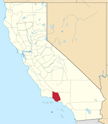 | |
| CDPs | ||
| Unincorporated communities | ||
| Footnotes | ‡This populated place also has portions in an adjacent county or counties | |

Coordinates: 34°21′36″N 119°09′00″W / 34.36000°N 119.15000°W