Anderson, California
| Anderson, California | ||
|---|---|---|
| City in California | ||
| ||
| Nickname(s): City of Opportunity[1] | ||
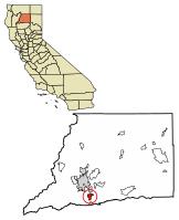 Location of Anderson in Shasta County, California | ||
 Anderson, California Location in the United States | ||
| Coordinates: 40°27′8″N 122°17′48″W / 40.45222°N 122.29667°WCoordinates: 40°27′8″N 122°17′48″W / 40.45222°N 122.29667°W | ||
| Country |
| |
| State |
| |
| County | Shasta | |
| Incorporated | January 16, 1956[2] | |
| Government | ||
| • Type | Council-manager | |
| • City council |
Mayor Baron V. Browning Vice Mayor Norma Comnick Susie Baugh Melissa Hunt Stan Neutze | |
| Area[3] | ||
| • Total | 6.62 sq mi (17.15 km2) | |
| • Land | 6.37 sq mi (16.50 km2) | |
| • Water | 0.25 sq mi (0.64 km2) 3.74% | |
| Elevation | 430 ft (132 m) | |
| Population (2010) | ||
| • Total | 9,932 | |
| • Estimate (2017)[4] | 10,370 | |
| • Density | 1,627.43/sq mi (628.35/km2) | |
| Time zone | UTC-8 (Pacific (PST)) | |
| • Summer (DST) | UTC-7 (PDT) | |
| ZIP code | 96007 | |
| Area code(s) | 530 | |
| FIPS code | 06-02042 | |
| GNIS feature ID | 0277470 | |
| Website | http://ci.anderson.ca.us/ | |

Anderson is a city in Shasta County, California, United States, approximately 10 miles south of Redding. The population was 9,932 at the 2010 census, up from 9,022 at the 2000 census.
The city was named after ranch owner Elias Anderson who granted the Oregon and California Railroad trackage rights and land for a station.[5]
History
Railroad activity came to the area in 1872. Anderson is named after Elias Anderson, who owned the largest land grant in the vicinity. The city's Anderson River Park sits on part of the original land grant owned by Anderson.[6]
Geography
Anderson is located at 40°27′08″N 122°17′48″W / 40.452092°N 122.296560°W.[7]
According to the United States Census Bureau, the city has a total area of 6.6 square miles (17 km2), of which 6.4 square miles (17 km2) of it is land and 0.2 square miles (0.52 km2) of it (3.74%) is water.
Climate
According to the Köppen Climate Classification system, Anderson has a Hot-summer Mediterranean climate, abbreviated "Csa" on climate maps.[8]
Demographics
| Historical population | |||
|---|---|---|---|
| Census | Pop. | %± | |
| 1890 | 508 | — | |
| 1960 | 4,492 | — | |
| 1970 | 5,492 | 22.3% | |
| 1980 | 7,381 | 34.4% | |
| 1990 | 8,299 | 12.4% | |
| 2000 | 9,022 | 8.7% | |
| 2010 | 9,932 | 10.1% | |
| Est. 2017 | 10,370 | [4] | 4.4% |
| U.S. Decennial Census[9] | |||
2010
The 2010 United States Census[10] reported that Anderson had a population of 9,932. The population density was 1,500.3 people per square mile (579.3/km²). The racial makeup of Anderson was 8,273 (83.3%) White, 70 (0.7%) African American, 426 (4.3%) Native American, 256 (2.6%) Asian, 17 (0.2%) Pacific Islander, 353 (3.6%) from other races, and 537 (5.4%) from two or more races. Hispanic or Latino of any race were 1,070 persons (10.8%).
The Census reported that 9,920 people (99.9% of the population) lived in households, 12 (0.1%) lived in non-institutionalized group quarters, and 0 (0%) were institutionalized.
There were 3,944 households, out of which 1,453 (36.8%) had children under the age of 18 living in them, 1,503 (38.1%) were opposite-sex married couples living together, 771 (19.5%) had a female householder with no husband present, 254 (6.4%) had a male householder with no wife present. There were 364 (9.2%) unmarried opposite-sex partnerships, and 25 (0.6%) same-sex married couples or partnerships. 1,163 households (29.5%) were made up of individuals and 490 (12.4%) had someone living alone who was 65 years of age or older. The average household size was 2.52. There were 2,528 families (64.1% of all households); the average family size was 3.07.
The population was spread out with 2,746 people (27.6%) under the age of 18, 934 people (9.4%) aged 18 to 24, 2,565 people (25.8%) aged 25 to 44, 2,420 people (24.4%) aged 45 to 64, and 1,267 people (12.8%) who were 65 years of age or older. The median age was 34.1 years. For every 100 females, there were 87.6 males. For every 100 females age 18 and over, there were 82.2 males.
There were 4,211 housing units at an average density of 636.1 per square mile (245.6/km²), of which 1,888 (47.9%) were owner-occupied, and 2,056 (52.1%) were occupied by renters. The homeowner vacancy rate was 2.8%; the rental vacancy rate was 4.6%. 4,727 people (47.6% of the population) lived in owner-occupied housing units and 5,193 people (52.3%) lived in rental housing units.
2000
As of the census[11] of 2000, there were 9,022 people, 3,372 households, and 2,319 families residing in the city. The population density was 1,412.0 people per square mile (545.1/km²). There were 3,579 housing units at an average density of 560.2 per square mile (216.3/km²). The racial makeup of the city was 86.51% White, 0.62% African American, 4.13% Native American, 1.77% Asian, 0.12% Pacific Islander, 2.33% from other races, and 4.51% from two or more races. Hispanic or Latino of any race were 7.30% of the population.
There were 3,372 households out of which 39.3% had children under the age of 18 living with them, 42.6% were married couples living together, 20.2% had a female householder with no husband present, and 31.2% were non-families. 26.5% of all households were made up of individuals and 12.0% had someone living alone who was 65 years of age or older. The average household size was 2.64 and the average family size was 3.14.
In the city, the population was spread out with 31.6% under the age of 18, 9.2% from 18 to 24, 27.1% from 25 to 44, 18.3% from 45 to 64, and 13.9% who were 65 years of age or older. The median age was 32 years. For every 100 females, there were 87.4 males. For every 100 females age 18 and over, there were 79.6 males.
The median income for a household in the city was $24,558, and the median income for a family was $29,259. Males had a median income of $28,074 versus $20,745 for females. The per capita income for the city was $11,744. About 22.2% of families and 28.3% of the population were below the poverty line, including 43.3% of those under age 18 and 9.5% of those age 65 or over.
According to a 2006 estimate, the population is 10,677. The report by the California Department of Finance lists the annual percentage change population estimate at 1.4%.[12]
In 2007, the population dropped from 10,677 to 10,580.
In areas north of Anderson, 4,036 live in unincorporated urban areas along Highway 273. Another 8,342 live in rural areas, including at least 3,500 people in the communities of Olinda and Happy Valley, which is west of Anderson and southwest of Redding. A total of 21,400 people live in the entire Anderson area, including Olinda, Happy Valley, and some areas south of Churn Creek Bottom.
Politics
In the state legislature Anderson is located in the 1st Senate District, represented by Republican Ted Gaines,[13] and the 1st Assembly District, represented by Republican Brian Dahle.[14]
Federally, Anderson is in California's 1st congressional district, represented by Republican Doug LaMalfa.[15]
Education
- Anderson Union High School
- Oakview High School
- North Valley High School
- Anderson New Technology High School
- Shasta Christian Academy
Recreation
The city is home to Anderson River Park, North Volonte Park, and South Volonte Park. Anderson River Park is located off of Stingy Ln. down Rupert Rd. The park is situated on the Sacramento River. The park consists of athletic fields, picnic areas, fishing access, play structures, and a disc golf course. North Volonte Park is located off South St. on Emily Rd. North Volonte Park is separated from South Volonte Park. North Volonte Park is a developed park which consists of softball and baseball fields. It also has a skate park. South Volonte Park is located behind North Volonte Park. South Volonte Park is wetlands that are outlined by a jogging trail. It also contains exercise equipment.
References
- ↑ "City of Anderson". Retrieved 2018-07-29.
- ↑ "California Cities by Incorporation Date". California Association of Local Agency Formation Commissions. Archived from the original (Word) on November 3, 2014. Retrieved August 25, 2014.
- ↑ "2017 U.S. Gazetteer Files". United States Census Bureau. Retrieved Aug 27, 2018.
- 1 2 "Population and Housing Unit Estimates". Retrieved March 24, 2018.
- ↑ Gudde, Erwin; William Bright (2004). California Place Names (Fourth ed.). University of California Press. p. 12. ISBN 0-520-24217-3.
- ↑ Northern California. Heathrow, Florida: AAA Publishing. 2012. p. 45.
- ↑ "US Gazetteer files: 2010, 2000, and 1990". United States Census Bureau. 2011-02-12. Retrieved 2011-04-23.
- ↑ Climate Summary for Anderson, California
- ↑ "Census of Population and Housing". Census.gov. Archived from the original on May 12, 2015. Retrieved June 4, 2015.
- ↑ "2010 Census Interactive Population Search: CA - Anderson city". U.S. Census Bureau. Retrieved July 12, 2014.
- ↑ "American FactFinder". United States Census Bureau. Archived from the original on 2013-09-11. Retrieved 2008-01-31.
- ↑ State of California, Department of Finance, E-1 Population Estimates for Cities, Counties and State with Annual Percent Change — January 1, 2005 and 2006. Sacramento, California, May 2006.
- ↑ "Senators". State of California. Retrieved March 10, 2013.
- ↑ "Members Assembly". State of California. Retrieved March 2, 2013.
- ↑ "California's 1st Congressional District - Representatives & District Map". Civic Impulse, LLC. Retrieved March 1, 2013.
External links
| Wikivoyage has a travel guide for Anderson, California. |
- Official City Website
- Anderson Union High School District
- Images of Anderson from the Eastman’s Originals Collection, Special Collections Dept., University of California, Davis.
Municipalities and communities of Shasta County, California, United States | ||
|---|---|---|
| Cities | 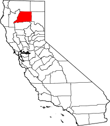 | |
| CDPs | ||
| Unincorporated communities |
| |
| Indian reservations | ||
| Ghost towns |
| |
| Footnotes | ‡This populated place also has portions in an adjacent county or counties | |