Mesquite, Nevada
| Mesquite, Nevada | |
|---|---|
| City | |
| City of Mesquite | |
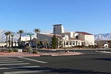
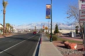 Main Street in January 2007, near City Hall | |
| Motto(s): Escape, Momentarily[1] | |
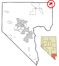 Location of Mesquite in Clark County, Nevada | |
 Mesquite Location in the United States  Mesquite Mesquite (the US) | |
| Coordinates: 36°48′9″N 114°4′56″W / 36.80250°N 114.08222°WCoordinates: 36°48′9″N 114°4′56″W / 36.80250°N 114.08222°W | |
| Country | United States |
| State | Nevada |
| Counties | Clark, Lincoln |
| Settled | 1880 |
| Incorporated | 1984[2] |
| Government | |
| • Mayor | Allan Litman[3] |
| Area | |
| • Total | 32.4 sq mi (83.8 km2) |
| • Land | 31.9 sq mi (82.6 km2) |
| • Water | 0.5 sq mi (1.2 km2) |
| Elevation | 1,601 ft (488 m) |
| Population (2010)[4] | |
| • Total | 15,276 |
| • Estimate (July 1, 2017)[5] | 18,541 |
| • Density | 470/sq mi (180/km2) |
| Time zone | UTC−8 (PST) |
| • Summer (DST) | UTC−7 (PDT) |
| ZIP codes | 89024, 89027, 89034 |
| Area code(s) | 702 |
| FIPS code | 32-46000 |
| GNIS feature ID | 0842060 |
| Website |
www |
Mesquite is a U.S. city in Clark County, Nevada, adjacent to the Arizona state line and 80 miles (130 km) northeast of Las Vegas on Interstate 15. As of July 1, 2017, the United States Census estimates that the city had a population of 18,541.[6] The city is located in the Virgin River valley adjacent to the Virgin Mountains in the northeastern part of the Mojave Desert. It is home to a growing retirement community, as well as several casino resorts and golf courses.
History
Mesquite was settled by Mormon pioneers in 1880, who called it Mesquite Flat. The community was finally established on the third attempt after having been flooded out from the waters of the Virgin River. The name was later shortened to Mesquite, and the city was incorporated by Thelma Davis[7] in May 1984. The community was named for the mesquite timber near the original town site.[8] Mesquite, like nearby Bunkerville, had its origins in farming. The Peppermill Mesquite casino, which opened in the 1970s, drove Mesquite's diversified economy. The city incorporated in 1984 and established a master development plan during the early 1990s.[2] In the mid-1990s, more casinos opened.[9] By 2006, Mesquite was one of the fastest-growing small towns in the United States, though the late-2000s recession led to the closure of both the Mesquite Star and Oasis (formerly The Peppermill) casinos.[2]
Geography
Mesquite occupies the northeast corner of Clark County and extends north into the southeast corner of Lincoln County. The eastern border of the city is the Arizona state line. The city is in the Virgin River valley, occupying the northern side of the river. The city lies adjacent to the Virgin Mountains in the northeastern Mojave Desert near the southern mouth of the Virgin River Gorge.
Interstate 15 passes through the city, leading southwest 80 miles (130 km) to downtown Las Vegas and northeast 39 miles (63 km) to St. George, Utah. Nevada State Route 170 leads south from the center of town, crossing the Virgin River into the unincorporated community of Bunkerville before looping back to I-15 at the western city limits of Mesquite.
According to the U.S. Census Bureau, the city of Mesquite has a total area of 32.4 square miles (83.8 km2), of which 31.9 square miles (82.6 km2) is land and 0.46 square miles (1.2 km2), or 1.40%, is water.[10]
Demographics
| Historical population | |||
|---|---|---|---|
| Census | Pop. | %± | |
| 1990 | 1,871 | — | |
| 2000 | 9,389 | 401.8% | |
| 2010 | 15,276 | 62.7% | |
| Est. 2016 | 17,987 | [5] | 17.7% |
| U.S. Decennial Census[11] | |||
As of the census[12] of 2010, there were 15,276 people, 8,911 houses, 6,378 Houses occupied, and 4,444 families residing in the city. The population density was 613.3 per square mile (236.8/km²) in the year 2000. There were 4,442 housing units at an average density of 290.1 per square mile (112.0/km²). The racial makeup of the city was 80.30% White, 1.27% Asian, 0.98% Native American, 0.65% African American, 0.07% Pacific Islander, 14.56% from other races, and 2.17% from two or more races. Hispanic or Latino of any race were 24.75% of the population. There were 3,498 households out of which 28.7% had children under the age of 18 living with them, 62.8% were married couples living together, 7.2% had a female householder with no husband present, and 26.5% were non-families. Of all households, 20.4% were made up of individuals and 7.4% had someone living alone who was 65 years of age or older. The average household size was 2.66 and the average family size was 3.08.
In the city, the population was spread out with 25.6% under the age of 18, 7.7% from 18 to 24, 22.8% from 25 to 44, 27.3% from 45 to 64, and 16.6% who were 65 years of age or older. The median age was 40 years. For every 100 females, there were 103.8 males. For every 100 females age 18 and over, there were 104.0 males. The median income for a household in the city was $40,392, and the median income for a family was $42,941. Males had a median income of $27,083 versus $24,402 for females. The per capita income for the city was $20,191. About 6.2% of families and 10.2% of the population were below the poverty line, including 18.3% of those under age 18 and 6.0% of those age 65 or over.
Education
The city of Mesquite is a part of the Clark County School District. There are four public schools in the valley.[13]
| School | Location | Grades |
|---|---|---|
| Virgin Valley Elementary | Mesquite | K–5 |
| Joseph L. Bowler Elementary | Bunkerville | K-5 |
| Charles A. Hughes Middle School | Mesquite | 6–8 |
| Virgin Valley High School | Mesquite | 9–12 |
Sports
Minor professional teams
| Team | Sport | League | Venue (capacity) | Established | Titles |
|---|---|---|---|---|---|
| Mesquite Desert Dogs | Basketball | TBL | Rising Star Sports Ranch (600) | 2018 | 0 |
Climate
Located within the Mojave Desert, Mesquite experiences a desert climate with a large degree of diurnal temperature variation.
| Climate data for Mesquite, NV | |||||||||||||
|---|---|---|---|---|---|---|---|---|---|---|---|---|---|
| Month | Jan | Feb | Mar | Apr | May | Jun | Jul | Aug | Sep | Oct | Nov | Dec | Year |
| Record high °F (°C) | 77 (25) |
84 (29) |
99 (37) |
103 (39) |
115 (46) |
120 (49) |
123 (51) |
118 (48) |
112 (44) |
106 (41) |
90 (32) |
78 (26) |
123 (51) |
| Average high °F (°C) | 62.0 (16.7) |
65.9 (18.8) |
74.1 (23.4) |
82.8 (28.2) |
92.8 (33.8) |
102.1 (38.9) |
107.7 (42.1) |
106.0 (41.1) |
99.7 (37.6) |
86.7 (30.4) |
70.4 (21.3) |
62.4 (16.9) |
84.4 (29.1) |
| Average low °F (°C) | 29.5 (−1.4) |
34.2 (1.2) |
39.6 (4.2) |
47.2 (8.4) |
55.6 (13.1) |
63.4 (17.4) |
70.3 (21.3) |
69.9 (21.1) |
59.7 (15.4) |
48.7 (9.3) |
36.3 (2.4) |
29.7 (−1.3) |
48.7 (9.3) |
| Record low °F (°C) | 2 (−17) |
18 (−8) |
20 (−7) |
28 (−2) |
39 (4) |
45 (7) |
52 (11) |
52 (11) |
44 (7) |
33 (1) |
20 (−7) |
12 (−11) |
2 (−17) |
| Average precipitation inches (mm) | 0.53 (13.5) |
1.09 (27.7) |
0.56 (14.2) |
0.49 (12.4) |
0.04 (1) |
0.10 (2.5) |
0.51 (13) |
0.48 (12.2) |
0.33 (8.4) |
0.64 (16.3) |
0.60 (15.2) |
0.48 (12.2) |
5.85 (148.6) |
| Source: http://www.wrcc.dri.edu/cgi-bin/cliMAIN.pl?nv5085 | |||||||||||||
Media
In 1987, the Virgin Valley's first newspaper, The Desert Echo, began distribution out of a local home on Riverside Road. The Desert Valley Times emerged by 1995, and The Desert Echo merged with The Desert Valley Times in 1998. Around 2000/2001, St. George–based The Spectrum (a Gannett newspaper) bought and distributed The Desert Valley Times.
In 2006, Mesquite Media Group (MMG) was formed. MMG started MesquiteLocalNews.com in early 2006, the community's first daily internet newspaper with current news published daily. In September 2006, MMG started publishing the Mesquite Local News, a weekly print newspaper that is distributed each Thursday. In June 2009, Mesquite Local News was sold to Stephens Media, which owns the Las Vegas Review-Journal as well as numerous other newspapers in Nevada. The Mesquite Local News was later sold to Battle Born Media, LLC in May 2014.
Economy
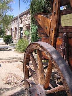
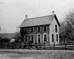
Mesquite is home to several casinos, including the Virgin River Casino, CasaBlanca, Eureka Casino Hotel, and Stateline Casino and Motel. The Virgin Valley Heritage Museum has exhibits about area pioneers and local history. The museum building, built in 1940, is listed in the National Register of Historic Places. Mesquite is a stopping point for those traveling along I-15 between Salt Lake City, Las Vegas, and Los Angeles. Mesquite is also a destination for year-round golf, with over nine public courses in the warm desert climate, it draws golfers from all over. Mesquite Airport provides facilities for general aviation and skydiving.[9] It previously hosted the annual RE/MAX World Long Drive Championship until 2015.
Notable residents and former residents
- Jerry Montgomery, football coach
- William Redd, businessman
- Stephen Paddock, perpetrator of the 2017 Las Vegas shooting
References
- ↑ Staff Writer. "Visit Mesquite, Nevada: Official Site".
- 1 2 3 Ann O'Neill (August 21, 2011). "Deaths reveal a small town's mean streak". CNN. Retrieved 2011-08-21.
- ↑ http://www.mesquitenv.gov/city-government/mayor-city-council/allan-litman
- ↑ "Annual Estimates of the Resident Population: April 1, 2010 to July 1, 2013 (PEPANNRES): Nevada". U.S. Census Bureau, American Factfinder. Retrieved October 16, 2014.
- 1 2 "Population and Housing Unit Estimates". Retrieved June 9, 2017.
- ↑ https://www.census.gov/quickfacts/fact/table/mesquitecitynevada,US/PST045217
- ↑ Mesquite Magazine pg 17,18
- ↑ Federal Writers' Project (1941). Origin of Place Names: Nevada (PDF). W.P.A. p. 16.
- 1 2 Staff Writer. "Mesquite, Nevada history". Archived from the original on 25 September 2010. Retrieved 22 May 2010.
- ↑ "Geographic Identifiers: 2010 Demographic Profile Data (G001): Mesquite city, Nevada". U.S. Census Bureau, American Factfinder. Retrieved October 16, 2014.
- ↑ "Census of Population and Housing". Census.gov. Retrieved June 4, 2015.
- ↑ "American FactFinder". United States Census Bureau. Retrieved 2015-03-18.
- ↑ "2014-2015 CCSD zoning map" (PDF). CCSD.net.
External links
| Wikimedia Commons has media related to Mesquite, Nevada. |
- City of Mesquite official website
- Official State of Nevada Tourism site
- Mesquite Chamber of Commerce
Places adjacent to Mesquite, Nevada | |
|---|---|
Municipalities and communities of Clark County, Nevada, United States | ||
|---|---|---|
| Cities | 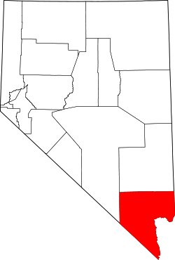 | |
| CDPs | ||
| Unincorporated communities | ||
| Township | ||
| Ghost towns | ||
| Indian reservations | ||
| Footnotes | ‡This populated place also has portions in an adjacent county or counties | |
Municipalities and communities of Lincoln County, Nevada, United States | ||
|---|---|---|
| Cities | 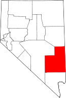 | |
| CDPs | ||
| Other unincorporated communities | ||
| Ghost towns | ||
| Footnotes | ‡This populated place also has portions in an adjacent county or counties | |