Storey County, Nevada
| Storey County, Nevada | |
|---|---|
| County | |
| Storey County | |
 Storey County Courthouse, Virginia City | |
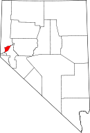 Location in the U.S. state of Nevada | |
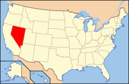 Nevada's location in the U.S. | |
| Founded | 1861 |
| Named for | Edward Farris Storey |
| Seat | Virginia City |
| Largest community | Virginia City |
| Area | |
| • Total | 264 sq mi (684 km2) |
| • Land | 263 sq mi (681 km2) |
| • Water | 0.7 sq mi (2 km2), 0.3% |
| Population (est.) | |
| • (2015) | 3,987 |
| • Density | 15/sq mi (6/km2) |
| Congressional district | 2nd |
| Time zone | Pacific: UTC−8/−7 |
| Website |
storeycounty |
Storey County is a county located in the U.S. state of Nevada. As of the 2010 census, the population was 4,010,[1] making it the third-least populous county in Nevada. Its county seat is Virginia City.[2]
Storey County is part of the Reno, NV Metropolitan Statistical Area.
History
Storey County was created in 1861 and named for Captain Edward Farris Storey, who was killed in 1860 in the Pyramid Lake War. It was the most populous county in Nevada when organized in 1861. Virginia City is the county seat. It was originally to be named McClellan County after General George B. McClellan, who later ran unsuccessfully against Abraham Lincoln for President in the 1864 election. Storey County benefited from the discovery of Comstock Lode silver.
In 1969, the actor Dick Simmons played W. Frank Stewart, a silver mining operator who served from 1876 to 1880 as a state senator for Storey County,[3] in the episode "How to Beat a Badman" of the syndicated television series, Death Valley Days, hosted by Robert Taylor not long before Taylor's own death. In the story line, Senator Stewart is determined to gain at a bargain price a silver claim being worked by two young former outlaws (Tom Heaton and Scott Graham).[4]
The county population collapsed after the Comstock Lode was fully mined and hit a minimum of 568 in the 1960 U.S. Census. Since then, its population has partially recovered because of its relative proximity to Reno.
Today, Storey County is known for its legal prostitution and Tesla's Gigafactory 1. In the 2006 election, Storey became the only county to vote in support of Question 7, a statewide ballot initiative sponsored by the Marijuana Policy Project to tax and regulate marijuana as if it were alcohol.
Geography
According to the U.S. Census Bureau, the county has a total area of 264 square miles (680 km2), of which 263 square miles (680 km2) is land and 0.7 square miles (1.8 km2) (0.3%) is water.[5]
Major highways
Adjacent counties and city
- Washoe County - north
- Lyon County - southeast
- Carson City - southwest
Demographics
| Historical population | |||
|---|---|---|---|
| Census | Pop. | %± | |
| 1870 | 11,359 | — | |
| 1880 | 16,115 | 41.9% | |
| 1890 | 8,806 | −45.4% | |
| 1900 | 3,673 | −58.3% | |
| 1910 | 3,045 | −17.1% | |
| 1920 | 1,469 | −51.8% | |
| 1930 | 667 | −54.6% | |
| 1940 | 1,216 | 82.3% | |
| 1950 | 671 | −44.8% | |
| 1960 | 568 | −15.4% | |
| 1970 | 695 | 22.4% | |
| 1980 | 1,503 | 116.3% | |
| 1990 | 2,526 | 68.1% | |
| 2000 | 3,399 | 34.6% | |
| 2010 | 4,010 | 18.0% | |
| Est. 2016 | 4,051 | [6] | 1.0% |
| U.S. Decennial Census[7] 1790-1960[8] 1900-1990[9] 1990-2000[10] 2010-2013[1] | |||
2000 census
As of the census[11] of 2000, there were 3,399 people, 1,462 households, and 969 families residing in the county. The population density was 13 people per square mile (5/km²). There were 1,596 housing units at an average density of 6 per square mile (2/km²). The racial makeup of the county was 93.00% White, 0.29% Black or African American, 1.44% Native American, 1.00% Asian, 0.15% Pacific Islander, 1.68% from other races, and 2.44% from two or more races. 5.12% of the population were Hispanic or Latino of any race.
Of the 1,462 households, 21.80% had children under the age of 18 living with them, 54.60% were married couples living together, 7.50% had a female householder with no husband present, and 33.70% were non-families. 25.60% of all households were made up of individuals and 6.90% had someone living alone who was 65 years of age or older. The average household size was 2.32 and the average family size was 2.74.
In the county, 19.70% of the population was under the age of 18, 4.70% from 18 to 24, 26.80% from 25 to 44, 35.70% from 45 to 64, and 13.10% who were 65 years of age or older. The median age was 44 years. For every 100 females, there were 107.60 males. For every 100 females age 18 and over, there were 103.10 males.
The median income for a household in the county was $45,490, and the median income for a family was $57,095. Males had a median income of $40,123 versus $26,417 for females. The per capita income for the county was $23,642. 5.80% of the population and 2.50% of families were below the poverty line. Out of the total people living in poverty, 4.20% are under the age of 18 and 4.80% are 65 or older.
2010 census
As of the 2010 United States Census, there were 4,010 people, 1,742 households, and 1,141 families residing in the county.[12] The population density was 15.3 inhabitants per square mile (5.9/km2). There were 1,990 housing units at an average density of 7.6 per square mile (2.9/km2).[13] The racial makeup of the county was 92.1% white, 1.6% Asian, 1.6% American Indian, 1.0% black or African American, 0.4% Pacific islander, 1.1% from other races, and 2.2% from two or more races. Those of Hispanic or Latino origin made up 5.7% of the population.[12] In terms of ancestry, 20.9% were German, 20.1% were Irish, 11.5% were English, 7.2% were Italian, and 2.6% were American.[14]
Of the 1,742 households, 23.1% had children under the age of 18 living with them, 53.6% were married couples living together, 7.6% had a female householder with no husband present, 34.5% were non-families, and 26.0% of all households were made up of individuals. The average household size was 2.30 and the average family size was 2.76. The median age was 50.5 years.[12]
The median income for a household in the county was $61,525 and the median income for a family was $65,121. Males had a median income of $53,936 versus $34,208 for females. The per capita income for the county was $31,079. About 0.4% of families and 5.6% of the population were below the poverty line, including 2.6% of those under age 18 and 0.0% of those age 65 or over.[15]
Communities
There are no incorporated communities in Storey County.
Economy
Politics
Storey County leans towards the Republican Party, with it voting for every Republican since 1976, with the exception being in 1992, when it voted for Independent Ross Perot.
| Year | Republican | Democratic | Third parties |
|---|---|---|---|
| 2016 | 63.2% 1,616 | 29.4% 752 | 7.4% 190 |
| 2012 | 57.1% 1,321 | 39.8% 920 | 3.2% 73 |
| 2008 | 51.6% 1,247 | 45.6% 1,102 | 2.9% 69 |
| 2004 | 57.8% 1,253 | 40.2% 871 | 2.0% 44 |
| 2000 | 56.4% 1,014 | 37.0% 666 | 6.6% 118 |
| 1996 | 42.6% 705 | 37.1% 614 | 20.3% 336 |
| 1992 | 30.2% 458 | 32.1% 488 | 37.7% 573 |
| 1988 | 56.4% 651 | 37.4% 432 | 6.2% 72 |
| 1984 | 66.7% 570 | 29.5% 252 | 3.8% 32 |
| 1980 | 58.8% 460 | 28.4% 222 | 12.9% 101 |
| 1976 | 43.1% 274 | 48.7% 310 | 8.2% 52 |
| 1972 | 69.2% 508 | 30.8% 226 | |
| 1968 | 50.0% 222 | 38.7% 172 | 11.3% 50 |
| 1964 | 39.7% 172 | 60.3% 261 | |
| 1960 | 54.9% 203 | 45.1% 167 | |
| 1956 | 60.1% 226 | 39.9% 150 | |
| 1952 | 58.0% 206 | 42.0% 149 | |
| 1948 | 48.2% 187 | 47.4% 184 | 4.4% 17 |
| 1944 | 48.5% 163 | 51.5% 173 | |
| 1940 | 37.0% 224 | 63.0% 382 | |
| 1936 | 26.2% 139 | 73.8% 392 | |
| 1932 | 33.4% 124 | 66.6% 247 | |
| 1928 | 40.6% 185 | 59.4% 271 | |
| 1924 | 37.2% 283 | 27.5% 209 | 35.4% 269 |
| 1920 | 52.5% 324 | 44.1% 272 | 3.4% 21 |
| 1916 | 45.8% 403 | 52.6% 463 | 1.6% 14 |
| 1912 | 19.3% 166 | 46.5% 400 | 34.2% 294 |
| 1908 | 48.9% 447 | 43.9% 402 | 7.2% 66 |
| 1904 | 61.5% 627 | 31.6% 322 | 7.0% 71 |
See also
- National Register of Historic Places listings in Storey County, Nevada
- Republic of Molossia – a micronation in southern Storey County
References
- 1 2 "State & County QuickFacts". United States Census Bureau. Retrieved September 23, 2013.
- ↑ "County Explorer". National Association of Counties. Retrieved 2011-06-07.
- ↑ "Nevada legislators, 1861-2015" (PDF). leg.state.nv.us. Retrieved July 15, 2015.
- ↑ "How to Beat a Badman". Internet Movie Data Base. March 18, 1969. Retrieved July 15, 2015.
- ↑ "2010 Census Gazetteer Files". United States Census Bureau. August 22, 2012. Retrieved December 20, 2014.
- ↑ "Population and Housing Unit Estimates". Retrieved June 9, 2017.
- ↑ "U.S. Decennial Census". United States Census Bureau. Retrieved December 20, 2014.
- ↑ "Historical Census Browser". University of Virginia Library. Retrieved December 20, 2014.
- ↑ "Population of Counties by Decennial Census: 1900 to 1990". United States Census Bureau. Retrieved December 20, 2014.
- ↑ "Census 2000 PHC-T-4. Ranking Tables for Counties: 1990 and 2000" (PDF). United States Census Bureau. Retrieved December 20, 2014.
- ↑ "American FactFinder". United States Census Bureau. Retrieved 2008-01-31.
- 1 2 3 "DP-1 Profile of General Population and Housing Characteristics: 2010 Demographic Profile Data". United States Census Bureau. Retrieved 2016-01-21.
- ↑ "Population, Housing Units, Area, and Density: 2010 - County". United States Census Bureau. Retrieved 2016-01-21.
- ↑ "DP02 SELECTED SOCIAL CHARACTERISTICS IN THE UNITED STATES – 2006-2010 American Community Survey 5-Year Estimates". United States Census Bureau. Retrieved 2016-01-21.
- ↑ "DP03 SELECTED ECONOMIC CHARACTERISTICS – 2006-2010 American Community Survey 5-Year Estimates". United States Census Bureau. Retrieved 2016-01-21.
- ↑ Leip, David. "Dave Leip's Atlas of U.S. Presidential Elections". uselectionatlas.org. Retrieved 2018-04-12.
External links
Places adjacent to Storey County, Nevada | ||||||||||
|---|---|---|---|---|---|---|---|---|---|---|
| ||||||||||
Municipalities and communities of Storey County, Nevada, United States | ||
|---|---|---|
| CDP | | |
| Unincorporated community | ||
| Footnotes | ‡This populated place also has portions in adjacent county or counties. | |