Lyon County, Nevada
| Lyon County, Nevada | ||
|---|---|---|
| County | ||
| Lyon County | ||
.jpg) Lyon County Courthouse | ||
| ||
 Location in the U.S. state of Nevada | ||
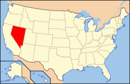 Nevada's location in the U.S. | ||
| Founded | 1861 | |
| Named for | Nathaniel Lyon | |
| Seat | Yerington | |
| Largest city | Fernley | |
| Area | ||
| • Total | 2,024 sq mi (5,242 km2) | |
| • Land | 2,001 sq mi (5,183 km2) | |
| • Water | 23 sq mi (60 km2), 1.1% | |
| Population (est.) | ||
| • (2015) | 52,585 | |
| • Density | 26/sq mi (10/km2) | |
| Congressional districts | 2nd, 4th | |
| Time zone | Pacific: UTC−8/−7 | |
| Website |
lyon-county | |

Lyon County is a county in the U.S. state of Nevada. As of the 2010 census, the population was 51,980.[1] Its county seat is Yerington.[2]
Lyon County includes the Fernley, NV Micropolitan Statistical Area, which is part of the Reno-Carson City-Fernley, NV Combined Statistical Area.
History
Lyon County was one of the nine original counties created on November 25, 1861.[3] It was named after Nathaniel Lyon, the first Union General to be killed in the Civil War.[4] Its first county seat was established at Dayton on November 29, 1861,[5] which had just changed its name from Nevada City in 1862, and which had been called Chinatown before that. After the Dayton Court House burned down in 1909, the seat was moved to Yerington in 1911. There were stories that it was named for Captain Robert Lyon, a survivor of the Pyramid Lake War in 1860, but Nevada State Archives staff discovered a county seal with the picture of the Civil War general, settling the conflict.
Geography
According to the U.S. Census Bureau, the county has a total area of 2,024 square miles (5,240 km2), of which 2,001 square miles (5,180 km2) is land and 23 square miles (60 km2) (1.1%) is water.[6] It is the third-smallest county in Nevada by area. The highest point is approximately 10,565 feet (3,220 m) on the northeast ridge of Middle Sister, the peak of which is located in adjacent Mono County, California, while the highest independent mountain completely within Lyon County is the nearby East Sister. The most topographically prominent peak in Lyon County is Bald Mountain.
Part of the Toiyabe National Forest is located within Lyon County.
Major highways
.svg.png)
.svg.png)


Adjacent counties and city
- Washoe County - north
- Storey County - northwest
- Churchill County - east
- Douglas County - west
- Carson City - west
- Mineral County - southeast
- Mono County, California - southwest
Demographics
| Historical population | |||
|---|---|---|---|
| Census | Pop. | %± | |
| 1870 | 1,837 | — | |
| 1880 | 2,409 | 31.1% | |
| 1890 | 1,987 | −17.5% | |
| 1900 | 2,268 | 14.1% | |
| 1910 | 3,568 | 57.3% | |
| 1920 | 4,078 | 14.3% | |
| 1930 | 3,810 | −6.6% | |
| 1940 | 4,076 | 7.0% | |
| 1950 | 3,679 | −9.7% | |
| 1960 | 6,143 | 67.0% | |
| 1970 | 8,221 | 33.8% | |
| 1980 | 13,594 | 65.4% | |
| 1990 | 20,001 | 47.1% | |
| 2000 | 34,501 | 72.5% | |
| 2010 | 51,980 | 50.7% | |
| Est. 2016 | 53,179 | [7] | 2.3% |
| U.S. Decennial Census[8] 1790-1960[9] 1900-1990[10] 1990-2000[11] 2010-2013[1] | |||
2000 census
As of the census[12] of 2000, there were 34,501 people, 13,007 households, and 9,443 families residing in the county. The population density was 17 people per square mile (7/km²). There were 14,279 housing units at an average density of 7 per square mile (3/km²). The racial makeup of the county was 88.62% White, 0.65% Black or African American, 2.45% Native American, 0.61% Asian, 0.14% Pacific Islander, 4.59% from other races, and 2.94% from two or more races. 10.97% of the population were Hispanic or Latino of any race.
There were 13,007 households out of which 33.20% had children under the age of 18 living with them, 58.40% were married couples living together, 9.10% had a female householder with no husband present, and 27.40% were non-families. 21.40% of all households were made up of individuals and 8.30% had someone living alone who was 65 years of age or older. The average household size was 2.61 and the average family size was 3.02.
In the county, the population was spread out with 27.10% under the age of 18, 6.60% from 18 to 24, 27.30% from 25 to 44, 25.20% from 45 to 64, and 13.70% who were 65 years of age or older. The median age was 38 years. For every 100 females, there were 102.50 males. For every 100 females age 18 and over, there were 100.00 males.
The median income for a household in the county was $40,699, and the median income for a family was $44,887. Males had a median income of $34,034 versus $25,914 for females. The per capita income for the county was $18,543. About 7.20% of families and 10.40% of the population were below the poverty line, including 14.10% of those under age 18 and 7.10% of those age 65 or over.
From 2000 until 2008, Lyon County was one of the fastest-growing counties in the United States.[13] However, its growth rate collapsed during 2008.[14]
2010 census
As of the 2010 United States Census, there were 51,980 people, 19,808 households, and 14,137 families residing in the county.[15] The population density was 26.0 inhabitants per square mile (10.0/km2). There were 22,547 housing units at an average density of 11.3 per square mile (4.4/km2).[16] The racial makeup of the county was 85.0% white, 2.5% American Indian, 1.4% Asian, 0.8% black or African American, 0.3% Pacific islander, 6.4% from other races, and 3.7% from two or more races. Those of Hispanic or Latino origin made up 14.8% of the population.[15] In terms of ancestry, 20.0% were German, 18.5% were English, 15.5% were Irish, 5.9% were Italian, and 5.3% were American.[17]
Of the 19,808 households, 33.2% had children under the age of 18 living with them, 55.3% were married couples living together, 10.2% had a female householder with no husband present, 28.6% were non-families, and 22.1% of all households were made up of individuals. The average household size was 2.61 and the average family size was 3.02. The median age was 40.9 years.[15]
The median income for a household in the county was $48,433 and the median income for a family was $56,106. Males had a median income of $45,319 versus $31,536 for females. The per capita income for the county was $21,041. About 8.7% of families and 12.8% of the population were below the poverty line, including 14.9% of those under age 18 and 6.6% of those age 65 or over.[18]
Communities
Cities
Census-designated places
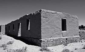
Other unincorporated places
- Argo
- Artesia
- Bucklands Station
- Cambridge
- Churchhill
- Como
- Davis Station
- Greenville
- Hoye
- Hudson
- Johntown
- Ludwig
- Lux
- Marshland
- Mason
- Mound House
- Nordyke
- Palmyra
- Pine Grove
- Ramsey
- Rapids City
- Rockland
- Simpson
- Stone Cabin
- Sutro
- Sweetwater
- Thompson
- Tippecanoe
- Twin Flat
- Walker River
- Weeks
- Wellington
- Willington Springs
- Wichman
Politics
Although not so historically Republican as neighbouring Douglas County, Lyon is nonetheless a powerfully Republican county. The last Democrat to carry the county was Franklin D. Roosevelt in 1940 – the county was one of three in Nevada to vote for Barry Goldwater in 1964 – and Jimmy Carter in 1976 is the last Democrat to pass forty percent of Lyon County’s vote.
| Year | Republican | Democratic | Third parties |
|---|---|---|---|
| 2016 | 67.4% 16,005 | 25.9% 6,146 | 6.8% 1,611 |
| 2012 | 63.0% 13,520 | 34.4% 7,380 | 2.6% 565 |
| 2008 | 57.6% 12,154 | 39.8% 8,405 | 2.6% 544 |
| 2004 | 64.9% 11,136 | 32.9% 5,637 | 2.2% 378 |
| 2000 | 60.6% 7,270 | 33.0% 3,955 | 6.4% 767 |
| 1996 | 49.0% 4,753 | 35.3% 3,419 | 15.7% 1,527 |
| 1992 | 38.1% 3,509 | 30.2% 2,777 | 31.7% 2,918 |
| 1988 | 62.8% 4,390 | 32.9% 2,301 | 4.2% 296 |
| 1984 | 69.9% 4,320 | 27.1% 1,673 | 3.0% 184 |
| 1980 | 68.0% 3,709 | 23.6% 1,288 | 8.4% 459 |
| 1976 | 49.7% 2,068 | 44.8% 1,866 | 5.5% 228 |
| 1972 | 74.6% 2,813 | 25.4% 959 | |
| 1968 | 53.9% 1,616 | 31.3% 939 | 14.8% 444 |
| 1964 | 51.3% 1,397 | 48.7% 1,327 | |
| 1960 | 59.7% 1,494 | 40.3% 1,009 | |
| 1956 | 68.5% 1,697 | 31.5% 781 | |
| 1952 | 71.6% 1,453 | 28.4% 576 | |
| 1948 | 59.2% 967 | 38.5% 629 | 2.3% 37 |
| 1944 | 55.8% 895 | 44.2% 708 | |
| 1940 | 47.4% 963 | 52.6% 1,067 | |
| 1936 | 28.8% 487 | 71.2% 1,203 | |
| 1932 | 31.7% 456 | 68.3% 983 | |
| 1928 | 56.8% 927 | 43.2% 704 | |
| 1924 | 47.4% 618 | 17.7% 231 | 34.8% 454 |
| 1920 | 67.1% 945 | 24.4% 344 | 8.5% 119 |
| 1916 | 40.9% 669 | 47.0% 769 | 12.1% 197 |
| 1912 | 11.6% 136 | 37.5% 438 | 50.9% 594[lower-alpha 1] |
| 1908 | 50.1% 458 | 39.8% 364 | 10.2% 93 |
| 1904 | 67.8% 392 | 28.4% 164 | 3.8% 22 |
Education
Lyon County has sixteen schools provided by the Lyon County School District.
Transportation
Air
There are three public airports in Lyon County:
- Yerington Municipal Airport, with a 5,800-foot long runway.
- Silver Springs Airport, with a 7,200-foot long runway capable of accepting 737's (its runway lights are visible when driving down on Fir Street from Ramsey Weeks cut-off to 95A).
- Tiger Field on US 95A about three miles from Fernley, with a gravel runway of 2,750 feet and a paved runway of 5,600 feet.
Railroads
The Central Pacific (the first transcontinental railroad) ran through the county, although a portion of the original route has been shifted for a new route south of Wadsworth in favor of Fernley. The Central Pacific later became the Southern Pacific Railroad which was merged into Union Pacific in 1996.
The Virginia and Truckee Railroad runs through Mound House in western Lyon County, on its way from Carson City to Virginia City.
The narrow-gauge Carson and Colorado Railroad had its terminus in Mound House, where it intersected with the V&T. It traveled east through Dayton, then turned south to the Mason Valley, and east again on its way to Walker Lake. Later a branch line connected the C&C to the Southern Pacific at Hazen.
The Eagle Salt Works Railroad ran for 13.5 miles, primarily on the original Central Pacific grade from Luva (2 miles east of Fernley) to Eagle Salt Works.
The Nevada Copper Belt Railroad ran on the west side of the Mason Valley.
Train
The Amtrak passenger train California Zephyr passes through, but does not stop in Lyon County. The nearest Amtrak passenger stations are Reno and Winnemucca, Nevada. The California Zephyr runs from the San Francisco Bay Area to Chicago via Salt Lake City, Denver and Omaha.
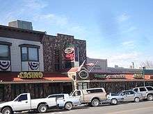
Entertainment
Prostitution is licensed and legalized in Lyon county. Open ranches include:
- Moonlite Bunny Ranch (which is located near the Lyon/Carson border)
- Sagebrush Ranch
See also
| Wikimedia Commons has media related to Lyon County, Nevada. |
Notes
- ↑ The leading “other’ candidate, Progressive Theodore Roosevelt, received 355 votes, while Socialist candidate Eugene Debs received 239 votes.
References
- 1 2 "State & County QuickFacts". United States Census Bureau. Archived from the original on July 14, 2011. Retrieved September 23, 2013.
- ↑ "County Explorer". National Association of Counties. Retrieved 2011-06-07.
- ↑ "Creation of Nevada's Counties". Nevada Association of Counties. Retrieved 25 November 2017.
- ↑ Gannett, Henry (1905). The Origin of Certain Place Names in the United States. U.S. Government Printing Office. p. 193. Retrieved 2016-01-01.
- ↑ Laws of the Territory of Nevada passed at the first regular session of the Legislative Assembly. San Francisco, CA: Valentine & Co. 1862. pp. 289–291. Retrieved May 14, 2014.
- ↑ "2010 Census Gazetteer Files". United States Census Bureau. August 22, 2012. Retrieved December 20, 2014.
- ↑ "Population and Housing Unit Estimates". Retrieved June 9, 2017.
- ↑ "U.S. Decennial Census". United States Census Bureau. Archived from the original on May 12, 2015. Retrieved December 20, 2014.
- ↑ "Historical Census Browser". University of Virginia Library. Retrieved December 20, 2014.
- ↑ "Population of Counties by Decennial Census: 1900 to 1990". United States Census Bureau. Retrieved December 20, 2014.
- ↑ "Census 2000 PHC-T-4. Ranking Tables for Counties: 1990 and 2000" (PDF). United States Census Bureau. Retrieved December 20, 2014.
- ↑ "American FactFinder". United States Census Bureau. Archived from the original on 2013-09-11. Retrieved 2008-01-31.
- ↑ Les Christie, CNNMoney staff writer (2006-03-16). "100 fastest growing counties - Mar. 16, 2006". Money.cnn.com. Retrieved 2016-01-01.
- ↑
- 1 2 3 "DP-1 Profile of General Population and Housing Characteristics: 2010 Demographic Profile Data". United States Census Bureau. Retrieved 2016-01-21.
- ↑ "Population, Housing Units, Area, and Density: 2010 - County". United States Census Bureau. Retrieved 2016-01-21.
- ↑ "DP02 SELECTED SOCIAL CHARACTERISTICS IN THE UNITED STATES – 2006-2010 American Community Survey 5-Year Estimates". United States Census Bureau. Retrieved 2016-01-21.
- ↑ "DP03 SELECTED ECONOMIC CHARACTERISTICS – 2006-2010 American Community Survey 5-Year Estimates". United States Census Bureau. Retrieved 2016-01-21.
- ↑ Leip, David. "Dave Leip's Atlas of U.S. Presidential Elections". uselectionatlas.org. Retrieved 2018-04-12.
External links
Coordinates: 39°01′N 119°11′W / 39.01°N 119.19°W
Places adjacent to Lyon County, Nevada | ||||||||||
|---|---|---|---|---|---|---|---|---|---|---|
| ||||||||||
Municipalities and communities of Lyon County, Nevada, United States | ||
|---|---|---|
| Cities | | |
| CDPs | ||
| Other unincorporated communities | ||
| Ghost towns | ||
| Indian reservation | ||