Yerington, Nevada
| Yerington, Nevada | |
|---|---|
| City | |
_near_Littell_Street_in_downtown_Yerington%2C_Nevada.jpg) Main Street (SR 208) in downtown Yerington | |
| Motto(s): "Preserving Our History While Planning Our Future" | |
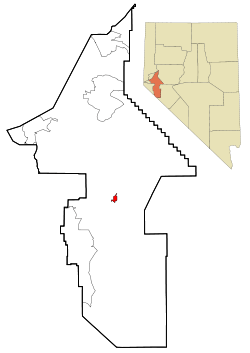 Location of Yerington, Nevada | |
 Yerington, Nevada Location in the United States | |
| Coordinates: 38°59′7″N 119°9′55″W / 38.98528°N 119.16528°W | |
| Country | United States |
| State | Nevada |
| County | Lyon |
| Government | |
| • Mayor |
George Dini [1] |
| Area | |
| • Total | 8.6 sq mi (22.3 km2) |
| • Land | 8.6 sq mi (22.3 km2) |
| • Water | 0.0 sq mi (0.0 km2) |
| Elevation | 4,390 ft (1,338 m) |
| Population (2010) | |
| • Total | 3,048 |
| • Estimate (2016)[2] | 3,142 |
| • Density | 350/sq mi (140/km2) |
| Time zone | UTC-8 (Pacific (PST)) |
| • Summer (DST) | UTC-7 (PDT) |
| ZIP code | 89447 |
| Area code(s) | 775 |
| FIPS code | 32-85400 |
| GNIS feature ID | 0848686 |
| Website |
www |
Yerington is a city in Lyon County, Nevada, United States. The population was 3,048 at the 2010 census.[3] It is named after Henry M. Yerington, Superintendent of the Virginia and Truckee Railroad from 1868 to 1910. The city incorporated in 1907.[4] It is the current county seat of Lyon County, with the first county seat having been established at Dayton, Nevada on November 29, 1861.[5] After the Dayton Court House burned down in 1909, the county seat was moved to Yerington in 1911.
Geography
Yerington is located at the intersection of US 95A and Nevada State Route 208. According to the United States Census Bureau, the city has a total area of 8.6 square miles (22.3 km2), all land.[3] The Walker River is formed in southern Lyon County, 9 miles (14 km) south of Yerington, by the confluence of the East Walker and West Walker. It flows into the Mason Valley where Yerington is located, and is used for irrigation.

Demographics
| Historical population | |||
|---|---|---|---|
| Census | Pop. | %± | |
| 1900 | 682 | — | |
| 1910 | 1,169 | 71.4% | |
| 1920 | 1,005 | −14.0% | |
| 1930 | 964 | −4.1% | |
| 1940 | 1,157 | 20.0% | |
| 1950 | 1,764 | 52.5% | |
| 1960 | 2,010 | 13.9% | |
| 1970 | 2,021 | 0.5% | |
| 1980 | 2,367 | 17.1% | |
| 1990 | 2,883 | 21.8% | |
| 2000 | 3,048 | 5.7% | |
| 2010 | 3,048 | 0.0% | |
| Est. 2016 | 3,142 | [2] | 3.1% |
| U.S. Decennial Census[6] | |||
For the 2010 census,[7] basic statistics show there were 3,048 people, 1,302 households, and 747 families residing in the city. The population density was 1792.9 people per square mile. There were 1,507 housing units at an average density of 886.5 per square mile. The racial makeup of the city was 80.20% White, 0.60% African American, 6.80% Native American, 0.60% Asian, 8.90% from other races, and 3.00% from two or more races. Hispanic or Latino of any race were 18.80% of the population.
In comparison, during the census [8] of 2000, there were 2,883 people, 1,203 households, and 729 families residing in the city. The population density was 1,698.4 people per square mile. There were 1,359 housing units at an average density of 800.6 per square mile. The racial makeup of the city was 84.53% White, 0.17% African American, 6.24% Native American, 0.38% Asian, 5.79% from other races, and 2.88% from two or more races. Hispanic or Latino of any race were 15.44% of the population.
There were 1,203 households out of which 27.7% had children under the age of 18 living with them, 46.1% were married couples living together, 10.2% had a female householder with no husband present, and 39.4% were non-families. 35.0% of all households were made up of individuals, and 19.6% had someone living alone who was 65 years of age or older. The average household size was 2.29, and the average family size was 2.97.
In the city, the population was spread out with 24.7% under the age of 18, 8.1% from 18 to 24, 22.2% from 25 to 44, 19.4% from 45 to 64, and 25.7% who were 65 years of age or older. The median age was 41 years. For every 100 females, there were 99.1 males. For every 100 females age 18 and over, there were 92.7 males.
The median income for a household in the city was $31,151, and the median income for a family was $39,038. Males had a median income of $25,724 versus $24,550 for females. The per capita income for the city was $18,640. About 12.6% of families and 17.9% of the population were below the poverty line, including 26.2% of those under age 18 and 12.3% of those age 65 or over.
Native People
The Yerington Paiute Tribe of the Yerington Colony and Campbell Ranch is headquartered in Yerington.[9] The people, known as Namu (human beings) in their own language, have lived in the Smith and Mason Valleys in Northwestern Nevada, since around 1000 A.D.[10]
Notable people
- Nevada Barr, (1952- ) mystery writer, created the Anna Pigeon series
- Jesse Brinkley,(1976- ) professional boxer, contestant on season one of The Contender
- Joe Dini, (1929-2014) longtime member of the Nevada Assembly
- Wovoka, (1856-1932) also known as Jack Wilson. Paiute religious leader
Wilson Ranch fire balloon
During World War II, one of many Japanese fire balloons launched at the United States landed on the Wilson Ranch near Yerington.[11] The ranchers, not knowing what it was, attempted to notify the authorities by mail, but did not receive a response until after they cut it up and used it as a hay tarp.[12]
In popular culture
"Darcy Farrow," a folk song written by Steve Gillette and Tom Campbell, mentions Yerington ("Her eyes shone bright like the pretty lights / That shine in the night out of Yerington town," 7-8) and other places and landmarks in the area, including Virginia City, the Carson Valley, and the Truckee River. Critics have noted the geographical inaccuracy in the line "The Walker runs down to the Carson Valley plain."[13]
John Denver's version of "Darcy Farrow" sold more than 4 million copies.[14]
Climate
Yerington experiences a borderline cool desert climate (Köppen BWk)/cool semi-arid climate (BSk). Yerington is noticeably more arid than areas even marginally closer to the Sierra Nevada – it receives only half as much precipitation as Carson City, a third as much as South Lake Tahoe and only one-eighth as much as Nevada City, California on the western Sierra slopes. Because the drying effect of the Pine Nut Mountains is most pronounced in the winter, Yerington receives very little snow in most years: the median monthly snowfall is zero except in January when it is 0.5 inches or 0.013 metres, although in the very cold and snowy month of January 1916 as much as 37.0 inches (0.94 m) fell and that season saw a total of 39.5 inches (1.00 m). January 2017 proved the first month to exceed 4 inches or 101.6 millimetres of precipitation when it totalled 4.55 inches (115.6 mm).[15] The wettest "rain year" has been from July 1955 to June 1956 with 9.06 inches (230.1 mm) and the driest from July 1949 to June 1950 with only 1.62 inches (41.1 mm), although the calendar year of 1983 saw 10.58 inches or 268.7 millimetres. The most precipitation in one day is 2.02 inches (51.3 mm) on September 18, 1955, closely rivalled by December 23 of that year when 2.00 inches (50.8 mm) fell.
During the summer, temperatures are generally hot to very hot in the afternoon, but the high altitude and low humidity means temperature drop to a comfortable level at night. On average, 2.8 afternoons each summer will exceed 100 °F or 37.8 °C and 57.6 afternoons reach 90 °F or 32.2 °C. It is rare, though, that minima stay above 68 °F or 20 °C, although thirteen mornings stayed this warm in 2015. The hottest minimum has been 78 °F (25.6 °C) on July 22, 2003, and the hottest temperature 107 °F (41.7 °C) on July 15, 2014. In the winter, afternoons are sunny and cool to cold with all but six topping freezing on average, although mornings typically range from freezing to frigid: 152 mornings fall below freezing in an average year and two fall to or below 0 °F or −17.8 °C. The coldest temperature on record is −26 °F (−32.2 °C) on January 21, 1937, and the coldest month January 1949 which averaged 12.4 °F or −10.9 °C with a mean minimum of −4.6 °F (−20.3 °C). The coldest afternoon is 6 °F or −14.4 °C, which occurred on February 6, 1989 and again on December 22 of 1990.
| Climate data for Yerington, Nevada (1971 to 2000; extremes since 1894) | |||||||||||||
|---|---|---|---|---|---|---|---|---|---|---|---|---|---|
| Month | Jan | Feb | Mar | Apr | May | Jun | Jul | Aug | Sep | Oct | Nov | Dec | Year |
| Record high °F (°C) | 72 (22) |
76 (24) |
84 (29) |
92 (33) |
100 (38) |
102 (39) |
107 (42) |
106 (41) |
100 (38) |
93 (34) |
80 (27) |
74 (23) |
107 (42) |
| Average high °F (°C) | 46.1 (7.8) |
53.1 (11.7) |
59.9 (15.5) |
66.7 (19.3) |
75.0 (23.9) |
84.6 (29.2) |
92.0 (33.3) |
90.5 (32.5) |
82.3 (27.9) |
70.4 (21.3) |
55.8 (13.2) |
46.9 (8.3) |
68.6 (20.3) |
| Average low °F (°C) | 20.9 (−6.2) |
25.3 (−3.7) |
30.5 (−0.8) |
35.5 (1.9) |
43.0 (6.1) |
50.1 (10.1) |
55.4 (13) |
53.8 (12.1) |
46.3 (7.9) |
36.4 (2.4) |
26.5 (−3.1) |
19.6 (−6.9) |
36.9 (2.7) |
| Record low °F (°C) | −26 (−32) |
−23 (−31) |
−2 (−19) |
5 (−15) |
15 (−9) |
26 (−3) |
30 (−1) |
26 (−3) |
19 (−7) |
5 (−15) |
−5 (−21) |
−20 (−29) |
−26 (−32) |
| Average precipitation inches (mm) | 0.49 (12.4) |
0.56 (14.2) |
0.59 (15) |
0.37 (9.4) |
0.76 (19.3) |
0.51 (13) |
0.27 (6.9) |
0.34 (8.6) |
0.27 (6.9) |
0.41 (10.4) |
0.37 (9.4) |
0.37 (9.4) |
5.31 (134.9) |
| Average snowfall inches (cm) | 1.9 (4.8) |
2.3 (5.8) |
1.1 (2.8) |
0.0 (0) |
0.1 (0.3) |
trace | 0.0 (0) |
0.0 (0) |
0.0 (0) |
0.3 (0.8) |
0.8 (2) |
0.6 (1.5) |
7.1 (18) |
| Average precipitation days (≥ 0.01 inch) | 4.0 | 4.2 | 4.1 | 2.6 | 3.8 | 2.8 | 1.9 | 1.9 | 2.2 | 2.8 | 3.3 | 3.5 | 37.1 |
| Average snowy days (≥ 0.1 inch) | 0.7 | 0.5 | 0.4 | trace | trace | 0.0 | 0.0 | 0.0 | 0.0 | 0.1 | 0.3 | 0.2 | 2.2 |
| Source: National Oceanic and Atmospheric Administration[16] | |||||||||||||
References
- ↑ "City of Yerington Website". Retrieved 25 November 2011.
- 1 2 "Population and Housing Unit Estimates". Retrieved June 9, 2017.
- 1 2 "Geographic Identifiers: 2010 Demographic Profile Data (G001): Yerington city, Nevada". U.S. Census Bureau, American Factfinder. Retrieved January 25, 2013.
- ↑ Federal Writers' Project (1941). Origin of Place Names: Nevada (PDF). W.P.A. p. 49.
- ↑ Laws of the Territory of Nevada passed at the first regular session of the Legislative Assembly. San Francisco, CA: Valentine & Co. 1862. pp. 289–291. Retrieved May 14, 2014.
- ↑ "Census of Population and Housing". Census.gov. Retrieved June 4, 2015.
- ↑ "American FactFinder". United States Census Bureau. Retrieved 2018-09-15.
- ↑ "American FactFinder". United States Census Bureau. Retrieved 2008-01-31.
- ↑ Conway, Lorna. "Tribal Government." Yerington Paiute Tribe. 2007 (retrieved 12 December 2008)
- ↑ "Our Culture". Yerington Paiute Tribe. Retrieved 2018-09-26.
- ↑ "Japanese Balloons and Attached Devices, TAIC Report, Number 41, May 1945". Retrieved 2015-02-07.
- ↑ Schindler, Hal (1995-05-05). "Utah Was Spared Damage By Japan's Floating Weapons". The Salt Lake Tribune. Retrieved 2015-02-07.
- ↑ Gillette, Steve. "Darcy Farrow Lyrics". Steve Gillette & Cindy Mangsen website. Retrieved 2013-02-08.
- ↑ Steele-Carlin, Sherril (2001-10-14). "Darcy Farrow, NV". American Profile. Archived from the original on 2008-12-09. Retrieved 2016-04-27.
- ↑ National Weather Service; NOW Data, Reno, Nevada
- ↑ "Climatography of the United States No. 20: 1971-2000" (PDF). National Climatic Data Center. 2004. Retrieved on September 8, 2013.
External links
| Wikimedia Commons has media related to Yerington, Nevada. |
Municipalities and communities of Lyon County, Nevada, United States | ||
|---|---|---|
| Cities |  | |
| CDPs | ||
| Other unincorporated communities | ||
| Ghost towns | ||
| Indian reservation | ||