Laughlin, Nevada
| Laughlin, Nevada | |
|---|---|
| Unincorporated town | |
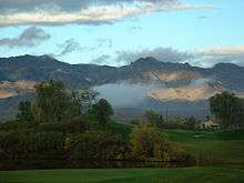
 Laughlin seen from Spirit Mountain | |
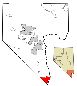 Location of Laughlin in Clark County, Nevada | |
 Laughlin, Nevada Location in the United States | |
| Coordinates: 35°8′30″N 114°37′7″W / 35.14167°N 114.61861°W | |
| Country | United States |
| State | Nevada |
| County | Clark |
| Founded | 1964 |
| Named for | Don Laughlin |
| Area | |
| • Total | 89.4 sq mi (231.5 km2) |
| • Land | 88.0 sq mi (228.0 km2) |
| • Water | 1.4 sq mi (3.5 km2) 1.55% |
| Elevation | 558 ft (170 m) |
| Population (2010)[1] | |
| • Total | 7,323 |
| • Density | 83.1/sq mi (32.1/km2) |
| Time zone | UTC-8 (PST) |
| • Summer (DST) | UTC-7 (PDT) |
| ZIP codes | 89028-89029 |
| Area code(s) | 702/725 |
| FIPS code | 32-41000 |
| GNIS feature ID | 0856066 |
Laughlin /ˈlɔːf.lɪn/ is an unincorporated town[2] and census-designated place in Clark County, Nevada, United States, and a port located on the Colorado River. Laughlin is 90 miles (140 km) south of Las Vegas, located in the far southern tip of Nevada. It is best known for its gaming, entertainment, and water recreation. As of the 2010 census, the population was 7,323.[3] The nearby communities of Bullhead City, Arizona; Needles, California; Fort Mohave, Arizona; and Mohave Valley, Arizona, bring the Laughlin area's total population to about 100,000.[4][5]
Laughlin was named for Don Laughlin, an Owatonna, Minnesota, native who purchased the southern tip of Nevada in 1964 (informally called South Pointe). At the time, Don Laughlin operated the 101 Club in Las Vegas. He opened what would become the Riverside Resort, and later wanted to call the community Riverside or Casino, but the post office opted for Laughlin instead.[6]
Laughlin is advertised as a family-friendly destination. Being located on the river, outdoor and family activities are emphasized. Many of the casinos that line the Colorado River are linked by an unofficial pedestrian thoroughfare known as the Laughlin Riverwalk.
History
The southernmost tip of Nevada, along the Colorado River, where Nevada, California, and Arizona meet, has become a major national tourist destination and gambling resort within the last few decades. The townsite of Laughlin was established in the 1940s as South Pointe because of the proximity to the southern tip of the state of Nevada. The early town consisted of a motel and bar that catered to gold and silver miners, construction workers building Davis Dam, and fishing enthusiasts. In the 1950s, construction workers left, and the town all but disappeared.
In 1964, Don Laughlin, owner of the 101 Club in Las Vegas, flew over the site and saw its tourism potential. He offered to buy the land, and within a few years, the small motel and casino, consisting of only 12 slots and two live tables, was bustling. In 1966, the Riverside Resort built the first 14-floor high-rise; in 1972, 48 rooms were added, followed by several additions. A second casino, the Bobcat Club, opened in 1967, where the Golden Nugget Laughlin currently operates. In 1968, a third casino, the Monte Carlo, opened its doors. Across the river, Bullhead City, Arizona, flourished in the glow of the casino light. Shuttle boats transported customers from the Arizona side of the river to Laughlin's resorts and back.
The 1980s saw the construction of several more hotels and casinos. The Colorado Hotel (now the Pioneer), The Regency, Sam's Town Gold River (now the Laughlin River Lodge), and The Edgewater opened in the early 1980s. Other investors saw the growth as an opportunity to get in on the action. A second boom resulted in the construction of The Colorado Belle, Harrah's Del Rio, and The Ramada Express (now The Tropicana Express). In 1987, Don Laughlin funded and built the Laughlin Bridge at a cost of $3.5 million. He donated the bridge to the states of Nevada and Arizona. The bridge carries 30,000 vehicles daily. In 1988, a megaresort called the Emerald Resort that would be the biggest in southern Nevada was announced, but its first tower was left unfinished due to the junk bond market's collapse in 1990; the project's golf course however opened and operated from 1991 to 2005.[7] The Flamingo Hilton, now known as The Aquarius, was built in 1990.
Today there are nine hotel/casinos and one motel in Laughlin providing over 10,000 rooms, 154,000 square feet (14,300 m2) of meeting space, 60 restaurants, two museums, a 34-lane bowling center, and a variety of boutiques, spas, and salons. More than 14,000 casino workers now cross the Colorado by shuttle boat or the Laughlin Bridge each day. Laughlin currently attracts less than 2 million visitors annually who visit to gamble, enjoy water sports on the Colorado River, or attend many high-profile special events hosted by the community.[8]
The Mohave Power Station opened in 1971,[9] but closed down on December 31, 2005.
Geography and climate
According to the United States Census Bureau, the census-designated place (CDP) of Laughlin (which may not coincide exactly with the town boundaries) has a total area of 89.3 square miles (231 km2), of which 88.0 square miles (228 km2) is land and 1.4 square miles (3.6 km2) is water.
Laughlin is one of the lowest-lying communities in Nevada, situated just 558 feet (170 m) above sea level.
Climate
Laughlin has a desert climate (Köppen climate classification BWh), with under six inches of precipitation per year. Summers are very hot with days frequently exceeding 110 °F (43 °C) in July and August while night-time lows tend to stay between 76–86 °F (24–30 °C). The winters are mild with days typically seeing temperatures between 65–75 °F (18–24 °C) and corresponding night-time lows between 43–52 °F (6–11 °C). It is one of the United States' hottest cities during the summer. Heat waves involving temperatures going over 120 °F (49 °C) are not unusual.
| Climate data for Laughlin, Nevada (Laughlin/Bullhead City Int'l. Airport 1981–2010 Normals) | |||||||||||||
|---|---|---|---|---|---|---|---|---|---|---|---|---|---|
| Month | Jan | Feb | Mar | Apr | May | Jun | Jul | Aug | Sep | Oct | Nov | Dec | Year |
| Record high °F (°C) | 83 (28) |
93 (34) |
102 (39) |
107 (42) |
118 (48) |
126 (52) |
126 (52) |
122 (50) |
117 (47) |
111 (44) |
95 (35) |
88 (31) |
126 (52) |
| Average high °F (°C) | 66.3 (19.1) |
71.3 (21.8) |
79.6 (26.4) |
88.5 (31.4) |
98.4 (36.9) |
107.9 (42.2) |
112.2 (44.6) |
110.3 (43.5) |
103.6 (39.8) |
90.4 (32.4) |
75.4 (24.1) |
65.1 (18.4) |
89.2 (31.8) |
| Average low °F (°C) | 44.1 (6.7) |
46.5 (8.1) |
50.3 (10.2) |
56.5 (13.6) |
65.7 (18.7) |
73.2 (22.9) |
80.1 (26.7) |
79.9 (26.6) |
71.8 (22.1) |
60.2 (15.7) |
50.1 (10.1) |
43.2 (6.2) |
60.2 (15.7) |
| Record low °F (°C) | 25 (−4) |
28 (−2) |
33 (1) |
40 (4) |
47 (8) |
50 (10) |
64 (18) |
60 (16) |
54 (12) |
37 (3) |
30 (−1) |
23 (−5) |
23 (−5) |
| Average precipitation inches (mm) | 0.95 (24.1) |
1.05 (26.7) |
0.78 (19.8) |
0.18 (4.6) |
0.05 (1.3) |
0.02 (0.5) |
0.27 (6.9) |
0.77 (19.6) |
0.34 (8.6) |
0.54 (13.7) |
0.43 (10.9) |
0.60 (15.2) |
5.98 (151.9) |
| Average precipitation days (≥ 0.01 in) | 3.6 | 3.9 | 2.6 | 1.5 | .3 | .4 | 1.3 | 1.9 | .9 | 1.3 | 1.3 | 1.9 | 20.7 |
| Source: WRCC[10] | |||||||||||||
Demographics
As of the census[11] of 2000, there were 7,076 people, 3,177 households, and 1,995 families residing in the CDP. The population density was 80.3 people per square mile (31.0/km²). There were 4,127 housing units at an average density of 46.8 per square mile (18.1/km²). The racial makeup of the CDP was 89.06% White, 2.81% African American, 0.62% Native American, 2.29% Asian, 0.18% Pacific Islander, 2.74% from other races, and 2.29% from two or more races. Hispanic or Latino of any race were 10.56% of the population.
There were 3,177 households out of which 19.7% had children under the age of 18 living with them, 47.7% were married couples living together, 10.4% had a female householder with no husband present, and 37.2% were non-families. 26.0% of all households were made up of individuals and 8.7% had someone living alone who was 65 years of age or older. The average household size was 2.22 and the average family size was 2.61.
The population is spread out with 18.3% under the age of 18, 6.1% from 18 to 24, 23.3% from 25 to 44, 33.6% from 45 to 64, and 18.6% who were 65 years of age or older. The median age was 46 years. For every 100 females, there were 97.7 males. For every 100 females age 18 and over, there were 95.0 males.
The median income for a household in the CDP was $36,885, and the median income for a family was $40,104. Males had a median income of $27,854 versus $20,973 for females. The per capita income for the CDP was $21,097. About 7.5% of families and 9.6% of the population were below the poverty line, including 14.7% of those under age 18 and 1.9% of those age 65 or over.
Government and politics
Government
Laughlin is an unincorporated town which has the same boundaries as the Township of Laughlin. The town is the subdivision by which it is governed by the Clark County Commission, which receives advice from the elected Laughlin Town Advisory Board (LTAB). Members of the LTAB are elected for terms of two years. Prior to November 2016, the members of the LTAB were appointed.
There is a Laughlin Town Manager who is appointed by and reports to an Assistant County Manager who, in turn, reports to the County Manager. The current (February 2018) Town Manager is Dr. Brian Paulson. Laughlin falls under the jurisdiction of the Las Vegas Metropolitan Police Department (LVMPD), and fire protection is provided by the Clark County Fire Department. The current (February 2018) commander of the Laughlin police Sub-Station is Lt. Jeffrey Hewes. Laughlin has one of the lowest crime rates in the country, with a crime rate index of 2 (100 being the national average).
The Township of Laughlin, which is a judicial district for the purposes of elections, consists of a Justice Court, presided over by a Justice of the Peace (elected for a six-year term as a non-partisan official) and a Constable (elected for a four-year term as a partisan official). Currently (February 2018) the Justice of the Peace is the Honorable Timothy Atkins and the Constable is Jordan Ross (Republican).
Town services
Library
The Laughlin Library is operated by the Las Vegas-Clark County Library District and has full access to the district's extensive collection of books, periodicals, and videos. It includes computers with printers, and internet access for public use, wireless internet access, a fully stocked and staffed children's library, study rooms, a community room, and a small art gallery. It is the largest rural library in Clark County.
Community Resources Center
The Community Resources Center is located in the Clark County Regional Government Center complex in Laughlin. Several social services agencies provide assistance to the public from this building. The River Fund, Inc., is a local non-profit agency providing direct emergency and crisis services for individuals and families. East Valley Family Services is a non-profit organization that provides support for Laughlin through a variety of programs targeted to families, children, and seniors, as well as providing advice regarding other public assistance programs. The State of Nevada Division of Welfare and Supportive Services provides timely and temporary services for families, the disabled, and the elderly.
Water Supply
The Big Bend Water District provides the water supply for Laughlin.
Water Reclamation
The Clark County Water Reclamation District provides water treatment and recycling for Laughlin.
Flood Control
The Clark County Regional Flood Control District plans and engineers flood control management for Laughlin.
Annual events
Beginning in 2001, the Tropicana Express Hotel and Casino has been the host for the Talent Quest National Finals. The contest is held in the third week of September, where qualifying singers compete for the top spot in Male and Female Pop/Rock/R&B and Male and Female Country/Western.
New Year's celebrations can be interesting since the neighboring town of Bullhead City, Arizona (in the Mountain Standard Time Zone), is one hour ahead of Laughlin (in the Pacific Standard Time Zone). Revelers can ring in the New Year in Bullhead City and then cross the bridge into Laughlin to ring it in again one hour later.
The Laughlin River Run started in 1983 and has thousands of avid motorcyclists attending annually each spring, usually in late April.
Each year around the Easter holiday, the annual Townfest takes place along Needles Highway, dividing West and East Laughlin. It includes a traditional small town parade, participants including boy scouts and girl scouts, school bands, churches, and Little League teams. Other festivities include a carnival, raffles and food booths provided by local service clubs, a beer garden and live musical entertainment.
The annual River Regatta attracts up to 40,000 people who make a leisurely 9 mile, 3-4 hour float trip down the Colorado River between Laughlin, Nev. and Bullhead City, Ariz. Participants are allowed to lash together up to 10 floating devices and create rafts, and many are decorated in keeping with the theme of the River Regatta, which changes annually.
Community, education and lifestyle
Education
The Clark County School District serves Laughlin. Children are transported by bus to local schools all located within the town limits. They are Bennett Elementary School (K-5), Laughlin Junior High School (6-8) and Laughlin High School (9-12).[12][13][14] The Junior High School and the High School share the same campus, which has numerous modern facilities including a well-equipped auditorium and a gymnasium.
Visitation
Laughlin is the third most visited casino and resort destination in the state after Las Vegas and Reno and is one of the top five destinations for American RV enthusiasts.[15]
A September 2013, article in the Las Vegas Review-Journal:
| “ | Once a boomtown, Laughlin has seen nothing but declines for a dozen years, almost exactly coinciding with the loss of regular airline flights after Sept. 11, 2001. The 2.1 million visitors recorded last year by the Las Vegas Convention and Visitors Authority is less than half the 1997 peak. Through July, the count has dropped another 2.2 percent compared to 2012.[16] | ” |
Parks
Located in the North Reach of Laughlin is the Colorado River Greenway Heritage Trail park. It include nine miles of trails for bicyclists, pedestrians, and equestrians; restrooms; picnic sites; shade shelters; fishing piers; an extensive playground with water sprays in the summer; and a pedestrian bridge over State Highway 163 which provides access to the Colorado River.
In the center of Upper Laughlin, next to the Spirit Mountain Activity Center, and one block from the town library, is Mountain View Park. It includes two softball fields, a playground, exercise trail, tennis courts, basketball courts, volleyball court, shaded picnic tables, a dog run, and a skateboard park.
At the south end of Upper Laughlin is the town pool. It is open during the summer months, and it includes full locker room facilities, shaded tables, and a large water park style slide.
Transportation
There are currently no freeways that pass through Laughlin. Intersections that have traffic lights number about twelve in the town, predominantly in the Casino District. Nevada State Route 163 connects Laughlin with southern Nevada and with Arizona State Route 95 in Bullhead City.
The Southern Nevada Transit Coalition provides bus service on two routes in Laughlin, one of which operates 24 hours a day, 365 days a year. It also operates express buses to Las Vegas. Laughlin/Bullhead International Airport (IFP) lies across the river in Bullhead City, Arizona. The airport is served by American Airlines providing daily flights to Phoenix, AZ. It also provides casino-sponsored chartered flights, and is also utilized by some private aircraft. Private shuttle companies connect Laughlin with McCarran International Airport in Las Vegas.[17][18] A shuttle also connects Laughlin with the Amtrak station in Kingman, Arizona.[18] Laughlin is served by the bus company TUFESA with service to Phoenix and Las Vegas.[19]
See also
References
- ↑ "GEOGRAPHIC IDENTIFIERS 2010 Demographic Profile Data". United States Census Bureau. 2010-04-01. Retrieved 2011-08-04.
- ↑ http://www.clarkcountynv.gov/Depts/admin_services/laughlin/Pages/LaughlinTownAdvisoryBoard.aspx Laughlin Town Board
- ↑ "Profile of General Population and Housing Characteristics: 2010 Demographic Profile Data (DP-1): Laughlin CDP, Nevada". U.S. Census Bureau, American Factfinder. Retrieved March 12, 2012.
- ↑ "Bullhead Regional Economic Development Authority". Bullheadazeda.com. Retrieved 2012-01-05.
- ↑ "Mohave County QuickFacts from the US Census Bureau". Quickfacts.census.gov. Archived from the original on 2011-07-15. Retrieved 2012-01-05.
- ↑ "History of Laughlin, Nevada". A2zlasvegas.com. Retrieved 2010-12-29.
- ↑ Segall, Eli (2016-12-18). "Laughlin's abandoned Emerald River resort remains an eyesore". Las Vegas Review Journal. Retrieved 2017-01-10.
- ↑ James Shown - Winnemucca, NV. "Nevada History". Nevada History. Retrieved 2012-01-05.
- ↑ "Existing Electric Generating Units in the United States, 2006" (Excel). Energy Information Administration, U.S. Department of Energy. 2006. Retrieved 2008-07-14.
- ↑ "Western Regional Climate Center NCDC 1981-2010 Normals". Desert Research Institute. Retrieved 2014-02-09.
- ↑ "American FactFinder". United States Census Bureau. Retrieved 2008-01-31.
- ↑ "2008-09 Elementary School - Southeastern Attendance Boundaries." Clark County School District. Retrieved September 28, 2008. Archived September 30, 2011, at the Wayback Machine.
- ↑ "2008-09 Middle School - Northern Attendance Boundaries." Clark County School District. Retrieved September 28, 2008. Archived September 30, 2011, at the Wayback Machine.
- ↑ "2008-09 High School - Southern Attendance Boundaries." Clark County School District. Retrieved September 28, 2008. Archived September 30, 2011, at the Wayback Machine.
- ↑ "Laughlin Town Manager's Office". Archived from the original on 2007-04-10. Retrieved 2007-04-28.
- ↑ "Las Vegas Review-Journal". Las Vegas Review-Journal. Retrieved 1 April 2018.
- ↑ "Tri State Shuttle". www.tristateairportshuttle.com. Retrieved 1 April 2018.
- 1 2 "Home". Commuter Services. Retrieved 1 April 2018.
- ↑ "Tufesa: Bus Tickets Los Angeles to Las Vegas - GotoBus". www.gotobus.com. Retrieved 1 April 2018.
External links
| Wikimedia Commons has media related to Laughlin, Nevada. |
| Wikivoyage has a travel guide for Laughlin, Nevada. |
- Laughlin Town Manager
- Laughlin Township Justice Court
- Laughlin Constable's Office
- Laughlin Chamber of Commerce
- Laughlin Visitor Information Center
- Laughlin Economic Development Corporation
- Laughlin Junior/Senior High School
- William Bennett Elementary School
- KLBC-TV, Channel 2, Laughlin, Nevada
- Laughlin Nevada Times
Municipalities and communities of Clark County, Nevada, United States | ||
|---|---|---|
| Cities | 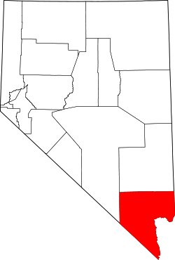 | |
| CDPs | ||
| Unincorporated communities | ||
| Township | ||
| Ghost towns | ||
| Indian reservations | ||
| Footnotes | ‡This populated place also has portions in an adjacent county or counties | |
Coordinates: 35°8′30″N 114°37′7″W / 35.14167°N 114.61861°W