Barclay, Nevada
| Barclay | |
|---|---|
| Unincorporated community | |
 Barclay Location of Barclay in Nevada | |
| Coordinates: 37°30′48″N 114°15′06″W / 37.51333°N 114.25167°WCoordinates: 37°30′48″N 114°15′06″W / 37.51333°N 114.25167°W | |
| Country | United States |
| State | Nevada |
| County | Lincoln |
| Elevation[1] | 5,354 ft (1,632 m) |
| Time zone | UTC-8 (PST) |
| • Summer (DST) | UTC-7 (PDT) |
| GNIS feature ID | 858313[1] |
| Other names |
Clover Valley Clover Valley Junction[1] |
Barclay is a town in Lincoln County, Nevada, United States. Originally a Mormon settlement in the late 1860s, it has few residents and appears on several ghost town lists.[2][3] The Barclay post office closed in 1910.[4] Main sites in the town include an old Mormon cemetery, and an abandoned Post Office, the latter being one of the few remaining buildings in the town.
The National Mustang Association owns a ranch in the area that serves as a sanctuary for wild horses.[5]
References
- 1 2 3 U.S. Geological Survey Geographic Names Information System: Barclay, Nevada. Retrieved on 2009-05-16.
- ↑ "Clover Valley-Barclay". ghosttowns.com. Retrieved 6 August 2011.
- ↑ "Barclay Nevada!". robertwynn.com. Archived from the original on 16 July 2011. Retrieved 6 August 2011.
- ↑ U.S. Geological Survey Geographic Names Information System: Barclay Post Office
- ↑ "Current achievements". National Mustang Association. Retrieved 6 August 2011.
Municipalities and communities of Lincoln County, Nevada, United States | ||
|---|---|---|
| Cities | 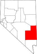 | |
| CDPs | ||
| Other unincorporated communities | ||
| Ghost towns | ||
| Footnotes | ‡This populated place also has portions in an adjacent county or counties | |
This article is issued from
Wikipedia.
The text is licensed under Creative Commons - Attribution - Sharealike.
Additional terms may apply for the media files.