Nevada State Route 320
| ||||
|---|---|---|---|---|
| Caselton Mine Loop | ||||
| Route information | ||||
| Maintained by NDOT | ||||
| Length | 10.674 mi[1] (17.178 km) | |||
| Existed | 1976 – present | |||
| Major junctions | ||||
| Southeast end |
| |||
| Northwest end |
| |||
| Highway system | ||||
| ||||

State Route 320 (SR 320) is a state highway in Lincoln County, Nevada, United States. Known as the Caselton Mine Loop, the highway is a loop route of U.S. Route 93 (US 93) near Pioche serving the Caselton Mining District.
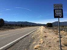
View from the north end of SR 320 looking southbound
Major intersections
The entire route is in Lincoln County.
| Location | mi | km | Destinations | Notes | |
|---|---|---|---|---|---|
| | 0.000 | 0.000 | |||
| | 10.674 | 17.178 | |||
| 1.000 mi = 1.609 km; 1.000 km = 0.621 mi | |||||
See also
| Wikimedia Commons has media related to Nevada State Route 320. |


References
Route map:
- ↑ Nevada Department of Transportation (January 2017). "State Maintained Highways of Nevada: Descriptions and Maps". Retrieved 2017-04-14.
This article is issued from
Wikipedia.
The text is licensed under Creative Commons - Attribution - Sharealike.
Additional terms may apply for the media files.