Pershing County, Nevada
| Pershing County, Nevada | ||
|---|---|---|
| County | ||
| Pershing County | ||
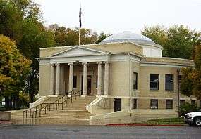 Pershing County Courthouse in Lovelock | ||
| ||
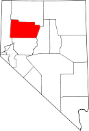 Location in the U.S. state of Nevada | ||
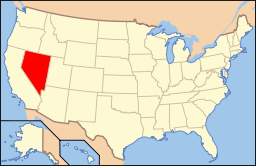 Nevada's location in the U.S. | ||
| Founded | 1919 | |
| Named for | John J. Pershing | |
| Seat | Lovelock | |
| Largest city | Lovelock | |
| Area | ||
| • Total | 6,067 sq mi (15,713 km2) | |
| • Land | 6,037 sq mi (15,636 km2) | |
| • Water | 31 sq mi (80 km2), 0.5% | |
| Population | ||
| • (2010) | 6,753 | |
| • Density | 1.1/sq mi (0.4/km2) | |
| Congressional district | 2nd | |
| Time zone | Pacific: UTC−8/−7 | |
| Website |
pershingcounty | |
Pershing County is a county in the U.S. state of Nevada. As of the 2010 census, the population was 6,753.[1] Its county seat is Lovelock.[2] The county was named after army general John J. Pershing (1860–1948). It was formed from Humboldt County in 1919, and the last county to be established in Nevada. The Black Rock Desert, location for the annual Burning Man festival, is partially in the county.
The county is listed as Nevada Historical Marker 17. The marker is at the courthouse in Lovelock.[3]
Geography
According to the U.S. Census Bureau, the county has a total area of 6,067 square miles (15,710 km2), of which 6,037 square miles (15,640 km2) is land and 31 square miles (80 km2) (0.5%) is water.[4] The tallest and most topographically prominent mountain in Pershing County is Star Peak at 9,840 ft (3,000 m).
Major highways
Adjacent counties
- Washoe County - west
- Humboldt County - north
- Lander County - east
- Churchill County - south
National protected area
Demographics
| Historical population | |||
|---|---|---|---|
| Census | Pop. | %± | |
| 1920 | 2,803 | — | |
| 1930 | 2,652 | −5.4% | |
| 1940 | 2,713 | 2.3% | |
| 1950 | 3,103 | 14.4% | |
| 1960 | 3,199 | 3.1% | |
| 1970 | 2,670 | −16.5% | |
| 1980 | 3,408 | 27.6% | |
| 1990 | 4,336 | 27.2% | |
| 2000 | 6,693 | 54.4% | |
| 2010 | 6,753 | 0.9% | |
| Est. 2016 | 6,560 | [5] | −2.9% |
| U.S. Decennial Census[6] 1790-1960[7] 1900-1990[8] 1990-2000[9] 2010-2013[1] | |||
2000 census
As of the census[10] of 2000, there were 6,693 people, 1,962 households, and 1,383 families residing in the county. The population density was 1 person per square mile (0.4/km²). There were 2,389 housing units at an average density of 0 per square mile (0/km²). The racial makeup of the county was 77.69% White, 5.35% Black or African American, 3.42% Native American, 0.63% Asian, 0.22% Pacific Islander, 9.38% from other races, and 3.30% from two or more races. 19.33% of the population were Hispanic or Latino of any race.
There were 1,962 households out of which 38.40% had children under the age of 18 living with them, 57.20% were married couples living together, 7.30% had a female householder with no husband present, and 29.50% were non-families. 24.30% of all households were made up of individuals and 8.60% had someone living alone who was 65 years of age or older. The average household size was 2.69 and the average family size was 3.22.
In the county, the population was spread out with 25.70% under the age of 18, 8.50% from 18 to 24, 36.00% from 25 to 44, 22.10% from 45 to 64, and 7.80% who were 65 years of age or older. The median age was 34 years. For every 100 females there were 158.80 males. For every 100 females age 18 and over, there were 182.10 males.
The median income for a household in the county was $40,670, and the median income for a family was $46,268. Males had a median income of $34,417 versus $24,301 for females. The per capita income for the county was $16,589. About 10.20% of families and 11.40% of the population were below the poverty line, including 14.20% of those under age 18 and 5.60% of those age 65 or over.
2010 census
As of the 2010 United States Census, there were 6,753 people, 2,018 households, and 1,375 families residing in the county.[11] The population density was 1.1 inhabitants per square mile (0.42/km2). There were 2,464 housing units at an average density of 0.4 per square mile (0.15/km2).[12] The racial makeup of the county was 81.9% white, 3.7% black or African American, 3.2% American Indian, 1.3% Asian, 0.1% Pacific islander, 6.7% from other races, and 3.1% from two or more races. Those of Hispanic or Latino origin made up 22.3% of the population.[11] In terms of ancestry, 19.5% were German, 16.8% were Irish, 13.8% were English, 5.1% were Italian, and 4.4% were American.[13]
Of the 2,018 households, 31.6% had children under the age of 18 living with them, 51.9% were married couples living together, 9.1% had a female householder with no husband present, 31.9% were non-families, and 26.6% of all households were made up of individuals. The average household size was 2.51 and the average family size was 3.02. The median age was 41.0 years.[11]
The median income for a household in the county was $56,491 and the median income for a family was $61,410. Males had a median income of $51,333 versus $28,871 for females. The per capita income for the county was $17,519. About 10.2% of families and 13.7% of the population were below the poverty line, including 23.0% of those under age 18 and 2.7% of those age 65 or over.[14]
Communities
City
- Lovelock (county seat)
- Black Rock City (temporary)
Census-designated places
Other unincorporated communities
Many of the following places are considered ghost towns.
Politics
| Year | Republican | Democratic | Third parties |
|---|---|---|---|
| 2016 | 70.8% 1,403 | 21.7% 430 | 7.5% 149 |
| 2012 | 61.9% 1,167 | 33.6% 632 | 4.5% 85 |
| 2008 | 58.6% 1,075 | 36.7% 673 | 4.8% 88 |
| 2004 | 70.0% 1,341 | 28.1% 538 | 2.0% 38 |
| 2000 | 67.8% 1,221 | 26.4% 476 | 5.8% 105 |
| 1996 | 47.4% 743 | 36.0% 565 | 16.6% 261 |
| 1992 | 41.1% 643 | 29.8% 467 | 29.1% 456 |
| 1988 | 62.1% 867 | 32.8% 458 | 5.1% 71 |
| 1984 | 71.9% 956 | 25.0% 333 | 3.1% 41 |
| 1980 | 68.4% 877 | 24.3% 311 | 7.3% 94 |
| 1976 | 46.9% 635 | 46.8% 633 | 6.3% 85 |
| 1972 | 70.0% 853 | 30.0% 365 | |
| 1968 | 46.7% 567 | 38.4% 466 | 14.8% 180 |
| 1964 | 39.7% 486 | 60.3% 738 | |
| 1960 | 47.5% 648 | 52.5% 716 | |
| 1956 | 61.4% 895 | 38.6% 562 | |
| 1952 | 63.8% 919 | 36.2% 522 | |
| 1948 | 53.7% 677 | 42.9% 541 | 3.5% 44 |
| 1944 | 50.7% 538 | 49.3% 524 | |
| 1940 | 46.1% 594 | 54.0% 696 | |
| 1936 | 23.8% 269 | 76.2% 861 | |
| 1932 | 23.8% 247 | 76.2% 792 | |
| 1928 | 54.6% 543 | 45.4% 452 | |
| 1924 | 36.1% 308 | 19.2% 164 | 44.7% 382 |
| 1920 | 56.5% 563 | 39.1% 389 | 4.4% 44 |
See also
References
- 1 2 "State & County QuickFacts". United States Census Bureau. Retrieved September 23, 2013.
- ↑ "County Explorer". National Association of Counties. Retrieved 2011-06-07.
- ↑ "Nevada Historical Markers". Nevada State Historic Preservation Office. Archived from the original on February 4, 2013. Retrieved 24 February 2013.
- ↑ "2010 Census Gazetteer Files". United States Census Bureau. August 22, 2012. Retrieved December 20, 2014.
- ↑ "Population and Housing Unit Estimates". Retrieved June 9, 2017.
- ↑ "U.S. Decennial Census". United States Census Bureau. Retrieved December 20, 2014.
- ↑ "Historical Census Browser". University of Virginia Library. Retrieved December 20, 2014.
- ↑ "Population of Counties by Decennial Census: 1900 to 1990". United States Census Bureau. Retrieved December 20, 2014.
- ↑ "Census 2000 PHC-T-4. Ranking Tables for Counties: 1990 and 2000" (PDF). United States Census Bureau. Retrieved December 20, 2014.
- ↑ "American FactFinder". United States Census Bureau. Retrieved 2008-01-31.
- 1 2 3 "DP-1 Profile of General Population and Housing Characteristics: 2010 Demographic Profile Data". United States Census Bureau. Retrieved 2016-01-21.
- ↑ "Population, Housing Units, Area, and Density: 2010 - County". United States Census Bureau. Retrieved 2016-01-21.
- ↑ "DP02 SELECTED SOCIAL CHARACTERISTICS IN THE UNITED STATES – 2006-2010 American Community Survey 5-Year Estimates". United States Census Bureau. Retrieved 2016-01-21.
- ↑ "DP03 SELECTED ECONOMIC CHARACTERISTICS – 2006-2010 American Community Survey 5-Year Estimates". United States Census Bureau. Retrieved 2016-01-21.
- ↑ Leip, David. "Dave Leip's Atlas of U.S. Presidential Elections". uselectionatlas.org. Retrieved 2018-04-12.
External links
Places adjacent to Pershing County, Nevada | ||||||||||
|---|---|---|---|---|---|---|---|---|---|---|
| ||||||||||
Municipalities and communities of Pershing County, Nevada, United States | ||
|---|---|---|
| City | | |
| CDPs | ||
| Unincorporated community | ||
| Ghost towns | ||