Laconia, New Hampshire
| Laconia, New Hampshire | ||
|---|---|---|
| City | ||
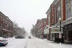 Main Street in Laconia | ||
| ||
| Motto(s): City on the Lakes | ||
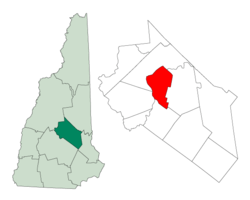 Location in Belknap County, New Hampshire | ||
| Coordinates: 43°31′39″N 71°28′13″W / 43.52750°N 71.47028°WCoordinates: 43°31′39″N 71°28′13″W / 43.52750°N 71.47028°W | ||
| Country | United States | |
| State | New Hampshire | |
| County | Belknap | |
| Incorporated | 1855 | |
| Villages |
Downtown Lakeport Weirs Beach | |
| Government | ||
| • Type | Council–manager government | |
| • Mayor | Edward Engler | |
| • City Council |
Members
| |
| • City Manager | Scott Myers | |
| Area | ||
| • Total | 26.6 sq mi (68.8 km2) | |
| • Land | 20.0 sq mi (51.9 km2) | |
| • Water | 6.5 sq mi (16.9 km2) 24.54% | |
| Elevation | 502 ft (153 m) | |
| Population (2010) | ||
| • Total | 15,951 | |
| • Estimate (2016)[1] | 16,470 | |
| • Density | 821/sq mi (317.1/km2) | |
| Time zone | UTC−5 (Eastern) | |
| • Summer (DST) | UTC−4 (Eastern) | |
| ZIP codes | 03246, 03247, 03249 | |
| Area code(s) | 603 | |
| FIPS code | 33-40180 | |
| GNIS feature ID | 0867917 | |
| Website | www.cityoflaconianh.org | |
Laconia is a city in Belknap County, New Hampshire, United States. The population was 15,951 at the 2010 census,[2] and an estimated 16,470 as of 2016.[1] It is the county seat of Belknap County.[3] Laconia, situated between Lake Winnipesaukee and Winnisquam Lake, includes the villages of Lakeport and Weirs Beach. Each June for nine days beginning on the Saturday of the weekend before Father's Day and ending on Father's Day, the city hosts Laconia Motorcycle Week, also more simply known as 'bike week', one of the country's largest rallies, and each winter, the Laconia World Championship Sled Dog Derby. The city is also the site of the state's annual Pumpkin Festival since 2015, having organized it after its former home of Keene rejected it due to riots in their neighborhoods in 2014.[4] The city also includes one of the colleges of the Community College System of New Hampshire.
History
A large Abenaki Indian settlement called Acquadocton Village once existed at the point now known as The Weirs, named by colonists for fishing weirs[5] discovered at the outlet of the Winnipesaukee River. Early explorers had hoped to follow the Piscataqua River north to Lake Champlain in search of the great lakes and rivers of Canada mentioned in Indian folklore. About 1652, the Endicott surveying party visited the area, an event commemorated by Endicott Rock, a local landmark. A fort would be built at Laconia in 1746. But ongoing hostilities between the English, French, and their respective Native American allies prevented settlement until 1761, after which it remained for many years a part of Meredith and Gilford called Meredith Bridge.
Beginning in 1765, lumber and grist mills were established on Mill Street, with taverns built soon thereafter on Parade Street. About 1822, the courthouse was built, which would become county seat at the creation of Belknap County in 1840. In 1823, the Belknap Mill was built to manufacture textiles; in operation by 1828, the structure is today a museum listed on the National Register of Historic Places and is the oldest unaltered brick textile mill in the country.[6] Local industry produced lumber, textiles, shoes, hosiery, knitting machinery and needles. But the city's largest employer would be the Laconia Car Company, builder of rail, trolley and subway cars. Started in 1848, it lasted until the 1930s. The railroad entered town in 1849, carrying both freight and an increasing number of summer tourists to popular Weirs Beach.
In 1855, Laconia was incorporated as a town from land in Meredith Bridge, Lakeport, Weirs and part of Gilmanton. The name was probably derived from the old Laconia Company, formed by Captain John Mason and the Masonian Proprietors to sell parcels of land during the colonial era. The Great Fire of 1860 destroyed most of Main Street from Mill to Water streets, followed by the Great Lakeport Fire of 1903, a blaze so fierce that fire companies were brought by train from as far away as Dover. Laconia was incorporated as a city in 1893.
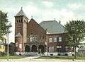 Courthouse, 1906
 Railroad station, c. 1910
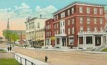
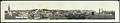 Panorama of central business district, c. 1910
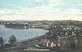 Bird's-eye view of Laconia, c. 1911
 Church Street, c. 1912
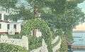 Shore Path, c. 1915
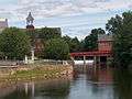 Belknap Mills in downtown Laconia, 2008
Geography
Laconia is located northwest of the geographic center of Belknap County. The city lies at the center of New Hampshire's Lakes Region, and all or part of four major bodies of water lie within its limits: Lake Winnipesaukee, Winnisquam Lake, Opechee Bay and Paugus Bay (sometimes counted as an arm of Winnipesaukee, but historically a separate body of water).
Laconia contains three main villages. Downtown Laconia, where the Belknap County Courthouse is located, can be found in the southern tip of the city, along the Winnipesaukee River between Opechee Bay to the north and Winnisquam Lake to the southwest. Lakeport, located between Opeechee Bay and Paugus Bay, is near the geographic center of the city. Weirs Beach, around the channel connecting Paugus Bay with Lake Winnipesaukee, lies at the northern edge of the city.
U.S. Route 3 passes through parts of the city, bypassing downtown but passing through Weirs Beach. New Hampshire Route 11 bypasses the city in a concurrency with US 3. The two highways lead southwest from Laconia to Tilton and Franklin. New Hampshire Route 11A represents the old routes 11 and 3 through downtown as Court Street and Union Avenue, but then turns east on Gilford Avenue to lead to Gilford and West Alton. New Hampshire Route 106 runs north-south through downtown, leading south to Concord and north to Meredith. New Hampshire Route 107 leads southeast from downtown towards Gilmanton and Pittsfield. Route 107 turns north in downtown and follows Union Avenue (former Route 3) to a junction with US 3 near the north end of the Laconia Bypass. US 3 continues north along the east shore of Paugus Bay, through Weirs Beach and into Meredith. Route 11 leads east from the Laconia Bypass past Glendale and into Alton. New Hampshire Route 11B leads east from Weirs Beach into Gilford.
Laconia Municipal Airport is located just east of the city limits in Gilford.
According to the United States Census Bureau, the city has a total area of 26.6 square miles (68.8 km2), of which 20.0 square miles (51.9 km2) are land and 6.5 square miles (16.9 km2) are water, comprising 24.54% of the city.[7] Laconia is drained by the Winnipesaukee River. It is bounded in the southwest by Winnisquam Lake, and by Lake Winnipesaukee in the northeast. Laconia lies fully within the Merrimack River watershed.[8] The highest point in Laconia is a 960-foot (290 m) hill in the northern part of the city, west of Paugus Bay's Pickerel Cove and just east of Route 106.
Demographics
| Historical population | |||
|---|---|---|---|
| Census | Pop. | %± | |
| 1860 | 1,806 | — | |
| 1870 | 2,309 | 27.9% | |
| 1880 | 3,790 | 64.1% | |
| 1890 | 6,143 | 62.1% | |
| 1900 | 8,042 | 30.9% | |
| 1910 | 10,183 | 26.6% | |
| 1920 | 10,897 | 7.0% | |
| 1930 | 12,471 | 14.4% | |
| 1940 | 13,484 | 8.1% | |
| 1950 | 14,745 | 9.4% | |
| 1960 | 15,288 | 3.7% | |
| 1970 | 14,888 | −2.6% | |
| 1980 | 15,575 | 4.6% | |
| 1990 | 15,743 | 1.1% | |
| 2000 | 16,411 | 4.2% | |
| 2010 | 15,951 | −2.8% | |
| Est. 2016 | 16,470 | [1] | 3.3% |
| U.S. Decennial Census[9] | |||
As of the census[10] of 2000, there were 16,411 people, 6,724 households, and 4,168 families residing in the city. The population density was 809.3 people per square mile (312.4/km²). There were 8,554 housing units at an average density of 421.8 per square mile (162.9/km²). The racial makeup of the city was 96.79% White, 0.55% African American, 0.41% Native American, 0.73% Asian, 0.02% Pacific Islander, 0.27% from other races, and 1.22% from two or more races. Hispanic or Latino of any race were 0.99% of the population.
There were 6,724 households out of which 28.0% had children under the age of 18 living with them, 46.4% were married couples living together, 11.2% had a female householder with no husband present, and 38.0% were non-families. 30.3% of all households were made up of individuals and 12.3% had someone living alone who was 65 years of age or older. The average household size was 2.32 and the average family size was 2.87.
In the city, the population was spread out with 22.3% under the age of 18, 8.8% from 18 to 24, 28.1% from 25 to 44, 23.5% from 45 to 64, and 17.2% who were 65 years of age or older. The median age was 39 years. For every 100 females, there were 94.4 males. For every 100 females age 18 and over, there were 92.2 males.
The median income for a household in the city was $37,796, and the median income for a family was $45,307. Males had a median income of $31,714 versus $22,818 for females. The per capita income for the city was $19,540. About 7.5% of families and 8.9% of the population were below the poverty line, including 10.9% of those under age 18 and 5.3% of those age 65 or over.
Government
| Year | GOP | DEM | Others |
|---|---|---|---|
| 2016 | 53.02% 4,303 | 40.70% 3,303 | 6.28% 510 |
| 2012 | 48.95% 3,859 | 49.95% 3,938 | 1.10% 87 |
| 2008 | 46.83% 3,750 | 52.67% 4,218 | 0.50% 40 |
| 2004 | 54.53% 4,286 | 44.67% 3,511 | 0.80 % 63 |
| 2000 | 53.76% 3,814 | 42.49% 3,015 | 3.75% 266 |
| 1996 | 45.21% 2,842 | 45.58% 2,865 | 9.21% 579 |
| 1992 | 43.68% 3,033 | 34.42% 2,390 | 21.89% 1,520 |
Laconia is governed by a mayor-council and city manager system. The Mayor and council are elected in a citywide vote, while the city manager is hired by the council. The council consists of six members who are elected from the six single-member wards.
In the New Hampshire Senate, Laconia is in the 7th District, represented by Republican Harold French. On the New Hampshire Executive Council, Laconia is in the 1st District, represented by Republican Joe Kenney. In the United States House of Representatives, Laconia is in New Hampshire's 1st congressional district, represented by Democrat Carol Shea-Porter.
Laconia is a fairly independent or swing city at the presidential level.
Education
Laconia's public school system is run by the Laconia School District, School Administrative Unit 30.
- Public schools
Laconia School District has one public high school, one middle school and three elementary schools:
- Laconia High School
- Laconia Middle School (formerly Memorial Middle School)
- Elm Street Elementary School
- Pleasant Street Elementary School
- Woodland Heights Elementary School
- Private schools
There are two parochial schools within the city limits of Laconia:
- Laconia Christian Academy, serving grades K-12
- Holy Trinity Catholic School, serving grades K-8
- Post-secondary schools
There is one area institution of higher education with a total enrollment of approximately 1000 students:
Culture
Sports
Laconia is home to the Winnipesaukee Muskrats of the New England Collegiate Baseball League (NECBL). The franchise began play in 2010 at Robbie Mills Field in Laconia. Starting in the 2014-15 season, the city will be home to the New Hampshire Fighting Spirit of the Northern States Junior Hockey League (NSHL).[13]
Laconia Motorcycle Week
One of the largest motorcycle rallies in the world takes place in Laconia during nine days in June, ending on Father's Day. Founded in 1923, attendance was 375,000 in 2004 and 188,000 in 2010. Events include races, shows, and a motorcycle hill climb competition.
Laconia Multicultural Festival
Held annually, the Laconia Multicultural Festival is a community event that highlights the music, arts, crafts and cuisine of authentic cultural artists to celebrate diversity. The festival was created by former Mayor Matthew Lahey and former Police Chief Bill Baker in 2000.
New Hampshire Pumpkin Festival
After the city council of Keene, New Hampshire, rejected the permit for their annual Pumpkin Festival to be held there following riots in the city's neighborhoods in 2014, it was announced that Laconia would host the festival for the city's first time in 2015.[4] The twenty-fifth New Hampshire Pumpkin Fest was held on October 24, 2015, with fewer than ten thousand jack-o'-lanterns lit.[14] The festival has continued to be held in Laconia annually since.
Sites of interest
- Belknap Mill Society Museum
- Gale Memorial Library
- Funspot Family Fun Center, named "Largest Arcade in the World" by Guinness World Records; home of the International Classic Video & Pinball Tournament
- Lake Winnipesaukee Historical Society Museum
- Robbie Mills Field, home of the Laconia Muskrats of the New England Collegiate Baseball League
- Weirs Beach, New Hampshire
Notable people
- Charles A. Busiel, 45th governor of New Hampshire; mayor of Laconia
- Pearl Chertok, professional harpist and composer; born in Laconia (1918)
- Connie Converse (1924- ), disappeared singer-songwriter
- Chas Guldemond, snowboarder; two time bronze medalist in the X Games
- Doris "Granny D" Haddock, activist; walked 3,200 miles across the US to advocate for campaign finance reform
- Fletcher Hale, U.S. congressman (1925-1931)
- John Adams Harper, U.S. congressman (1811-1813)
- Martin Alonzo Haynes, U.S. congressman (1883-1887)
- Ellery Albee Hibbard, U.S. congressman (1871-1873)
- Joseph Oliva Huot, U.S. congressman (1965-1967), born in Laconia (1917)
- Tony Lavelli (1926-1998), small forward with the Boston Celtics and New York Knicks
- Thomas J. McIntyre, U.S. senator (1962–1979), born in Laconia
- Penny Pitou, first U.S. Olympic skier to win a medal in an Olympic downhill event (1960)
- Claude Rains, actor; died in Laconia (1967)
- Paul W. K. Rothemund, 2007 recipient of a MacArthur Fellowship
- Daniel E. Somes, U.S. congressman from Maine (1856–1858)
- Dawn Zimmer, mayor of Hoboken, New Jersey (2009–present)
See also
- Laconia, in Greece
References
- 1 2 3 "Population and Housing Unit Estimates". Retrieved June 9, 2017.
- ↑ United States Census Bureau, American FactFinder, 2010 Census figures. Retrieved March 23, 2011.
- ↑ "Find a County". National Association of Counties. Retrieved 2011-06-07.
- 1 2 Sexton, Adam (April 24, 2015). "It's official: Laconia will host this year's pumpkin festival". WMUR-TV. Retrieved September 23, 2015.
- ↑ "The Illustrated Laconian: History and Industries of Laconia, N. H. (Descriptive of the City and Its Manufacturing and Business Interests)".
- ↑ National Trust for Historic Preservation. "Historic Belknap Mill". Retrieved July 27, 2016
- ↑ "Geographic Identifiers: 2010 Demographic Profile Data (G001) - Laconia city, New Hampshire". U.S. Census Bureau American Factfinder. Retrieved November 7, 2011.
- ↑ Foster, Debra H.; Batorfalvy, Tatianna N.; Medalie, Laura (1995). Water Use in New Hampshire: An Activities Guide for Teachers. U.S. Department of the Interior and U.S. Geological Survey.
- ↑ "Census of Population and Housing". Census.gov. Retrieved June 4, 2015.
- ↑ "American FactFinder". United States Census Bureau. Retrieved 2008-01-31.
- ↑ http://sos.nh.gov/ElectResults.aspx
- ↑ "Keewakwa Abenaki Keenahbeh - Whispering Giant Sculptures on Waymarking.com". Groundspeak, Inc. June 28, 2006. Retrieved 2016-09-13.
- ↑ Staff (March 14, 2014). "Fighting Spirit Laconia bound: Northern States Hockey League team will call Ice Arena home next winter". Retrieved June 2, 2014.
- ↑ Paula Tracy; Kristen Carosa (October 25, 2015). "First Laconia Pumpkin Fest does not break Keene's world record". WMUR.com. WMUR-TV. Retrieved October 25, 2015.
External links
| Wikivoyage has a travel guide for Laconia. |
| Wikimedia Commons has media related to Laconia, New Hampshire. |
- City of Laconia official website
- Laconia Public Library
- New Hampshire Economic and Labor Market Information Bureau Profile
Places adjacent to Laconia, New Hampshire | |
|---|---|
Municipalities and communities of Belknap County, New Hampshire, United States | ||
|---|---|---|
| City | 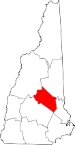 | |
| Towns | ||
| CDPs | ||
| Other villages | ||
| Footnotes | ‡This populated place also has portions in an adjacent county or counties | |