Hanover, New Hampshire
| Hanover, New Hampshire | |
|---|---|
| Town | |
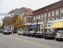 Hanover Main Street | |
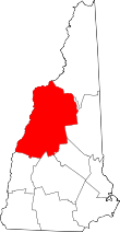
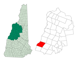 Location in Grafton County, New Hampshire | |
| Coordinates: 43°42′08″N 72°17′22″W / 43.70222°N 72.28944°WCoordinates: 43°42′08″N 72°17′22″W / 43.70222°N 72.28944°W | |
| Country | United States |
| State | New Hampshire |
| County | Grafton |
| Incorporated | 1761 |
| Villages |
Hanover Etna Hanover Center |
| Government | |
| • Board of Selectmen |
Peter L. Christie, Chair Athos J. Rassias William V. Geraghty Nancy A. Carter Joanna Whitcomb |
| • Town Manager | Julia N. Griffin |
| Area | |
| • Total | 50.3 sq mi (130.2 km2) |
| • Land | 49.0 sq mi (127.0 km2) |
| • Water | 1.3 sq mi (3.3 km2) 2.52% |
| Elevation | 528 ft (161 m) |
| Population (2010) | |
| • Total | 11,260 |
| • Density | 220/sq mi (86/km2) |
| Time zone | UTC−5 (Eastern) |
| • Summer (DST) | UTC−4 (Eastern) |
| ZIP code | 03755 |
| Area code(s) | 603 |
| FIPS code | 33-33860 |
| GNIS feature ID | 0873619 |
| Website |
www |
Hanover is a town along the Connecticut River in Grafton County, New Hampshire, United States. The population was 11,260 at the 2010 census.[1] CNN and Money magazine rated Hanover the sixth best place to live in America in 2011,[2] and the second best in 2007.[3] "This just might be the best college town," read the headline of a story in the January–February 2017 issue of Yankee.[4]
Dartmouth College and the US Army Corps of Engineers Cold Regions Research and Engineering Laboratory are located in Hanover. The Appalachian Trail crosses the town.
The main village of the town, where 8,636 people resided at the 2010 census,[5] is defined as the Hanover census-designated place (CDP), and is located at the junctions of New Hampshire routes 10, 10A, and 120. The town also contains the villages of Etna and Hanover Center.
History
Hanover was chartered by Governor Benning Wentworth on July 4, 1761, and in 1765–1766 its first European inhabitants arrived, the majority from Connecticut. Although the surface is uneven, the town developed into an agricultural community. Dartmouth College was established in 1769 beside the Common at a village called "the Plain"—an extensive and level tract of land a mile (1.6 kilometers) from the Connecticut River, and about 150 feet (46 m) above it.[6]
At one point in its history, the southwest corner of Hanover was known as "Dresden", which in the 1780s joined other disgruntled New Hampshire towns along the Connecticut River that briefly defected to what was then the independent Vermont Republic. For a time, Dresden was capital of the republic.[7] After various political posturings, however, the towns returned to New Hampshire at the heated insistence of George Washington.[8] One remnant of this era is that the name "Dresden" is still used in the Dresden School District, an interstate school district serving both Hanover and Norwich, Vermont—the first and one of the few interstate school districts in the nation.
The film Winter Carnival (1939) was shot in Hanover.[9]
Etymology
"Hannover" (as it was spelled in the 1761 charter and in its German original form as well) was named either after a local parish in Sprague, Connecticut, or after the German House of Hanover in honor of the reigning British-Hanoverian king, George III.[10] Originally Han(n)over is a city (capital) in Lower Saxony, North Germany.
While it is likely that the name "Dresden" derived from Dresden in Germany, it has also been suggested that it could derive directly from the old Sorbian word drezg ("forest") or Drezd'ane, for an inhabitant of a forest.[11][12]
Geography
According to the United States Census Bureau, the town has a total area of 50.3 square miles (130.3 km2), of which 49.0 square miles (126.9 km2) is land and 1.3 square miles (3.4 km2) is water, comprising 2.52% of the town.[1] The primary settlement in Hanover, where over 75% of the town's population resides, is defined as the Hanover census-designated place (CDP) and contains the areas around Dartmouth College and the intersections of New Hampshire Routes 10, 10A, and 120. The CDP has a total area of 5.0 square miles (13 km2), of which 4.6 square miles (12 km2) is land and 0.4 square miles (1.0 km2) is water.[5]
Hanover borders the towns of Lyme, Canaan, and Enfield, New Hampshire; Norwich, Vermont; and the city of Lebanon, New Hampshire. Inside the limits of Hanover are the small rural villages of Etna and Hanover Center.
The highest point in Hanover is the north peak of Moose Mountain, at 2,313 feet (705 m) above sea level. Hanover lies fully within the Connecticut River watershed.[13]
There are a number of trails and nature preserves in Hanover, and the majority of these trails are suitable for snowshoes and cross-country skis. The Velvet Rocks Trail, located on the Appalachian Trail, has a number of rock climbing and bouldering spots.
Climate
Hanover experiences a warm summer continental climate (Köppen Dfb), with long, cold, snowy winters, and warm, humid summers. Temperatures average 19.0 °F (−7.2 °C) in January to 70.9 °F (21.6 °C) in July, and the annual mean is 46.0 °F (7.8 °C). Extremes range from −40 °F (−40 °C), recorded on February 16, 1943,[14] to 103 °F (39 °C), recorded on August 2, 1975.[15]
| Climate data for Hanover, New Hampshire | |||||||||||||
|---|---|---|---|---|---|---|---|---|---|---|---|---|---|
| Month | Jan | Feb | Mar | Apr | May | Jun | Jul | Aug | Sep | Oct | Nov | Dec | Year |
| Record high °F (°C) | 64 (18) |
63 (17) |
86 (30) |
93 (34) |
96 (36) |
98 (37) |
101 (38) |
103 (39) |
97 (36) |
87 (31) |
79 (26) |
70 (21) |
103 (39) |
| Average high °F (°C) | 29.3 (−1.5) |
34.0 (1.1) |
43.5 (6.4) |
56.6 (13.7) |
70.4 (21.3) |
78.5 (25.8) |
82.9 (28.3) |
80.8 (27.1) |
71.3 (21.8) |
58.5 (14.7) |
45.6 (7.6) |
33.6 (0.9) |
57.1 (13.9) |
| Average low °F (°C) | 8.7 (−12.9) |
11.6 (−11.3) |
22.1 (−5.5) |
32.8 (0.4) |
44.1 (6.7) |
53.5 (11.9) |
58.8 (14.9) |
57.3 (14.1) |
49.4 (9.7) |
37.3 (2.9) |
28.4 (−2) |
15.6 (−9.1) |
35 (1.6) |
| Record low °F (°C) | −28 (−33) |
−40 (−40) |
−22 (−30) |
7 (−14) |
22 (−6) |
30 (−1) |
39 (4) |
33 (1) |
22 (−6) |
13 (−11) |
−12 (−24) |
−34 (−37) |
−40 (−40) |
| Average precipitation inches (mm) | 2.97 (75.4) |
2.34 (59.4) |
2.87 (72.9) |
3.02 (76.7) |
3.45 (87.6) |
3.36 (85.3) |
3.69 (93.7) |
3.70 (94) |
3.54 (89.9) |
3.47 (88.1) |
3.38 (85.9) |
2.90 (73.7) |
38.69 (982.6) |
| Average snowfall inches (cm) | 17.6 (44.7) |
12.7 (32.3) |
10.8 (27.4) |
2.0 (5.1) |
0 (0) |
0 (0) |
0 (0) |
0 (0) |
0 (0) |
0 (0) |
4.0 (10.2) |
15.3 (38.9) |
62.4 (158.6) |
| Average precipitation days (≥ 0.01 in) | 11.0 | 8.7 | 10.5 | 11.7 | 12.7 | 12.6 | 12.2 | 11.9 | 12.1 | 11.6 | 11.9 | 11.4 | 138.3 |
| Average snowy days (≥ 0.1 in) | 8.7 | 6.0 | 3.8 | 1.2 | 0 | 0 | 0 | 0 | 0 | 0 | 2.8 | 7.3 | 29.8 |
| Source #1: NOAA (normals, 1971−2000) [16] | |||||||||||||
| Source #2: The Weather Channel (extreme temperatures) [17] | |||||||||||||
Demographics
| Historical population | |||
|---|---|---|---|
| Census | Pop. | %± | |
| 1790 | 1,380 | — | |
| 1800 | 1,912 | 38.6% | |
| 1810 | 2,135 | 11.7% | |
| 1820 | 2,222 | 4.1% | |
| 1830 | 2,361 | 6.3% | |
| 1840 | 2,613 | 10.7% | |
| 1850 | 2,350 | −10.1% | |
| 1860 | 2,308 | −1.8% | |
| 1870 | 2,085 | −9.7% | |
| 1880 | 2,147 | 3.0% | |
| 1890 | 1,817 | −15.4% | |
| 1900 | 1,884 | 3.7% | |
| 1910 | 2,075 | 10.1% | |
| 1920 | 2,264 | 9.1% | |
| 1930 | 3,043 | 34.4% | |
| 1940 | 3,425 | 12.6% | |
| 1950 | 6,259 | 82.7% | |
| 1960 | 7,329 | 17.1% | |
| 1970 | 8,494 | 15.9% | |
| 1980 | 9,119 | 7.4% | |
| 1990 | 9,212 | 1.0% | |
| 2000 | 10,850 | 17.8% | |
| 2010 | 11,260 | 3.8% | |
| Est. 2015 | 11,401 | [18] | 1.3% |
| U.S. Decennial Census[19] | |||
As of the census of 2010, there were 11,260 people, 3,119 households, and 1,797 families residing in the town. The population density was 220 people per square mile (86/km2). There were 3,278 housing units at an average density of 65.2 per square mile (25.2/km2). The racial makeup of the town was 81.0% White, 3.4% Black, 0.8% Native American, 10.8% Asian, 0.03% Pacific Islander, 0.7% from other races, and 3.2% from two or more races. Hispanic or Latino of any race were 3.9% of the population.[20]
There were 3,119 households out of which 27.4% had children under the age of 18 living with them, 51.5% were married couples living together, 4.7% had a female householder with no husband present, and 42.4% were non-families. 31.0% of all households were made up of individuals and 16.1% had someone living alone who was 65 years of age or older. The average household size was 2.37 and the average family size was 2.95.[20]
In the town, the population was spread out with 27.8% at or under the age of 19, 25.5% from 20 to 24, 14.4% from 25 to 44, 18.6% from 45 to 64, and 13.7% who were 65 years of age or older. The median age was 23 years.[20]
For the period 2010-14, the estimated median income for a household in the town was $94,063, and the median income for a family was $129,000. Male full-time workers had a median income of $87,550 versus $53,141 for females. The per capita income for the town was $34,140. About 2.0% of families and 12.0% of the population were below the poverty line, including 3.4% of those under age 18 and 4.8% of those age 65 or over.[21]
Government
| Year | GOP | DEM | Others |
|---|---|---|---|
| 2016 | 11.94% 926 | 84.63% 6,561 | 3.43% 266 |
| 2012 | 23.67% 1,727 | 74.97% 5,469 | 1.36% 99 |
| 2008 | 17.67% 1,328 | 81.69% 6,140 | 0.64% 48 |
| 2004 | 21.70% 1,444 | 77.42% 5,152 | 0.89% 59 |
| 2000 | 29.56% 1,541 | 65.05% 3,391 | 5.39% 281 |
| 1996 | 31.71% 1,424 | 63.16% 2,836 | 5.12% 230 |
| 1992 | 25.91% 1,201 | 62.70% 2,906 | 11.39% 528 |
In the New Hampshire Senate, Hanover is included in the 5th District and is represented by Democrat Martha S. Hennessey. On the New Hampshire Executive Council, Hanover is in the 1st District and is represented by Republican Joe Kenney. In the United States House of Representatives, Hanover is a part of New Hampshire's 2nd congressional district and is currently represented by Democrat Ann McLane Kuster.
Like most other college towns, Hanover is a liberal bastion and a Democratic stronghold in presidential elections. No Republican presidential nominee has managed to receive over 32 percent of the vote in the town in the past two decades. Hanover backed Hillary Rodham Clinton with 85 percent of the vote in 2016, providing the former Secretary of State and U.S. Senator from New York with her largest margin of victory in the state of New Hampshire, which she narrowly won by 2,736 votes statewide. Her margin of victory in Hanover was by over twice that amount, allowing attribution that her margin in Hanover was what ultimately allowed her to carry the Granite State. However, Hanover did not back Clinton in the 2008 Democratic primary (supporting Barack Obama with 58.15 percent of the vote to Clinton’s 26.11 percent) nor did it support her in the 2016 Democratic primary when voters opted for U.S. Senator Bernie Sanders from neighboring Vermont with 53.04 percent of the vote.
Education
.jpg)
- Public schools
- Hanover High School
- Frances C. Richmond Middle School
- Bernice A. Ray Elementary School
- Universities
- Private schools
- The Clark School was at one time located in Hanover but merged with Cardigan Mountain School in the nearby town of Canaan in 1953.[23]
Economy
Hypertherm,[24] White Mountains Insurance Group, and Daat Research Corp. are based in Hanover.
Infrastructure
- Water
The Hanover Water Company supplies water for downtown Hanover from several local reservoirs. The company is owned by Dartmouth College (52.8%) and the Town of Hanover (47.2%), with management by the Town of Hanover under a contract. In 2000, all full-time company employees became town employees. In recent years, the town has spent over $20 million to upgrade main water lines, and will undergo another $6 million project to build a new water treatment plant. Outside the downtown area, residents rely on private wells that are not maintained by the town.
- Other utilities
FairPoint Communications furnishes telephone communication. The municipality provides sewage treatment.
Notable people
References
- 1 2 "Geographic Identifiers: 2010 Census Summary File 1 (G001), Hanover town, Grafton County, New Hampshire". American FactFinder. U.S. Census Bureau. Retrieved June 22, 2016.
- ↑ "Best Places to Live: Top 100 - Hanover, N.H. (6)". Money Magazine. Cable News Network. A Time Warner Company. Retrieved 2011-11-01.
- ↑ "Best Places to Live: Top 100 - Hanover, N.H. (2)". Money Magazine. Cable News Network. A Time Warner Company. Retrieved 2011-02-08.
- ↑ "Hanover, New Hampshire | Could You Live Here? - New England Today". New England Today. 2016-12-17. Retrieved 2017-02-21.
- 1 2 "Geographic Identifiers: 2010 Census Summary File 1 (G001), Hanover CDP, New Hampshire". American FactFinder. U.S. Census Bureau. Retrieved June 22, 2016.
- ↑ Coolidge, Austin J.; John B. Mansfield (1859). A History and Description of New England. Boston, Massachusetts. pp. 516–519.
- ↑ Hill, Ralph Nading (1965). The College on the Hill: A Dartmouth Chronicle. Hanover, NH: Dartmouth Publishing. p. 46.
- ↑ Daniell, Jere (1976). "The American Republic: 1760–1780: The Western Rebellion". New Hampshire Profile. The Flow of History. Retrieved 2011-02-08.
- ↑ Barth, Jack (1991). Roadside Hollywood: The Movie Lover's State-By-State Guide to Film Locations, Celebrity Hangouts, Celluloid Tourist Attractions, and More. Contemporary Books. Page 249. ISBN 9780809243266.
- ↑ "About the Town of Hanover". www.hanovernh.org. Archived from the original on 2010-05-28. Retrieved 2011-02-08.
- ↑ The settlers in the riverside forest, an appellation fully compatible with that of the early inhabitants of the Hanover Plain.
- ↑ Dick Hoefnagel and Virginia L. Close. "Dresden: What Is in the Name". Retrieved October 25, 2008.
- ↑ Foster, Debra H.; Batorfalvy, Tatianna N.; Medalie, Laura (1995). Water Use in New Hampshire: An Activities Guide for Teachers. U.S. Department of the Interior and U.S. Geological Survey.
- ↑ "February Daily Averages for Hanover, NH (03755)". The Weather Channel. Retrieved November 14, 2011.
- ↑ "August Daily Averages for Hanover, NH (03755)". The Weather Channel. Retrieved November 14, 2011.
- ↑ "Climatography of the United States No. 20 1971−2000: HANOVER, NH" (PDF). National Oceanic and Atmospheric Administration. Retrieved 2011-04-02.
- ↑ "Monthly Averages for Hanover, NH (03755)" (Table). The Weather Channel. Retrieved 2011-11-14.
- ↑ "Annual Estimates of the Resident Population for Incorporated Places: April 1, 2010 to July 1, 2015". Archived from the original on June 2, 2016. Retrieved July 2, 2016.
- ↑ "Census of Population and Housing". Census.gov. Retrieved June 4, 2016.
- 1 2 3 "Profile of General Population and Housing Characteristics: 2010 Census Summary File 1 (DP-1), Hanover town, Grafton County, New Hampshire". American FactFinder. U.S. Census Bureau. Retrieved June 22, 2016.
- ↑ "Selected Economic Characteristics: 2010-2014 American Community Survey 5-Year Estimates (DP03), Hanover town, Grafton County, New Hampshire". American FactFinder. U.S. Census Bureau. Retrieved June 22, 2016.
- ↑ http://sos.nh.gov/ElectResults.aspx
- ↑ Hopkins, Robert C.; Rearick, Richard R. (1995). Cardigan Mountain School: History, 1945-1995. Littleton, NH: Sherwin Dodge. pp. 81–88.
- ↑ Hypertherm
External links
| Wikivoyage has a travel guide for Hanover, New Hampshire. |
- Town website
- Hanover Area Chamber of Commerce
- Howe Library
- New Hampshire Economic and Labor Market Information Bureau Profile
Places adjacent to Hanover, New Hampshire | |
|---|---|