Bridgewater, New Hampshire
| Bridgewater, New Hampshire | |
|---|---|
| Town | |
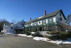 Bridgewater Inn | |
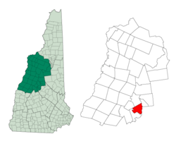 Location in Grafton County, New Hampshire | |
| Coordinates: 43°38′16″N 71°44′10″W / 43.63778°N 71.73611°WCoordinates: 43°38′16″N 71°44′10″W / 43.63778°N 71.73611°W | |
| Country | United States |
| State | New Hampshire |
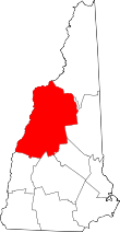
| County | Grafton |
| Incorporated | 1788 |
| Government | |
| • Board of Selectmen |
Maurice Jenness, Jr. Terence Murphy Henry Woolner |
| Area | |
| • Total | 21.5 sq mi (55.6 km2) |
| • Land | 21.3 sq mi (55.1 km2) |
| • Water | 0.2 sq mi (0.5 km2) 0.84% |
| Elevation | 640 ft (195 m) |
| Population (2010) | |
| • Total | 1,083 |
| • Density | 50/sq mi (19/km2) |
| Time zone | UTC-5 (Eastern) |
| • Summer (DST) | UTC-4 (Eastern) |
| Area code(s) | 603 |
| FIPS code | 33-07540 |
| GNIS feature ID | 0873551 |
| Website |
www |
Bridgewater is a town in Grafton County, New Hampshire, United States. The population was 1,083 at the 2010 census.[1]
History
The land comprising Bridgewater was originally part of a town known as New Chester, which was separated into Bridgewater, Bristol, Hill, Danbury, and Wilmot. The town name was chosen because many of the settlers were from Bridgewater, Massachusetts.
Bridgewater originally included all of Bridgewater, Hill and Bristol. It was first settled in 1776, by Thomas Crawford. It was incorporated 12 February 1788.[2]
In 1874, the Bridgewater station was served by the Montreal railroad.[2]
Geography
According to the United States Census Bureau, the town has a total area of 21.5 square miles (56 km2), of which 21.3 sq mi (55 km2) is land and 0.2 sq mi (0.52 km2) is water, comprising 0.84% of the town. The highest point in Bridgewater is Peaked Hill, at 1,905 feet (581 m) above sea level. Bridgewater lies fully within the Merrimack River watershed.[3]
Demographics
| Historical population | |||
|---|---|---|---|
| Census | Pop. | %± | |
| 1790 | 281 | — | |
| 1800 | 664 | 136.3% | |
| 1810 | 1,104 | 66.3% | |
| 1820 | 727 | −34.1% | |
| 1830 | 783 | 7.7% | |
| 1840 | 747 | −4.6% | |
| 1850 | 667 | −10.7% | |
| 1860 | 560 | −16.0% | |
| 1870 | 453 | −19.1% | |
| 1880 | 384 | −15.2% | |
| 1890 | 332 | −13.5% | |
| 1900 | 244 | −26.5% | |
| 1910 | 187 | −23.4% | |
| 1920 | 199 | 6.4% | |
| 1930 | 151 | −24.1% | |
| 1940 | 226 | 49.7% | |
| 1950 | 222 | −1.8% | |
| 1960 | 293 | 32.0% | |
| 1970 | 398 | 35.8% | |
| 1980 | 606 | 52.3% | |
| 1990 | 796 | 31.4% | |
| 2000 | 974 | 22.4% | |
| 2010 | 1,083 | 11.2% | |
| Est. 2015 | 1,085 | [4] | 0.2% |
| U.S. Decennial Census[5] | |||
As of the census[6] of 2000, there were 974 people, 414 households, and 289 families residing in the town. The population density was 45.8 people per square mile (17.7/km²). There were 850 housing units at an average density of 40.0 per square mile (15.4/km²). The racial makeup of the town was 99.08% White, 0.10% Native American, 0.51% Asian, 0.21% from other races, and 0.10% from two or more races. Hispanic or Latino of any race were 0.62% of the population.
There were 414 households out of which 24.9% had children under the age of 18 living with them, 61.6% were married couples living together, 6.5% had a female householder with no husband present, and 30.0% were non-families. 23.9% of all households were made up of individuals and 12.3% had someone living alone who was 65 years of age or older. The average household size was 2.35 and the average family size was 2.78.
In the town, the population was spread out with 19.7% under the age of 18, 4.5% from 18 to 24, 25.2% from 25 to 44, 31.3% from 45 to 64, and 19.3% who were 65 years of age or older. The median age was 45 years. For every 100 females, there were 96.8 males. For every 100 females age 18 and over, there were 89.8 males.
The median income for a household in the town was $50,662, and the median income for a family was $54,722. Males had a median income of $33,250 versus $26,250 for females. The per capita income for the town was $28,600. About 6.1% of families and 6.9% of the population were below the poverty line, including 5.4% of those under age 18 and 4.9% of those age 65 or over.
References
- ↑ United States Census Bureau, American FactFinder, 2010 Census figures. Retrieved March 23, 2011.
- 1 2 Article in Statistics and Gazetteer of New-Hampshire (1875)
- ↑ Foster, Debra H.; Batorfalvy, Tatianna N.; Medalie, Laura (1995). Water Use in New Hampshire: An Activities Guide for Teachers. U.S. Department of the Interior and U.S. Geological Survey.
- ↑ "Annual Estimates of the Resident Population for Incorporated Places: April 1, 2010 to July 1, 2015". Retrieved July 2, 2016.
- ↑ "Census of Population and Housing". Census.gov. Archived from the original on May 12, 2015. Retrieved June 4, 2016.
- ↑ "American FactFinder". United States Census Bureau. Archived from the original on 2013-09-11. Retrieved 2008-01-31.
External links
- Town of Bridgewater official website
- New Hampshire Economic and Labor Market Information Bureau Profile
Places adjacent to Bridgewater, New Hampshire | ||||||||||
|---|---|---|---|---|---|---|---|---|---|---|
| ||||||||||