Sitamau State
| Sitamau State सीतामऊ रियासत | ||||||
| Princely State of British India | ||||||
| ||||||
| ||||||
 | ||||||
| History | ||||||
| • | Established | 1701 | ||||
| • | Accession to the Indian Union | 1948 | ||||
| Area | ||||||
| • | 1901 | 523 km2 (202 sq mi) | ||||
| Population | ||||||
| • | 1901 | 28,422 | ||||
| Density | 54.3 /km2 (140.8 /sq mi) | |||||


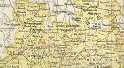
Sitamau State [1] was a princely state of the British Raj before 1947. Its capital was in Sitamau town, Mandsaur district, Madhya Pradesh. The total area of the state was 523 square kilometres.[2]
History
Sitamau State was founded in 1701. On 5 January 1819 it became a British protectorate.[3] Sitamau State belonged to Malwa Agency[4] and was an 11-gun salute state. Its rulers were related to the ruling families of Ratlam and Sailana states.
Rulers
The state was ruled by the Rathore dynasty of Rajputs. The last ruler of Sitamau State signed the instrument of accession to the Indian Union and the state became part of India on 15 June 1948.
Rajas
- 1701 – 1748 Kesho Das
- 1748 – 1752 Gaj Singh
- 1752 – 1802 Fateh Singh
- 1802 – 1867 Raj Ram Singh I (d. 1867)
- 1867 – 28 May 1885 Bhawani Singh (b. 1836 – d. 1885)
- 8 Dec 1885 – 1899 Bahadur Singh
- 1899 – 9 May 1900 Shardul Singh
- 11 May 1900 – 15 Aug 1947 Raj Ram Singh II (b. 1880 – d. 1967) (from 11 Dec 1911, Sir Raj Ram Singh II)
See also
References
- ↑ Imperial Gazetteer of India, v. 23, p. 51.
- ↑ "Sitamau (Princely state)". Indian Princely States website. Retrieved 20 March 2007.
- ↑ Indian Princely States
- ↑

This article is issued from
Wikipedia.
The text is licensed under Creative Commons - Attribution - Sharealike.
Additional terms may apply for the media files.