Jalpaiguri
| Jalpaiguri | |
|---|---|
| Metropolitan city | |
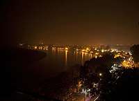 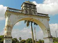 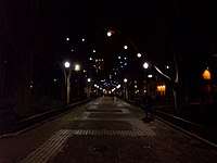 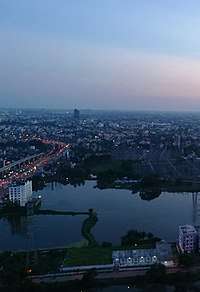 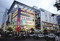 Top to bottom : The Teesta, Baikunthapur Rajbari Gate, View of the hills from the city, Alley, Karala Riverside Cosmos Arcade | |
 Jalpaiguri Location in West Bengal, India | |
| Coordinates: 26°31′N 88°44′E / 26.52°N 88.73°ECoordinates: 26°31′N 88°44′E / 26.52°N 88.73°E | |
| Country |
|
| State | West Bengal |
| District | Jalpaiguri |
| Founded | 1885 |
| Founded by | British India |
| Named for | The Headquarters of Jalpaiguri division, one of the five divisions of West Bengal; The Circuit Bench of the Kolkata High Court |
| Government | |
| • Type | Municipal Corporation |
| • Body | Jalpaiguri Municipal Corporation |
| • Chairman | Mohan Bose (All India Trinamool Congress) |
| Area | |
| • Metropolitan city | 90.29 km2 (34.86 sq mi) |
| Area rank | 6th |
| Elevation | 89 m (292 ft) |
| Population (2011)[1] | |
| • Metropolitan city | 107,341 |
| • Rank | 9th[2] |
| • Density | 1,200/km2 (3,100/sq mi) |
| • Metro[1] | 169,002 |
| Demonym(s) | Jalpaigurians, Jalpaiguribashi |
| Languages | |
| • Official | Bengali, English |
| Time zone | UTC+5:30 (IST) |
| PIN | 735 101-735 110 (city limits), 735120-735135 (suburbs) |
| Telephone code | +913561 |
| Vehicle registration | WB-71, WB-72 2 |
| Lok Sabha constituency | Jalpaiguri |
| Vidhan Sabha constituency | Jalpaiguri, Rajganj, Maynaguri, Dabgram Fulbari |
| Website |
jalpaigurimunicipality |
|
1The coordinates given here are in metric system and based upon the Microsoft Encarta Reference Library Map Center 2005 2 The Vehicle Code given here based upon the Jalpaiguri District Court documentations. | |
Jalpaiguri (pronounced [ʤælpaɪˈgʊəri]) is a city in the Indian state of West Bengal. It is the largest city and the headquarters of the Jalpaiguri district, and the divisional headquarters of the region. The city is located on the banks of the Teesta River which is the second largest river in West Bengal after the Ganges, on the foothills of the Himalayas.[3] The city is the home to the circuit bench of the Kolkata High Court, the other seat being at Port Blair in the Andaman and Nicobar Islands.[1][2] It is presently, the sixth largest city in the state after Kolkata, Asansol, Siliguri, Durgapur and Berhampore. The city has become an important trade center of West Bengal, besides being a principal commercial, tourism, transportation, and educational center. Jalpaiguri features the JGEC Deemed University, the second campus of the University of North Bengal, the newly built Jalpaiguri Medical College and the Biswa Bangla Krirangan/ Jalpaiguri Sports Village. It lies 35 kilometers away from its twin city, Siliguri which both merges up to be the largest metropolis of the region.
Etymology
The name "Jalpaiguri" most probably comes from the Bhutanese term je-le-pe-go-ri, meaning a place where warm clothes are traded, suggesting a trading centre. Another suggestion is that it is from the word "Jalpai" meaning olive, and "Guri" meaning a place.[4] The city once had many olive trees.
History
The Raikat family was a princely family that controlled large estates in Baikunthapur what is now a part of West Bengal, India, first as subjects to the state of Koch Bihar, later as Zamindars to the Mughal rulers of Bengal, and then to British Raj.The Raikat family is descended from the Koch dynasty, who took control of the Kamata Kingdom in 1515. The family founder was Sisya Singha, elder brother of Viswa Singha, the second Koch Maharajah. At Viswa Singha's coronation in 1523, Sisya Singha held the royal umbrella atop the crown, a sign of vassalage. Sisya Singha was given the title "Raikat" or "family guardian", and his descendants were hereditary prime ministers of the Koch Bihar successor state to the Kamata kingdom. They were given the land of Baikunthapur in the present Jalpaiguri district of West Bengal.[5]
Geography

Jalpaiguri is located at 26°31′N 88°44′E / 26.52°N 88.73°E.[6] It has an average elevation of 75 metres (246 feet).Jalpaiguri lies in the middle of the vast fertile plains (Terai) south of the Himalayas, watered by innumerable rivers and rivulets rising from and flowing down the Himalayas. Other than the Teesta, the Karala River, nicknamed the "Thames of Jalpaiguri", flows through the city thereby bisecting it into two halves.
Climate
The city of Jalpaiguri experiences three seasons mainly, namely summer, monsoons and winter. Summers are tropical and quite hot with temperatures ranging in the mid-thirties (Celsius). The highest recorded temperature in Jalpaiguri was 41.3 degree Celsius. Monsoons are very severe with the city experiencing high amount of rainfall, sometimes stalling all life and activities. Winters are again quite severe and chilly, with the cold Himalayan winds blowing straight into the city. Temperatures are around 8 to 14 degrees Celsius during this period. The lowest recorded temperature in Jalpaiguri City was 2.1 degree Celsius. [7] However, the climate has undergone a drastic change in the past few years, with the mercury rising and the rainfall decreasing each year.[8]
| Climate data for Jalpaiguri | |||||||||||||
|---|---|---|---|---|---|---|---|---|---|---|---|---|---|
| Month | Jan | Feb | Mar | Apr | May | Jun | Jul | Aug | Sep | Oct | Nov | Dec | Year |
| Average high °C (°F) | 23 (73) |
25 (77) |
28 (82) |
31 (88) |
33 (91) |
35 (95) |
34 (93) |
31 (88) |
28 (82) |
26 (79) |
24 (75) |
23 (73) |
28 (83) |
| Average low °C (°F) | 3 (37) |
10 (50) |
13 (55) |
21 (70) |
24 (75) |
25 (77) |
26 (79) |
25 (77) |
23 (73) |
16 (61) |
10 (50) |
4 (39) |
17 (62) |
| Average precipitation mm (inches) | 8 (0.31) |
18 (0.71) |
33 (1.3) |
94 (3.7) |
300 (11.81) |
658 (25.91) |
818 (32.2) |
643 (25.31) |
538 (21.18) |
142 (5.59) |
13 (0.51) |
5 (0.2) |
3,266 (128.58) |
| Source: Jalpaiguri Weather | |||||||||||||
| Jalpaiguri | ||||||||||||||||||||||||||||||||||||||||||||||||||||||||||||
|---|---|---|---|---|---|---|---|---|---|---|---|---|---|---|---|---|---|---|---|---|---|---|---|---|---|---|---|---|---|---|---|---|---|---|---|---|---|---|---|---|---|---|---|---|---|---|---|---|---|---|---|---|---|---|---|---|---|---|---|---|
| Climate chart (explanation) | ||||||||||||||||||||||||||||||||||||||||||||||||||||||||||||
| ||||||||||||||||||||||||||||||||||||||||||||||||||||||||||||
| ||||||||||||||||||||||||||||||||||||||||||||||||||||||||||||
Demographics
In the 2011 census, Jalpaiguri City had a population of 107,341 (53,708 male and 53,633 female)[1] while the Metropolitan region had a population of 169,002; 85,226 males and 83,787 females. The 0–6 years population was 14,522. Effective literacy rate for the 7+ population was 86.03 per cent.[9]
Jalpaiguri has a majority of Hindus which includes Bengali population. Other minority communities include Gorkhas (Nepali), Marwaris and Biharis. Kamatapuri, Bengali, Nepali are the languages that are spoken by the local people of Jalpaiguri.
Civic administration
Civic administration is the responsibility of the Jalpaiguri Municipal Corporation which is the fifth oldest one in West Bengal after that of Kolkata, Howrah, Berhampore and Burdwan. Set up in 1885, it is headed by a chairman who is elected by the all residents of the city. It has 25 wards that elect the ward councilors. The All India Trinamool Congress is in power of this municipal body. The chairman of the municipality is Mohan Bose.[10]
Economy
Jalpaiguri has been witnessing radical changes, along with rapid development in segments like industry, real estate, and information technology firms, and education, since the advent of the twenty-first century. The changes are with respect to infrastructure and industrial growth for steel (direct reduced iron), metal, cement and knowledge-based industries. Many engineering, technology, management, and professional study colleges have opened at Jalpaiguri. Housing co-operatives and flats, shopping malls, multiplexes, cineplexes a science and energy park, a software technology park (STPI), hotels and stadiums have also come up.
Jalpaiguri has its own bank, the Jalpaiguri Central Co-operative Bank, whose head office is located at Temple Street of the city. Founded in 1919, it has more than 20 branches with ATMs spread across North Bengal.
Utility services
The municipality is responsible for providing basic services, such as potable water and sanitation. The water is supplied by the municipal authorities using its groundwater resources, and almost all the houses in the municipal area are connected through the system. Solid waste is collected every day by the city van from individual houses. The surface drains, mostly uncemented, drain into the Teesta River. Electricity is supplied by the West Bengal State Electricity Board, and the West Bengal Fire Service provides emergency services like fire tenders. Almost all the roads are metalled (macadam), and street lighting is available throughout the city.
The Public Works Department is responsible for road maintenance in the city and on the roads connecting Jalpaiguri with other cities and towns in the region. Health services in Jalpaiguri include a government-owned District Hospital, a Regional Cancer Centre, a local T.B. Hospital, and private hospitals, clinics and nursing homes.
Transport
Public transport includes cycle rickshaws, auto rickshaws, local buses and tempos. There is no metered vehicular transport. While 6-seater city autos ply between two fixed destinations of about 10–15 km, one can hire petrol-driven auto rickshaws from auto stands at a rate fixed by the municipal authorities. A total of 16,000 rickshaws licensed by the municipal corporation.
Rail
Jalpaiguri Urban Agglomeration has five important railway stations:-
- Jalpaiguri Town is the oldest station in the area.
- Jalpaiguri Road was opened in 1944. It has broad gauge extended to New Bongaigaon.
- Mohitnagar lies at Mohitnagar in the Haldibari-New Jalpaiguri line.
- Jalpaiguri Junction is situated at the further western part of the city. The railway station serves Jalpaiguri, Raninagar and other nearby places.
- New Jalpaiguri Junction railway station is a major railway junction in the vicinity.
Road
The Netaji Subhash Central Bus Terminus situated next to the North Bengal State Transport Corporation (NBSTC) Bus Stop is a major stop for most private and state-owned buses in the region. The Royal Government of Bhutan also operates buses from Jalpaiguri to its border town Phuentsholing. Air conditioned sleeper coach bus service is also available from Jalpaiguri to Kolkata, Patna and Assam. There are several bus stands in the Jalpaiguri:-
- NBSTC Depot: Govt. buses are available from here.
- Kadamtala Bus Terminus: Private buses to Siliguri are available from here.
- Super Bus Stand near the Jalpaiguri railway station – Super (or non-stop) bus services to Siliguri are available from here.
- Netaji Subhas Chandra Bose Private Bus Terminus: Buses to the Dooars region, i.e., Malbazar, Birpara, are available from here.
- Bowbazaar Bus Stand: Bus services to Haldibari are available from here.
Culture

Major festivals observed at Jalpaiguri include Durga puja, Chhath Puja, Ganesh puja, Laxmi puja, Saraswati puja, and Diwali. Baisakhi Mela is one of the oldest fairs in Jalpaiguri which takes place in the Bengali month of Baisakh (i.e., April–May).
Lot of fairs and carnivals take place in Jalpaiguri. The most popular fairs in Jalpaiguri are Baisakhi Mela, Hasta Shilpa Mela, Book Fair, and Lexpo Fair. Most of the fairs happens in the Jalpaiguri Sports Village, Jalpaiguri District Sports Complex Stadium or the Town Club Stadium. [11] The city hosts group theatres, music & dance schools and night clubs.
Education
Jalpaiguri's schools are run by the state government or private organisations, many of which are religious. Bengali and English are the primary languages of instruction; Nepali and Hindi are also used.[12][13] Schools in Jalpaiguri follow the "10+2+3" plan. After completing their secondary education, students typically enroll in schools that have a higher secondary facility and are affiliated with the West Bengal Council of Higher Secondary Education, the Indian Certificate of Secondary Education (ICSE), or the Central Board of Secondary Education (CBSE).[12] They usually choose a focus on liberal arts, business, or science. Vocational programs are also available.[12] Zilla School, Govt. School for Boys,Fanindradeb Institution, Sonaulla High School Holy Child School, Jalpaiguri, Sunitibala Sadar Girls School, D.A.V. School, Jalpaiguri High School, Techno India School, Kendriya Vidyalaya, Saint Anthony's Day School, Saint Paul's School, Jalpaiguri, Government Girls High School. In 2012, the Government proposed a medical college for the suburb of Paharpur.[14]
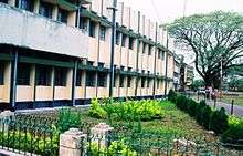
Colleges include the Ananda Chandra College, P.D. Women's College, St. Xavier's College, all of which are affiliated with the University of North Bengal. Also, since 2011, the second campus of the university with the same name provides with master's degrees in arts, sciences, and commerce.[15] Jalpaiguri Polytechnic Institute, is a Government Diploma level institute with 3 yrs.(10+) Civil, Electrical, Mechanical & Automobile Engineering and 2 yrs.(12+) The Institute of Pharmacy, Jalpaiguri is the sole pharmacist college in the region which offers pharmacy courses under West Bengal State Council of Technical Education, Kolkata. There is also an industrial training institute in the city. [16][17]
The Jalpaiguri Government Engineering College is an autonomous institution of the Government of West Bengal under the Maulana Abul Kalam Azad University of Technology. It is located near the National Highway 27 (West Bengal State Highway 12A) at Denguajhar, Jalpaiguri[18]. The construction of the new medical college has shortly began in the Paharpur suburb of the city. Jalpaiguri Law College is the city's law college.
Media
- Newspaper: English-language newspapers include the Times of India, The Economic Times, The Asian Age, The Statesman and The Telegraph. Several Bengali newspapers, including Uttarbanga Sambad, Bartaman, Ganashakti, Aajkaal and Pratidin are also available.
- Radio: In addition to All India Radio, other private FM radio stations of Radio High 92.7 MHz, Red FM 93.5 MHz and Radio Misty 94.3 MHz are available from the city.
- Television : Jalpaiguri receives almost all the television channels that are received by the rest of India. Apart from the state-owned terrestrial network Doordarshan, cable television serves most of the homes in the city, while satellite television is common in the outlying areas and in wealthier households. Besides mainstream Indian channels, the city also receives some Nepali and Bangladeshi television channels. Local news broadcasts, sporting events, and concerts are broadcast live or delayed via cable to many households. DTH services by government and private companies are also available such as Tata Sky, Dish TV, Videocon d2h, Airtel Digital TV and Reliance Digital TV. Jalpaiguri has four local channels – JCC, CCN, Uttarer Mon and Amar Cable.
- Internet: Internet cafes can be found in the main market area, served through broadband services provided by BSNL and other private companies like MetroNET (Orange Networks) and Sinet (JCC and CCN).
- Mobile phone: The area is serviced by cell phone companies such as Idea, Vodafone, Jio (4G), Airtel, Aircel, BSNL, Reliance, Tata Indicom, MTS, Tata Docomo, Virgin Mobile and Uninor. And also has 3G network of BSNL, Reliance, Vodafone, Bharti Airtel, and Aircel.
Sports
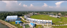
Table tennis, cricket, taekwon-do, chess and football are the most popular sports here. The Jalpaiguri District Sports Complex Stadium and the Town Club Stadium are the city's only outdoor stadiums and have hosted many state and national level matches. The stadium houses the Sports Authority of India sports hostel for athletes. There are three indoor stadiums at Shilpasamitipara, Raikatpara and Hakimpara, respectively in the southern part of the city. The new stadium next to Sports Complex has facilities for lawn tennis, badminton, table tennis, and other indoor sports.
Visitor attractions

- Raikatpara Palace Gate
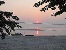
- Bay of the River Teesta
- Rajbari Dighi, an urban lake attached just opposite to the Baikunthapur Palace
- The Alley on the banks of the river Karala
- Spurs of the Teesta
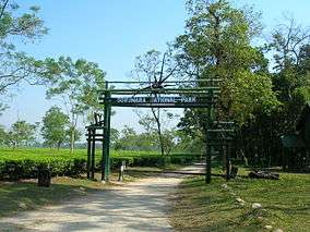
- Gorumara National Park, Malbazar, Jalpaiguri district
- Chapramari Wildlife Sanctuary
- Royal Palace of Baikunthapur Royal Estate, at Rajbaripara. The building has made in the early twentieth century in place of the old palace by Raja Jayantadev Raikot.
- Rabindra Bhawan (also called the Arya Natya Samaj), a cultural centre
- Jogomaya Kalibari, a famous temple dedicated to the Goddess Kali on Temple Street. It also houses a temple of Baba Loknath.
- Sri Adyashakti Ma Bhramari Devi Temple, one of the 51 Shakti Peethas
- Devi Chaudhurani Mandir- It is believed that Devi Chaudhurani the bandit queen from the novel of Bankim Chandra Chatterjee, has her Kali Temple near the banks of the Karala River and has an underground subway to the banks of Teesta.
Notable residents
- Ratan Lal Basu, fiction writer in English
- Swapna Barman, heptathlete was born here[19]
- Samaresh Majumdar, Bengali author of novels like Uttoradhikar, Kalpurush, and Kaalbela.
- Pradip Kumar Banerjee, football player and coach who represented India at the international level.
- Bappi Lahiri, Indian singer
- Mimi Chakraborty, Tollywood actress
See also
References
- 1 2 3 4 5 "Jalpaiguri Metropolitan Region". Jalpaiguri City Census 2011 data. Census 2011. Retrieved 1 January 2016.
- 1 2 "Urban Agglomerations/Cities having population 1 lakh and above" (PDF). Provisional Population Totals, Census of India 2011. Census India. Retrieved 10 October 2011.
- ↑ http://jalpaiguri.gov.in/html/tourism.html. Missing or empty
|title=(help) - ↑ Raha, Manis Kumar (1989). Matriliny to Patriliny: A Study of the Rabha Society. Gian Publishing House. p. 22.
- ↑ Cooch Behar: Royal History : Book of Facts and Events, Chapter 1, p. 5
- ↑ "Maps, Weather, and Airports for Jalpaiguri, India". fallingrain.com.
- ↑ District Profile, Jalpaiguri Government website Accessed on 1 October 2006
- ↑ Sharma Lakhotia, Anuradha (7 November 2006). "Darjeeling warming up faster than earth". The Telegraph. Retrieved 7 November 2006.
- ↑ "Urban Agglomerations/Cities having population 1 lakh and above" (pdf). Provisional Population Totals, Census of India 2011. censusindia.gov. Retrieved 21 October 2011.
- ↑ "Press Note, Delimitation Commission" (PDF). Assembly Constituencies in West Bengal. Delimitation Commission. pp. 4, 23. Retrieved 18 April 2009.
- ↑ "Track record". The Tribune. 21 November 2010. Retrieved 27 October 2012.
- 1 2 3 "Annual Report 2007–2008" (PDF). Department of School Education, Government of West Bengal. p. 69. Retrieved 10 December 2011.
- ↑ "List of most reputed schools in West Bengal". West Bengal Board of Secondary Education. Retrieved 10 December 2011.
- ↑ Ganguly, Arnab (12 July 2012). "Medical college for Indian cities". The Telegraph. Retrieved 27 October 2012.
- ↑ EOI, Correspondence. "NBDD minister inaugurates multiple projects". Archived from the original on 14 January 2015.
- ↑ "Private education Bill passed amidst Opposition walkout". The Statesman. 6 July 2012. Archived from the original on 20 December 2012. Retrieved 7 July 2012.
- ↑ "Bill passed to set up private varsity". Asian Age. 7 July 2012. Archived from the original on 11 December 2017. Retrieved 7 July 2012.
- ↑ "Google Maps". Google Maps. Retrieved 2018-08-08.
- ↑ "Could never afford nutritious food required by athlete, Asian gold-medallist Swapna Barman's father". The Indian Express. 2017-07-11. Retrieved 2017-07-17.
External links

- Official website of Jalpaiguri Municipality
- Official website of Jalpaiguri district
- West Bengal Jalpaiguri District
- Siliguri Jalpaiguri Development Authority
Cities, towns and locations in Jalpaiguri district | |||||||
|---|---|---|---|---|---|---|---|
| Cities, municipal and census towns |
| ||||||
| Locations other than cities and towns | |||||||
| Related Topics |
| ||||||