Alberta Highway 2
Route map:
| ||||
|---|---|---|---|---|
 Highway 2 highlighted in red | ||||
| Route information | ||||
| Length | 1,273 km[lower-alpha 1] (791 mi) | |||
| Major junctions | ||||
| South end |
| |||
| North end |
| |||
| Location | ||||
| Specialized and rural municipalities | ||||
| Major cities | Calgary, Airdrie, Red Deer, Lacombe, Leduc, Edmonton, St. Albert | |||
| Highway system | ||||
|
Provincial highways in Alberta
| ||||

Alberta Provincial Highway No. 2, commonly referred to as Highway 2 or the Queen Elizabeth II Highway,[lower-alpha 2] is a major highway in Alberta, Canada that stretches from the Canada–United States border through Calgary and Edmonton to Grande Prairie. Running primarily north to south for approximately 1,273 kilometres (791 mi), it is the longest and busiest highway in the province carrying nearly 170,000 vehicles per day in central Calgary. Between Edmonton and Fort Macleod, the highway forms a portion of Alberta's Export Highway and the CANAMEX Corridor. More than half of Alberta's 4 million residents live in the Calgary–Edmonton Corridor created by Highway 2.
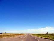
U.S. Route 89 enters Alberta from Montana and becomes Highway 2, a two-lane road that traverses the foothills of southern Alberta to Fort Macleod where it intersects Highway 3 and becomes divided. In Calgary, the route is a busy freeway named Deerfoot Trail that continues into central Alberta as the Queen Elizabeth II Highway, bypassing Red Deer. In Edmonton, it is briefly concurrent with freeway sections of Highways 216 and 16 before bisecting the city of St. Albert and reverting to two lanes en route to Athabasca. It bends northwest along the south shore of Lesser Slave Lake as the Northern Woods and Water Route into High Prairie, before turning north to Peace River, west to Fairview and finally south to Grande Prairie where it ends at Highway 43.
Originally numbered as Highway 1, Highway 2 is the oldest major highway in Alberta and the first to stretch north into the Peace Country. It was historically known as the Calgary and Edmonton Trail, Sunshine Trail, and the Blue Trail. Major changes include the construction of a divided expressway between Calgary and Edmonton in the 1960s, realignment along Deerfoot Trail in the 1980s, and twinning south of Calgary in the 1990s. A Highway 43 realignment in 1998 shortened Highway 2 by nearly 90 km (56 mi) to its current northern terminus in Grande Prairie; it previously extended west to British Columbia Highway 2 at the border. Several projects including median widening and interchange upgrades have been undertaken in the 2010s to increase the safety of the highway's busier sections, with further improvements either under construction or awaiting funding. Bypasses of Fort Macleod, Claresholm, and Nanton are planned as part of Alberta's effort to make its portion of the CANAMEX Corridor free-flowing from border to border.
Route description
Overview
Highway 2 is a core route in the National Highway System of Canada. The speed limit along most parts of the highway between Fort Macleod and Morinville is 110 km/h (68 mph) and in urban areas, such as through Claresholm, Nanton, Calgary and Edmonton, it ranges from 50 km/h (31 mph) to 100 km/h (62 mph). During the winter, accidents are common on the stretch of the highway between Calgary and Edmonton as the weather can change rapidly and drivers underestimate the conditions, overwhelming emergency services attempting to respond.[3] As the main north-south access in Alberta, Highway 2 is the preferred path of the CANAMEX Corridor.[4] Between Fort Macleod and Edmonton, Highway 2 maintains no fewer than four lanes of traffic and is largely a freeway between Okotoks and Edmonton, with improvements underway to eliminate the at-grade crossings that remain.[5]
Southern Alberta
Foothills
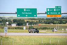
Highway 2 begins at the United States border, as the two lane U.S. Route 89 crosses into Canada at Carway.[6] The road proceeds north through the Rocky Mountain Foothills to a brief concurrency with Highway 501, before bisecting the town of Cardston.[7] At the north end of town, the highway enters Blood Indian Reserve No. 148 and Highway 5 splits west to Waterton Lakes National Park; it is briefly concurrent with Highway 2 before splitting east to cross the St. Mary River en route to Magrath and Lethbridge. Highway 2 continues north to another short concurrency with Highway 505 during which it crosses the Waterton River to Stand Off, continuing across the Belly River to Fort Macleod in the Municipal District of Willow Creek.[5]
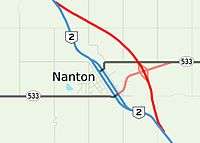
Less than 1 km before meeting Highway 3 southeast of Fort Macleod, Highway 2 becomes a divided highway.[5] Highway 3 splits east to Lethbridge, and the combined Highways 2 and 3 turn due west through town as a divided highway at a speed limit of 50 km/h. West of town, the highways diverge at an interchange; Highway 3 continues west as the Crowsnest Highway to Pincher Creek and British Columbia, and Highway 2 turns north across the Oldman River as a divided highway.[8] It continues approximately 25 km (16 mi) north to Granum from which Highway 519 splits to the east. In tandem with Highway 23, Highway 519 is often used by CANAMEX traffic to bypass Fort Macleod.[9] Further north on Highway 2, the towns of Claresholm and Nanton are each bisected at a reduced speed limit of 50 km/h. The highway is concurrent with Highway 533 for its brief distance through Nanton.[10]
North of Nanton, the highway continues into the Municipal District of Foothills to a major junction with Highways 23 and 2A at High River, after which it veers northwest to cross the Highwood River.[8] On the other side of the river, a second interchange provides access to Okotoks via Highways 7 and 2A, and Highway 2 continues north across the Sheep River to De Winton where Highway 2A splits into southwest Calgary as Macleod Trail, and Highway 2 veers northeast toward the Bow River valley and southeast Calgary.[11]
| Deerfoot Trail | |
| Length: | 46 km (29 mi) |
| South end: |
|
| North end: |
|
Calgary
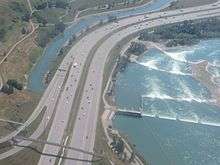
From its split with Macleod Trail, Highway 2 becomes a major freeway named Deerfoot Trail that descends to cross the Bow River before entering Calgary city limits. In the city it crosses the river twice more, jogging back and forth between its east and west bank.[11][12] The freeway intersects the Stoney Trail ring road at the south end of Calgary, with signage recommending that traffic en route to Calgary International Airport, Edmonton, and Medicine Hat use eastbound Stoney Trail as a bypass.[13] Deerfoot Trail then merges with the major routes of Anderson Road and Bow Bottom Trail. Crossing Glenmore Trail (Highway 8), Memorial Drive (access to downtown Calgary) and 16 Avenue NE (Highway 1), Deerfoot Trail continues into north Calgary past the Calgary International Airport en route to a second interchange with Stoney Trail at the Calgary city limit. The Deerfoot Trail designation is dropped, and the highway carries on north into Rocky View County.[14]
Central Alberta
Queen Elizabeth II Highway
|
Queen Elizabeth II Highway | |
| Length: | 261 km[15] (162 mi) |
| South end: |
|
| North end: | 41 Ave SW, Edmonton |

Highway 2 exits north Calgary as a six-lane freeway called the Queen Elizabeth II Highway, a name it retains until the southern city limit of Edmonton.[14] It passes the major shopping centre of CrossIron Mills, bisecting the city of Airdrie several kilometers later.[7] North of Airdrie, the route extends to Highway 72 before bypassing Crossfield and entering Mountain View County, continuing north past interchanges at Highways 581 and 582 leading to the communities of Carstairs and Didsbury, respectively. The highway meets Highway 27 at a cloverleaf interchange near Olds, approximately halfway between Calgary and Red Deer. Highway 2 enters Red Deer County and proceeds to interchanges with Highway 587 at Bowden, Highways 54 and 590 at Innisfail, and Highway 42 near Penhold prior to the city of Red Deer. South of the city, from McKenzie Road to 19 Street, the highway widens to six lanes through an area known as Gasoline Alley. It is a popular stop for travellers and truckers including fuel stations and food establishments on either side of the highway, accessible via the interchange at McKenzie Road.[16] Continuing north the highway again reduces to four lanes, veering left to bypass Red Deer to the west while Gaetz Avenue splits north into the city.[17]
West of Red Deer, Highway 2 passes Red Deer College and the Alberta Sports Hall of Fame and Museum before descending into the valley of the Red Deer River.[8] It crosses the river alongside a railroad bridge, then curves north to interchanges with Highways 11 and 11A, leading west to Rocky Mountain House and Sylvan Lake, respectively.[18] North of 11A, the highway crosses the Blindman River into Lacombe County to an interchange with Highway 597 at Blackfalds, curving slightly northeast to an interchange at Highway 12 at Lacombe.[7]

North of Lacombe, Highway 2 is again briefly concurrent with Highway 2A before reaching Highway 53 near Ponoka just after crossing the Battle River.[19] The four lane highway continues approximately 30 km (19 mi) through gentle rolling hills of aspen parkland in Ponoka County to an interchange at Highway 611 where it enters Wetaskiwin County.[20] Near Bearhills Lake, the highway meets Highway 13, providing access east to Wetaskiwin and Camrose, and west to Pigeon Lake. North of an interchange with Highway 616 the highway enters Leduc County, bending northeast toward the city of Leduc.[7]
After entering Leduc city limits, Highway 2 meets Highway 2A, which proceeds southeast through Leduc's southern suburbs as a four lane arterial road. Highway 2 immediately travels over Highway 39 at a diamond interchange, serving as the main access to central Leduc and ultimately leading west to Drayton Valley. Now six lanes wide, Highway 2 curves slightly to the northeast to pass on the east side of Edmonton International Airport, still 13 km (8.1 mi) south of Edmonton city limits.[20] The grass median significantly widens to over 100 m (330 ft), and access to the airport and Nisku is provided by an interchange at Airport Road.[21] Traffic levels increase as commuters travel to and from the Leduc area to Edmonton, and the highway meets a second interchange at Highway 19/625 which serves the airport. The highway curves slightly to the northeast to an interchange at 41 Avenue SW, marking the Edmonton city limit and the end of the Queen Elizabeth II Highway designation.[22]
Edmonton and Sturgeon County

Five separately named routes are designated as Highway 2 in the cities of Edmonton and St. Albert, denoted by varying levels of signage. At the south end of Edmonton, the highway significantly widens to five lanes each way. The northbound lanes become Gateway Boulevard and the southbound lanes Calgary Trail, and the two carriageways diverge to pass Gateway Park, located in the median of the highway and accessible from both directions.[22] North of the park, the two directions of travel come back together, now at a reduced speed limit of 90 km/h (56 mph), to meet at the major east-west arterial of Ellerslie Road, providing access to Edmonton's southern residential areas of Heritage Valley, Ellerslie, and Summerside. This diamond interchange is intertwined with the major cloverstack interchange at Anthony Henday Drive (Highway 216) which immediately follows. Henday is a ring road that surrounds Edmonton, connecting Highway 2 to Highway 16. Signage directs traffic destined for Lloydminster to use the southeast portion of Henday to reach Highway 16 north of Sherwood Park. Traffic destined for Jasper, Cold Lake, and Fort McMurray are directed onto the southwest portion of Henday to reach Highway 16 at Edmonton's west end.[23]
.jpg)
.jpg)
The freeway ends as three lanes of Gateway Boulevard eventually widen to four, travelling north past South Edmonton Common through south Edmonton as a busy urban street to Whitemud Drive.[22] Calgary Trail carries the southbound lanes of Highway 2 approximately 225 m (738 ft) to the west of Gateway Boulevard. The designation of Highway 2 turns west onto Whitemud Drive and it becomes a freeway once again, though now only at 80 km/h (50 mph), unlike the 100 km/h limit of the highway through Calgary.[24]
Whitemud Drive descends to cross Whitemud Creek before curving north to span the North Saskatchewan River on the Quesnell Bridge.[22] It then turns back west to meet Anthony Henday Drive again, now in the vicinity of West Edmonton Mall. Henday assumes the designation of Highway 2 for a 6.7 km (4 mi) stretch to Yellowhead Trail (Highway 16), though the concurrency is unsigned. Yellowhead Trail continues east into Edmonton as a six lane freeway, again unsigned as Highway 2, until St. Albert Trail which proceeds northwest through light industrial and commercial areas before crossing Anthony Henday Drive to exit Edmonton into St. Albert.[22] The six lane road is the main artery of the city with a speed limit of 60 km/h (37 mph), and crosses the Sturgeon River before exiting the city to the north into Sturgeon County as a divided highway approximately 5 km (3 mi) beyond the Sturgeon River. North of the city, the highway intersects Highway 37 before an interchange at Highway 642 west of Morinville, the main access for the town.[22]
Northern Alberta
Westlock County and Athabasca
|
Northern Woods and Water Route | |
| Length: | 262 km[25] (163 mi) |
| West end: |
|
| East end: |
|

Highway 2 reduces to a two lane highway immediately after Morinville, extending north past Manawan and Haley Lakes into Westlock County and a three-way intersection with Highway 18 near Clyde and Westlock.[26] The highway turns due east, briefly concurrent with Highway 18 for 1 km, before turning northeast through increasingly wooded areas and a short concurrency with Highway 663 to Athabasca.[7][27] The highway descends through the town at 50 km/h as 50 Street toward the Athabasca River valley, before turning west to parallel the river as 50 Avenue.[28] From this point until its split with Highway 49 over 200 km (120 mi) to the west, Highway 2 is designated as the Northern Woods and Water Route.[29][30]
The speed limit returns to 100 km/h as the highway climbs from the valley toward Baptiste Lake.[31] At the lake, the two lane Highway 2 turns north to follow the west bank of the Athabasca River for approximately 35 km (22 mi) before turning west at Lawrence Lake toward the unincorporated community of Hondo. There, it meets the northern terminus of Highway 44 before crossing the river and continuing northwest for 50 km to the southern terminus of Highway 88 in Slave Lake. Highway 88 follows the east bank of Lesser Slave Lake before a long journey north to Fort Vermilion.[8] In Slave Lake, Highway 2 bisects the town at a limit of 60 km/h, before returning to 100 km/h west of Caribou Trail, following the scenic southern shore of Lesser Slave Lake to Highway 33 near Kinuso, which leads south to Swan Hills. At Driftpile the highway crosses a river of the same name en route to High Prairie at the west end of Lesser Slave Lake.[7][32]
Peace Country
14 km (8.7 mi) west of High Prairie, the highway turns north past Winagami Lake to the town of McLennan on the south shore of Kimiwan Lake. It carries on west to a junction with Highway 49, locally known as 'Donnelly Corner'.[33] The two lane highway proceeds north through aspen parkland past Lac Magloire to the town of Nampa,[34] after which it crosses the Heart River, a tributary of Peace River. The highway then curves to the northwest and descends along the steep east bank of the Heart River into the town of Peace River.[35] A passing lane aids eastbound traffic climbing from the valley.

The two lane highway continues west through the town of Peace River before crossing the river of the same name. Climbing on the west bank of the river, it widens to four lanes and meets Alberta Highway 684 (Shaftesbury Trail) before exiting Peace River, reducing to two lanes, and passing north of Peace River Airport. 5 km (3.1 mi) east Cardinal Lake, Highway 2 meets Highway 35, the Mackenzie Highway. Highway 2 turns south to Grimshaw, while Highway 35 turns north, following the Peace River to High Level.[36] Highway 2 bisects Grimshaw as 51 Street, then exits the town before turning west shortly thereafter, winding through the aspen parkland of the Peace Country to the town of Fairview, in which a campus of Grande Prairie Regional College is immediately south of the highway. The road continues west out of Fairview as Highway 64A, while Highway 2 turns south to exit the town, curving west then south again toward the Peace River valley. It again curves west to descend along the river's steep north bank.[36] The highway crosses the Peace River on the Dunvegan Bridge, a suspension bridge over 700 m (2,300 ft) long.[37][38]:50 Passing lanes assist traffic climbing from the valley on both sides of the river.[36]
The highway continues 20 km (12 mi) south to the town of Rycroft, where Highway 49 splits west carrying the remainder of the Northern Woods and Water Route to the British Columbia border.[36] Highway 2 continues south to Highway 59 where it becomes a divided highway before bisecting Sexsmith and continuing to its terminus north of Grande Prairie at Highway 43. Prior to highway renumbering in northwestern Alberta, Highway 2 followed Highway 43's current alignment into British Columbia, where it became Highway 2 to Dawson Creek.
Traffic
Volume
| Location | Volume |
|---|---|
| Carway | 1,230 |
| Fort Macleod | 5,980 |
| High River | 14,050 |
| Memorial Dr Calgary | 169,080 |
| 32 St Red Deer | 43,030 |
| Ellerslie Rd Edmonton | 98,220 |
| Morinville | 6,610 |
| Athabasca | 5,620 |
| Peace River | 15,490 |
| Grande Prairie | 20,240 |

Highway 2 has a wide range of traffic levels along its length. At the south end, the highway is a lightly travelled two lane road from the United States border to Fort Macleod. It then doubles to four lanes and volume progressively increases until De Winton north of Okotoks, but remains relatively light.[39] Within Calgary, volume climbs exponentially on Deerfoot Trail through the southern suburbs of the city reaching nearly 170,000 vehicles per day at Memorial Drive near downtown, making that stretch of Highway 2 the busiest roadway in western Canada. Volume swiftly drops north of Beddington Trail in Calgary, but remains moderate on the Queen Elizabeth II Highway until Edmonton where it again increases to nearly 95,000 vehicles per day in the vicinity of Ellerslie Road. Whitemud Drive, Anthony Henday Drive, Yellowhead Trail, and St. Albert Trail are all busy expressways carrying large volumes of local traffic, especially at peak hours. North of St. Albert the drop in traffic is brisk, increasingly so after Morinville where the highway is no longer divided. Volume remains very light through most of the Peace Country before briefly exceeding 20,000 vehicles per day near the northern terminus in Grande Prairie.[39]
Alberta Transportation publishes yearly traffic volume data for provincial highways.[39] The table compares the AADT at several locations along Highway 2 using data from 2016, expressed as an average daily vehicle count over the span of a year (AADT).
Enforcement and collisions
The Queen Elizabeth II Highway between Calgary and Edmonton is prone to collisions in the winter, sometimes resulting in hours of delay, closures, and redirection of traffic onto sections of the adjacent Highway 2A.[40] Deerfoot Trail in Calgary is also prone to a higher than average number of collisions due to its high volume and concentration of interchanges within a relatively short distance.[41]
Alberta Transportation has established several zones on the Queen Elizabeth II Highway where the 110 km/h speed limit is enforced by aircraft.[42][43] The program is conducted by the Royal Canadian Mounted Police, and was relaunched in 2013 after being on hiatus due to budget concerns.[44] Several aircraft are used including the Eurocopter AS350 helicopter. The number of tickets written during the operation is generally not enough to negate the cost of operating the aircraft, but police have stated that they are catching drivers committing infractions over a longer stretch of the road.[45] In 2016, Leduc proposed photo radar speed enforcement on Highway 2 between the south end of the city and Edmonton's southern limit to catch excessive speeders, pending provincial approval.[46][47] It is already in use within Edmonton and Leduc limits, but it would be the first implementation on Highway 2. Some residents complained that revenue was the main objective of the project.[48] The argument was refuted by Leduc mayor Greg Krischke, who stated that the project is not a "cash cow" and the primary objective is to reduce excessive speed and increase safety for first responders.[48] An Alberta Transportation study shows that 100,000 vehicles exceeded 140 km/h (87 mph) on the stretch in 2015, and Krischke stated that drivers who do not want tickets should abide by the speed limit.[48] However, in 2014, less than 10% of injury collisions in Alberta involved drivers travelling at unsafe speeds.[49] Tailgating was a factor in almost 50% of injury collisions.[49]
History
On May 23, 2005, the section between Calgary and Edmonton was renamed the Queen Elizabeth II Highway in honour of Her Majesty's visit to Alberta as part of the province's centennial celebrations; the first road sign was personally unveiled by the Queen. It is the first highway in Canada to be named for the current Queen (Ontario's Queen Elizabeth Way is named for Queen Elizabeth, the late Queen Mother).[50]
A review of historical Alberta official road maps shows that Highway 2 was numbered Highway 1 prior to 1941 (while the current Highway 1 was Highway 2 at the time).[51]
The Claresholm highway massacre took place on Alberta Highway 2 on December 15, 2011. The suspect killed three people then turned the gun on himself in a murder–suicide.
Future
Southern Alberta
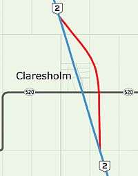
Highway 2 from Fort Macleod to south Edmonton is part of the CANAMEX Corridor, a divided highway with a combination of interchanges and several at-grade intersections except for a 50 km (31 mi) fully controlled access freeway section in Calgary. The only set of traffic lights on this CANAMEX section are in central Claresholm;[53] a bypass is proposed that would carry Highway 2 to the east of town on a new free-flowing alignment.[54] A similar bypass to the east of Nanton is also proposed.[55] A bypass of Fort Macleod has also been planned, tentatively designated as Highway 2X. It would be constructed in conjunction with a Highway 3 bypass of the town, making both routes free-flowing through the area.[56] Plans have also been drafted for significant reconstruction of the interchange of Highway 2 and Highway 23 near High River. The existing cloverleaf interchange was built in 1967 and does not meet the current standards in Alberta's Highway Design Guide.[57]
In Calgary, where Highway 2 (Deerfoot Trail) experiences heavy congestion at peak hours, a major planning study is underway to determine the best course of action for upgrades to the freeway.[58] In 2007, a study was completed by Alberta outlining plans for upgrades to the incomplete interchange of Glenmore Trail and Deerfoot Trail, one of the busiest road junctions in the province.[59] Stage 1 of the proposed improvements would correct a pinch point on Deerfoot Trail by constructing a new three lane bridge to carry the northbound lanes over Glenmore.[60] The southbound lanes would then be realigned on the existing bridges, such that Deerfoot Trail would be three lanes each way through the interchange, up from two.[59]
Central and northern Alberta
Planning is underway to convert the Queen Elizabeth II Highway between Calgary and Edmonton to a freeway.[61] Near Red Deer, traffic levels are close to 50,000 vehicles per day, and Alberta Transportation begins consideration of widening to six lanes when levels exceed 30,000 vehicles per day.[62] South of Airdrie, reconstruction of an existing interchange at Highway 566 is proposed,[63] and new interchanges have been planned at Township Roads 264 and 265 to support future development in the area.[64] Widening of the highway from four to six lanes between Airdrie and Crossfield is planned,[65] and between Highway 42 and Highway 597.[66] Work is underway to straighten the alignment of Highway 2 at the south end of Red Deer.[67] The project includes demolition of an existing bridge and construction of four new bridges for Highway 2. A substandard curve will be removed and straightened, and a left entrance to Highway 2 for southbound traffic from Gaetz Avenue will be reconstructed to crossover to the west side of the highway before joining the southbound lanes from the right side in a more conventional configuration.[67] The existing bridges on this section of the highway were built in 1962.[38]:35
Between Edmonton and Leduc, Alberta Transportation has drafted plans to construct a dual freeway system in conjunction with a second ring road approximately 8 km (5 mi) beyond Anthony Henday Drive.[68] The existing interchange at Highway 2A south of Leduc would be closed and reconstructed to modern standards further south. Between Edmonton and 41 Avenue SW, the highway would be realigned several hundred meters to the west to facilitate construction of a large interchange with the outer ring road.[69] The existing bridges at Airport Road, Highway 19, 41 Avenue SW, and Ellerslie Road have all been constructed with sufficient width to allow for construction of two additional sets of lanes.[70] In 2015, a planning study was completed outlining a new interchange at 65 Avenue in Leduc.[71] In northwest Edmonton, a planned extension of Ray Gibbon Drive will bypass St. Albert from Anthony Henday Drive to Highway 2. Upon completion of this road, Ray Gibbon Drive would be designated as Highway 2.[72] An interchange at Cardiff Road is also planned, just south of Morinville.[73]
North of Morinville, Highway 2 is a lightly travelled two lane highway carrying well under 10,000 vehicles per day,[39] but in 2012 Alberta Transportation completed a study to plan for extension of twinning from Morinville to north of Highway 18 near Clyde.[74] In 2013, a study was completed analyzing possible truck bypasses of Athabasca, to the east and west of the current alignment.[75] A 2010 study assessed twinning of Highway 49 from Valleyview to Donnelly, and Highway 2 from Donnelly to south of Nampa.[76]
Major intersections
| Rural/specialized municipality | Location | km[77] | mi | Exit | Destinations[78] | Notes | ||
|---|---|---|---|---|---|---|---|---|
| Cardston County | Carway | 0.0 | 0.0 | Continuation into Montana | ||||
| Canada–United States border at Piegan–Carway Border Crossing | ||||||||
| | 5.4 | 3.4 | PAR 136 west – Police Outpost Provincial Park | |||||
| 20.7 | 12.9 | South end of Hwy 501 concurrency | ||||||
| Cardston | 21.3 | 13.2 | Cardston Truck Bypass | Unsigned Hwy 501 north[10] | ||||
| 23.5 | 14.6 | North end of Hwy 501 concurrency | ||||||
| 25.0 | 15.5 | South end of Hwy 5 concurrency; unsigned Hwy 501 south | ||||||
| Blood I.R. No. 148 | 25.8 | 16.0 | North end of Hwy 5 concurrency | |||||
| | 41.4 | 25.7 | South end of Hwy 505 concurrency | |||||
| 44.8 | 27.8 | North end of Hwy 505 concurrency | ||||||
| Stand Off | 55.0 | 34.2 | ||||||
| Cardston County |
No major junctions | |||||||
| M.D. of Willow Creek No. 26 | | 75.2 | 46.7 | |||||
| Fort Macleod | 84.4 | 52.4 | Hwy 2 branches west; south end of Hwy 3 concurrency; south end of CANAMEX Corridor | |||||
| 85.7 | 53.3 | |||||||
| 89.5 | 55.6 | 89 | Hwy 2 branches north; north end of Hwy 3 concurrency | |||||
| | 90.4 | 56.2 | Crosses Oldman River | |||||
| 91.5 | 56.9 | |||||||
| Granum | 109.2 | 67.9 | ||||||
| Claresholm | 126.0 | 78.3 | ||||||
| 126.9 | 78.9 | 50 Avenue | Traffic signals | |||||
| Stavely | 143.0 | 88.9 | ||||||
| | 149.5 | 92.9 | ||||||
| Nanton | 165.5 | 102.8 | South end of Hwy 533 concurrency | |||||
| 166.9 | 103.7 | North end of Hwy 533 concurrency | ||||||
| ↑ / ↓ | | 173.5 | 107.8 | Township Road 170 / 722 Avenue | Former Hwy 2A | |||
| M.D. of Foothills No. 31 | | 179.9 | 111.8 | 674 Avenue E – Cayley | ||||
| 183.2 | 113.8 | |||||||
| Freeway begins | ||||||||
| High River | 192.9 | 119.9 | 194 | Signed as exits 194A (east) and 194B (west) | ||||
| 194.8 | 121.0 | (195) | 24 Street NE | Southbound exit only | ||||
| 196.2 | 121.9 | 197 | 498 Avenue E to Hwy 543 west – Longview | |||||
| | 201.4 | 125.1 | 202 | 1104 Drive E – Mazeppa | Southbound exit, northbound entrance | |||
| Aldersyde | 208.3 | 129.4 | 209 | |||||
| | 221.6 | 137.7 | 222 | South end of Hwy 2A concurrency | ||||
| 223.6 | 138.9 | 225 | North end of Hwy 2A concurrency; northbound exit, southbound entrance | |||||
| South end of Deerfoot Trail | ||||||||
| 225.9 | 140.4 | 227 | Dunbow Road – Heritage Pointe, De Winton | |||||
| ↑ / ↓ | | 228.2 | 141.8 | Crosses Bow River | ||||
| City of Calgary | 229.9 | 142.9 | (230) | 212 Avenue SE | Dogbone interchange with loop ramp approved, open by 2018[79] | |||
| 231.4 | 143.8 | 232 | ||||||
| 231.9– 234.5 | 144.1– 145.7 | 234 | Signed as exits 234A (east) and 234B (west); exit 101 on Hwy 201; unsigned Hwy 22X | |||||
| 234B | McKenzie Lake Boulevard / Cranston Boulevard | Southbound exit, northbound entrance | ||||||
| 233.6 | 145.2 | 236 | McKenzie Towne Boulevard / McKenzie Lake Boulevard | |||||
| 237.2 | 147.4 | 238 | 130 Avenue SE | |||||
| 238.7 | 148.3 | 240 | Barlow Trail north | |||||
| 240.4 | 149.4 | 241 | 24 Street SE / Douglasdale Boulevard | |||||
| 241.6 | 150.1 | Ivor Strong Bridge across Bow River | ||||||
| 241.7– 242.6 | 150.2– 150.7 | 243 | Anderson Road / Bow Bottom Trail | |||||
| 243.7 | 151.4 | 245 | Southland Drive | |||||
| 244.6 | 152.0 | 246 | 11 Street SE – Shopping Centre | Southbound exit and entrance | ||||
| 245.5 | 152.5 | 247 | Heritage Drive / Glenmore Trail west – Shopping Centre | Northbound exit and entrance | ||||
| 246.7 | 153.3 | 248 | Glenmore Trail | Southbound signed as exits 248A (east) and 248B (west); northbound traffic uses exit 247 to Glenmore Trail west; unsigned Hwy 8 west | ||||
| 249.0 | 154.7 | Calf Robe Bridge across Bow River | ||||||
| 250.3 | 155.5 | 251 | Peigan Trail east / Barlow Trail south | |||||
| 253.0 | 157.2 | 254 | 17 Avenue SE east / Blackfoot Trail south | Former Hwy 1A east | ||||
| 254.6 | 158.2 | 256 | Memorial Drive – City Centre | |||||
| 256.8 | 159.6 | 258 | ||||||
| 258.6 | 160.7 | 260 | 32 Avenue NE | |||||
| 260.3 | 161.7 | 261 | McKnight Boulevard | Signed as exits 261A (east) and 261B (west) | ||||
| 262.0 | 162.8 | 263 | 64 Avenue NE | |||||
| 263.7 | 163.9 | 265 | Beddington Trail / 11 Street NE | Northbound exit, southbound entrance | ||||
| 265.6 | 165.0 | 266 | ||||||
| 267.5 | 166.2 | 268 | ||||||
| 292.2– 271.4 | 181.6– 168.6 | 271 | Exit 60 on Hwy 201 | |||||
| North end of Deerfoot Trail • South end of | ||||||||
| Rocky View County | Balzac | 272.7 | 169.4 | 273 | CrossIron Drive – CrossIron Mills | Northbound exit, southbound entrance | ||
| 274.4 | 170.5 | 275 | ||||||
| City of Airdrie | 280.9 | 174.5 | 282 | Yankee Valley Boulevard | ||||
| 282.2 | 175.4 | (284) | East Lake Crescent | Northbound exit only | ||||
| 284.1 | 176.5 | 285 | ||||||
| Rocky View County | | 293.8 | 182.6 | 295 | ||||
| 303.9 | 188.8 | 305 | ||||||
| Mountain View County | | 313.6 | 194.9 | 315 | ||||
| 325.0 | 201.9 | 326 | ||||||
| Olds | 339.5 | 211.0 | 340 | Signed as exits 340A (east) and 340B (west) | ||||
| Red Deer County | | 352.2 | 218.8 | 353 | Southbound exit only | |||
| Bowden | 355.5 | 220.9 | 357 | |||||
| Innisfail | 364.0 | 226.2 | 365 | |||||
| 367.4 | 228.3 | 368 | Former Hwy 54 alignment | |||||
| | 383.1 | 238.0 | 384 | |||||
| Gasoline Alley | 389.7 | 242.1 | 391 | McKenzie Road | ||||
| 390.7 | 242.8 | — | Willow Street – Petrolia Industrial Park | Northbound exit only | ||||
| 391.2 | 243.1 | — | Leva Avenue | Southbound exit only | ||||
| City of Red Deer | 392.7 | 244.0 | 394 | Northbound exit, southbound entrance closed during interchange reconstruction.[80] | ||||
| 393.4 | 244.4 | 394 | Current Southbound exit, northbound exit under construction[81] Future Exit 395[82] | |||||
| 395.6 | 245.8 | 397 | 32nd Street / C&E Trail – Red Deer College | |||||
| 398.2 | 247.4 | Crosses Red Deer River | ||||||
| 400.4 | 248.8 | 401 | ||||||
| 403.8 | 250.9 | 405 | Northbound signed as exit 405A, southbound signed as exit 405B | |||||
| Red Deer County |
No major junctions | |||||||
| ↑ / ↓ | | 408.7 | 254.0 | Crosses Blindman River | ||||
| Lacombe County | Blackfalds | 410.8 | 255.3 | 412 | ||||
| Lacombe | 421.3 | 261.8 | 422 | |||||
| | 430.1 | 267.3 | 431 | South end of Hwy 2A concurrency | ||||
| 435.8 | 270.8 | 437 | North end of Hwy 2A concurrency | |||||
| ↑ / ↓ | | 438.1 | 272.2 | 439 | ||||
| Ponoka County | | 444.6 | 276.3 | 446 | Matejka Road | |||
| 445.8 | 277.0 | 447 | Gee Road | Southbound exit and northbound entrance | ||||
| 446.8 | 277.6 | Crosses Battle River | ||||||
| Ponoka | 448.9 | 278.9 | 450 | Signed as exits 450A (east) and 450B (west) | ||||
| | 461.2 | 286.6 | 462 | Menaik Road | ||||
| ↑ / ↓ | | 467.6 | 290.6 | 469 | ||||
| County of Wetaskiwin No. 10 | | 480.6 | 298.6 | 482 | Signed as exits 482A (east) and 482B (west) | |||
| 487.3 | 302.8 | 488 | Correction Line Road | |||||
| 495.8 | 308.1 | 497 | ||||||
| Leduc County | | 507.1 | 315.1 | 508 | Kavanagh, Glen Park District | |||
| City of Leduc | 514.4 | 319.6 | 516 | |||||
| 515.8 | 320.5 | 517 | ||||||
| 516.8 | 321.1 | 519 | Leduc Business Sector (to 50 Street) | Northbound exit and entrance | ||||
| 518.2 | 322.0 | 519 | 50 Street – Leduc Business Sector | Southbound exit, northbound entrance | ||||
| 519.7 | 322.9 | 521 | Leduc Business Sector (Sparrow Crescent) | Northbound exit only | ||||
| Leduc County | Nisku | 521.0 | 323.7 | 522 | ||||
| 524.4 | 325.8 | 525 | Truck bypass to Hwy 16 west | |||||
| ↑ / ↓ | | 531.2 | 330.1 | North end of | ||||
| 532 | 41 Avenue SW | |||||||
| City of Edmonton | 534.6 | 332.2 | (535) | Ellerslie Road | No access to/from Anthony Henday Drive | |||
| 534.7– 536.7 | 332.2– 333.5 | (536) | North end of CANAMEX Corridor; exit 78 on Hwy 216; northbound left exit | |||||
| 537.1 | 333.7 | (537) | 19 Avenue NW | No southbound entrance | ||||
| 537.9 | 334.2 | (538) | 23 Avenue NW | |||||
| 538.6 | 334.7 | Freeway ends, splits into one-way road pair | ||||||
| 539.4 | 335.2 | 34 Avenue NW | ||||||
| 540.9 | 336.1 | Gateway Boulevard – City Centre | Hwy 2 branches west | |||||
| North end of Calgary Trail and Gateway Boulevard • East end of Whitemud Drive • Freeway begins | ||||||||
| 541.7 | 336.6 | — | 106 Street | |||||
| 542.6 | 337.2 | — | 111 Street | |||||
| 544.2 | 338.2 | — | 119 Street / 122 Street | |||||
| 545.1 | 338.7 | Rainbow Valley Bridge across Whitemud Creek | ||||||
| 546.1 | 339.3 | — | Terwillegar Drive | Left exit | ||||
| 547.0 | 339.9 | — | 53 Avenue | No access to/from Terwillegar Drive | ||||
| 548.6 | 340.9 | Fox Drive | ||||||
| 548.9 | 341.1 | Quesnell Bridge across North Saskatchewan River | ||||||
| 550.1 | 341.8 | — | 149 Street | No eastbound exit | ||||
| 551.3 | 342.6 | — | 159 Street | Connects to 156 Street | ||||
| 552.5 | 343.3 | — | 170 Street – West Edmonton Mall | Former alignment of Hwy 2 | ||||
| 553.5 | 343.9 | — | 178 Street – West Edmonton Mall | |||||
| 555.4 | 345.1 | 18[lower-roman 1] | Whitemud Drive west to Hwy 628 west | Hwy 2 branches north; south end of unsigned segment; south end of Hwy 216 hidden concurrency | ||||
| West end of Whitemud Drive • South end of Anthony Henday Drive | ||||||||
| 556.6 | 345.9 | 19[lower-roman 1] | 87 Avenue / Webber Greens Drive – West Edmonton Mall | |||||
| 558.3 | 346.9 | 21[lower-roman 1] | 100 Avenue – City Centre | |||||
| 562.3 | 349.4 | 25[lower-roman 1] 378[lower-roman 2] | Unsigned Hwy 2 branches east; south end of Hwy 216 hidden concurrency; south (west) end of Hwy 16 hidden concurrency | |||||
| North end of Anthony Henday Drive • West end of Yellowhead Trail | ||||||||
| 563.8 | 350.3 | 379[lower-roman 2] | 184 Street | |||||
| 565.4 | 351.3 | 381[lower-roman 2] | 170 Street | Former alignment of Hwy 2 | ||||
| 567.2 | 352.4 | 383[lower-roman 2] | 156 Street | |||||
| Freeway ends | ||||||||
| 568.0 | 352.9 | 149 Street | ||||||
| 569.4 | 353.8 | 381[lower-roman 2] | St. Albert Trail | Hwy 2 branches north; south end of unsigned segment; north (east) end of Hwy 16 hidden concurrency | ||||
| East end of Yellowhead Trail • South end of St. Albert Trail | ||||||||
| 571.7 | 355.2 | 137 Avenue | ||||||
| 573.5 | 356.4 | 156 Street / Campbell Road | ||||||
| 574.4 | 356.9 | Exit 31 on Hwy 216 | ||||||
| City of St. Albert | 575.1 | 357.4 | Gervais Road / Hebert Road | |||||
| 577.0 | 358.5 | St. Anne Street / Sturgeon Road – Downtown | ||||||
| 577.1 | 358.6 | Crosses Sturgeon River | ||||||
| 577.8 | 359.0 | McKenney Avenue / Bellerose Drive | ||||||
| 579.1 | 359.8 | Giroux Road / Boudreau Road | ||||||
| 579.5 | 360.1 | |||||||
| 582.2 | 361.8 | North end of St. Albert Trail | ||||||
| Sturgeon County | | 586.1 | 364.2 | — | Interchange | |||
| Morinville | 592.7 | 368.3 | Cardiff Road | Interchange proposed (no construction timeline) | ||||
| 596.1 | 370.4 | — | Interchange | |||||
| | 612.7 | 380.7 | ||||||
| Westlock County | | 626.1 | 389.0 | UAR 79 east – Vimy | ||||
| 635.8 | 395.1 | Hwy 2 branches east; south (west) end of Hwy 18 concurrency | ||||||
| Clyde | 637.3 | 396.0 | Hwy 2 turns north; north (east) end of Hwy 18 concurrency | |||||
| | 656.2 | 407.7 | UAR 170 east – Tawatinaw | |||||
| 664.6 | 413.0 | |||||||
| Athabasca County | | 692.4 | 430.2 | South end of Hwy 663 concurrency | ||||
| 695.1 | 431.9 | North end of Hwy 663 concurrency | ||||||
| Athabasca | 708.9 | 440.5 | Hwy 2 branches west; Northern Woods and Water Route follows Hwy 55 east | |||||
| East end of | ||||||||
| | 722.9 | 449.2 | Hwy 2 branches north, then turns west | |||||
| M.D. of Lesser Slave River No. 124 | | 781.1 | 485.4 | Hwy 2 branches north | ||||
| 784.3 | 487.3 | Hwy 2 turns west | ||||||
| 787.5 | 489.3 | Crosses Athabasca River | ||||||
| Slave Lake | 839.2 | 521.5 | ||||||
| 840.5 | 522.3 | Main Street S | ||||||
| | 859.3 | 533.9 | UAR 124 north – Widewater | |||||
| 862.5 | 535.9 | UAR 167 north – Canyon Creek | ||||||
| Big Lakes County | | 881.9 | 548.0 | |||||
| 886.9 | 551.1 | UAR 125 north – Kinuso | ||||||
| 899.1 | 558.7 | UAR 170 north – Faust | ||||||
| 921.4 | 572.5 | UAR 166 north – Joussard | ||||||
| 939.6 | 583.8 | |||||||
| 944.6 | 586.9 | UAR 174 south – Enilda | ||||||
| High Prairie | 956.2 | 594.2 | ||||||
| | 970.9 | 603.3 | Hwy 2 branches north | |||||
| M.D. of Smoky River No. 130 | | 991.9 | 616.3 | |||||
| McLennan | 1,005.7 | 624.9 | Centre Street N | |||||
| Donnelly | 1,018.6 | 632.9 | UAR 136 north | |||||
| 1,020.2 | 633.9 | Hwy 2 branches north; Northern Woods and Water Route follows Hwy 49 west | ||||||
| West end of | ||||||||
| Northern Sunrise County | Nampa | 1,055.8 | 656.0 | |||||
| | 1,074.6 | 667.7 | ||||||
| Town of Peace River | 1,082.3 | 672.5 | — | Interchange | ||||
| 1,082.7 | 672.8 | — | 98 Street – Town Centre | Interchange; eastbound exit, westbound entrance | ||||
| 1,083.1– 1,083.6 | 673.0– 673.3 | Peace River Bridge across Peace River | ||||||
| 1,084.3 | 673.8 | — | Interchange | |||||
| 1,086.2 | 674.9 | |||||||
| M.D. of Peace No. 135 | | 1,092.7 | 679.0 | |||||
| 1,094.3 | 680.0 | |||||||
| 1,102.5 | 685.1 | Hwy 2 branches south | ||||||
| North end of Mackenzie Highway | ||||||||
| 1,104.1 | 686.1 | PAR 106 west – Queen Elizabeth Provincial Park | ||||||
| Grimshaw | 1,107.1 | 687.9 | Mile Zero of Mackenzie Highway | |||||
| South end of Mackenzie Highway | ||||||||
| 1,107.3 | 688.0 | |||||||
| | 1,110.5 | 690.0 | Hwy 2 turns west | |||||
| Berwyn | 1,119.4 | 695.6 | UAR 238 north | |||||
| Brownvale | 1,129.3 | 701.7 | ||||||
| M.D. of Fairview No. 136 | Whitelaw | 1,143.1 | 710.3 | |||||
| Bluesky | 1,155.1 | 717.7 | UAR 214 north | |||||
| Fairview | 1,164.9 | 723.8 | Hwy 2 branches south | |||||
| | 1,176.6 | 731.1 | ||||||
| Dunvegan | 1,190.2– 1,190.8 | 739.6– 739.9 | Dunvegan Bridge across Peace River | |||||
| M.D. of Spirit River No. 133 | Rycroft | 1,210.7 | 752.3 | |||||
| Saddle Hills County | | 1,227.3 | 762.6 | North end of Hwy 677 concurrency | ||||
| 1,228.9 | 763.6 | South end of Hwy 677 concurrency | ||||||
| County of Grande Prairie No. 1 | | 1,256.2 | 780.6 | |||||
| Sexsmith | 1,258.6 | 782.1 | 100 Avenue | Sexsmith north access | ||||
| 1,259.4 | 782.6 | 95 Avenue | Sexsmith south access | |||||
| | 1,263.1 | 784.9 | ||||||
| Clairmont | 1,269.6 | 788.9 | 100 Avenue | |||||
| 1,271.3 | 789.9 | 84 Avenue | ||||||
| 1,272.9 | 790.9 | — | Interchange | |||||
| Continues as | ||||||||
1.000 mi = 1.609 km; 1.000 km = 0.621 mi
| ||||||||
See also
Notes
- ↑ Average between northbound length of 1,272 km (790 mi)[1] and southbound length of 1,274 km (792 mi)[2]
- ↑ Officially, the Queen Elizabeth II Highway (QEII) refers only to the section between the northern Calgary city limit at Stoney Trail (Highway 201) and the southern Edmonton city limit at 41 Avenue SW.
References
- ↑ Google (November 15, 2016). "Northbound length of Highway 2 in Alberta" (Map). Google Maps. Google. Retrieved November 15, 2016.
- ↑ Google (January 14, 2017). "Southbound length of Highway 2 in Alberta" (Map). Google Maps. Google. Retrieved January 14, 2017.
- ↑ Kozicka, Patricia (November 28, 2014). "Officers 'overwhelmed' by QEII crashes; travel on Alberta highways still not recommended". Global News. Archived from the original on February 17, 2016. Retrieved November 5, 2016.
Eaten said two main problems he sees on the roads are people going too fast and following too close. He also believes winter tires are crucial in this kind of weather.
- ↑ "Government of Alberta—CANAMEX Trade corridor". Archived from the original on July 19, 2006. Retrieved June 22, 2006.
- 1 2 3 Google (November 5, 2016). "Highway 2 in southern Alberta" (Map). Google Maps. Google. Retrieved November 5, 2016.
- ↑ Google (November 4, 2016). "Highway 2 at the United States border" (Map). Google Maps. Google. Retrieved November 4, 2016.
- 1 2 3 4 5 6 Alberta Official Road Map (Map) (2010 ed.). Alberta Tourism, Parks and Recreation.
|access-date=requires|url=(help) - 1 2 3 4 "Provincial Highway 1-216 Progress Chart" (PDF). Alberta Transportation. March 2015. Archived (PDF) from the original on April 10, 2016. Retrieved October 12, 2016.
- ↑ "Intersection Assessment: Highway 23/519" (PDF). AMEC Environment & Infrastructure. Lethbridge. February 2013. p. 6. Retrieved November 5, 2016.
This route is now a popular shortcut for motorists wishing to bypass the town of Fort MacLeod...
- 1 2 "Provincial Highways 500 - 986 Progress Chart" (PDF). Alberta Transportation. March 2015. Retrieved May 17, 2016.
- 1 2 Google (October 23, 2016). "Deerfoot Trail in south Calgary" (Map). Google Maps. Google. Retrieved October 23, 2016.
- ↑ "Calgary - Community Association Boundaries". Calgary Public Library - Digital Library. Calgary - Potential Heritage Conservation Sites. 1977. Retrieved October 27, 2016.
- ↑ Google (May 2016). "Bypass signage". Google Street View. Google. Retrieved October 26, 2016.
- 1 2 Google (October 27, 2016). "Deerfoot Trail in north Calgary" (Map). Google Maps. Google. Retrieved October 27, 2016.
- ↑ Google (November 15, 2016). "QEII Highway Length" (Map). Google Maps. Google. Retrieved November 15, 2016.
- ↑ For a partial list of businesses in Gasoline Alley, see "Gasoline Alley East". Archived from the original on September 25, 2016. Retrieved November 6, 2016.
- ↑ Google (June 2015). "Highway 2 splitting to Gaetz Avenue in Red Deer, Alberta". Google Street View. Retrieved November 6, 2016.
- ↑ Google (June 2016). "Highway 2 across the Red Deer River". Google Street View. Retrieved November 6, 2016.
- ↑ Google (August 2015). "Highway 2 across the Battle River". Google Street View. Retrieved November 6, 2016.
- 1 2 Google (November 5, 2016). "Highway 2 in central Alberta" (Map). Google Maps. Google. Retrieved November 5, 2016.
- ↑ Google (September 2015). "Highway 2 near Edmonton International Airport". Google Street View. Retrieved November 6, 2016.
- 1 2 3 4 5 6 Google (October 28, 2016). "Highway 2 in Edmonton" (Map). Google Maps. Google. Retrieved October 28, 2016.
- ↑ Google (September 2015). "Highway 2 at Anthony Henday Drive". Google Street View. Retrieved November 6, 2016.
- ↑ Mertz, Emily (August 4, 2015). "Whitemud Drive speed suggestion project aims to improve traffic flow". Global News. Archived from the original on February 10, 2016. Retrieved December 17, 2016.
- ↑ Google (November 15, 2016). "Northern Woods and Water Route section of Alberta Highway 2" (Map). Google Maps. Google. Retrieved November 15, 2016.
- ↑ Google (October 28, 2016). "Highway 2/18 near Clyde and Westlock, Alberta" (Map). Google Maps. Google. Retrieved October 28, 2016.
- ↑ Google (October 2012). "Highway 2 near Colinton, Alberta". Google Street View. Retrieved November 6, 2016.
- ↑ Google (November 6, 2016). "Highway 2 in Athabasca, Alberta" (Map). Google Maps. Google. Retrieved November 6, 2016.
- ↑ Microsoft Streets and Tips (Map) (2004 ed.). Microsoft Corporation Redmond Washington.
- ↑ "Northern Woods and Water Route, Canada". PlanetWare Inc. 1995–2009. Archived from the original on October 26, 2009.
- ↑ Google (September 2013). "Athabasca River from Alberta Highway 2 west of Athabasca". Google Street View. Retrieved November 6, 2016.
- ↑ Google (October 2015). "Highway 2 in High Prairie, Alberta". Google Street View. Retrieved November 6, 2016.
- ↑ Google (November 10, 2016). "Highway 2 near Donnelly, Alberta" (Map). Google Maps. Google. Retrieved November 10, 2016.
- ↑ Google (July 2013). "Highway 2 near Lac Magloire, Alberta". Google Street View. Retrieved November 10, 2016.
- ↑ Google (July 2013). "Highway 2 descending into Peace River, Alberta". Google Street View. Retrieved November 10, 2016.
- 1 2 3 4 Google (November 5, 2016). "Highway 2 in northern Alberta" (Map). Google Maps. Google. Retrieved November 5, 2016.
- ↑ Google (November 14, 2016). "Dunvegan Bridge" (Map). Google Maps. Google. Retrieved November 14, 2016.
- 1 2 "Transportation Infrastructure Management System - Existing Structures in the Provincial Highway Corridor" (PDF). Alberta Transportation. September 28, 2012. Retrieved November 21, 2016.
- 1 2 3 4 5 CornerStone Solutions Inc. (February 17, 2017). "Alberta Highways 1 to 986 - Traffic Volume History 2007 - 2016" (PDF). Alberta Transportation. pp. 5–16. Retrieved July 23, 2017.
- ↑ Gerson, Jen (March 21, 2013). "Huge multi-vehicle pile-up injures 100 people near Edmonton". National Post.
- ↑ "Deerfoot remains Calgary's most dangerous road". 660 News. January 2, 2013. Archived from the original on October 20, 2016. Retrieved November 18, 2016.
Recent crash statistics reinforce the fact, that Deerfoot Trail is the most likely road in the city, where people will be involved in a crash.
- ↑ "Aircraft Patrol Zones" (PDF). Alberta Transportation. February 2013. Archived (PDF) from the original on March 26, 2016.
- ↑ "RCMP back in the air to nab speeders on Alberta highways". CBC News. July 15, 2013. Archived from the original on April 11, 2015. Retrieved November 18, 2016.
- ↑ Weismiller, Bryan (May 9, 2014). "Look out speeders: Alberta highway cops expanding aerial patrol zones". Metro News. Archived from the original on November 18, 2016. Retrieved November 18, 2016.
- ↑ Platt, Michael (August 25, 2013). "Alberta Mounties, sheriffs targeting highway horrors from the sky". Calgary Sun. Retrieved November 18, 2016.
"Observing from the air really gives you a chance to see the big picture, and really pick out vehicles travelling faster for a long period of time, as well as other dangerous manoeuvres," said [Sheriff Jason] Graw... aboard the Eurocopter AS350...
- ↑ Parsons, Paige (August 25, 2016). "Leduc's mayor proposes using photo radar to reduce accidents on section of Queen Elizabeth II Highway". Edmonton Journal. Archived from the original on August 25, 2016. Retrieved November 18, 2016.
- ↑ Dias, Thomas (August 25, 2016). "Leduc looking at setting up photo radar on Highway 2". 630 News. Archived from the original on August 27, 2016. Retrieved November 18, 2016.
- 1 2 3 "Leduc mayor wants photo radar on QE2". CBC News. August 26, 2016. Archived from the original on August 27, 2016. Retrieved November 18, 2016.
- 1 2 "Collision Facts" (PDF). Alberta Transportation. 2014. Archived (PDF) from the original on March 15, 2016. Retrieved November 18, 2016.
- ↑ "Highway 2 receives 'Royal' treatment". Alberta Transportation. May 23, 2005. Archived from the original on March 25, 2016. Retrieved November 4, 2016.
Highway 2 between Edmonton and Calgary is now known as the Queen Elizabeth II Highway.
- ↑ Department of Public Works (1939). "Highway Map of Province of Alberta Canada" (PDF). Retrieved April 14, 2010.
- ↑ For the Claresholm bypass, see "Town of Claresholm - Municipal Development Plan" (PDF). UMA Engineering Ltd. Lethbridge: Town of Claresholm. March 2007. p. 33.
- For the Nanton bypass, see "Town of Nanton - Municipal Development Plan". Oldman River Regional Services Commission. Lethbridge: Town of Nanton. September 2004. p. 45. Retrieved November 16, 2016.
- ↑ "Lights go out from Claresholm to Edmonton". Alberta Transportation. October 7, 2005. Archived from the original on March 25, 2016. Retrieved November 15, 2016.
- ↑ Armfelt, Cory; Waiguru, Maina. "Claresholm - Building a Sustainable Community" (PDF). Archived from the original (PDF) on November 15, 2016.
A long-term plan to relocate Highway 2 (Queen Elizabeth 2 Highway) so that it no longer runs directly through the town is central to Claresholm's planning. Within the next five to 10 years, a highway bypass is expected to be located about 800 metres from the downtown area.
- ↑ "M.D. approves concept of four bypass interchanges". Nanton News. February 15, 2005. Retrieved November 15, 2016.
The Municipal District of Willow Creek has accepted in principle the proposed locations of four interchanges when Highway 2 becomes a freeway...
- For land acquisition concerns, see "Candidates talk about Highway 2 realignment". Nanton News. February 20, 2008. Retrieved November 15, 2016.
...several open houses in all have occurred in the communities that would be affected by the Highway 2 realignment... The land for the highway realignment has been officially designated...
- For a possible construction timeline, see Patterson, Jessica (March 17, 2009). "No news of highway plans frustrate town". Retrieved November 15, 2016.
[Mayor] Blake believes it may be as many as 10 years [2019] before construction begins... The provincial government conducted a study of the proposed bypass in 2006, which recommended constructing an interchange with access to Nanton at Highway 533.
- For land acquisition concerns, see "Candidates talk about Highway 2 realignment". Nanton News. February 20, 2008. Retrieved November 15, 2016.
- ↑ "HIGHWAYS 2 and 3 Fort Macleod Bypass Functional Planning Study" (PDF). Alberta Transportation. McElhanney. Retrieved June 20, 2016.
- ↑ For the interchange reconfiguration plan, see "Highway 23 Network Review and Highway 2 Interchange Reconfiguration - Final Report" (PDF). March 2010. Archived from the original (PDF) on November 15, 2016. Retrieved November 15, 2016.
- For technical details of the existing Highway 23 bridge over Highway 2, see "Transportation Infrastructure Management System - Existing Structures in the Provincial Highway Corridor" (PDF). Alberta Transportation. September 28, 2012. p. 20. Retrieved November 21, 2016.
- For the Highway Design Guide, see "Highway Geometric Design Guide". Alberta Transportation. Retrieved November 15, 2016.
- ↑ Labby, Bryan (July 13, 2015). "Deerfoot Trail traffic fix delayed indefinitely". Archived from the original on February 12, 2016. Retrieved October 20, 2016.
- 1 2 "Deerfoot Trail / Glenmore Trail Interchange". Alberta Transportation. 2016. Archived from the original on March 25, 2016. Retrieved October 23, 2016.
- ↑ "Stage 1 Design" (PDF). Alberta Transportation. Archived from the original (PDF) on March 26, 2016. Retrieved October 23, 2016.
- ↑ "Highway 2 Corridor Improvement Study" (PDF). Archived (PDF) from the original on November 16, 2016. Retrieved November 16, 2016.
- ↑ Pike, Helen; Tumilty, Ryan (October 1, 2015). "Province looks at expanding Highway 2 between Calgary and Edmonton". Metro News. Archived from the original on November 18, 2016. Retrieved November 18, 2016.
Highways typically get an expansion to between six or eight lanes when volumes reach between 30,000 and 50,000 cars per day, the [Alberta Transportation] document states.
- ↑ "Proposed Interchange - Highway 2 & Highway 566" (PDF). 2013. Archived (PDF) from the original on November 15, 2016. Retrieved November 15, 2016.
- ↑ For the Township Road 264 proposal, see "Queen Elizabeth II Highway (QEII) and Township Road 264 - Interchange Functional Planning Study" (PDF). Alberta Transportation. Archived (PDF) from the original on November 15, 2016. Retrieved November 15, 2016.
- For the Township Road 265 proposal, see "Interchange - Twp Rd 265 - Executive Summary from Planning Report" (PDF). Alberta Transportation. March 2008. Archived (PDF) from the original on November 15, 2016.
- ↑ "Highway 2 widening between Airdrie and Crossfield - Plan" (PDF). Alberta Transportation. Archived from the original (PDF) on November 15, 2016.
- ↑ "Functional Planning Study – Highway 2 – from Highway 42 to Highway 597" (PDF). Alberta Transportation. October 2011. Archived (PDF) from the original on November 15, 2016. Retrieved November 15, 2016.
The Highway 2 Planning Study, from Highway 42 to Highway 597 has identified the recommended improvements required for Highway 2 to be widened to six and ultimately eight lanes within the study limits.
- 1 2 "New Red Deer interchange part of $7B in highway projects Notley says will bring jobs". CBC News. Archived from the original on April 21, 2016. Retrieved October 31, 2016.
- ↑ "Queen Elizabeth II Highway - Functional Planning Study" (PDF). Alberta Transportation. May 2010. Archived (PDF) from the original on November 17, 2016. Retrieved November 17, 2016.
- ↑ "Queen Elizabeth II Highway - Functional Planning Study" (PDF). Alberta Transportation. June 2009. Archived (PDF) from the original on November 17, 2016. Retrieved November 17, 2016.
- ↑ Google (September 2015). "Extra wide Highway 2 median at Highway 19". Google Street View. Google. Retrieved November 17, 2016.
- Google (September 2015). "Provision for expansion to the outside on Highway 2 at Ellerslie Road". Google Street View. Google. Retrieved November 17, 2016.
- ↑ "Queen Elizabeth II and 65th Avenue Interchange (Leduc) - Functional Planning Study" (PDF). Castleglenn Consultants Inc. Calgary: Alberta Transportation. September 2015. Archived (PDF) from the original on November 17, 2016. Retrieved November 16, 2016.
- ↑ "Alberta Transportation: Planning in the Capital Region" (PDF). Alberta Transportation. p. 14. Archived from the original (PDF) on March 3, 2016. Retrieved October 14, 2016.
[Ray Gibbon Drive is] identified [as] an ultimate freeway corridor, which includes limited highway access & interchange locations.
- ↑ "Edmonton & Area Provincial Highway Projects". Alberta Transportation. Retrieved November 17, 2016.
Planning has been completed for an Interchange at Highway 2 and Cardiff Road. Project is outside the departments three-year construction program.
- ↑ "Highway 2:36 - North of Morinville to North of Highway 18 - Functional Planning Study" (PDF). Alberta Transportation. June 2012. Archived (PDF) from the original on November 17, 2016. Retrieved November 16, 2016.
- ↑ "Athabasca Truck Route Study" (PDF). Alberta Transportation. June 25, 2013. Archived (PDF) from the original on November 17, 2016. Retrieved November 17, 2016.
- ↑ "Highways 2/49 - Functional Planning Study" (PDF). Alberta Transportation. 2010. Archived (PDF) from the original on November 17, 2016. Retrieved November 17, 2016.
- ↑ Google (December 1, 2017). "Highway 2 in Alberta" (Map). Google Maps. Google. Retrieved December 1, 2017.
- ↑ MapArt Publishing (2005). Alberta Road Atlas (2005 ed.). Oshawa, ON: MapArt Publishing. pp. 32, 33, 34, 42, 44, 45, 46, 47, 56, 64, 70, 76, and 82.
- ↑ Klingbeil, Annalise (March 22, 2017). "Cranston-Seton interchange gets green light after developer kicks in $13M". Calgary Herald. Archived from the original on March 22, 2017. Retrieved April 6, 2017.
- ↑ "Gaetz Avenue Interchange: Detours and alternate access". Alberta Transportation. Government of Alberta. August 22, 2016. Retrieved November 23, 2016.
- ↑ "Highway 2 / Gaetz Avenue Interchange" (PDF). Alberta Transportation. Retrieved May 17, 2016.
- ↑ "Gaetz Ave / QEII Interchange" (PDF). Alberta Transportation. Retrieved May 17, 2016.
External links
- CANAMEX Trade Corridor by Alberta Transportation.