17 Avenue SE (Calgary)
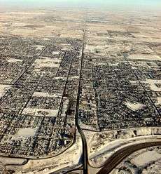 Aerial view of 17 Avenue SE looking east | |
| Part of | Former Hwy 1A |
|---|---|
| Length | 15.5 km[1] (9.6 mi) |
|
17 Avenue SE | |
| International Avenue | |
| Length | 11.2 km (7.0 mi)[1] |
| Location | Calgary, Alberta |
| West end | 9 Avenue SE |
| Major junctions |
|
| East end |
116 Street SE (Calgary-Chestermere city limits) |
|
Chestermere Boulevard | |
| Length | 3.8 km (2.4 mi)[1] |
| Location | Chestermere, Alberta |
| West end |
116 Street SE (Calgary-Chestermere city limits) |
| East end | Hwy 1 (TCH) |
| Neighborhoods |
|---|
|
17 Avenue SE is a major arterial road in east Calgary, Alberta, Canada. 17 Avenue SE focal point of the International Avenue Business Revitalization Zone (BRZ) and is the main roadway through the former town of Forest Lawn. Chestermere Boulevard is a major arterial road and the eastern extension of 17 Avenue SE through Chestermere, Alberta, Canada.[2] The roadway is a former alignment of Highway 1A.

Route description
The west end of 17 Avenue SE begins with a small segment at a 5-way intersection with 9 Avenue SE and 15 Street SE (due to traffic calming, access to northbound 15 Street SE is closed), crossing the Canadian Pacific Railway, and ending at 17A Street SE. It begins again just to the south at the Blackfoot Trail / 19 Street SE intersection and crosses the Bow River via the Cushing Bridge before intersecting Deerfoot Trail (Highway 2). Prior to the construction of Blackfoot Trail, 17 Avenue SE was a continuous roadway and the section between 19 Street SE and Deerfoot Trail is now generally referred to as part of Blackfoot Trail. 19 Street SE serves as the main access between 9 Avenue SE and Blackfoot Trail / 17 Avenue SE.
East of Deerfoot Trail, 17 Avenue SE leaves the Bow River valley and intersects Barlow Trail, though it is only accessible for westbound traffic. It passes through the communities of Albert Park/Radisson Heights, Southview, and Forest Lawn, and continues east past Elliston Park before intersecting Stoney Trail. It transitions into rural farmland and at 116 Street SE (also known as Range Road 284 or Conrich Road), crosses enters into the city of Chestermere, where it becomes Chestermere Boulevard. It ends at the Highway 1 (Trans-Canada Highway) interchange, where it continues east as Range Road 243.
History
17 Avenue SE is the original alignment of Highway 1 through eastern Calgary. In 1949, Highway 1 was rerouted to follow 16 Avenue N, bypassing downtown Calgary and Forest Lawn, and 17 Avenue SE designated as Highway 1A. The section of Highway 1A west of Deerfoot Trail was dropped in the 1970s, resulting in Highway 1A being a short alternate route into Calgary and its southeast industrial parks. In 1993, the International Avenue BRZ was established resulting in 17 Avenue SE being nicknamed as International Avenue.[3] In 2007, the City of Calgary annexed land from Rocky View County up to Range Road 284 (now 116 Street SE);[4] while in 2009, Chestermere annexed land up to the Calgary city limit,[5] resulting in Highway 1A no longer traveling through a rural municipality and signalling a possible end to the Highway 1A designation. In 2013, the province of Alberta decommissioned Highway 1A,[6] and as of 2016 remnant Highway 1A signage still remains on Deerfoot Trail and sections of 17 Avenue SE within Calgary; however, it has been removed along Stoney Trail, through Chestermere, and along the Trans-Canada Highway.
Future
The City of Calgary considers 17 Avenue SE between 26 Street SE and 60 Street SE as a Main Street, slated to be a mixed-use residential and commercial corridor.[7] The City of Calgary is planning to construct a transitway along the centre of 17 Avenue SE; Phase 1 would involve construction between 28 Street SE and Hubalta Road[8] and Phase 2 crossing Deerfoot Trail and connecting with 9 Avenue SE.[9] Phase 1 construction is slated start in 2017 while Phase 2 is in the design stage. Long-term plans call for the mixed-use corridor and transitway to extend east into Chestermere.[10][11]
Major intersections
From west to east.[2]
| Location | km[1] | mi | Destinations | Notes | |
|---|---|---|---|---|---|
| Calgary | 0.0 | 0.0 | 9 Avenue SE / 15 Street SE | ||
| 0.5 | 0.31 | Blackfoot Trail / 17A Street SE / 19 Street SE | Blackfoot Trail concurrency begins Through traffic follows Blackfoot Trail | ||
| 0.9 | 0.56 | Cushing Bridge across the Bow River | |||
| 1.5 | 0.93 | Partial cloverleaf interchange (Hwy 2 Exit 254) Blackfoot Trail concurrency ends | |||
| 2.1 | 1.3 | Barlow Trail / 26 Street SE | No eastbound exit to Barlow Trail | ||
| 2.2 | 1.4 | 28 Street SE | |||
| 2.7 | 1.7 | Radisson Drive / 33 Street SE | |||
| 3.1 | 1.9 | 36 Street SE | |||
| 3.9 | 2.4 | 44 Street SE | |||
| 4.5 | 2.8 | 50 Street SE | |||
| 4.7 | 2.9 | 52 Street SE | |||
| 5.2 | 3.2 | Hubalta Road | |||
| 5.5 | 3.4 | 60 Street SE | |||
| 6.4 | 4.0 | 68 Street SE | |||
| 6.6 | 4.1 | 70 Street SE | |||
| 7.3 | 4.5 | Partial cloverleaf interchange (Hwy 201 Exit 81) | |||
| 7.9 | 4.9 | 84 Street SE south | |||
| 8.2 | 5.1 | 84 Street SE north | |||
| 9.5 | 5.9 | 100 Street SE | |||
| Calgary–Chestermere city line | 11.2 | 7.0 | 116 Street SE / Range Road 284 | ||
| East end of 17 Avenue SE • West end Chestermere Boulevard | |||||
| Chestermere | 12.8 | 8.0 | Rainbow Road | ||
| 13.8 | 8.6 | Invermere Drive | |||
| 14.2 | 8.8 | Marina Drive | |||
| 14.7 | 9.1 | Windermere Drive / West Chestermere Drive | |||
| 15.0 | 9.3 | Crosses Chestermere Lake | |||
| 15.3 | 9.5 | Cove Drive / East Chestermere Drive | |||
| 15.5 | 9.6 | Partial cloverleaf interchange | |||
| Continues as Range Road 243 | |||||
1.000 mi = 1.609 km; 1.000 km = 0.621 mi
| |||||
See also
Route map:
References
- 1 2 3 4 Google (December 21, 2016). "17 Avenue SE in Calgary" (Map). Google Maps. Google. Retrieved December 21, 2016.
- 1 2 Sherlock's Map of Calgary (16th ed.). Langdon, Alberta: Sherlock Publishing Ltd. 2014. pp. 28, 29, 30, 66, and 68. ISBN 1-895229-80-4.
- ↑ "History". International Avenue | SE17. Retrieved December 19, 2016.
- ↑ History of Annexation (PDF) (Map). The City of Calgary. June 13, 2016. Retrieved 20 December 2016.
- ↑ "Order in Council: OC130-2009" (PDF). Alberta Municipal Affairs. Government of Alberta. February 9, 2009. Retrieved December 20, 2016.
- ↑ "Highway 1A becomes Chestermere Boulevard" (PDF). City of Chestermere. June 17, 2013. Retrieved December 20, 2016.
- ↑ "17 Ave SE". Main Streets: Planning the future of Calgary's thriving main streets. City of Calgary: Planning and Development. April 8, 2014. Retrieved December 20, 2016.
- ↑ "17 Avenue S.E. Bus Rapid Transit (BRT) project". Transportation Infrastructure. The City of Calgary. July 3, 2015. Retrieved December 20, 2016.
- ↑ "17 Ave. S.E. BRT—Phase 2: 28 Street S.E. to 9 Avenue S.E." Transportation Infrastructure. The City of Calgary. November 23, 2016. Retrieved December 20, 2016.
- ↑ "17 Avenue S.E. Corridor Study: Stoney Trail to East City Limit". Transportation Planning. City of Calgary. June 12, 2015. Retrieved December 20, 2016.
- ↑ "Chestermere Boulevard Corridor Plan" (PDF). City of Chestermere. HDR. Retrieved December 20, 2016.