Big Lakes County
| Big Lakes County | ||
|---|---|---|
| Municipal district | ||
 Boundary sign | ||
| ||
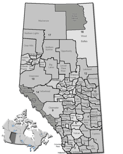 Location of Big Lakes in Alberta | ||
| Coordinates: 55°25′57″N 116°29′10″W / 55.43250°N 116.48611°WCoordinates: 55°25′57″N 116°29′10″W / 55.43250°N 116.48611°W | ||
| Country |
| |
| Province |
| |
| Region | Northern Alberta | |
| Census division | No. 17 | |
| Incorporated | 1995 | |
| Government[1] | ||
| • Reeve | Kenneth Wayne Matthews | |
| • Governing body | Big Lakes County Council | |
| • Office location | High Prairie | |
| Area (2016)[2] | ||
| • Land | 13,942.43 km2 (5,383.20 sq mi) | |
| Population (2016)[2] | ||
| • Total | 5,672 | |
| • Density | 0.4/km2 (1/sq mi) | |
| Time zone | UTC-7 (MST) | |
| Website | biglakescounty.ca | |
Big Lakes County, formerly the Municipal District of Big Lakes, is a municipal district in north-central Alberta, Canada.
It is located in Census Division 17, around the Lesser Slave Lake. Utikuma Lake and Winagami Lake are also located in this municipal district.
History
Big Lakes County was previously known as the Municipal District of Big Lakes prior to March 6, 2015.[3]
Demographics
As a census subdivision in the 2016 Census of Population conducted by Statistics Canada, Big Lakes County recorded a population of 5,672 living in 2,099 of its 2,728 total private dwellings, a −4.1% change from its 2011 population of 5,912.[2] This includes the populations of three Métis settlements, East Prairie (304), Gift Lake (658) and Peavine (607),[4] located within the census subdivision that are municipalities independent of Big Lakes County.[5] With a land area of 13,942.43 km2 (5,383.20 sq mi), the census subdivision had a population density of 0.4/km2 (1.1/sq mi) in 2016.[2] Excluding the three Metis settlements, Big Lakes County had a population of 4,103 in 2016,[2] a change of −16.5% from its 2011 population of 4,914.[6]
Big Lakes County's 2013 municipal census counted a population of 3,861,[7] a −7.7% change from its 2002 municipal census population of 4,181.[8]
As a census subdivision in the 2011 Census of Population, Big Lakes had a population of 5,912 living in 2,143 of its 2,710 total dwellings, a -1.3% change from its 2006 adjusted population of 5,989. This includes the populations of three Metis settlements, East Prairie (366), Gift Lake (662) and Peavine (690),[9] located within the census subdivision that are municipalities independent of Big Lakes County.[5] With a land area of 13,928.13 km2 (5,377.68 sq mi), the census subdivision had a population density of 0.4/km2 (1.1/sq mi) in 2011.[10] As a municipality in the 2011 Census, Big Lakes County had a population of 4,914 without the three Métis settlements.[6]
Visible minorities and Aboriginals
Big Lakes had the most Métis people per capita of any Canadian census subdivision in 2006 with a population of 5,000 or more due to the census' inclusion of the population of the three Métis settlement municipalities within Big Lakes' totals.
| Visible minority and Aboriginal population (Canada 2006 Census) | |||
|---|---|---|---|
| Population group | Population | % of total population | |
| White | 2,815 | 48.5% | |
| Visible minority group Source:[11] | South Asian | 20 | 0.3% |
| Chinese | 10 | 0.2% | |
| Black | 0 | 0% | |
| Filipino | 0 | 0% | |
| Latin American | 0 | 0% | |
| Arab | 0 | 0% | |
| Southeast Asian | 0 | 0% | |
| West Asian | 0 | 0% | |
| Korean | 10 | 0.2% | |
| Japanese | 0 | 0% | |
| Visible minority, n.i.e. | 0 | 0% | |
| Multiple visible minority | 10 | 0.2% | |
| Total visible minority population | 60 | 1% | |
| Aboriginal group Source:[12] | First Nations | 845 | 14.6% |
| Métis | 2,030 | 35% | |
| Inuit | 0 | 0% | |
| Aboriginal, n.i.e. | 25 | 0.4% | |
| Multiple Aboriginal identity | 30 | 0.5% | |
| Total Aboriginal population | 2,930 | 50.5% | |
| Total population | 5,805 | 100% | |
Communities and localities
|
The following urban municipalities are surrounded by Big Lakes County:[5]
The following hamlets are located within Big Lakes County:[5] The following Indian reserves are located within Big Lakes County:
|
The following localities are located within Big Lakes County:[13]
|
See also
References
- ↑ "Municipal Officials Search". Alberta Municipal Affairs. September 22, 2017. Retrieved September 25, 2017.
- 1 2 3 4 5 "Population and dwelling counts, for Canada, provinces and territories, and census subdivisions (municipalities), 2016 and 2011 censuses – 100% data (Alberta)". Statistics Canada. February 8, 2017. Retrieved February 8, 2017.
- ↑ "O.C. 76/2015". Government of Alberta. March 6, 2015. Retrieved March 9, 2015.
- ↑ "Population and dwelling counts, for Canada, provinces and territories, and designated places, 2016 and 2011 censuses – 100% data (Alberta)". Statistics Canada. February 8, 2017. Retrieved February 9, 2017.
- 1 2 3 4 "Specialized and Rural Municipalities and Their Communities" (PDF). Alberta Municipal Affairs. December 28, 2012. Retrieved January 6, 2013.
- 1 2 "2012 Municipal Affairs Population List" (PDF). Alberta Municipal Affairs. November 22, 2012. Retrieved January 6, 2013.
- ↑ "2013 Municipal Affairs Population List" (PDF) (PDF). Alberta Municipal Affairs. November 20, 2013. ISBN 978-1-4601-1418-6. Retrieved December 4, 2013.
- ↑ "2005 Official Population List" (PDF) (PDF). Alberta Municipal Affairs. November 28, 2005. Retrieved August 27, 2013.
- ↑ "Population and dwelling counts, for Canada, provinces and territories, and designated places, 2011 and 2006 censuses (Alberta)". Statistics Canada. April 11, 2012. Retrieved January 6, 2013.
- ↑ "Population and dwelling counts, for Canada, provinces and territories, and census subdivisions (municipalities), 2011 and 2006 censuses (Alberta)". Statistics Canada. 2012-02-08. Retrieved 2012-02-08.
- ↑ Community Profiles from the 2006 Census, Statistics Canada - Census Subdivision
- ↑ Aboriginal Population Profile from the 2006 Census, Statistics Canada - Census Subdivision
- ↑ "Standard Geographical Classification (SGC) 2006, Economic Regions: 4817027 - Big Lakes, geographical codes and localities, 2006". Statistics Canada. 2010-03-05. Retrieved 2012-08-11.
External links
Places adjacent to Big Lakes County | |
|---|---|