Alberta Highway 633

Highway 633 shield

Highway 633
Villeneuve Road
Route information
Maintained by Alberta Transportation
Length 89 km (55 mi)
Major junctions
West end Hwy 757 near Gainford
 
East end Hwy 2 in St. Albert
Location
Specialized
and rural
municipalities
Parkland County, Lac Ste. Anne County, Sturgeon County
Major cities St. Albert
Highway system

Provincial highways in Alberta

Hwy 631Hwy 640

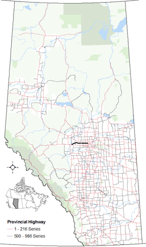
Alberta Provincial Highway No. 633, commonly referred to as Highway 633, is a highway in the province of Alberta, Canada. It runs west-east from Highway 757 just north of Highway 16 to Highway 2 (St. Albert Trail) in St. Albert.[1] It runs through the summer villages on the north side of Isle Lake, and the south side of Lac Ste. Anne. It is also known as Villeneuve Road between Villeneuve and St. Albert.

Major intersections

Starting from the west end of Highway 633:

Rural/specialized municipalityLocationkmmiDestinationsNotes
Parkland County00.0 Hwy 727 to Hwy 16 (TCH) Sangudo, Gainford
Township Road 534A
Hwy 633 western terminus
53°36′40″N 114°51′41″W / 53.61111°N 114.86139°W / 53.61111; -114.86139 (633 km 00)
Lac Ste. Anne CountyLake Isle116.8Range Road 5553°38′52″N 114°42′52″W / 53.64778°N 114.71444°W / 53.64778; -114.71444 (633 km 11)
Darwell2012 Hwy 765 Cherhill, Fallis53°40′12″N 114°35′31″W / 53.67000°N 114.59194°W / 53.67000; -114.59194 (633 km 20)
3723Range Road 34 Val Quentin53°39′27″N 114°22′13″W / 53.65750°N 114.37028°W / 53.65750; -114.37028 (633 km 37)
3824Range Road 33 Alberta Beach53°39′27″N 114°20′44″W / 53.65750°N 114.34556°W / 53.65750; -114.34556 (633 km 38)
4629 Hwy 43 Grande Prairie, Carvel, Edmonton53°39′27″N 114°13′23″W / 53.65750°N 114.22306°W / 53.65750; -114.22306 (633 km 46)
Sturgeon County6440 Hwy 779 Calahoo, Stony Plain53°39′27″N 114°0′7″W / 53.65750°N 114.00194°W / 53.65750; -114.00194 (633 km 64)
Villeneuve7647 Hwy 44 Westlock, Acheson, Edmonton53°39′29″N 113°48′33″W / 53.65806°N 113.80917°W / 53.65806; -113.80917 (633 km 76)
City of St. Albert8653Ray Gibbon Drive53°39′29″N 113°40′40″W / 53.65806°N 113.67778°W / 53.65806; -113.67778 (633 km 86)
8955 St. Albert Trail (Hwy 2) Athabasca, Edmonton
Erin Ridge Road
Hwy 633 eastern terminus
53°39′29″N 113°37′48″W / 53.65806°N 113.63000°W / 53.65806; -113.63000 (633 km 89)
1.000 mi = 1.609 km; 1.000 km = 0.621 mi

References

  1. Google (August 22, 2017). "Highway 633 in Alberta" (Map). Google Maps. Google. Retrieved August 22, 2017.


This article is issued from Wikipedia. The text is licensed under Creative Commons - Attribution - Sharealike. Additional terms may apply for the media files.