Waterton Lakes National Park
| Waterton Lakes National Park | |
|---|---|
|
IUCN category II (national park) | |
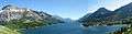
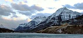 Upper Waterton Lake | |
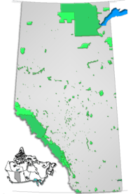
 Waterton Lakes National Park Location | |
| Location | Alberta, Canada |
| Nearest city | Pincher Creek |
| Coordinates | 49°02′45″N 113°54′55″W / 49.04583°N 113.91528°WCoordinates: 49°02′45″N 113°54′55″W / 49.04583°N 113.91528°W |
| Area | 505 km2 (195 sq mi) |
| Established |
1895 (national park) 1979 (biosphere reserve) 1995 (world heritage site) |
| Visitors | 402,542 (in 2012/13[1]) |
| Governing body | I.D. Council, Parks Canada |
| World Heritage site | 354 |
| Improvement District No. 4 | |
|---|---|
| Improvement district | |
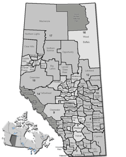 Location of Waterton Lakes National Park in Alberta | |
| Coordinates: 49°02′45″N 113°54′55″W / 49.04583°N 113.91528°W | |
| Country |
|
| Province |
|
| Region | Southern Alberta |
| Census division | No. 3 |
| Government[2] | |
| • Governing body | I.D. 4 Council |
| • Chair | Brian Reeves |
| • CAO | J. Scott Barton |
| Area (2016)[3] | |
| • Land | 485.66 km2 (187.51 sq mi) |
| Population (2016)[3] | |
| • Total | 105 |
| • Density | 0.2/km2 (0.5/sq mi) |
| Time zone | UTC-7 (MST) |
| • Summer (DST) | UTC-6 (MDT) |
| Postal code | T0K 2M0 |
| Area code(s) | 403, 587 |
| Website | Parks Canada |
Waterton Lakes National Park is a national park located in the southwest corner of Alberta, Canada, and borders Glacier National Park in Montana, United States. Waterton was Canada's fourth national park, formed in 1895 and named after Waterton Lake, in turn after the Victorian naturalist and conservationist Charles Waterton. The park contains 505 km2 (195 sq mi) of rugged mountains and wilderness.
Operated by Parks Canada, Waterton is open all year, but the main tourist season is during July and August. The only commercial facilities available within the park are located at the Waterton Park townsite. The park ranges in elevation from 1,290 metres (4,232 ft) at the townsite to 2,910 m (9,547 ft) at Mount Blakiston. It offers many scenic trails, including Crypt Lake trail. In 2012/2013, Waterton Lakes National Park had 402,542 visitors.[1]
The park was the subject of a short film in 2011's National Parks Project, directed by Peter Lynch and scored by Cadence Weapon, Laura Barrett and Mark Hamilton.
History
In 1932, Waterton-Glacier International Peace Park was formed from Waterton and Glacier. It was dedicated to world peace by Sir Charles Arthur Mander on behalf of Rotary International. Although the park has a lot of diversity for its size, the main highlight is the Waterton lakes—the deepest in the Canadian Rockies—overlooked by the historic Prince of Wales Hotel National Historic Site.
Fauna
Animals that inhabit this national park include wolverines, bighorn sheep, bald eagles, white-tailed deer, mule deer, mountain goats, elk, moose, foxes, timber wolves, bison, coyotes, beavers, river otters, cougars, lynxes, bobcats, snowshoe hares, pikas, hoary marmots, grizzly bears and black bears.
Climate
| Climate data for Waterton Park Gate, Alberta, Canada | |||||||||||||
|---|---|---|---|---|---|---|---|---|---|---|---|---|---|
| Month | Jan | Feb | Mar | Apr | May | Jun | Jul | Aug | Sep | Oct | Nov | Dec | Year |
| Average high °C (°F) | −1.9 (28.6) |
2.8 (37) |
3.7 (38.7) |
10 (50) |
14.2 (57.6) |
18.1 (64.6) |
23.6 (74.5) |
24.7 (76.5) |
18.4 (65.1) |
11.6 (52.9) |
3.3 (37.9) |
−0.5 (31.1) |
10.7 (51.2) |
| Average low °C (°F) | −13.3 (8.1) |
−6.4 (20.5) |
−7 (19) |
−1.2 (29.8) |
2.7 (36.9) |
6.5 (43.7) |
8 (46) |
8.1 (46.6) |
4.5 (40.1) |
0.6 (33.1) |
−5.5 (22.1) |
−9.1 (15.6) |
−1 (30.1) |
| Average snowfall cm (inches) | 33 (13) |
17 (6.7) |
29 (11.4) |
39 (15.4) |
14 (5.5) |
0 (0) |
0 (0) |
0 (0) |
10 (3.9) |
12 (4.7) |
35 (13.8) |
27 (10.6) |
216 (85) |
| Source: The Weather Network[4] | |||||||||||||
Biosphere Reserve
In 1979, Waterton and bordering Glacier National park in the US were designated as World Biosphere reserves, preserving mountains, prairie, lakes and freshwater wetlands ecosystems. Habitats represented in the parks' range include: prairie grasslands, aspen grove forests, alpine tundra/high meadows, lower subalpine forests, deciduous and coniferous forests.[5]
World Heritage Site
The park is part of the Waterton-Glacier International Peace Park, designated as World Heritage Site in 1995 for their distinctive climate, physiographic setting, mountain-prairie interface, and tri-ocean hydrographical divide. They are areas of significant scenic values with abundant and diverse flora and fauna.[6]
Photo gallery

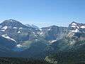 View from top of Summit Trail
 Panorama taken from Prince of Wales hotel looking south
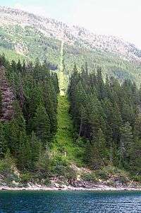 49th parallel at Waterton Lake
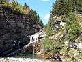 Cameron Falls
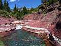 Red Rock Canyon
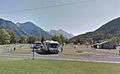 Waterton Park townsite campground
 South Beach of Waterton Park townsite
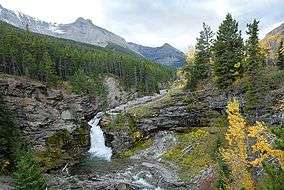 Blakiston Falls (upper)
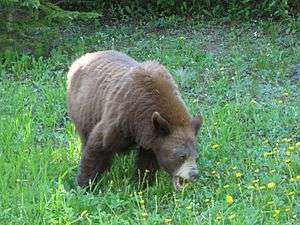 Cinnamon-coloured Black Bear eating dandelions, in Akamina Parkway.
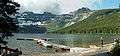
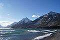 View of the mountains surrounding the Waterton Lake.
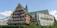
 Castilleja miniata Indian Paintbrush on the Bears Hump
.jpg) View from Bears Hump
View from Bears Hump
| Wikimedia Commons has media related to Waterton Lakes National Park. |
See also
References
- 1 2 "Parks Canada Attendance 2007-08 to 2012-13" (PDF). Parks Canada. July 31, 2013. p. 2. Retrieved May 29, 2014.
- ↑ "Municipal Officials Search". Alberta Municipal Affairs. September 22, 2017. Retrieved September 25, 2017.
- 1 2 "Population and dwelling counts, for Canada, provinces and territories, and census subdivisions (municipalities), 2016 and 2011 censuses – 100% data (Alberta)". Statistics Canada. February 8, 2017. Retrieved February 8, 2017.
- ↑ "Waterton Park Weather". The Weather Network. Retrieved 12 April 2017.
- ↑ UNESCO Archived 2006-10-09 at the Wayback Machine. - Park description at UNESCO World Biosphere Reserve
- ↑ UNESCO - Park description at UNESCO World Heritage
External links
| Wikivoyage has a travel guide for Waterton Lakes National Park. |
- Waterton Lakes National Park (Parks Canada)
- Map Highlighting Park's Boundaries
- Pure Experience: Waterton Lakes National Park (Travel Alberta)
| Western | |
|---|---|
| Eastern | |
| Northern | |
| Tentative List | |
| Former |
|
| |
| Subdivisions | |||||||
|---|---|---|---|---|---|---|---|
| Communities | |||||||
| Cities and urban service areas | |||||||
| Rural municipalities |
| ||||||
| Specialized municipalities | |||||||
| |||||||