111 Street, Edmonton
| 111 Street SW | |
|
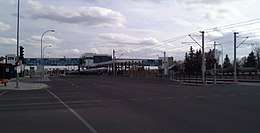
Start/End points of 111 Street | |
| Maintained by | the City of Edmonton |
|---|---|
| Length | 8.2 km[1] (5.1 mi) |
| Location | Edmonton |
| South end | Ellerslie Road / James Mowatt Trail |
| Major junctions | Anthony Henday Drive, 23 Avenue, 34 Avenue, Whitemud Drive, 51 Avenue |
| North end | 61 Avenue |
111 Street is a major arterial road in south Edmonton, Alberta, Canada. The south leg of the LRT runs between the northbound and southbound lanes north of 23 Avenue. It passes by Southgate Centre and the former location of Heritage Mall,[2] now the location of the Century Park transit-oriented development.
111 Street was originally part of the 1963 Metro Edmonton Transportation Study (METS), which proposed a downtown freeway loop and feeder routes, including three southern approaches from Highway 2 via 111 Street, Calgary Trail, and 91 Street / Mill Creek Ravine.[3] As 111 Street was constructed, a wide right-of-way was integrated; however the freeway plan was ultimately cancelled. In the 2000s, the LRT Capital Line was expanded and constructed along the median and opened in 2010.[4]
Neighbourhoods
List of neighbourhoods 111 Street runs through, in order from south to north:[5]
Major intersections
This is a list of major intersections, starting at the south end of 111 Street.[5] The entire route is in Edmonton.
| km[1] | mi | Destinations | Notes | ||
|---|---|---|---|---|---|
| 0.0 | 0.0 | Continues as James Mowatt Trail | |||
| Ellerslie Road (9 Avenue SW) | At-grade (traffic lights) | ||||
| 1.2 | 0.75 | Partial cloverleaf interchange (traffic lights); exit 2 on Hwy 216 | |||
| 2.1 | 1.3 | 12 Avenue NW | At-grade (traffic lights) | ||
| 2.4 | 1.5 | Crosses Blackmud Creek | |||
| 3.3 | 2.1 | 23 Avenue NW | At-grade (traffic lights) | ||
| 3.7 | 2.3 | Passes (LRT southern terminus; travels in median) | |||
| 4.1 | 2.5 | Saddleback Road / 29A Avenue | At-grade (traffic lights) | ||
| 4.6 | 2.9 | 34 Avenue NW | At-grade (traffic lights) | ||
| 5.7 | 3.5 | 40 Avenue | At-grade (traffic lights) | ||
| 6.5 | 4.0 | Split diamond interchange (traffic lights) | |||
| 6.8 | 4.2 | Passes | |||
| 7.0 | 4.3 | Southgate Centre access | At-grade (traffic lights) | ||
| 7.1 | 4.4 | 51 Avenue | At-grade (traffic lights) | ||
| 8.2 | 5.1 | 61 Avenue (to 109 Street) | At-grade (traffic lights) | ||
| 1.000 mi = 1.609 km; 1.000 km = 0.621 mi | |||||
See also
Route map:
References
- 1 2 Google (April 3, 2018). "111 Street in Edmonton, AB" (Map). Google Maps. Google. Retrieved April 3, 2018.
- ↑ "Hertiage Mall: Edmonton, Alberta, Canada". DeadMalls.com. March 29, 2006. Retrieved April 3, 2018.
- ↑ Edmonton District Planning Commission (1963). "Exhibit 1: Phase 1 Development Key Plan" (Map). Metropolitan Edmonton transportation study: Plan and program. Volume 2. Retrieved October 26, 2017.
- ↑ "The Way We Move LRT for Everyone" (PDF). Edmonton Transit System and City of Edmonton. pp. 4–5. Archived from the original (pdf) on September 10, 2015. Retrieved September 8, 2015.
- 1 2 "City of Edmonton map utility". Archived from the original on 2009-06-25. Retrieved 2009-06-23.