Municipal District of Peace No. 135
| Municipal District of Peace No. 135 | ||
|---|---|---|
| Municipal district | ||
| ||
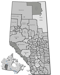 Location of Peace No. 135 in Alberta | ||
| Coordinates: 56°08′51″N 117°44′2″W / 56.14750°N 117.73389°WCoordinates: 56°08′51″N 117°44′2″W / 56.14750°N 117.73389°W | ||
| Country |
| |
| Province |
| |
| Region | Northern Alberta | |
| Census division | No. 19 | |
| Established | 1916 | |
| Incorporated | 1945 | |
| Government[1] | ||
| • Reeve | Robert Willing | |
| • Governing body | M.D. of Peace Council | |
| • Office location | adjacent to Berwyn | |
| Area (2016)[2] | ||
| • Land | 847.47 km2 (327.21 sq mi) | |
| Population (2016)[2] | ||
| • Total | 1,747 | |
| • Density | 2.1/km2 (5/sq mi) | |
| Time zone | UTC-7 (MST) | |
| Website | mdpeace.com | |
The Municipal District of Peace No. 135 is a municipal district in northwestern Alberta, Canada. Located in Census Division No. 19, its municipal office is located outside but adjacent to the Village of Berwyn.
Demographics
In the 2016 Census of Population conducted by Statistics Canada, the Municipal District of Peace No. 135 recorded a population of 1,747 living in 578 of its 639 total private dwellings, a 20.8% change from its 2011 population of 1,446. With a land area of 847.47 km2 (327.21 sq mi), it had a population density of 2.1/km2 (5.3/sq mi) in 2016.[2]
In the 2011 Census, Statistics Canada originally reported that the Municipal District of Peace No. 135 had a population of 1,344 living in 503 of its 539 total dwellings, a -9.6% change from its 2006 population of 1,487.[3] Statistics Canada subsequently amended the 2011 census results to a population of 1,446 living in 540 of its 578 total dwellings, a -2.8% change from 2006.[4] With a land area of 850.88 km2 (328.53 sq mi), it had a population density of 1.7/km2 (4.4/sq mi) in 2011.[3][4]
Communities and localities
|
The following urban municipalities are surrounded by the Municipal District of Peace No. 135:[5]
The following hamlets are located within the Municipal District of Peace No. 135:[5]
|
The following localities are located within the Municipal District of Peace No. 135:[6]
|
Attractions
Economy
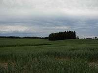
Agriculture is a significant part of the area's economy, with the region being dubbed as most northern agricultural industry oasis in the world.[7] The region has unique growing combination of a northern climate, fertile soils, and a watershed system fed by glacial run offs.
See also
References
- ↑ "Municipal Officials Search". Alberta Municipal Affairs. September 22, 2017. Retrieved September 25, 2017.
- 1 2 3 "Population and dwelling counts, for Canada, provinces and territories, and census subdivisions (municipalities), 2016 and 2011 censuses – 100% data (Alberta)". Statistics Canada. February 8, 2017. Retrieved February 8, 2017.
- 1 2 "Population and dwelling counts, for Canada, provinces and territories, and census subdivisions (municipalities), 2011 and 2006 censuses (Alberta)". Statistics Canada. February 8, 2012. Retrieved February 8, 2012.
- 1 2 "Corrections and updates". Statistics Canada. March 21, 2013. Retrieved April 15, 2013.
- 1 2 "Specialized and Rural Municipalities and Their Communities" (PDF). Alberta Municipal Affairs. 2012-03-01. Retrieved 2012-08-12.
- ↑ "Standard Geographical Classification (SGC) 2006, Economic Regions: 4819071 - Peace No. 135, geographical codes and localities, 2006". Statistics Canada. 2010-03-05. Retrieved 2012-08-12.
- ↑ "Defining Quality of Peace Country Agriculture" (PDF). Branding the Peace Country Association. Apr 2009.
External links
Places adjacent to Municipal District of Peace No. 135 | |
|---|---|