Rimbey
| Rimbey | |
|---|---|
| Town | |
| Town of Rimbey | |
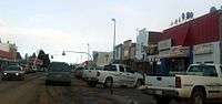
 Mainstreet Rimbey | |
| Motto(s): The friendly international town | |
 Rimbey Location of Rimbey in Alberta | |
| Coordinates: 52°38′25″N 114°14′02″W / 52.64028°N 114.23389°W | |
| Country |
|
| Province |
|
| Region | Central Alberta |
| Census division | 8 |
| Municipal district | Ponoka County |
| Incorporated[1] | |
| • Village | June 13, 1919 |
| • Town | December 13, 1948 |
| Government[2] | |
| • Mayor | Rick Pankiw |
| • Governing body | Rimbey Town Council |
| • MP | Blaine Calkins |
| Area (2016)[3] | |
| • Land | 11.4 km2 (4.4 sq mi) |
| Elevation[4] | 930 m (3,050 ft) |
| Population (2016)[3] | |
| • Total | 2,567 |
| • Density | 225.1/km2 (583/sq mi) |
| Time zone | UTC-7 (MST) |
| Postal code span | T0C 2J0 |
| Area code(s) | +1-403 |
| Highways |
Highway 20 Highway 53 |
| Waterways | Gull Lake |
| Website | Official website |
Rimbey /ˈrɪmbiː/ is a town in central Alberta, Canada. It is located at the junction of Highways 20 and 53 in the Blindman River valley area approximately 62 kilometres (39 mi) northwest of Red Deer and 145 kilometres (90 mi) southwest of Edmonton.
Provincially, Rimbey is part of the Rimbey-Rocky Mountain House-Sundre electoral district and federally in the Wetaskiwin riding.
History
Officially made a community in 1902, the first name given to the settlement at the turn of the century was Kansas Ridge as many of the settlers originated from the American state of Kansas. Among them were the three Rimbey brothers (Sam, Ben, and Jim) for whom the town was officially named after in 1904. The Rimbeys moved to Canada from Scott County, Illinois having moved to Illinois in the 1830s from Maryland. They were born in Pennsylvania.
In 1919 the Lacombe and Blindman Valley Electric Railway (later part of the Canadian Pacific Railway) reached Rimbey, and there was much enthusiasm for the "new town" by the tracks (now Highway 20). Two grain companies built elevators the following year and Rimbey's population swelled to 319 by 1921.
The Second World War brought abrupt changes to Rimbey, as young men and sometimes their families left the village. When war was over some returned and others did not. Many new faces came to Rimbey and the population surged to 634 by 1946.
Demographics
In the 2016 Census of Population conducted by Statistics Canada, the Town of Rimbey recorded a population of 2,567 living in 1,077 of its 1,160 total private dwellings, a 7.9% change from its 2011 population of 2,378. With a land area of 11.4 km2 (4.4 sq mi), it had a population density of 225.2/km2 (583.2/sq mi) in 2016.[3]
In the 2011 Census, the Town of Rimbey had a population of 2,378 living in 983 of its 1,081 total dwellings, a 5.6% increase from its 2006 population of 2,252. With a land area of 11.34 km2 (4.38 sq mi), it had a population density of 209.7/km2 (543.1/sq mi) in 2011.[5]
The population of the Town of Rimbey according to its 2008 municipal census was 2,496.[6]
Economy
Rimbey is mainly a farming community, with the oil and gas sector increasing in importance.
The town has full amenities including hotels, motels, several grocery, convenience, and liquor stores and a campground. Rimbey has its own hospital and ambulance (although more specialized procedures are sent to Red Deer, Calgary or Edmonton) and its own detachment of the Royal Canadian Mounted Police.
Attractions
Pas-Ka-Poo Park includes large open lawns, a historical village site, museums and a wide array of interesting displays, including the World's Largest Collection of International Trucks in the Smithson International Truck Museum.
The Rimbey Golf & Trailer Park was located 1.5 kilometres (0.93 mi) south. The golf course has since been closed down, due to flooding.
The town had an outdoor swimming pool open from May to September every year, which has been rebuilt as a 3,900 ft (1,200 m)² junior olympic pool with a beach entrance, two hot tubs, a double loop waterslide and a 2,100 ft (640 m)² splash pad for toddlers up to 15 years of age.
The Beatty House is a historical house in the centre of town and can be booked for tours or to house social events.
There are also a couple of smaller public parks (designed for children) around town.
Education
Operated by the Wolf Creek School Division No. 72, the Rimbey Elementary School, the Rimbey Junior-Senior High School, and the West Country Outreach School provide education within Rimbey. The town is also home to the Rimbey Christian School, a private school that offers learning for students in K-9. The Rimbey Nursery School offers play-based programs for children 3 to 5 years old.[7]
Media
The town newspaper is the Rimbey Review.[8] The Review commenced publishing on January 27, 1997 and was owned by Sylvan Lake News. The paper was sold to Black Press in 2005. The Rimbey Review succeeded the Rimbey Record, which had been publishing since the early 1930s. The Record was cited, in 1937, for its assistance in a series for the Edmonton Journal, which won that paper a Pulitzer prize. The Rimbey Record was, at its demise, part of a chain of newspapers, under the banner Record Publishing that failed financially after an unsuccessful attempt to go public. The town had one radio station VF8020, which was owned by The Church of Nazarene of Rimbey.
Notable people
- Harry Lang, professional wrestler best known as Cowboy Lang[9]
See also
References
- ↑ "Location and History Profile: Town of Rimbey" (PDF). Alberta Municipal Affairs. October 7, 2016. p. 534. Retrieved October 13, 2016.
- ↑ "Municipal Officials Search". Alberta Municipal Affairs. September 22, 2017. Retrieved September 25, 2017.
- 1 2 3 "Population and dwelling counts, for Canada, provinces and territories, and census subdivisions (municipalities), 2016 and 2011 censuses – 100% data (Alberta)". Statistics Canada. February 8, 2017. Retrieved February 8, 2017.
- ↑ "Alberta Private Sewage Systems 2009 Standard of Practice Handbook: Appendix A.3 Alberta Design Data (A.3.A. Alberta Climate Design Data by Town)" (PDF) (PDF). Safety Codes Council. January 2012. pp. 212–215 (PDF pages 226–229). Retrieved October 9, 2013.
- ↑ "Population and dwelling counts, for Canada, provinces and territories, and census subdivisions (municipalities), 2011 and 2006 censuses (Alberta)". Statistics Canada. 2012-02-08. Retrieved 2012-02-08.
- ↑ Alberta Municipal Affairs (2009-09-15). "Alberta 2009 Official Population List" (PDF). Retrieved 2010-09-14.
- ↑ "Schools". Town of Rimbey. Retrieved 2011-08-26.
- ↑ Rimbey Review
- ↑ Oliver, Greg. "Midget star Cowboy Lang dies". SLAM! Wrestling. Retrieved November 11, 2015.
External links
| Wikimedia Commons has media related to Rimbey. |
Places adjacent to Rimbey | |
|---|---|