Belaka
| Belaka Municipality वेलका नगरपालिका | |
|---|---|
| Municipality | |
 Belaka Municipality Location in Province No. 1 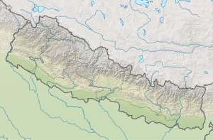 Belaka Municipality Belaka Municipality (Nepal) | |
| Coordinates: 26°47′N 87°04′E / 26.79°N 87.07°ECoordinates: 26°47′N 87°04′E / 26.79°N 87.07°E | |
| Country |
|
| Province | Province No. 1 |
| District | Udayapur |
| Total Wards | 9 |
| Government | |
| • Type | Mayor–council |
| • Body | Belaka Municipality |
| • Mayor | Durga Kumar Thapa (NCP) |
| • Deputy Mayor | Mrs. Raj Kumari Chaudhary (NCP) |
| Area of Municipality | |
| • Total | 344.73 km2 (133.10 sq mi) |
| Area rank | 4th (Province No. 1) |
| Population (2011) | |
| • Total | 42,386 |
| Time zone | UTC+5:45 (NST) |
| Postal code | 56300 |
| Area code(s) | 035 |
| Website | www.belakamun.gov.np |
Belaka (Nepali: बेलका) is a municipality located in Udayapur District of Province No. 1 of Nepal. It is one out of total four urban municipalities located in Udayapur District. It has covered eastmost areas of Udayapur District.
The total area of the municipality is 344.73 square kilometres (133.10 sq mi) and the population of the municipality is 42,386 as of 2011 Nepal census[1] [2]
The municipality was formed on 10 March 2017, when Government of Nepal announced 744 local level units as per the new constitution of Nepal 2015. [3] thus the municipality came into existence. The municipality was formed merging following former VDCs: Tapeshwari, Rampur Thoksila, Mainamaini and Katunjebawala. The municipality is divided into 9 wards and the headquarter of the municipality is located at Rampur Thoksila.[2]
Geography
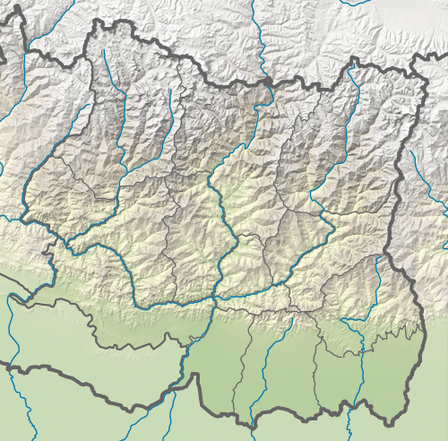
The municipality is situated in the easternmost part of Udayapur district. The geographical coordinations for the municipality is 26°42′09″N 86°55′29″E / 26.70250°N 86.92472°E - 26°55′38″N 87°10′06″E / 26.92722°N 87.16833°E Latitude and longitude. The municipality covers an area of 344.37 square kilometres (132.96 sq mi). Shiwalik and Mahabharat Range borders at north and south part of the municipality. Sun kosi River flows on north border of the municipality which meets to Kosi River which flows on eastern border of the municipality. The municipality includes urban area of Rampur Thoksila and it's neighborhood, rural areas, forests, foothills and grasslands.
It is surrounded by Bhojpur District in north, Dhankuta in north-east, Sunsari in east, Saptari in south and Chaudandigadhi of Udayapur in west. The Koshi Tappu Wildlife Reserve is within in south-east corner.
External links
References
- ↑ "Belaka Municipality in Nepal". Retrieved 17 October 2017.
- 1 2 "District Corrected Last for RAJAPATRA" (PDF). www.mofald.gov.np. Retrieved 17 July 2018.
- ↑ "New local level structure comes into effect from today". www.thehimalayantimes.com. The Himalayan Times. 10 March 2017. Retrieved 17 July 2018.
Headquarter: Triyuga | ||
| Municipality | 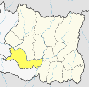 | |
| Rural Municipality | ||