Rautamai
| Rautamai Gaunpalika रौतामाई गाउँपालिका | |
|---|---|
| Rural Municipality | |
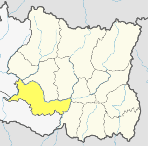
 Rautamai Gaunpalika Location in Nepal | |
| Coordinates: 26°59′N 86°40′E / 26.99°N 86.66°ECoordinates: 26°59′N 86°40′E / 26.99°N 86.66°E | |
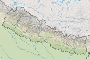
| Country |
|
| Province | Province No. 1 |
| District | Udayapur |
| Established | 10 March 2017 |
| Area | |
| • Total | 204 km2 (79 sq mi) |
| Population (2011) | |
| • Total | 23,481 |
| • Density | 120/km2 (300/sq mi) |
| Time zone | UTC+5:45 (Nepal Standard Time) |
| Area code(s) | 035 |
| Headquarter | Bhuttar (The old office of Bhutar Village Development Committee |
| Website | Official Website |
Rautamai
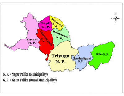
Rautamai Rural Municipality (Nepali: रौतामाई गाउँपालिका) is a rural municipality in Udayapur district of Province No. 1 in Nepal. There are 4 rural municipalities in Udayapur district. There are 8 wards in this municipality. According to 2011 census of Nepal, the total population of the municipality is 23,481 and total area is 204 km².[1] The headquarter of the municipality is in Bhuttar
The rural municipality was established on March 10, 2017 when Ministry of Federal Affairs and Local Development dissolved the existing village development committees and announced the establishment of this new local body.
Nametar, Bhuttar, Laphagaun, Pokhari, Rauta and Aaptar VDCs were merged to form the new rural municipality.
See also
External links
References
- ↑ "CITY POPULATION – statistics, maps & charts". www.citypopulation.de. 8 October 2017. Retrieved 3 February 2018.
This article is issued from
Wikipedia.
The text is licensed under Creative Commons - Attribution - Sharealike.
Additional terms may apply for the media files.