Urlabari
| Urlabari उर्लाबारी | |
|---|---|
| Municipality | |
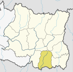
 Urlabari Location in Nepal | |
| Coordinates: 26°40′N 87°37′E / 26.67°N 87.61°ECoordinates: 26°40′N 87°37′E / 26.67°N 87.61°E | |
| Country |
|
| Zone | Koshi Zone |
| District | Morang District |
| Government | |
| • Mayor | Mr. Khadga Phagu (NC) |
| • Deputy Mayor | Mrs. Laxmi Bhandari (NCP) |
| Population (2071) | |
| • Total | 54,696 |
| Time zone | UTC+5:45 (NST) |
| Postal code | 56604 |
| Area code(s) | 021 |
| Website | www.urlabarimun.gov.np |
Urlabari is a town and municipality in Morang District in the Koshi Zone of south-eastern Nepal which is considered as the second largest city in Morang District after Biratnagar. At the time of the 1991 Nepal census it had a population of 18224.[1] At the time of the 2011 Nepal census it had a polulation of 35,166 and 8,165 households.
It is located 60 KM eastern part of metropolitan city Biratnagar. According to the declaration as the municipality from the government on 2071-01-25 to Urlabari, Morang. Jhapa lies in the east of this municipality, oriented to be known as a beautiful city of Morang district. From 2071 census the total population is 54,696. where 29,548 are the woman and 25,148 are men lived with 12,530 households.
Urlabari border:-
Damak Municipality in the East Patharisanichare Municipality and Letang Municipality in the West Miklajung Village Development in the north and Ratuwamai municipality in the west of it.
Health Post details: 1 Government Hospital, 1 Health Checkpoint and 6 Private Health post.
Community forest: Srijana community forest, Sunjhoda community forest, Salbari community forest and Beteni community forest.
Child Development Center: 6
Government education institute: There is lies more than 10 government education institute. some are Urlabari Bahumukhi Campus, Radhika Higher Secondary School, Sunpakkwa Higher Secondary, Radhika Secondary School, Srijana Secondary School, Durga Secondary School, Sunjodha Higher Secondary School, etc.
There are more 15 private held secondary school and higher school.
References
- ↑ "Nepal Census 2001". Nepal's Village Development Committees. Digital Himalaya. Retrieved 18 December 2008.