Arun Rural Municipality
| Arun Gaunpalika अरुण गाउँपालिका | |
|---|---|
| Rural Municipality | |
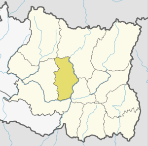
 Arun Gaunpalika Location in Province No. 1  Arun Gaunpalika Arun Gaunpalika (Nepal) | |
| Coordinates: 27°13′N 87°10′E / 27.21°N 87.16°ECoordinates: 27°13′N 87°10′E / 27.21°N 87.16°E | |
| Province | Province No. 1 |
| District | Bhojpur |
| Wards | 7 |
| Established | 10 March 2017 |
| Government | |
| • Type | Village Council |
| • Chairperson | Mr. Gajendra Bahadur Karki |
| • Vice-chairperson | Mrs. Binita Dhakal |
| Area | |
| • Total | 154.76 km2 (59.75 sq mi) |
| Population (2011) | |
| • Total | 17,687 |
| • Density | 110/km2 (300/sq mi) |
| Time zone | UTC+5:45 (Nepal Standard Time) |
| Headquarter | Pyauli |
| Website | official website |
Arun (Nepali: अरुण) is a rural municipality (गाउँपालिका) out of seven rural municipalities of Bhojpur District of Province No. 1 of Nepal. There are a total of 9 municipalities in Bhojpur in which 2 are urban and 7 are rural.
According to MoFALD Arun has an area of 154.76 square kilometres (59.75 sq mi) and the total population of the municipality is 17, 687 as of Census of Nepal 2011. [1] [2] Champe, Yangpang, Pyauli, Charambi, Jarayotar and Yaku VDCs were merged to form Arun Rural Municipality.[1] Pyauli is the Headquarter of this newly formed rural municipality.
References
- 1 2 "स्थानीय तहहरुको विवरण". www.mofald.gov.np/en. MoFALD. Retrieved 6 April 2018.
- ↑ "CITY POPULATION – statistics, maps & charts". www.citypopulation.de. 8 October 2017. Retrieved 4 April 2018.
External links
This article is issued from
Wikipedia.
The text is licensed under Creative Commons - Attribution - Sharealike.
Additional terms may apply for the media files.