Pauwadungma
| Pauwadungma पौवादुङमा गाउँपालिका | |
|---|---|
| Rural Municipality | |
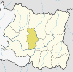
 Pauwadungma Location in Province No. 1  Pauwadungma Pauwadungma (Nepal) | |
| Coordinates: 27°09′N 87°08′E / 27.15°N 87.14°ECoordinates: 27°09′N 87°08′E / 27.15°N 87.14°E | |
| Province | Province No. 1 |
| District | Bhojpur |
| Wards | 6 |
| Government | |
| • Type | Village Council |
| • Chairperson | Mr. Kiran Rai |
| • Vice-chairperson | Mrs. Samjhana Rai |
| Area | |
| • Total | 118.86 km2 (45.89 sq mi) |
| Population (2011) | |
| • Total | 15,394 |
| • Density | 130/km2 (340/sq mi) |
| Time zone | UTC+5:45 (Nepal Standard Time) |
| Headquarter | Changre |
| Website | official website |
Pauwadungma (Nepali: पौवादुङमा) is a rural municipality (गाउँपालिका) out of seven rural municipalities of Bhojpur District of Province No. 1 of Nepal. There are a total of 9 municipalities in Bhojpur in which 2 are urban and 7 are rural.
According to MoFALD Pauwadungma has an area of 118.86 square kilometres (45.89 sq mi) and the total population of the municipality is 15, 394 as of Census of Nepal 2011. [1] [2] To form this new Rural Municipality Sanodumma, Thulodumma, Bastim, Changre, Tiwari Bhanjyang and Shyamsila were merged, which previously were Village development committee (local level administrative villages).[1] Fulfilling the requirement of the new Constitution of Nepal 2015, MoFALD replaced all old VDCs and Municipalities into 753 new local level body (Municipality).
Chyangre is the Headquarter of this newly formed rural municipality.
References
- 1 2 "स्थानीय तहहरुको विवरण". www.mofald.gov.np/en. MoFALD. Retrieved 7 April 2018.
- ↑ "CITY POPULATION – statistics, maps & charts". www.citypopulation.de. 8 October 2017. Retrieved 7 April 2018.