Deumai Municipality
| Deumai Municipality देउमाई नगरपालिका | |
|---|---|
| Municipality | |
 Deumai Municipality Location in Province No. 1  Deumai Municipality Deumai Municipality (Nepal) | |
| Coordinates: 26°55′59″N 87°49′31″E / 26.93306°N 87.82528°ECoordinates: 26°55′59″N 87°49′31″E / 26.93306°N 87.82528°E | |
| Country |
|
| Region | Eastern |
| Zone | Mechi Zone |
| District | Ilam District |
| Established | 2014 |
| Government | |
| • Mayor | Mr. Surya Pokharel (NCP) |
| • Deputy Mayor | Mrs. Pawi Maya Rai (NCP) |
| Area | |
| • Total | 50.7 km2 (19.6 sq mi) |
| Population (2011 Nepal census) | |
| • Total | 10,946 |
| • Density | 220/km2 (560/sq mi) |
| Time zone | UTC+5:45 (NST) |
| Website | official website |
Deumai is a municipality in the eastern development region of Ilam District in the Mechi Zone of Nepal. The new municipality was formed by merging two existing villages Mangalbare and Dhuseni on 02 Dec 2014.[1][2] The office of the municipality is that of the former Mangalbare village development committee.
Population
Deumai municipality is formed by merging Mangalbare and Dhuseni; it has a total population of 10,946 according to 2011 Nepal census.[3]
References
- ↑ "Govt announces 61 municipalities". The Kathmandu Post. 3 December 2014. Retrieved 2 December 2014.
- ↑ "Govt creates 61 new municipalities". República. 3 Dec 2014. Retrieved 2 Dec 2014.
- ↑ "2011 Nepal census (Ward Level)" (PDF). Central Bureau of Statistics. November 2012. Archived from the original (PDF) on 2013-07-31. Retrieved November 2012. Check date values in:
|accessdate=(help)
External links
See also
Headquarter: Ilam | ||
| Rural Municipalities | 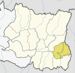 | |
| Municipalities | ||
This article is issued from
Wikipedia.
The text is licensed under Creative Commons - Attribution - Sharealike.
Additional terms may apply for the media files.