Baltimore County, Maryland
| Baltimore County, Maryland | |||
|---|---|---|---|
| County | |||
| Baltimore County | |||
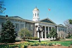 The Baltimore County Courthouse | |||
| |||
| Nickname(s): "B-More County", "The County" | |||
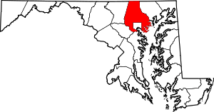 Location in the U.S. state of Maryland | |||
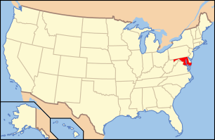 Maryland's location in the U.S. | |||
| Founded | June 30, 1659 | ||
| Named for | Cecil Calvert, 2nd Baron Baltimore | ||
| Seat | Towson | ||
| Largest community | Dundalk | ||
| Area | |||
| • Total | 682 sq mi (1,766 km2) | ||
| • Land | 598 sq mi (1,549 km2) | ||
| • Water | 83 sq mi (215 km2), 12% | ||
| Population (est.) | |||
| • (2017) | 832,468 | ||
| • Density | 1,392/sq mi (537/km2) | ||
| Congressional districts | 1st, 2nd, 3rd, 7th | ||
| Time zone | Eastern: UTC−5/−4 | ||
| Website |
www | ||

Baltimore County is located in the U.S. state of Maryland. It is Maryland's third-most populous county. Baltimore County is part of the Baltimore metropolitan area and Baltimore-Washington metropolitan area (a combined statistical area). Along with Washington, D.C. and its suburbs, the county also forms the southern anchor of the Northeast Megalopolis, which stretches northward to Boston. It hosts a diversified economy, with particular emphasis on government, education and health care.
The county is home to multiple universities including the University of Maryland, Baltimore County; Towson University; Goucher College and Stevenson University (formerly Villa Julie College).
History
The name Baltimore derives from Cecil Calvert, 2nd Baron Baltimore (1605–1675), the proprietor of the new colony in the Province of Maryland, and the town of Baltimore in County Cork, Ireland. The earliest known documentary record of the county is dated January 12, 1659, when a writ was issued on behalf of the General Assembly of Maryland to its sheriff.[1] The official founding of the county came in 1659, among the now 23 counties of the State of Maryland. This assumes that a certain amount of organization and appointments in the middle 17th Century had already occurred. Previously, (old) Baltimore County was known more as a geographical entity than a political one, with its territorial limits including most of northeastern Maryland, which was then the northwestern frontier of the Province and included the present day jurisdictions of Baltimore City, Cecil and Harford Counties, as well as parts of Carroll, Anne Arundel, Frederick, Howard and Kent Counties.
In 1674, a proclamation of the Proprietor established the then-extensive boundary lines for old Baltimore County. Over the next century, various segments of the old county were sliced off as population and settlements increased in fringe regions. A portion of northeastern Baltimore County, as well as a portion of northwestern Kent County, was split off to create Cecil County. In 1748, a portion of western Baltimore County, as well as a portion of Prince George's County to the south, were split off to create Frederick County. In 1773, Harford County to the east was split off, and in 1837 another part of western Baltimore County was combined with a part of eastern Frederick County to create Carroll County. After the adjustment of Baltimore County's southern boundary with Anne Arundel County, stated to be the upper Middle and Western Branches of the Patapsco River in 1727, a portion of the County's northwestern area was designated in 1838 as the "Western District" or "Howard District" of Arundel and in 1851 was officially separated to form Howard County.
Before 1674, Baltimore County court sessions were held in private residences, according to sketchy documentary evidence. In 1674, the General Assembly passed "An Act for erecting a Court-house and Prison in each County within this Province". The site of the courthouse, jail and county seat for Baltimore County was evidently "Old Baltimore" near the Bush River on land that in 1773 became part of Harford County.
The exact location of Old Baltimore was lost. It was certain that the location was somewhere on the site of the present-day Aberdeen Proving Grounds (APG), a U.S. Army weapons testing facility. APG's Cultural Resource Management Program attempted to find Old Baltimore, contracting with R. Christopher Goodwin & Associates (Goodwin). Goodwin first performed historical and archival work and coordinated with existing landscape features to locate the site of Old Baltimore. APG's Explosive Ordnance Disposal of Army personnel defused any unexploded ordnance. In 1997-1998. Goodwin dug 420 test pits, uncovering artifacts including a King Charles II farthing coin, and French and English gun flints. An unearthed brick foundation proved to be the remains of the tavern owned by colonist James Phillips. Another prominent land holder in Old Baltimore was William Osbourne, who operated the ferry across the Bush River.
In his article "Migrations of Baltimore Town", Reverend George Armistead Leakin related a letter he had received from Dr. George I. Hays. In that letter, Dr. Hays related an account of a raid by the Susquehannocks who took William Osbourne's oldest son. Osbourne was unsuccessful in an attempt to rescue the boy. The boy was never seen by Osbourne again.
In 1683, the Maryland General Assembly passed "An Act for Advancement of Trade" to "establish towns, ports, and places of trade, within the province." One of the towns established by the act was "on Bush River, on Town Land, near the Court-House". The courthouse on the Bush River referenced in the 1683 Act was in all likelihood the one created by the 1674 Act. "Old Baltimore" was in existence as early as 1674, but no documents describe what may have preceded it.
By 1695, the "Old Baltimore" courthouse had evidently been abandoned. County justices put the site up for sale. Apparently a new courthouse at "Simm's Choice" on the Baltimore County side of Little Gunpowder Falls had been under construction since 1692. In 1700, builder Michael Judd, sold it to the county justices. This move away from the Bush River area reflects the growing economic and political importance of the Gunpowder region. During the next decade, the county seat moved to Joppa.
By 1724, the legislative assembly authorized Thomas Tolley, Capt. John Taylor, Daniel Scott, Lancelot Todd and John Stokes to purchase 20 acres from a tract named "Taylor's Choice" after John Taylor. The assembly's ordinance directed that the land be divided into 40 lots with streets and alleys to accompany the courthouse and jail erected previously. By 1750 about 50 houses (including a few large two-story brick structures), a church (St. John's Anglican Parish), a courthouse, three stone warehouses, inns, taverns, stores, a public wharf and a "gallows-tree" with an "Amen Corner" with pillories and whipping posts (now located northeast of the City of Baltimore near present-day suburban "Joppatowne" off Harford Road).
A new port and wharfing site, Elk Ridge Landing, on the upper Patapsco River's Western Branch, became prosperous in the 18th Century. It was established on the "falls" of the river, below the rapids and rocks, where the river was deep enough for loaded sailing merchantmen. The landing was a designated "port of entry" and was the terminus of several "rolling roads" on which horse or oxen-drawn hogsheads (huge barrels) packed with tobacco were wheeled down to the Landing/port to be loaded on ships sailing for London and Europe. Gradually the site silted-up from soil erosion and poor farming cultivation on the upper Patapsco, and the maritime economy of the Landing faded. In the 19th Century it became an important stop on the Baltimore and Ohio Railroad and the main north-south East Coast highway for wagons and carriages. Still later it was on Washington Boulevard (designated U.S. Route 1) by 1926.
With a bit of financial pressure, and after paying for the cost of a new courthouse (300 pounds sterling), dominant business, commercial and political residents of the Town of Baltimore were able to have the Maryland General Assembly relocate the county seat to their growing port town. In 1768, following receipt of petitions for and against the relocation, the General Assembly passed an Act that moved the county seat from Joppa to Baltimore.[2] The first courthouse was constructed in 1768 at a new "Courthouse Square" (today on North Calvert Street, between East Lexington and East Fayette Streets).
The Town of Baltimore, Jonestown and Fells Point were incorporated as the City of Baltimore in 1796–1797. The city remained a part of surrounding Baltimore County and continued to serve as its county seat from 1768–1851.[3]
The site of the courthouse is now "Battle Monument Square", constructed 1815–1822 to commemorate the city and county defense in the War of 1812, including the bombardment of Fort McHenry by the British Royal Navy fleet in the Patapsco River, the two-day stand-off in fortifications dug east of the city on Loudenschlager's Hill (now "Hampstead Hill" in today's Patterson Park) and the earlier Battle of North Point in "Godly Woods" on the "Patapsco Neck" peninsula in the southeastern portion of the county, during September 12–14, 1814. These events have been commemorated ever since by Defenders' Day, an annual city, county and state official holiday on September 12.
A second city-county courthouse constructed in 1805–1809 was moved to the western side of the Square at North Calvert and East Lexington. A third courthouse including the lower magistrates, commissioners, district and circuit courts, orphans (inheritances/wills) court, small claims court and the old Supreme Bench of Baltimore City was constructed on the entire western block of North Calvert, East Lexington, East Fayette and Saint Paul Streets from 1896 to 1900. In 1985 this building was renamed the Clarence M. Mitchell Jr. City Circuit Courthouse, for the famous Baltimorean and leader of the Civil Rights Movement, Clarence M. Mitchell Jr. (1911–1984), reputed to be the "101st U.S. Senator".[4]
In 1816, the City of Baltimore annexed from Baltimore County several parcels of land known as the "Precincts" on its west, north, east and southwest sides. The County separated from the City (which it surrounds on the east, north and west) on July 4, 1851, as a result of the adoption of the 1851 second state constitution. Baltimore became one of the few "independent cities" in the United States, putting it on the same level with the state's other 23 counties and granting limited "home rule" powers outside the authority of the Maryland General Assembly.
Towsontown was voted in a referendum by the voting citizens as the new "county seat" on February 13, 1854. The City of Baltimore continued annexing land from the county, extending its western and northern boundaries in 1888. The factory and business owners in the eastern industrial communities of Canton and Highlandtown resisted and opposed annexation, but were annexed 30 years later. The last major annexation took place in 1918–1919, which again took territory from the County on all three sides (west, north and east) as well as to the south for the first time from Anne Arundel County, along the south shores of the Patapsco River.
A new Baltimore County Courthouse was authorized to be built facing Washington Avenue, between Chesapeake and Pennsylvania Avenues to replace the previous courthouse and governmental offices then centered for near 85 years in the City, which had been the official "county seat" since just before the American Revolution. Later surrounded by manicured flower gardens, shrubs and curved walkways, the historical landmark is built of local limestone and marble. It was completed and dedicated in 1855. Wings and annexes were added in 1910, 1923 and 1958. By the 1970s, the County's legal system and governmental offices had grown so much that a separate modernistic "County Courts Building" was erected to the west behind the old Courthouse with its annexes, separated by a paved plaza which is used for employee/visitors relaxations and official ceremonies.
A constitutional amendment to the 1867 Maryland Constitution was approved by referendum in 1948, prohibiting any future annexations without approval from residents in affected territories.
Extensive city-county hostilities came during the Civil Rights Movement, and by the 1980s the county's older inner suburbs faced increasing urban social ills. An atmosphere of cooperation emerged with the drawing of cross-border state assembly districts, organizing of regional government agencies, and increasing state assumption of powers.
The County has a number of properties and sites of local, state and national historical interest on the "National Register of Historic Places" which is maintained by the National Park Service of the U.S. Department of the Interior by the "Historic Sites Act" of August 1935.
Since 1854,Towson has been the county seat.[5]
Law and government
Baltimore County has had a charter government since 1956. The government consists of a County Executive and a seven-member County Council. The County Executive and Council members are elected in years of gubernatorial elections. The County Executive may serve a maximum of two consecutive terms.
Without incorporated cities or towns, the county government provides all local services to its residents, many of which are normally associated with city-type governmental agencies.
In 1956 the County adopted an "executive-council" system of government with "at large" representatives, replacing its traditional system of an elected Board of County Commissioners. Since then it has had eleven county executives and one "acting" executive, of which ten were Democrats and two were Republicans. The former Vice President of the United States, Spiro T. Agnew, served as the third executive from 1962 to 1966 and subsequently was elected Governor of Maryland, serving from 1967 to 1969. He was later accused of corruption and bribery while serving as County executive and pleaded "no contest" to unprecedented Federal criminal charges. He was forced to resign in 1973.
Politically, Baltimore County leans Democratic, but not as overwhelmingly as Baltimore City. In general, the northern portions of the county lean Republican, while the southern portion is more Democratic.
State's attorney
The Baltimore County State's Attorney is responsible for prosecuting the felony, misdemeanor and juvenile cases occurring in the county. As of 2017 the State's Attorney was Democrat Scott Shellenberger. He followed Sandra A. O'Connor, a Republican who served eight terms before retiring in 2006.
Law enforcement
The Baltimore County Police Department is responsible for police services. The 2017 head of the department is Chief James W. Johnson.
Established in the middle 17th Century, the Sheriff of Baltimore County was at first filled by county justices from 1662 to 1676. Thereafter the Court submitted three names from which the colonial governor chose a sheriff. Although terms of office initially varied, by 1692, a uniform two-year term was imposed. In 1699 a three-year term with separate commissions was adopted. The sheriff acted as the chief local representative of the Proprietary Government. His duties included the collection of all public taxes and after 1692, the collection of the yearly poll tax of forty pounds of tobacco for the support of the Anglican (Church of England) clergy and parishes. A sheriff received a percentage of collected monies, generally about five percent. He also received a yearly salary for duties such as reporting to the governor on affairs within the County, taking/estimating the census periodically, conveying official laws and proprietary requests to the county courts and selecting juries for court sessions. Along with enforcing all provincial laws, he posted new laws in public places. While his primary duty was to serve the Proprietor, the sheriff was aware of problems faced by poor planters and tradesmen. With taxes, yearly quit-rents and other costly expenditures, many of the poorer settlers were unable to pay their obligations when due. The sheriff often extended credit to these planters and paid their immediate obligations out of his own pocket. This lessened the impact of taxes for the poor, who repaid the sheriff after their harvests were brought in.
The modern Baltimore County Sheriff's Department is responsible for security of the two major County Circuit Courts buildings and various courtrooms elsewhere as well as process and warrant service. Sheriff's Deputies are sworn police officers and share the same powers of the more recently organized County Police Department. As of 2017, R. J. Fisher is the Baltimore County Sheriff.
Fire Department
The Baltimore County Fire Department (B.Co.F.D.)[6] provides fire protection, emergency medical services and emergency rescue to the county and surrounding areas, including Baltimore City, through mutual-aid pacts with those jurisdictions. The department consists of both paid and volunteer companies that provide services to overlapping territories. Twenty-five career (paid) stations and 28 volunteer stations operate there. More than 1,000 paid personnel and more than 2,000 volunteers serve in the department. The department conducts annual fire inspections on commercial properties, fire investigation and fire prevention education activities as well as water and tactical rescue. As of 2017, Kyrle W. Preis III[7] was Department Chief.
Fire Department Support
Central Alarmers (Station 155) was a private organization that provided fireground rehab support to firefighters (personal relief stations and refreshments) during large or prolonged incidents in the county's central and eastern regions. This organization merged with the White Marsh Volunteer Fire Company (Station 200) and continues to operate its services as a part of the White Marsh Volunteer Company. Box 234 Association (Station 156) also provides rehab support services to the western and southern regions of the county
County Executives
The Baltimore County Executive oversees the executive branch of the County government. The executive branch is charged with implementing County law and overseeing the government operations. The current acting County Executive is Fred Homan (previously the County Administrative Officer). Homan became acting County Executive on May 10, 2018 after the sudden death of County Executive Kevin B. Kamenetz. Kamenetz served two terms from 2010 until his death in 2018, and was previously a councilman from the northwest area on the Baltimore County Council.
County Council
The County Council adopts ordinances and resolutions and holds the County's legislative powers.
The County Council as of December 1, 2014 included 4 Democrats and 3 Republicans.
| District | Name | Party | |
|---|---|---|---|
| District 1 | Tom Quirk | Democratic | |
| District 2 | Vicki Almond | Democratic | |
| District 3 | Wade Kach | Republican | |
| District 4 | Julian E. Jones Jr. | Democratic | |
| District 5 | David S. Marks | Republican | |
| District 6 | Cathy Bevins | Democratic | |
| District 7 | Todd K. Crandell | Republican | |
Politics
Baltimore County is somewhat of a bellwether for Maryland politics. While it leans slightly Republican compared to the state as a whole. Republicans running for statewide office must carry it solidly to win a statewide election.[8] After going Republican in all but one presidential election from 1944 to 1988, it has voted for the Democratic candidate for president in each election since 1992. However, in gubernatorial elections, it has often gone Republican (1994, 1998, 2006) even as a Democratic candidate was elected governor.[9] In the 2014 Gubernatorial election Republican Larry Hogan won Baltimore County by over 20 points (59.03% to 38.89%).[10]
| Year | Republican | Democratic | Third parties |
|---|---|---|---|
| 2016 | 38.3% 149,477 | 55.9% 218,412 | 5.8% 22,793 |
| 2012 | 40.3% 154,908 | 57.3% 220,322 | 2.5% 9,552 |
| 2008 | 41.7% 158,714 | 56.2% 214,151 | 2.1% 8,073 |
| 2004 | 47.0% 166,051 | 51.6% 182,474 | 1.4% 4,954 |
| 2000 | 43.8% 133,033 | 52.8% 160,635 | 3.4% 10,416 |
| 1996 | 42.4% 114,449 | 49.1% 132,599 | 8.5% 22,920 |
| 1992 | 39.2% 126,728 | 44.4% 143,498 | 16.4% 52,994 |
| 1988 | 57.0% 163,881 | 42.3% 121,570 | 0.6% 1,844 |
| 1984 | 61.3% 171,929 | 38.1% 106,908 | 0.6% 1,591 |
| 1980 | 47.3% 132,490 | 43.3% 121,280 | 9.3% 26,147 |
| 1976 | 54.7% 143,293 | 45.3% 118,505 | |
| 1972 | 70.3% 175,897 | 28.1% 70,309 | 1.6% 4,018 |
| 1968 | 49.7% 108,930 | 36.9% 80,798 | 13.4% 29,283 |
| 1964 | 39.9% 77,870 | 60.1% 117,153 | 0.0% 50 |
| 1960 | 50.4% 96,027 | 49.6% 94,396 | |
| 1956 | 68.3% 104,021 | 31.7% 48,270 | |
| 1952 | 62.6% 81,898 | 37.0% 48,476 | 0.4% 484 |
| 1948 | 56.2% 41,846 | 42.8% 31,883 | 1.0% 761 |
| 1944 | 56.4% 34,047 | 43.6% 26,275 | |
| 1940 | 46.6% 26,652 | 53.1% 30,360 | 0.3% 186 |
| 1936 | 39.7% 18,893 | 59.6% 28,367 | 0.7% 316 |
| 1932 | 35.3% 13,938 | 62.4% 24,626 | 2.4% 930 |
| 1928 | 60.2% 23,889 | 39.4% 15,632 | 0.5% 180 |
| 1924 | 43.3% 9,383 | 43.5% 9,424 | 13.2% 2,854 |
| 1920 | 56.0% 12,432 | 42.2% 9,365 | 1.7% 386 |
| 1916 | 44.5% 12,633 | 53.6% 15,226 | 1.9% 547 |
| 1912 | 19.0% 4,247 | 51.7% 11,524 | 29.3% 6,541 |
| 1908 | 48.6% 10,197 | 49.1% 10,297 | 2.3% 488 |
| 1904 | 43.9% 7,570 | 54.5% 9,394 | 1.6% 282 |
| 1900 | 49.2% 9,348 | 48.2% 9,147 | 2.6% 492 |
Geography
According to the U.S. Census Bureau, the county covers 682 square miles (1,770 km2), of which 598 square miles (1,550 km2) are land and 83 square miles (210 km2) (12%) are water.[12] It is the third-largest county in Maryland by land area. The larger portion of the terrain is undulating, with bold hills often rising to a height of 800 feet (240 m) above tide water.[13] The highest elevation is approximately 960 feet (290 m) above sea level, along the Pennsylvania state line near Steltz. The lowest elevation is sea level along the shoreline of Chesapeake Bay.
Much of Baltimore County is suburban, straddling the border between the Piedmont plateau to the northwest and in the southern and southeastern regions of the county bordering the Patapsco River and the Chesapeake Bay, the Atlantic coastal plain. Northern Baltimore County is primarily rural, with a landscape of rolling hills and deciduous forests characteristic of the Southeastern mixed forests and shares the geography with its neighbors to the east and west, Carroll County and Harford County, and going north across the historic Mason–Dixon line into Adams County and York County in south-central Pennsylvania.
Adjacent counties and independent city
- York County, Pennsylvania (north)
- Carroll County (west)
- Harford County (east)
- Anne Arundel County (south)
- Kent County (Southeast)
- Howard County (southwest)
- Baltimore City (south)
National protected area
State protected area
Transportation
Major highways


Transit
The Maryland Transit Administration (MTA) operates three rail systems—one light rail, one rapid transit, and one commuter rail—in the Baltimore area; all three systems have stations in Baltimore County. The heavy-rail Metro Subway[14] runs northwest of the city to Owings Mills; the Light Rail[15] system runs north of Baltimore City to Hunt Valley and south of the city through Baltimore Highlands with some routes terminating at Baltimore/Washington International Thurgood Marshall Airport, Maryland. Commuter MARC Train service is available in the county at Halethorpe, St. Denis, and Martin State Airport stations.
The MTA's local[16] and regional[17] bus services also serve Baltimore County.
Rail
Both CSX Transportation and Amtrak mainlines run through the county. Former rail lines running through the County beginning in the 19th Century were the Maryland and Pennsylvania Railroad (MPR) and the Northern Central Railway (previously the Baltimore and Susquehanna Railroad, later becoming part of the old Pennsylvania Railroad). MPR and parts of the Northern Central were abandoned. The present-day streetcar/trolley line coming north from Anne Arundel County and the International Airport through Baltimore City uses the Northern Central right-of-way south of Cockeysville and Timonium; starting slightly north of that, the right-of-way was converted into the popular hiking, biking and jogging pathway from Loch Raven to the Mason–Dixon line with Pennsylvania known now as the Torrey C. Brown Rail Trail, named for a former state secretary of natural resources.
Demographics
| Historical population | |||
|---|---|---|---|
| Census | Pop. | %± | |
| 1790 | 38,937 | — | |
| 1800 | 59,030 | 51.6% | |
| 1810 | 75,780 | 28.4% | |
| 1820 | 96,201 | 26.9% | |
| 1830 | 120,870 | 25.6% | |
| 1840 | 134,379 | 11.2% | |
| 1850 | 210,646 | 56.8% | |
| 1860 | 54,135 | −74.3% | |
| 1870 | 63,387 | 17.1% | |
| 1880 | 83,336 | 31.5% | |
| 1890 | 72,909 | −12.5% | |
| 1900 | 90,755 | 24.5% | |
| 1910 | 122,349 | 34.8% | |
| 1920 | 74,817 | −38.8% | |
| 1930 | 124,565 | 66.5% | |
| 1940 | 155,825 | 25.1% | |
| 1950 | 270,273 | 73.4% | |
| 1960 | 492,428 | 82.2% | |
| 1970 | 621,077 | 26.1% | |
| 1980 | 655,615 | 5.6% | |
| 1990 | 692,134 | 5.6% | |
| 2000 | 754,292 | 9.0% | |
| 2010 | 805,029 | 6.7% | |
| Est. 2017 | 832,468 | [18] | 3.4% |
| Population before 1860 includes town and (1797) city of Baltimore. Population decline in 1890 and 1920 census figures reflect annexations by the City of Baltimore. | |||
2000 census
As of the census[23] of 2000, 754,292 people, 299,877 households and 198,518 families resided in the county. The population density was 1,260 people per square mile (487/km²). 313,734 housing units at an average density of 524 per square mile (202/km²). The racial makeup of the county was 74.39% White, 20.10% Black or African American, 0.25% Native American, 3.17% Asian, 0.03% Pacific Islander, 0.62% from other races and 1.43% from two or more races. 1.83% of the population were Hispanic or Latino of any race. 18.4% were of German, 10.8% Irish, 7.3% English, 7.0% Italian, 6.1% US or American and 5.4% Polish ancestry according to Census 2000. A large Jewish population migrated from Park Heights into the communities of Pikesville, Owings Mills and Reisterstown, referred to by Jewish residents as "100,000 Jews in three zip codes". According to the North American Jewish Data Bank[24] as of 2011 Baltimore County is 7.5% Jewish with a Jewish population of around 60,000 people.
Of 299,877 households, 30.20% had children under the age of 18 living with them, 49.40% were married couples living together, 12.80% had a female householder with no husband present and 33.80% were non-families. 27.30% of all households were made up of individuals and 10.10% had someone living alone who was 65 years of age or older. The average household size was 2.46 and the average family size was 3.00.
The age distribution shows 23.60% under the age of 18, 8.50% from 18 to 24, 29.80% from 25 to 44, 23.40% from 45 to 64, and 14.60% who were 65 years of age or older. The median age was 38 years. Every 100 females were accompanied by 90.00 males. Every 100 females age 18 and over were accompanied by 86.00 males.
The household median income was $50,667, and the median income for a family was $59,998. Males had a median income of $41,048 versus $31,426 for females. The per capita income for the county was $26,167. About 4.50% of families and 6.50% of the population were below the poverty line, including 7.20% of those under age 18 and 6.50% of those age 65 or over.
As of the 2010 Census the population of Baltimore County was 62.80% Non-Hispanic Whites, 26.05% Blacks, 0.33% Native American, 4.99% Asian, 0.04% Pacific Islander, 1.59% Some other race and 2.40% reporting more than one race. 4.19% of the Population was Hispanic.
2010 census
As of the 2010 United States Census, 805,029 people, 316,715 households, and 205,113 families resided there.[25] The population density was 1,345.5 inhabitants per square mile (519.5/km2). The 335,622 housing units supported an average density of 561.0 per square mile (216.6/km2).[26] The racial makeup of the county was 64.6% white, 26.1% black or African American, 5.0% Asian, 0.3% American Indian, 1.6% from other races, and 2.4% from two or more races. Those of Hispanic or Latino origin made up 4.2% of the population.[25] In terms of ancestry, 20.7% were German, 14.6% were Irish, 8.7% were English, 7.4% were Italian, 5.8% were Polish and 5.0% were American.[27]
Of the 316,715 households, 31.4% had children under the age of 18 living with them, 45.5% were married couples living together, 14.5% had a female householder with no husband present, 35.2% were non-families, and 28.3% of all households were made up of individuals. The average household size was 2.48 and the average family size was 3.04. The median age was 39.1 years.[25]
The household median income was $63,959 and the median income for a family was $78,385. Males had a median income of $53,104 versus $43,316 for females. The per capita income for the county was $33,719. About 5.3% of families and 8.1% of the population were below the poverty line, including 10.1% of those under age 18 and 7.6% of those age 65 or over.[28]
Economy
Among the county's major employers are MedStar Franklin Square Medical Center[29] on the east side in Rossville, the Social Security Administration, the national headquarters of which are in Woodlawn, and The Black & Decker Corporation, in Towson.[30] As of 2009, the county's workforce totaled 410,100, with 25% employed in the fields of education, health and human services, 10% in retailing, and less than 1% in agriculture.[31]
Top employers
According to the County's 2011 Comprehensive Annual Financial Report,[32] the top employers in the county are concentrated in the government, medical and educational fields. The only commercial entity is Erickson Living:
| # | Employer | # of Employees |
|---|---|---|
| 1 | Social Security Administration/CMS | 14,948 |
| 2 | Baltimore County Public Schools | 14,608 |
| 3 | Baltimore County | 8,429 |
| 4 | MedStar Franklin Square Medical Center | 3,500 |
| 5 | Towson University | 3,344 |
| 6 | Greater Baltimore Medical Center | 3,331 |
| 7 | St. Joseph Medical Center | 3,330 |
| 8 | University of Maryland, Baltimore County | 3,258 |
| 9 | Erickson Living | 3,070 |
| 10 | The Sheppard and Enoch Pratt Hospital | 2,380 |
Government and infrastructure
The Maryland State Police is headquartered at 1201 Reisterstown Road in the Pikesville CDP.[33][34]
The Federal Bureau of Investigation (FBI) Baltimore field office is located in Milford Mill.[35][36]
Education
Colleges and universities
The University System of Maryland maintains two universities in Baltimore County:
- Towson University in Towson, (founded 1866 as Maryland State Normal School in Baltimore City; renamed Maryland State Teachers College at Towson, 1935; Towson State College, 1963; Towson State University, 1976, Towson University, 1997).
- University of Maryland, Baltimore County in Catonsville, founded 1966.
The two private colleges in Baltimore County are:
- Goucher College (in Towson), founded as Women's College of Baltimore, 1885.
- Stevenson University, formerly Villa Julie College (campuses in Stevenson and Owings Mills).
Other schools with a campus in Baltimore County:
- Loyola College in Maryland (in Hunt Valley, main campus in Baltimore at North Charles Street and East Cold Spring Lane, [formerly Loyola College, founded 1852]).
- The Community College of Baltimore County (CCBC), with campuses in Catonsville, Essex, and Dundalk.
Public schools
All public schools in Baltimore County are operated by Baltimore County Public Schools, with the exception of the Imagine Me Charter School which opened August 2008.
Private schools
Baltimore County has a number of private schools at the K-12 grade levels. Among them are:
- Arlington Baptist High School
- Baltimore Actors Theatre Conservatory
- Beth Tfiloh Dahan Community School
- The Boys' Latin School of Maryland
- Calvert Hall College High School
- Cambridge School of Baltimore
- Concordia Preparatory School
- Garrison Forest School
- Jemicy School
- Loyola Blakefield
- Maryvale Preparatory School
- McDonogh School
- Mount de Sales Academy
- Notre Dame Preparatory School
- Oldfields School (all-girls')
- Our Lady of Grace School
- Our Lady of Mt. Carmel
- The Park School
- St. James Academy in Monkton
- St. Paul's School & St. Paul's School for Girls
- St. Timothy's School (all-girls')
Communities
Census-designated places
All areas in Baltimore County are unincorporated. As there are no incorporated cities in Baltimore County, all place names are neighborhoods, and have no legal jurisdiction over their area.
The following census-designated places recognized by the Census Bureau:
- Arbutus
- Baltimore Highlands
- Bowleys Quarters
- Carney
- Catonsville
- Cockeysville
- Dundalk
- Edgemere
- Essex
- Garrison
- Hampton
- Kingsville
- Lansdowne
- Lochearn
- Lutherville
- Mays Chapel
- Middle River
- Milford Mill
- Overlea
- Owings Mills
- Parkville
- Perry Hall
- Pikesville
- Randallstown
- Reisterstown
- Rosedale
- Rossville
- Timonium
- Towson (county seat)
- White Marsh
- Woodlawn
Unincorporated communities
Although not formally Census-Designated Places, these other communities are known locally and, in many cases, have their own post offices and are shown on roadmaps:
- Baldwin
- Boring
- Bradshaw
- Brooklandville
- Butler
- Chase
- Fork
- Fort Howard
- Germantown
- Glen Arm
- Glencoe
- Glyndon
- Halethorpe
- Hereford
- Hunt Valley
- Hydes
- Jacksonville
- Long Green
- Maryland Line
- Monkton
- Nottingham
- Oella
- Parkton
- Phoenix
- Ruxton
- Sparks
- Sparrows Point
- Stevenson
- Turners Station
- Upper Falls
- Upperco
- White Hall
Notable residents
- Mario Dewar Barrett, Famous R&B singer
- All Time Low, punk-rock band, formed in 2003
- Spiro Agnew, former Vice President of the United States, Baltimore County Executive, and governor of Maryland
- Holmes Alexander (1906–1985), historian, journalist, columnist, and member of the Maryland House of Delegates
- Peter Angelos, prominent attorney and owner, Baltimore Orioles
- A. J. Burnett, Major League Baseball player
- David Byrne, lead singer Talking Heads
- Tom Clancy, well-known author of political thrillers
- Kevin Clash, puppeteer most famous for Sesame Street's Elmo
- Louis S. Diggs, Baltimore County historian
- Samuel Durrance, Astronaut/Physicist
- Robert Ehrlich, 60th Governor of Maryland
- Jane Frank (1918–1986) artist (born in Baltimore, lived in Owings Mills and Towson most of her adult life)
- Lee Gatch, artist (born in a small rural community near Baltimore)
- Ira Glass, host and producer of This American Life
- Elaine Hamilton, abstract expressionist artist and Fulbright scholar
- William H. Harrison, Brigadier general in the Marine Corps during World War II
- Emily Spencer Hayden, photographer
- Foxhall P. Keene (1867–1941), horse breeder and Olympic gold medalist polo player
- Stacy Keibler, Actress and Model
- Harvey Ladew, designer of Ladew Topiary Gardens
- Bucky Lasek, famous vert ramp skateboarder, from Dundalk
- G. E. Lowman, clergyman and early radio evangelist
- Carol Mann, golfer
- Jim McKay, ABC-TV sportscaster
- John Merryman, Civil War militia officer, Maryland politician, and subject of the landmark habeas corpus case, Ex parte Merryman
- Glenn Milstead, known as the actor "Divine"
- Mo'Nique, American comedian and actress
- Michael Phelps, Olympic Gold-Medalist swimmer
- Rosa Ponselle, opera singer
- Charles Carnan Ridgely (1760–1829), governor of Maryland and master of the Hampton estate
- Eliza Ridgely (1803–1867), third mistress of the Hampton estate and the subject of the well-known portrait painting Lady with a Harp
- Mike Rowe, TV show host for Dirty Jobs
- Pam Shriver, professional tennis player, Olympic Gold Medalist Tennis
- Kathleen Kennedy Townsend, politician and member of the Kennedy family
- Johnny Unitas, former Baltimore Colt and Hall of Fame football player
- Nikolai Volkoff, former professional wrestler and member of the WWE Hall of Fame
- John Waters, filmmaker
- Cheryl Wheeler, singer-songwriter
- Former Baltimore Orioles Jim Gentile, Gus Triandos, and Mark Belanger
- Former major league baseball shortstop and manager Billy Hunter
- Former major league baseball pitcher Bob Turley
- Former Baltimore Orioles and Hall of Famers Brooks Robinson and Jim Palmer
- Former Baltimore Colts Dick Szymanski and Don Shula (later coach of the Miami Dolphins)
- Professional lacrosse players Ryan Boyle and Conor Gill
See also
References
- ↑ Located in the Maryland State Archives in the Hall of Records of the state capital of Annapolis,
- ↑ "Baltimore Town Made the County Seat". Maryland State Archives (Archives of Maryland On-line). Maryland State Archives. 61: 86–87.
- ↑ "Baltimore, Maryland—Government". Maryland Manual On-Line: A Guide to Maryland Government. Maryland State Archives. October 23, 2008. Archived from the original on September 19, 2008. Retrieved October 27, 2008.
- ↑ Historical marker, Towson Courthouse, Baltimore County Historical Society.
- ↑ "Find a County". National Association of Counties. Archived from the original on May 31, 2011. Retrieved 2011-06-07.
- ↑ Baltimore County Md. Fire Department – Overview. Baltimorecountymd.gov. Retrieved on 2013-07-15.
- ↑ Baltimore County Md. Fire Department – Contact Information. Baltimorecountymd.gov (2012-09-06). Retrieved on 2018-02-02.
- ↑ Loricchio, Lauren (29 October 2014). "Baltimore County a battle ground in tightening gubernatorial race". The Baltimore Sun. Retrieved 19 August 2016.
- ↑ "Maryland State Board of Elections". Retrieved 19 August 2016.
- ↑ "Election Summary Report Gubernatorial General Election Baltimore County, Maryland November 4, 2014 Summary For Jurisdiction Wide, All Counters, All Races OFFICIAL RESULTS" (PDF).
- ↑ Leip, David. "Dave Leip's Atlas of U.S. Presidential Elections". uselectionatlas.org.
- ↑ "2010 Census Gazetteer Files". United States Census Bureau. August 22, 2012. Archived from the original on September 13, 2014. Retrieved September 12, 2014.
- ↑

- ↑ "Subway". March 16, 2009. Archived from the original on March 16, 2009.
- ↑ "Light Rail". May 19, 2009. Archived from the original on May 19, 2009.
- ↑ "Bus". May 19, 2009. Archived from the original on May 19, 2009.
- ↑ "Commuter Bus". January 19, 2010. Archived from the original on January 19, 2010.
- ↑ "Population and Housing Unit Estimates". Retrieved March 30, 2018.
- ↑ "U.S. Decennial Census". United States Census Bureau. Archived from the original on May 12, 2015. Retrieved September 12, 2014.
- ↑ "Historical Census Browser". University of Virginia Library. Retrieved September 12, 2014.
- ↑ "Population of Counties by Decennial Census: 1900 to 1990". United States Census Bureau. Retrieved September 12, 2014.
- ↑ "Census 2000 PHC-T-4. Ranking Tables for Counties: 1990 and 2000" (PDF). United States Census Bureau. Retrieved September 12, 2014.
- ↑ "American FactFinder". United States Census Bureau. Archived from the original on September 11, 2013. Retrieved 2008-01-31.
- ↑ "Jewish Maps of the United States by Counties, 2011 - Berman Jewish DataBank". www.jewishdatabank.org.
- 1 2 3 "DP-1 Profile of General Population and Housing Characteristics: 2010 Demographic Profile Data". United States Census Bureau. Retrieved 2016-01-22.
- ↑ "Population, Housing Units, Area, and Density: 2010 – County". United States Census Bureau. Retrieved 2016-01-22.
- ↑ "DP02 SELECTED SOCIAL CHARACTERISTICS IN THE UNITED STATES – 2006–2010 American Community Survey 5-Year Estimates". United States Census Bureau. Retrieved 2016-01-22.
- ↑ "DP03 SELECTED ECONOMIC CHARACTERISTICS – 2006–2010 American Community Survey 5-Year Estimates". United States Census Bureau. Retrieved 2016-01-22.
- ↑ "Post 200 – Major Employers". Washington Post. 2011. Retrieved 2013-07-20.
- ↑ Lanman, Barry A. (2009). Baltimore County: Celebrating a Legacy 1659–2009. Cockeysville, Maryland: Baltimore County Historical Society. p. 178. ISBN 978-1-60743-522-8.
- ↑ Lanman, p. 115.
- ↑ "Baltimore County, Maryland Comprehensive Annual Financial Report, for the Year ended June 30, 2011" (PDF).
- ↑ Home page. Maryland State Police. Retrieved on March 23, 2009.
- ↑ "Pikesville CDP, Maryland." U.S. Census Bureau. Retrieved on March 23, 2009.
- ↑ "Baltimore Division." Federal Bureau of Investigation. Retrieved on June 9, 2015. "2600 Lord Baltimore Drive Baltimore, MD 21244"
- ↑ "2010 CENSUS – CENSUS BLOCK MAP: Milford Mill CDP, MD" (Archived 2015-06-08 at WebCite) (Map 2). U.S. Census Bureau. Retrieved on June 9, 2015.
External links
| Wikimedia Commons has media related to Baltimore County, Maryland. |
- Baltimore County Government
- Baltimore County Public Library system
- Baltimore Co. Public Schools
- Baltimore Weather – Provided by the weather station at UMBC.
- Baltimore County Timeline
- Baltimore County: Atlas of Baltimore County, 1898
- The 1915 Bromley Atlas of Baltimore County, Maryland From the Whitney Collection
Places adjacent to Baltimore County, Maryland | |
|---|---|
| Administration |  | |
|---|---|---|
| County Council |
| |
| Education | ||
| Landmarks | ||
| Medical | ||
| Parks | ||
| Transportation | ||
| Authority control |
|---|