Jonestown, Baltimore
| Jonestown | |
|---|---|
| Neighborhood of Baltimore | |
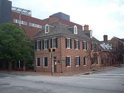 Flag House on Pratt Street | |
| Country | United States |
| State | Maryland |
| City | Baltimore |
| Time zone | UTC-5 (Eastern) |
| • Summer (DST) | EDT |
| ZIP code | 21202 |
| Area code | 410, 443, and 667 |
Jonestown is a neighborhood in the southeastern district of Baltimore. Its boundaries are the north side of Pratt Street, the west side of Central Avenue, the east side of Fallsway, and the south side of Orleans Street. The neighborhood lies north of the Little Italy, south of the Oldtown, west of the Washington Hill, and east of the Downtown Baltimore neighborhoods.
Jonestown is a historical section of southeast Baltimore established in 1732 that was laid out on 10 acres (40,000 m2) divided into twenty lots on the east side of the Jones Falls. The district is a mix of industrial, commercial and residential buildings. In the last half of the 20th century, Jonestown has shifted from a predominantly Eastern European and Jewish neighborhood into a predominantly African American neighborhood. Public housing replaced many of the former rowhomes and townhouses throughout the area, though a historical presence is still felt. In the early 2000s, though, modern row housing replaced the public housing. Jonestown is home to Baltimore's central post office in addition to 8 Baltimore City Landmarks including the Flag House; the Jewish Museum of Maryland, home of the Lloyd Street Synagogue; the Reginald F. Lewis Museum of Maryland African American History and Culture; the Carroll Mansion; and the Phoenix Shot Tower; the Old Town Friends' Meeting House; and the McKim's School.
Government and infrastructure
The United States Postal Service operates the Baltimore Main Post Office at 900 East Fayette Street in Jonestown.[1]
References
- ↑ "Post Office Location - BALTIMORE." United States Postal Service. Retrieved on May 5, 2009.
External links
- Demographics from Baltimore Neighborhood Indicators Alliance
- Neighborhood Information from Baltimore City Website
- Jonestown Historic District
Coordinates: 39°17′18″N 76°36′4″W / 39.28833°N 76.60111°W