Garrison, Maryland
| Garrison, Maryland | |
|---|---|
| Census-designated place | |
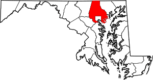
 Location of Garrison, Maryland | |
| Coordinates: 39°24′4″N 76°45′4″W / 39.40111°N 76.75111°WCoordinates: 39°24′4″N 76°45′4″W / 39.40111°N 76.75111°W | |
| Country |
|
| State |
|
| County |
|
| Area | |
| • Total | 3.1 sq mi (8.1 km2) |
| • Land | 3.1 sq mi (8.1 km2) |
| • Water | 0.0 sq mi (0.0 km2) |
| Elevation | 443 ft (135 m) |
| Population (2010) | |
| • Total | 8,823 |
| • Density | 2,800/sq mi (1,100/km2) |
| Time zone | UTC−5 (Eastern (EST)) |
| • Summer (DST) | UTC−4 (EDT) |
| ZIP code | 21055 |
| Area code(s) | 410 |
| FIPS code | 24-31625 |
| GNIS feature ID | 0590284 |
Garrison is a census-designated place (CDP) in Baltimore County, Maryland, United States, adjacent to Owings Mills. It consists mainly of the McDonogh area and Valley Centre. The population was 8,823 at the 2010 census.[1]
Geography
Garrison is located at 39°24′4″N 76°45′4″W / 39.40111°N 76.75111°W (39.401055, −76.751073).[2]
According to the United States Census Bureau, the CDP has a total area of 3.2 square miles (8.2 km2), of which 0.12% is water.
Demographics
| Historical population | |||
|---|---|---|---|
| Census | Pop. | %± | |
| 1990 | 5,045 | — | |
| 2000 | 7,969 | 58.0% | |
| 2010 | 8,823 | 10.7% | |
| source:[1][3] | |||
As of the census[4] of 2000, there were 7,969 people, 3,459 households, and 1,940 families residing in the CDP. The population density was 2,551.5 people per square mile (986.2/km²). There were 3,696 housing units at an average density of 1,183.4/sq mi (457.4/km²). The racial makeup of the CDP was 77.54% White, 17.09% African American, 0.13% Native American, 3.35% Asian, 0.01% Pacific Islander, 0.92% from other races, and 0.97% from two or more races. Hispanic or Latino of any race were 2.27% of the population. In 2000, 14% of Garrison residents identified as being of Russian American heritage. This was the second highest percentage of Russian Americans of any place in Maryland after Pikesville.[5] The majority of them are of Jewish ancestry. 2% of Garrison's residents were of Ukrainian descent and 1% were descended from other Eastern European countries. 8% were German, 7% Polish, 5% Irish, 4% English, 3% Italian, 2% Lithuanian, and 2% French.[6]
There were 3,459 households out of which 25.7% had children under the age of 18 living with them, 42.0% were married couples living together, 10.8% had a female householder with no husband present, and 43.9% were non-families. 35.5% of all households were made up of individuals and 6.3% had someone living alone who was 65 years of age or older. The average household size was 2.19 and the average family size was 2.90.
In the CDP, the population was spread out with 22.0% under the age of 18, 10.3% from 18 to 24, 34.4% from 25 to 44, 23.5% from 45 to 64, and 9.8% who were 65 years of age or older. The median age was 34 years. For every 100 females, there were 98.3 males. For every 100 females age 18 and over, there were 94.9 males.
The median income for a household in the CDP was $56,520, and the median income for a family was $62,171. Males had a median income of $45,286 versus $37,472 for females. The per capita income for the CDP was $36,236. About 4.6% of families and 5.8% of the population were below the poverty line, including 7.4% of those under age 18 and 9.3% of those age 65 or over.
Notable residents
- William Cabell Bruce, U.S. senator from Maryland, buried at St. Thomas Episcopal Church Cemetery
- William Maxwell Wood, MD, USN, first Surgeon General of the US Navy, buried at St. Thomas Episcopal Church Cemetery
- Thomas Cradock, an important colonial poet and local minister (St. Thomas's), buried at St. Thomas Episcopal Church Cemetery (see David Curtis Skaggs, ed., The Poetic Writings of Thomas Cradock, 1718-1770 (Newark: U Delaware Pr, 1983), 94n27).
References
- 1 2 "Profile of General Population and Housing Characteristics: 2010 Demographic Profile Data (DP-1): Garrison CDP, Maryland". U.S. Census Bureau, American Factfinder. Archived from the original on September 11, 2013. Retrieved February 23, 2012.
- ↑ "US Gazetteer files: 2010, 2000, and 1990". United States Census Bureau. 2011-02-12. Retrieved 2011-04-23.
- ↑ "CENSUS OF POPULATION AND HOUSING (1790-2000)". U.S. Census Bureau. Retrieved 2010-07-17.
- ↑ "American FactFinder". United States Census Bureau. Archived from the original on 2013-09-11. Retrieved 2008-01-31.
- ↑ "Ancestry Map of Russian Communities". Epodunk.com. Retrieved 2015-04-16.
- ↑ "Garrison, MD, Ancestry & Family History". Epodunk.com. Retrieved 2015-04-16.