White Oak, Maryland
| White Oak, Maryland | |
|---|---|
| census-designated place | |
 Aerial view of White Oak, Maryland, in January 2007. | |
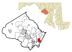 Location of White Oak, Maryland | |
| Coordinates: 39°2′32″N 76°59′18″W / 39.04222°N 76.98833°WCoordinates: 39°2′32″N 76°59′18″W / 39.04222°N 76.98833°W | |
| Country |
|
| State |
|
| County |
|
| Area | |
| • Total | 5.0 sq mi (12.9 km2) |
| • Land | 5.0 sq mi (12.9 km2) |
| • Water | 0.0 sq mi (0.0 km2) |
| Elevation | 371 ft (113 m) |
| Population (2000) | |
| • Total | 20,973 |
| • Density | 4,212.1/sq mi (1,626.3/km2) |
| Time zone | UTC−5 (Eastern (EST)) |
| • Summer (DST) | UTC−4 (EDT) |
| FIPS code | 24-84375 |
| GNIS feature ID | 0591544 |
White Oak is a census-designated place and an unincorporated area in Montgomery County, Maryland.
Geography
As an unincorporated area, White Oak's boundaries are not officially defined by either a municipal government or by the government of Montgomery County. Boundaries for the White Oak census-designated place have been established by the United States Census Bureau, while the United States Geological Survey recognizes White Oak to be a populated place located at 39°2′32″N 76°59′18″W / 39.04222°N 76.98833°W (39.042109, −76.988273).[1] Many of its residents consider themselves to be residents of the White Oak neighborhood of Silver Spring, similar to how large cities have different neighborhoods within their borders.
About White Oak
The community was known for its Naval Ordnance Laboratory, which was closed in 1994. The headquarters of the Food and Drug Administration now occupies the property, which has been renamed the Federal Research Center at White Oak. According to the United States Census Bureau, the place has a total area of 5.0 square miles (12.9 km²), all of it land. White Oak is a diverse neighborhood. The main area of White Oak is from Lockwood Dr starting from New Hampshire Ave (MD 650) towards Stewart Lane crossing Columbia Pike (US-29).
Quaint Acres
"Quaint Acres" is a subdivision of White Oak just north of modern Route 29 and west of New Hampshire Avenue. The subdivision was named after the house [2] of Altus Lacy Quaintance, a State Entomologist of Maryland who worked at the Maryland Agricultural College and later at the USDA.[3]
On May 26, 1945, a TB-25D 'Mitchell' bomber en route from Biloxi to Bolling Field crashed near Quaint Acres, killing all four aboard.[4] The bomber was piloted by Dudley M. Outcalt [5] who flew in the 94th Aero Squadron during World War I.[6]
After the war, the Quaint Acres subdivision was home to famed naturalist Rachel Carson and where she wrote Silent Spring in 1962, the book that facilitated the ban of the pesticide DDT in the United States. She built the ranch house at 11701 Berwick Rd. in 1956, and lived there until her death in 1964. The house is a National Historic Landmark, but not open to the public.[7]
Quaint Acres was also the Washington area home to Margaret Chase Smith, the first woman to be elected to both the U.S. House and the Senate.[8]
Demographics
| Historical population | |||
|---|---|---|---|
| Census | Pop. | %± | |
| 2000 | 20,973 | — | |
| 2010 | 17,403 | −17.0% | |
| [9] | |||
As of the census[10] of 2010, there were 17,403 people, 6,520 households, and 4,227 families residing in the area. The population density was 4,604.0 people per square mile (1,777.6/km²). There were 6,865 housing units at an average density of 1,816.1 per square mile (701.2/km²). The racial makeup of the area was 27.7% White, 49.4% African American, 0.4% Native American, 8.9% Asian, 0.1% Pacific Islander, 9.1% from other races, and 4.5% from two or more races. Hispanic or Latino of any race were 18.4% of the population. 6% of White Oak's residents were White Hispanics/Latinos, 21.6% were Hispanics/Latinos from some other race, and 1.5% were Afro-Latinos. 21.6% of the population were non-Hispanic whites, 47.8% were non-Hispanic blacks, and 8.9% were non-Hispanic Asians.[11]
White Oak is home to a large population Orthodox Jews and Conservative Jews. The Silver Spring Eruv Association includes parts of White Oak and the nearby neighborhoods of Kemp Mill and Colesville. An earlier eruv existed around the White Oak Apartments, until the larger eruv was constructed.[12] White Oak is home to several Orthodox and Conservative synagogues, including Southeast Hebrew Congregation and Shaare Tefila Congregation.[13][14]
Education
Depending on how White Oak is geographically defined, students attend Cresthaven, Jackson Road and Burnt Mills Elementary Schools, which feed into White Oak and Francis Scott Key Middle School. Eighth-grade students have the option of choosing between the three Northeast Consortium schools, Blake High School, Paint Branch High School, and Springbrook High School.
Springbrook is located in the White Oak CDP.[15]
References
- ↑ "US Gazetteer files: 2010, 2000, and 1990". United States Census Bureau. 2011-02-12. Retrieved 2011-04-23.
- ↑ "Garden Center Idea Spreads As Means of Diffusing Ideas", The Washington Post, July 28, 1935.
- ↑ "Microsoft Word - HistoryBissell.doc" (PDF). Retrieved 24 October 2016.
- ↑ "Plane Blown To Bits With 4 Near D.C.," The Washington Post, May 27, 1945 page M1
- ↑ "May 1945 USAAF Stateside Accident Reports". www.aviationarchaeology.com.
- ↑ "1st Pursuit Group Records - 1918 - November and December". Retrieved 24 October 2016.
- ↑ "Museums". Retrieved 24 October 2016.
- ↑ Ruben, Barbara (26 May 2007). "Chirp and Kwirr In Quaint Acres". Retrieved 24 October 2016 – via washingtonpost.com.
- ↑ Boundaries reduced from 2000-2010
- ↑ "American FactFinder". United States Census Bureau. Retrieved 2016-06-06.
- ↑ "Profile of General Population and Housing Characteristics: 2010". American FactFinder. Retrieved 2017-07-25.
- ↑ "An Imaginary Wall Encloses Community of Orthodox Jews". The Washington Post. Retrieved 2018-08-29.
- ↑ "SOUTHEAST HEBREW CONGREGATION". Jewish Historical Society of Greater Washington. Retrieved 2018-08-29.
- ↑ "SHAARE TEFILA CONGREGATION". Jewish Historical Society of Greater Washington. Retrieved 2018-08-29.
- ↑ "2010 CENSUS - CENSUS BLOCK MAP: White Oak CDP, MD" (Archive). U.S. Census Bureau. Retrieved on June 22, 2015.
Municipalities and communities of Montgomery County, Maryland, United States | ||
|---|---|---|
| Cities | 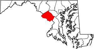 | |
| Towns | ||
| Villages & Special Tax Districts | ||
| CDPs |
| |
| Unincorporated communities | ||
| Footnotes | ‡This populated place also has portions in an adjacent county or counties | |