Lochearn, Maryland
| Lochearn, Maryland | |
|---|---|
| Census-designated place | |
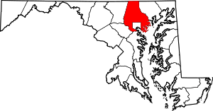
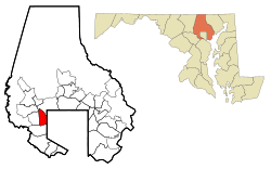 Location of Lochearn, Maryland | |
| Coordinates: 39°21′2″N 76°43′47″W / 39.35056°N 76.72972°WCoordinates: 39°21′2″N 76°43′47″W / 39.35056°N 76.72972°W | |
| Country |
|
| State |
|
| County |
|
| Established | 1882 |
| Area | |
| • Total | 5.6 sq mi (14.5 km2) |
| • Land | 5.6 sq mi (14.4 km2) |
| • Water | 0.0 sq mi (0.1 km2) |
| Elevation | 413 ft (126 m) |
| Population (2010) | |
| • Total | 25,333 |
| • Density | 4,500/sq mi (1,700/km2) |
| Time zone | UTC−5 (Eastern (EST)) |
| • Summer (DST) | UTC−4 (EDT) |
| FIPS code | 24-47450 |
| GNIS feature ID | 0590686 |
Lochearn is an unincorporated community and census-designated place in Baltimore County, Maryland, immediately to the west of the City of Baltimore. The population was 25,333 at the 2010 census.[1]
Geography
Lochearn is bordered on the east by the Baltimore City line, on the south by Gwynn Oak Avenue, Woodlawn Drive, and Dogwood Road, on the west by the Baltimore Beltway, and on the northeast by the Baltimore Metro transit line, including the Milford Mill station. Woodmoor shopping center is located on Essex and Liberty roads.
Lochearn is located at 39°21′02″N 76°43′47″W / 39.350630°N 76.729755°W (39.350630, −76.729755).[2] According to the United States Census Bureau, the CDP has a total area of 5.6 square miles (15 km2), of which 0.04 square miles (0.10 km2), or 0.36%, is water.
Major surface thoroughfares serving Lochearn
- Essex Road
- Liberty Road (Maryland Route 26) to Liberty Heights Avenue starting after Kelox Road and Northern Parkway in Baltimore City.
- Milford Mill Road
- Patterson Avenue (Baltimore) starting in Baltimore County in Lochearn to the Baltimore City line at Alter Street to Wabash Avenue, then Reisterstown Road. (Reisterstown Plaza is on the left hand side.)
Neighborhoods within Lochearn
- Brighton (part of Brighton is in Baltimore City)
- Milford
- Villa Nova
- Campfield Gardens
- Lochearn
- Forest Gardens
- Sudbrook Park
- Willow Glen
- Williamsburg/ Park Hill
Climate
The climate in this area is characterized by hot, humid summers and generally mild to cool winters. According to the Köppen Climate Classification system, Lochearn has a humid subtropical climate, abbreviated "Cfa" on climate maps.[3]
Transportation
Roads
The main road that runs through Lochearn is Liberty Road. Smaller roads serving individual communities include Buckingham Road, Croydon Road, Elba Drive, Essex Road, Lugine Avenue, Patterson Avenue, and St. Lukes Lane.
Public transportation
The Maryland Transit Administration's CityLink Lime Bus runs along Liberty Road through Lochearn.
Demographics
| Historical population | |||
|---|---|---|---|
| Census | Pop. | %± | |
| 1980 | 26,908 | — | |
| 1990 | 25,240 | −6.2% | |
| 2000 | 25,269 | 0.1% | |
| 2010 | 25,333 | 0.3% | |
| source:[1][4] | |||
As of the census[5] of 2000, there were 25,269 people, 9,771 households, and 6,732 families residing in the CDP. The population density was 4,537.1 people per square mile (1,751.6/km2). There were 10,229 housing units at an average density of 1,836.6 per square mile (709.1/km2). The racial makeup of the CDP was 18.50% White, 78.40% African American, 0.30% Native American, 0.81% Asian, 0.04% Pacific Islander, 0.49% from other races, and 1.46% from two or more races. Hispanic or Latino of any race were 1.50% of the population. 5% of Lochearn's residents were German, 4% Irish, 3% West Indian, 2% Sub-Saharan African, 2% English, 2% Jamaican, and 2% African.[6]
There were 9,771 households out of which 29.6% had children under the age of 18 living with them, 42.9% were married couples living together, 21.1% had a female householder with no husband present, and 31.1% were non-families. 26.4% of all households were made up of individuals and 8.1% had someone living alone who was 65 years of age or older. The average household size was 2.55 and the average family size was 3.06.
In the CDP, the population was spread out with 25.1% under the age of 18, 7.8% from 18 to 24, 27.2% from 25 to 44, 26.1% from 45 to 64, and 13.7% who were 65 years of age or older. The median age was 38 years. For every 100 females, there were 84.4 males. For every 100 females age 18 and over, there were 78.9 males.
The median income for a household in the CDP was $49,517, and the median income for a family was $54,994. Males had a median income of $35,459 versus $30,339 for females. The per capita income for the CDP was $21,652. About 4.7% of families and 7.0% of the population were below the poverty line, including 9.3% of those under age 18 and 7.3% of those age 65 or over.
Notable people
- Kevin B. Kamenetz, 11th County Executive of Baltimore County (2010-2018) and County Councilman (1994-2010).
References
| Wikivoyage has a travel guide for Lochearn. |
- 1 2 "Profile of General Population and Housing Characteristics: 2010 Demographic Profile Data (DP-1): Lochearn CDP, Maryland". U.S. Census Bureau, American Factfinder. Retrieved February 23, 2012.
- ↑ "US Gazetteer files: 2010, 2000, and 1990". United States Census Bureau. 2011-02-12. Retrieved 2011-04-23.
- ↑ Climate Summary for Lochearn, Maryland
- ↑ "CENSUS OF POPULATION AND HOUSING (1790-2000)". U.S. Census Bureau. Retrieved 2010-07-18.
- ↑ "American FactFinder". United States Census Bureau. Retrieved 2008-01-31.
- ↑ "Lochearn, MD, Ancestry & Family History". Epodunk.com. Retrieved 2015-04-16.