Langley Park, Maryland
| Langley Park, Maryland | |
|---|---|
| Census-designated place | |
 The Langley Park Mansion in September 2010 | |
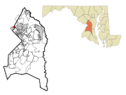 Location of Langley Park, Maryland | |
| Coordinates: 38°59′39″N 76°58′54″W / 38.99417°N 76.98167°WCoordinates: 38°59′39″N 76°58′54″W / 38.99417°N 76.98167°W | |
| Country |
|
| State |
|
| County |
|
| Government | |
| • Director, Action Langley Park | Bill Hanna |
| Area | |
| • Total | 1.0 sq mi (2.6 km2) |
| • Land | 1.0 sq mi (2.6 km2) |
| • Water | 0.0 sq mi (0.0 km2) |
| Elevation | 151 ft (46 m) |
| Population (2010) | |
| • Total | 18,755 |
| • Density | 19,000/sq mi (7,200/km2) |
| Time zone | UTC−5 (Eastern (EST)) |
| • Summer (DST) | UTC−4 (EDT) |
| ZIP codes | 20783, 20903 |
| Area code(s) | 301 |
| FIPS code | 24-45525 |
| GNIS feature ID | 0597659 |
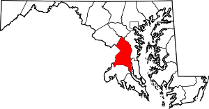
Langley Park is an unincorporated area and census-designated place (CDP) in Prince George's County, Maryland.[1] It is located inside the Capital Beltway, on the northwest edge of Prince George's County, bordering Montgomery County, Maryland. Langley Park is contained between University Boulevard to the south, the Northwest Branch Anacostia River to the north, Phelps Road to the east, and the Prince Georges County / Montgomery County line to the west. An extremely small stretch of Piney Branch Road (MD 320) which goes into Prince George's County, goes into the Langley Park neighborhood as well, just before it crosses the Northwest Branch Anacostia River and intersects New Hampshire Avenue (MD 650). While most of the Langley Park neighborhood contains the Hyattsville postal zip code of 20783, there is a small portion of Langley Park located west of New Hampshire Avenue (MD 650), but east of the Prince George's County/ Montgomery County Line, which contains the Silver Spring postal zip code of 20903. Langley Park is surrounded by the communities of Adelphi, Silver Spring, Takoma Park, Carole Highlands, and Lewisdale. As of the 2010 census, it had a population of 18,755.[2]
Two transit station locations on the proposed Purple Line are being planned to serve Langley Park.[3] One is at New Hampshire Avenue and University Boulevard, which was named the one of the most dangerous intersections in Maryland for pedestrians to cross. The danger is due to crossings of these six-lane routes mid-block at curbside bus stops.
The other proposed station is at University Boulevard and Riggs Road. The current bus system issues more transfers at these two intersections than at any other Prince George's County location not yet served by a Metro station.
History
"Langley Park" refers to the Langley Park estate established in 1923 by the McCormick-Goodhart family in the Chillum District of Prince George's County. The name McCormick-Goodhart represented the linking of one of Chicago's oldest families, that of Cyrus McCormick, with that of British barrister Frederick E. McCormick-Goodhart. Frederick's wife Henrietta (Nettie) was the daughter of Leander J. McCormick, a brother of Cyrus.[4] They named the 540-acre (2.2 km2) estate "Langley Park" after the Goodharts' ancestral home in Kent, England. In 1924, they erected an 18,000-square-foot (1,700 m2), 28-room Georgian Revival mansion, designed by architect George Oakley Totten, Jr., at a cost of $100,000. It remains a community landmark at 8151 15th Ave.[5] CASA of Maryland purchased the property in 2009, making the site its home base,[6] and a US$31 million Multicultural Community Center is now open in the mansion.[7] This property was listed on the National Register of Historic Places on August 29, 2008.[8]
During the late 1930s-early 1940s, Leander McCormick-Goodhart, son of Frederick and Nettie, served as personal assistant to Ambassador Lord Lothian and supervisor of American Relief to Great Britain through the British embassy.[9] As a result, the Langley Park estate became a regular site of social activities related to the British embassy including hosting the regular games of the Washington Cricket Club and, in June 1941, a British Relief Country Fair.[10][11]
The estate was first subdivided during and immediately after World War II, and was developed as a planned community by Pierre Ghent & Associates of Washington, D.C. The last major section would be developed in 1963. Because of the wartime and immediate postwar demand for housing, the 540-acre (2.2 km2) estate was quickly developed for low-rise apartment homes, semi-detached, and single family homes. Starting in 1949, a 1,542 garden apartment complex, Langley Park Apartments, now located along 14th Avenue, was built to house the exploding postwar population.[12] That same year, M.T. Broyhill and Sons started building on a 200-acre (0.81 km2) tract for 600 single family homes to be priced at around $10,000. These homes now lie north of Merrimac Drive. Both the apartments and homes were completed and occupied by June 1951.[13] In 1951, plans were unveiled for 500 additional multi-family rental dwellings and a 15-acre (61,000 m2), $4 million shopping center.[14]
In 1963, the last major segment of the Langley Park estate opened for development. It was a 25-acre (100,000 m2) parcel located directly around the manor house. It had been acquired in 1947 from the McCormick-Goodhart family by the Eudist Order for use as a seminary. The property was acquired for $900,000 by developers, who built the 400-unit Willowbrook Apartments on the site and opened them the following year.[15][16] The mansion then operated until the early 1990s as Willowbrook Montessori School.
The Langley Park Elementary School, now known as Langley Park-McCormick School, opened in 1950, at 15th Avenue and Merrimac Drive.[17] In 1988, Leander McCormick-Goodhart, real estate developer and descendant of the estate owners, sent the school a $10,000 donation after receiving an invitation to attend a school event.[18] That same year, 60 percent of the school population of 610 students was foreign born from 45 different countries and spoke 27 languages.[19]
In 1955, Langley Park was "the fastest growing trade area in Metropolitan Washington", with 200,000 people located within a 3-mile (4.8 km) radius. Affordable housing attracted a community consisting mostly of young couples with families. In the following decades, Langley Park became a middle-class enclave of predominantly white Jews of European descent.[20] During the 1970s, after desegregation, increasing numbers of African Americans moved into the community. Although some established families remained, the white population declined due to white flight to the outer suburbs. In 1970, the first language of 6.1 percent was Spanish; by 1980 that number had climbed to 13.4 percent.[21] During the 1980s, Hispanic and Caribbean immigrants from countries such as El Salvador, Mexico, Guatemala, Colombia, Bolivia, Peru, Jamaica and elsewhere in the West Indies led a new wave of migration into the community. In addition, Asian and African immigrants from places like Vietnam, India, Ethiopia and Nigeria settled into the area. It proved to be an attractive locale for immigrants due to the availability of affordable housing that could also accommodate families. The integration of these new groups into Langley Park reflected a larger trend of increased migration to the Greater Washington area during the 1980s and 1990s. By 1990, the area was 40 percent Hispanic.[22]
At the same time, the area suffered through a period of physical decline and increases in crime. During the 1980s, the community struggled with blighted residential and commercial areas. The apartment complexes experienced substantial turnover in occupancy. Residents in the 14th Avenue and Kanawha Street area in particular were subjected to "open air drug markets" and other criminal activity. Long-time residents and the new immigrant communities were both victims of crime. Some homeowners organized to address neighborhood concerns about rising crime. For the 1988–89 school year, bus service for children who lived in walking distance to school was implemented to ensure their safety. Police also increased their presence in the community. Apartment complexes, under new management, initiated safety measures to discourage drug activity such as installing new lighting, security doors and maintaining general upkeep of their properties. At the same time, police in Prince George's County conducted multiple raids in an effort to shut down drug activity in the county. By 1991, officials were taking note of an increase in illegal immigrants from Central America, and day laborers were beginning to become a common sight on area streets.[22]
Economy
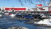
Langley Park is probably best known as a center of commercial activity in northwestern Prince George's County. At each of the two corners of the New Hampshire Avenue / University Boulevard intersection is a large strip shopping center. One is known as the Langley Park Plaza (northeast corner), while the other is known as the Langley Park Shopping Center (northwest corner). There are also three other small shopping centers a few blocks east of New Hampshire Avenue, two are located on the northeast and northwest sides of the intersection of University Boulevard and Riggs Road, while the third one is located at the intersection of University Boulevard and 15th Avenue.
- Langley Park Plaza is the main shopping center that serves the Langley Park neighborhood. It was once the second largest strip mall in Maryland. Plans were originally announced in 1951 for development of the 15-acre (61,000 m2) site to include 40 stores and a six- to eight-story office building. The site remained undeveloped until 1954, when the Washington, D.C.-based department store Lansburgh's announced plans to open a three-story, 126,750-square-foot (11,775 m2), $2 million store. It was the first major department store opened in Prince George's County.[23] Through the demise of the Lansburgh's chain in 1973, it would remain its most profitable store. At the store's opening in October 1955, in addition to substantial displays and a payroll of 350, it contained the "Hampshire Room" — a luncheonette seating 90 and a community room to hold about 200.[24][25] The remainder of the plaza opened shortly thereafter and included a Giant Food store[26] and Peoples Drug store. After Lansburgh's closed in 1973, it was occupied by E. J. Korvette, then Klein's,[26] followed by K-Mart from 1981 to 1996, and Toys "R" Us from November 1996 to January 31, 2007.[27] The Toys "R" Us moved here from a smaller location it originally operated a few blocks east of Langley Park, in the adjacent neighborhood of Lewisdale. A Value Village Thrift store has occupied its former space in Lewisdale ever since Toys "R" Us closed there and moved to the Langley Park Plaza. Eventually when Toys "R" Us closed its store in the Langley Park Plaza, its spot remained vacant for a little over 2 years, until a Regency Furniture store opened in late June/ July 2009. Regency Furniture has been operating and still continues to operate in that spot inside Langley Park Plaza today. The Giant Food store closed around Early 1998, right before Dutch-Based Royal Ahold Grocery Holdings Company was getting ready to buy the Giant supermarket chain. Atlantic Supermarket,[28] a local Latino supermarket, opened its doors on May 13, 1998.[29] Atlantic Supermarket has been and is still currently operating in Giant's former space ever since it closed. Most of the 1950s pre-neon signs and frozen food/ grocery aisles inside the store still remain from the Giant Food Store.[30] A Giant Food Store in Fort Washington, MD, is one among the very few Giant Food Stores serving the Washington D.C. metropolitan area today, to have kept the historic interior that closely resembles what the Langley Park Giant Food Store used to have. Even though Atlantic Supermarket does not have a deli, the deli sign still remains. Many of the store sections from the former Giant Food Store, such as the fresh seafood counter, hot meal counter, snack aisle, cereal aisle, milk aisle, and typical frozen eggs, beverage, and yogurt aisle, still remain in operation by Atlantic Supermarket. The store front/ cashier section of the store and produce section were added by Atlantic Supermarket, as the former Giant did not have these sections when it operated.[30] Additionally, the Hispanic mural on top of the ceiling by the cash registers, was added by Atlantic Supermarket. The former Giant Food Store did not originally have this mural. The rest of the picture signs of each of the grocery aisles, do however remain from the former Giant Food Store. The old-fashioned Winn-Dixie style aisle markers are also from the Giant Food Store. The Atlantic Supermarket store initially started off as being a compact supermarket with a much simpler store sign, a white rectangle frame with a red rectangle in between and the words, "Atlantic Supermarket", in white print. The front store sign changed supposedly when Atlantic decided to do major expansion to its supermarket in the middle of 2005. The front store sign ended up being changed to a somewhat more modernized white, castle-like triangular sign with the words, "Atlantic Supermarket International Foods", in a reddish, lavender type of color. Atlantic Supermarket added a unique light blue circle in the center of its store sign. The supermarket also changed the former white rectangular border it originally had, to being light blue. The expansion reportedly took over part of the parking lot and displaced twelve parking spaces that used to available in the plaza. This step by Atlantic Supermarket has only contributed to making the parking lot much smaller than it used to be. This was in part due to the fact that the McDonald's Fast Food Restaurant, which opened right outside the Langley Park Plaza in 1998, was already occupying quite a few former parking spaces of the huge parking lot. In addition to carrying classic American groceries found in many supermarket chains across America, they also offer a special selection of Latin-American, Asian, African, and Caribbean foods not formerly offered by the Giant Food Store.[30] Atlantic Supermarket offers a much broader section of fresh fruits and vegetables than traditional American supermarkets, as well. Also, the Peoples Drug store was converted into a CVS Pharmacy store when CVS corporation bought the 490-store Peoples Drug chain in the mid-nineties. The old-fashioned University Liquor store that has been inside the Langley Park Plaza for roughly five decades, is still operating in the Langley Park Plaza today. Also operating in the plaza today are Rainbow Clothing, New York Factory Outlet, Dollar Store, Jewelry Store, Family Furniture Discount Store, and At&t retailer store. The At&t retailer shop was added to the Langley Park Plaza in 2015. Prior to 2015, the spot At&t is currently operating in, has not been occupied.
- In recent years, the Langley Park Plaza has become a shopping destination for many recent immigrants, especially those from Central America. An attraction in the Langley Park Plaza is a fountain, nestled in a section of the mall, where recent immigrants take photos to show their families and friends at home that they have arrived in the United States.[31][32] The center continues in the hands of a descendant of the original Langley Park estate owner, Leander McCormick-Goodhart.
- Also, the Langley Park bus stop terminal for Prince George's County's The Bus Route 18, which served from the Addison Road Metro Station to Langley Park, used to be inside the Langley Park Plaza, right next to the place where Edwards Way intersects New Hampshire Avenue, until the Takoma Langley Crossroads Center opened in December 22, 2016. As of this date, the bus stop inside Langley Park Plaza by the intersection of Edwards Way and New Hampshire Avenue has been removed completely. The Bus route 18 began terminating at the Takoma Langley Crossroads Center instead. The route has still served between the Addison Road Metro Station and Langley Park ever since.
- The other major shopping center that serves the Langley Park neighborhood at the intersection of University Boulevard and New Hampshire Avenue, is known as the Langley Park Shopping Center. Its volume is 135,000 square feet(12,500 square meters). Currently, its two main tenants are a Rite Aid Pharmacy Store and Woodland's Pure Vegetarian Indian restaurant. The shopping center initially opened in August 1951, when a Food Fair supermarket opened; it was later converted to an Acme, then Grand Union. This center was home to a Drug Fair, Hot Shoppes, and the 1,000-seat Langley Theater, which opened in March 1952. Later converted to a multi-screen theater, it closed in the early 1990s when the owner, K/B Theaters, went out of business.[33] The shopping center is now home to the landmark Woodlands Indian restaurant. A Taco Bell Fast Food Restaurant opened in the Langley Park Shopping Center in the spring of 1998, taking over the space that the former Hot Shoppes Store has occupied for more than four decades. Right next to he Woodlands Indian Restaurant, there used to be a Subzi Mandi Indian Grocery store, which closed in the middle of 2011. There is a Gallo Clothing store, Dollar Store, Senor Coffee Shop, and Casa Blanca Bakery Shop that remain in operation still. The long-planned Takoma/Langley Crossroads Transit Center finally opened its doors on December 22, 2016 in the Langley Park Shopping Center parking lot, taking over most of the parking lot spaces and displacing Taco Bell's location by the shopping center. It mainly serves as a bus transfer point. At this transit center, people can get off one bus and transfer to another bus that gets them to their destination. After the Taco Bell was demolished, it relocated and opened its new store at the intersection of New Hampshire Avenue and Holton Lane in the adjacent neighborhood of Takoma Park, Maryland. Taco Bell's new location is right next to where the Aldi's Supermarket and Caribbean Market are both located.
- University Place is a small shopping center that serves the Langley Park neighborhood. It is located at the Intersection of University Boulevard and 15th Avenue. It consists of a China Palace Restaurant, La Chiquita Restaurant, Da Vita Dialysis Medical Store, Sweet Cash Pawn Store, a Laundromat/ Hair Salon Shop, and a Pho 75 Vietnamese Restaurant. The Da Vita Dialysis Medical Store replaced the spot in the shopping center which housed the Indian Jewelry store named, "Sam & Raj", until the middle of 2007. Once Sam & Raj left the shopping center, a so-called, "Lucky Jewelry & Gifts" store opened. That store also ended up eventually closing in 2015. Also in the shopping center, the La Chiquita Restaurant is currently occupying the spot that used to house an Americana Grocery Latin American Supermarket for about fifteen years. The Americana Grocery Latin American Supermarket closed in 2016.
- At the northwest corner of the intersection of University Boulevard and Riggs Road, there is a very small shopping center that does not have a name. It consists of a Carolina Furniture Store, Western Union Bank, Tick Tock Liquor Store, and Pep Boys Auto Repair Shop. The Carolina Furniture took over the spot of what used to be a "Mattress Discounters Store", in the middle of 2009.
- Then, last but not least, on the northeast corner of the intersection of University Boulevard and Riggs Road, there is another shopping center. This time, however; the shopping center is a little more jumbled up, meaning that it consists of stores that are in a wobbly line, rather than being organized in a single space. The shopping center consists of a Kenny's Caribbean Carryout Restaurant, Tire Shop, Exxon Mobil Gas Station, Krispy Kreme Donuts Store, Tiger Mart Convenience Store, 24- Hour Laundromat Shop, Family Dollar Store, Patel Brothers Indian Grocery Store, El Dorado Seafood Store. Domino's Pizza Restaurant, Seven Eleven Restaurant, Burger King Fast Food Restaurant, Irene's Papusas Fast Food Carryout Restaurant, and a Hyattsville Convenience Store. The Family Dollar store is currently occupying th space that used to house a Foot Locker Store. The Foot Locker Store closed in the middle of 2009, which is when Family Dollar took over/ opened.
Apartment complexes
As mentioned earlier in the article, many of the apartment complexes in the Langley Park, MD neighborhood were built in the mid 1920s and early 1940s. It consists of quite a few different apartment complexes.
- Campus Gardens Apartments (formerly "Isabella Gardens Apartments"), located at the intersections of University Boulevard to the south, Phelps Road to the east, and Riggs Road to the west.
- University Gardens Apartments, located at the intersections of Riggs Road to the east, 15th Avenue to the west, and Kanawha Street/ Jasmine Terrace to the south
- The Marylander Condominiums, located slightly north of the Campus Gardens Apartments at the intersection of Riggs Road and Keokee Street
- Serene Townhouse Village, located north of the intersection of Riggs Road and Jasmine Terrace, right across from the University Gardens Apartments
- Bedford Station Apartments, located at the intersections of University Boulevard to the south, 15th Avenue to the east, 14th Avenue to the west, and Kanawha Street to the north.
- The Villas at Langley Apartments, located on 15th Ave. north of Kanawha Street and south of Merrimac Drive, surrounding the Casa de Maryland mansion.
- Liberty Place Apartments, located at the intersection of University Boulevard and 14th Avenue
- Langley Terrace Apartments, located at the intersections of 14th Avenue, Langley Way, and Merrimac Drive, behind Langley Park Plaza
- Hampshire Village Apartments, located at the intersection of New Hampshire and Merrimac Drive
- Langley Gardens Apartments, located at the intersections of New Hampshire Avenue, Lebanon Street, and University Boulevard; This apartment complex used to serve as the Langley Park bus terminal for Montgomery County Ride-On bus routes 15, 16, 17, and 18 until the Takoma Langley Crossroads Center opened in December, 2015.
- University Landing Apartments, located at the intersection of University Boulevard and Merrimac Drive, right next to the Prince Georges/ Montgomery County Line, where the neighborhoods of Langley Park and Silver Spring meet; This apartment complex also originally used to serve as another separate Langley Park bus stop terminal for Wmata's Metrobus Route F8 (Prince Georges- Langley Park Line), from the year of 1978 until December 22, 2016 when the Takoma Langley Crossroads Center opened. As of this date, Wmata's route F8 began terminating at the Takoma Langley Crossroads Center instead. This bus terminal also used to formerly also serve as the terminal for Prince Georges County's The Bus Route 17, which served between Langley Park and the Ikea Store in College Park, MD until February 18, 2010. As of this date, The Bus Route 17 has been rerouted to serve from the bus terminal at the intersection of 34th Street & Rhode Island Avenue in Mount Rainier, MD to Ikea instead. Additionally, this bus terminal also used to serve UM Shuttle Bus Route 111, which traveled from the University of Maryland College Park Campus to the Silver Spring Metro Station. This bus route still traveled from the University of Maryland College Park to the Silver Spring Metro Station after no longer stopping at this bus stop. However, UM Shuttle Bus Route 111 was rerouted to use a more efficient route left from University Boulvard onto Piney Branch Road. This bus route used to stop at the intersection of University Boulevard and Merrimac Drive, turn right onto Carroll Avenue, and then turn left onto Piney Branch Road. The UM Shuttle Bus Route to the Silver Spring Metro Station did not initially stop at this bus stop, but was altered a few years ago to replace University of Maryland's former Adelphi South route that had been discontinued. UM Shuttle Bus Route 111 from the University of Maryland College Park Campus to the Silver Spring Metro Station also began stopping at the Takoma Langley Crossroads Center since it opened.
- Victoria Station Apartments, located slightly north of the intersection of New Hampshire Avenue and Merrimac Drive
- Suburban Hill Apartments, located at the intersections of New Hampshire Avenue, Ruatan street, and Quebec Terrace, directly south of the Northwest Branch Anacostia Trail, bordering the town of Adelphi and City of Silver Spring
- Quebec Arms Apartments, located on the northern side of the intersection of 14th Avenue and Merrimac Drive
Geography
Langley Park is located at 38°59′39″N 76°58′54″W / 38.99417°N 76.98167°W (38.994060, −76.981759).[34]
According to the United States Census Bureau, the place has a total area of 1.0 square mile (2.6 km2), all land.
Demographics
The racial and ethnic composition of the community has changed considerably as development patterns have evolved in the metropolitan Washington, D.C. area. Today, approximately 23,000 people live in proximity to Langley Park, including immigrants from an estimated 120 different countries, turning the area into one of the region’s most distinctive and broadly representative international communities. Hispanics with origins in El Salvador, Guatemala, Honduras, other Central American countries, and South America now comprise one of the largest ethnic groups in the area. Other significant immigrant groups include West Africans, Chinese, Vietnamese, Koreans, Indians, and Caribbean nationalities.
As of the census[35] of 2010, there were 18,755 people, 5,082 households, and 3,375 families residing in the area. The population density was 18,682.8 persons per square mile.
- 26.0% White
- 16.4% African American
- 2.6% Native American
- 2.9% Asian
- 0.5% Pacific Islander
- 43.6 from some other races
- 7.9% from two or more races[2]
76.6% of the population is Hispanic or Latino of any race (note that this includes a combination of Hispanics from all different parts of Latin America).[2]
There were 5,082 households, out of which 32.5% had children under the age of 18 living with them, 33.1% were married couples living together, 14.9% had a female householder with no husband present, and 33.6% were non-families. 18.0% of all households were made up of individuals and 2.7% had someone living alone who was 65 years of age or older. The average household size was 3.67, and the average family size was 3.69.[2]
In the community the population was spread out with 21.7% under the age of 18, 15.4% from 18 to 24, 43.6% from 25 to 44, 15.4% from 45 to 64, and 3.9% who were 65 years of age or older. The median age was 29.4 years. For every 100 females, there were 152.1 males. For every 100 females age 18 and over, there were 166.8 males.[2]
At the 2000 census, the median income for a household in the community was $37,939, and the median income for a family was $36,018. Males had a median income of $22,356 versus $21,931 for females. The per capita income for the community was $12,733. About 11.3% of families and 16.8% of the population were below the poverty line, including 21.4% of those under age 18 and 6.7% of those age 65 or over. A 2011 news article noted that "About one in five residents ... lives below the poverty level...."[6]
In 2000, 21.48% of Langley Park residents identified as being of Salvadoran heritage. This was the largest percentage of Salvadoran Americans of any place in the United States.[36] Over the last couple of years, there have also been growing communities of Guatemalans, Puerto Ricans, Nicaraguans and Mexicans.
Government and infrastructure
The Chillum-Adelphi Volunteer Fire Department (CAVFD) serves Langley Park. The station is in Langley Park CDP and has an Adelphi postal address.[37][38] In March 1951 and June 8, 1951 the CAVFD was established and chartered, respectively. From November and March 1953 the fire station on Riggs Road was constructed; the County Volunteer Firemen's Association designated it Station No. 34. Portions of Station No. 34 were rebuilt in the early 1960s, and it was rededicated on November 16, 1963. In 1962 the CAVFD began building a substation, No. 44, which was dedicated on November 16, 1963, but in 1992 it sold the substation to the county government.[39]
Prince George’s County Police Department's District 1 serves Langley Park;[40] its station is in Hyattsville.[41]
The United States Postal Service Langley Park Post Office is physically in the City of Takoma Park and has a Hyattsville postal address.[42]
Education
The Prince George's County Public Schools (PGCPS) operates public schools. Langley Park-McCormick Elementary School is located in Langley Park.[37][43] It had 679 students circa March 2013,[44] with all but 12 living in Langley Park.[45] In 2007 the school had 435 students. That year about 90% of the students at earlier grades were identified as learning English as a second language, and 370 students in all grade levels were Hispanic or Latino. Langley Park-McCormick entered into the Title I program due to the low income statuses of many of its students. Amy Stout became the principal in 2008 as former principal Sandra Jimenez, who started at Langley Park circa 2002, became the principal of Buck Lodge Middle School.[46]
In 1987 the 611 students originated from 33 countries, with about 50% being born outside the United States; Central American and South American-born students made up the majority of that group. That year the students altogether spoke 17 languages.[21] As of 2004 95% of the students were Hispanic/Latino.[47] In 2001, there were 750 students, with about 33% of them being in the "English for Speakers of Other Languages" (ESOL) program,[48] and over 90% qualifying for free or reduced lunches.[49] In 2001 it had five bilingual employees.[48]
Other schools educating significant numbers of Langley Park students include Mary Harris “Mother” Jones Elementary School in Adelphi, Cool Spring Elementary School in Adelphi, Buck Lodge Middle School in Adelphi, and High Point High School in Beltsville.[50] In 2013 the percentages of those schools' students living in Langley Park were 82%, 72%, 32%, and 23%.[44] In the 2012-2013 school year 2,669 Langley Park students attended Langley Park-McCormick, Jones, Cool Spring, Buck Lodge, and High Point; making up 92% of the public school students in the community; while 220 Langley Park students attended 52 other PGCPS Schools.[45] As of 2001 Langley Park-McCormick, Adelphi, and Cool Spring elementaries had percentages of Hispanic students and students with free/reduced lunches higher than the average for PGCPS; Adelphi and Cool Springs each had over 56% of their students being Hispanic/Latino and about 50% being on free/reduced lunches.[49]
Sections of the CDP north of Road 193 are assigned to Langley Park-McCormick, Jones, and Cool Spring; a section of the CDP south of Road 193 is zoned to Carole Highlands Elementary School.[37][51] Carole Highlands has a Takoma Park postal address but is within the Langley Park CDP boundaries.[52] As of the 1990 US Census and the 2000 US Census, Carole Highlands Elementary, as well as all of the areas south of Road 193, was in the Chillum CDP.[53][54][55] All of Langley Park CDP is served by Buck Lodge Middle and High Point High.[37][56][57]
In the 2011-12 school year 36% of 9th grade students from Langley Park, who attended High Point, did not go to school for at least 20 days per school year compared to 29% district average for 9th graders and 10% district average for 7th and 8th graders; the Langley Park 7th and 8th graders truancy rate was the same as the district average. Scott, et al. stated in a 2014 paper published by think tank The Urban Institute that a possible reason was that start time of High Point was the same as that of Buck Lodge Middle School even though the high school's distance from Langley Park was 4 miles (6.4 km) longer than that of the middle school.[58]
Recreation
Every year, Langley Park Day is held at Langley Park-McCormick Elementary. It has festivities as well as health screenings. It started in 1999. The school, Action Langley Park, the Prince George's County Department of Parks and Recreation, and the Maryland-National Capital Park and Planning Commission sponsors Langley Park Day.[59]
In literature
Langley Park of the early 1960s is featured in the short story "Blue Divisions" by Cuban-American author Alfredo Franco.[60]
References
- Scott, Molly M., Graham MacDonald, and Juan Collazos (The Urban Institute); Ben Levinger (Prince George’s County Public Schools); Eliza Leighton and Jamila Ball (CASA de Maryland). "From Cradle to Career: The Multiple Challenges Facing Immigrant Families in Langley Park Promise Neighborhood." The Urban Institute, June 23, 2014. Abstract.
Notes
- ↑ U.S. Geological Survey Geographic Names Information System: Langley Park, Maryland
- 1 2 3 4 5 "Profile of General Population and Housing Characteristics: 2010 Demographic Profile Data (DP-1): Langley Park CDP, Maryland". U.S. Census Bureau, American Factfinder. Retrieved December 20, 2011.
- ↑ Lazo, Luz (September 30, 2011). "In Langley Park, Purple Line brings promise, and fears, of change". The Washington Post.
- ↑ "Sues for Loss of Love of M'cormick-Goodhart," The Washington Post, Apr 28, 1925, p. 8.
- ↑ Maryland National Capital Parks and Planning Commission, "Inventory of Historic Sites" (Prince George's County), Entry 65-007, p. 36 (retrieved Sep 7, 2008).
- 1 2 Luz Lazo (30 September 2011), "In Langley Park, Purple Line brings promise, and fears, of change", The Washington Post, retrieved 15 November 2011
- ↑ "Where We Are Now," by CASA de MD, "CASA de MD.org," April 2010 (accessed July 14, 2010).
- ↑ National Park Service, National Register of Historic Places, Registration Form for Langley Park (PG#65-7) (retrieved Sep 7, 2008).
- ↑ Obituary of Leander McCormick-Goodhart, The Washington Post, Times Herald, Dec 18, 1965, p. E4.
- ↑ "Local Cricketers Play Ripping Game But Lose, 106-59," The Washington Post, May 24, 1939, p. 20.
- ↑ "British Relief Country Fair," The Washington Post, May 18, 1941, p. SC9.
- ↑ "4000 Apartment Units Planned," The Washington Post, Feb 6, 1949, p. R4.
- ↑ "Two Virginia Builders Plan 1850 Homes in 1950," The Washington Post, Jan 8, 1950, p. R1.
- ↑ "Shopping Center, Homes Will be Next Projects," The Washington Post, Apr 22, 1951, p. R1.
- ↑ "McCormick-Goodhart Tract Sold for Apartment Complex," The Washington Post, Times Herald, Aug 17, 1963, p. E10.
- ↑ "Developers Relax at Willowbrook," The Washington Post, Times Herald, Aug 8, 1964, p. C9.
- ↑ "Work on Langley Park School Moves Ahead," The Washington Post, Jan 26, 1950, p. B1.
- ↑ "Langley Park School's Invitation Gets RSVP in the Form of $10,000," The Washington Post, Jan 21, 1988, p. MD1.
- ↑ "Langley Park School Bridges Cultures," The Washington Post, Sep 22, 1988, p. MD21.
- ↑ "Langley Park: Coping With Change," by Gwen Ifill, The Washington Post, Aug 26, 1984, p. 35.
- 1 2 "Langley Park Bridging Age and Language Gaps," by Keith Harriston, The Washington Post, Nov 14, 1987, p. E1.
- 1 2 "Hispanics Carve Niche in P.G.," by Jim Naughton, The Washington Post, August 19, 1991, p. A1.
- ↑ "Lansburgh's Soon to Build a New Store," The Washington Post, Times Herald, Nov 21, 1954, p. M1.
- ↑ "Lansburgh's New Store Opens," The Washington Post, Times Herald, Oct 18, 1955, p. 17.
- ↑ "Lansburgh's Prince George's County's First Department Store," The Washington Post, Times Herald, Oct 23, 1955, p. L1.
- 1 2 "before langley park was langley park". www.justupthepike.com. Retrieved 2017-06-26.
- ↑ "Toys R Us leaving Langley Park". www.gazette.net. Retrieved 2017-06-25.
- ↑ "Atlantic supermarket - supermercado latino -". sitios.entravision.com. Retrieved 2017-06-26.
- ↑ "Atlantic Supermarket, Inc. in Langley Park, MD | Company Info & Reviews". Bizapedia.com. Retrieved 2017-11-13.
- 1 2 3 Supermarket_fan (2017-02-22). "NJ Supermarkets: Atlantic Supermarket - Hyattsville, MD". NJ Supermarkets. Retrieved 2017-10-24.
- ↑ "Immigrants Give Md. Fountain a Global Reach," by Allison Klein, The Washington Post, May 22, 2006.
- ↑ "A Stream From Ipala," by David Montgomery, The Washington Post, June 9, 2008 p. C1 (retrieved Sep 6, 2008).
- ↑ Cinema Treasures website, Langley Theater, Langley Park, Md (retrieved Sep 6, 2008).
- ↑ "US Gazetteer files: 2010, 2000, and 1990". United States Census Bureau. 2011-02-12. Retrieved 2011-04-23.
- ↑ "American FactFinder". United States Census Bureau. Retrieved 2008-01-31.
- ↑ http://epodunk.com/ancestry/Salvadoran.html
- 1 2 3 4 "2010 CENSUS - CENSUS BLOCK MAP: Langley Park CDP, MD." U.S. Census Bureau. Retrieved on January 31, 2018.
- ↑ "Where We Are." Chillum-Adelphi Volunteer Fire Department. Retrieved on September 9, 2018. "The Chillum-Adelphi Volunteer Fire Department Prince George’s County, MD – Co. 34 7833 Riggs Rd, Adelphi, MD 20783"
- ↑ "Department History." Chillum-Adelphi Volunteer Fire Department. Retrieved on September 9, 2018.
- ↑ "CITIZEN JOURNALISM: Residents hail officer's return". Washington Times. 2009-09-01. Retrieved 2018-09-19.
[...]District 1 substation, which includes Hyattsville, Langley Park and surrounding areas,[...]
- ↑ "District 1 Station - Hyattsville. Prince George's County Police Department. Retrieved on September 9, 2018. Beat map.
- ↑ "LANGLEY PARK." U.S. Postal Service. Retrieved on September 11, 2018. "1325 HOLTON LN HYATTSVILLE, MD 20783-9997" - See: "Ward Map (2013 Redistricting)." and "Street Plan." City of Takoma Park. Retrieved on September 11, 2018.
- ↑ "langleyparkmcc_banner2.jpg." Langley Park-McCormick Elementary School. Retrieved on January 7, 2011. "8201 15th Avenue, Hyattsville, MD 20784"
- 1 2 Scott, et al p. 22/88. See footnote of page 20 on how the think tank identified Langley Park students.
- 1 2 Scott, et al p. 22/88.
- ↑ Izadi, Elahe (2008-09-04). "New leadership at Langley Park-McCormick Elementary". The Gazette. Retrieved 2018-09-10.
- ↑ Lyles, Jeffrey K.; Corina E. Rivera (2004-11-18). "County schools reach out to Hispanics". The Gazette. Retrieved 2018-09-10.
- 1 2 "ESOL program bridges language gap". The Gazette. 2001-10-12. Retrieved 2018-09-10. - Also as: "New ESOL program helps to bridge the language barrier." Translated into Spanish as: "El programa de 'ESOL' rompe barreras de idióma" (translated by Oswaldo Jimenez).
- 1 2 "Action Langley Park urged to act". The Gazette. 2001-07-20. Retrieved 2018-09-10.
- ↑ Scott, et al p. 19/88.
- ↑ "NEIGHBORHOOD ELEMENTARY SCHOOLS AND BOUNDARIES SCHOOL YEAR 2017-2018." Prince George's County Public Schools. Retrieved on January 31, 2018.
- ↑ Home. Carole Highlands Elementary School. Retrieved on January 31, 2018.
- ↑ "1990 COUNTY BLOCK MAP (RECREATED): PRINCE GEORGE'S County." U.S. Census Bureau. Retrieved on January 31, 2018. See page 7
- ↑ "CENSUS 2000 BLOCK MAP: CHILLUM CDP." U.S. Census Bureau. Retrieved on January 31, 2018.
- ↑ "CENSUS 2000 BLOCK MAP: LANGLEY PARK CDP." U.S. Census Bureau. Retrieved on January 31, 2018.
- ↑ "NEIGHBORHOOD MIDDLE SCHOOLS AND BOUNDARIES SCHOOL YEAR 2017-2018." Prince George's County Public Schools. Retrieved on January 31, 2018.
- ↑ "NEIGHBORHOOD HIGH SCHOOLS AND BOUNDARIES SCHOOL YEAR 2017-2018." Prince George's County Public Schools. Retrieved on January 31, 2018.
- ↑ Scott, et al p. 53/88.
- ↑ Oliver, Julia (2001-05-03). "Langley Park Day celebrates third year". The Gazette. Retrieved 2018-09-09.
- ↑ Franco, Alfredo (Spring 2014). "Blue Divisions". Euphony Journal. 14 (2): 12.
Further reading
External links
- Maryland's International Corridor
- Chillum-Adelphi Volunteer Fire Department
- M-NCPPC Takoma / Langley Crossroads Project (retrieved Sep 6, 2008)