Landover, Maryland
| Landover, Maryland | |
|---|---|
| Census-designated place | |
| Motto(s): "Maryland With Pride" | |
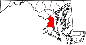
 Landover Location within the state of Maryland  Landover Landover (the US) | |
| Coordinates: 38°56′N 76°54′W / 38.933°N 76.900°WCoordinates: 38°56′N 76°54′W / 38.933°N 76.900°W | |
| Country | United States of America |
| State | Maryland |
| County | Prince George's |
| Area | |
| • Total | 4.1 sq mi (10.6 km2) |
| • Land | 4.1 sq mi (10.5 km2) |
| • Water | 0.0 sq mi (0.0 km2) |
| Population (2010) | |
| • Total | 23,078 |
| • Density | 5,600/sq mi (2,200/km2) |
| Time zone | UTC−5 (Eastern (EST)) |
| • Summer (DST) | UTC−4 (EDT) |
| ZIP code | 20785 |
| Area code(s) | 301 |
| GNIS feature ID | 597655 |
Landover is an unincorporated community and census-designated place in Prince George's County, Maryland, United States.[1] Landover is located within very close proximity to Washington D.C. although it does not directly border Washington D.C. unlike its neighboring communities, Chapel Oaks and Fairmount Heights, which directly border Washington D.C. and go all the way up to/ touch the Maryland/ D.C. line. As of the 2010 census it had a population of 23,078.[2] Landover is contained between Sheriff Road and Central Avenue to the south, Hill Road, Cabin Branch Drive, and the Washington Metropolitan Area Orange Line tracks to the west, John Hanson Highway (U.S. Highway 50) to the west, and Washington D.C.'s Capital Beltway (Interstate 495) to the north and east. Landover borders the adjacent communities of New Carrollton, Landover Hills, Glenarden, Lanham, Ardmore, Springdale, Cheverly, Chapel Oaks, Fairmount Heights, Carmody Hills, Pepper Mill Village, Walker Mill, and Largo. The main roads/ highways that go through Landover are Pennsy Drive, Landover Road (MD 202), Martin Luther King Junior Highway (MD 704), Veterans Parkway (MD 410), Columbia Park Road, Cabin Branch Drive, Ardwick Ardmore Road, Brightseat Road, Redskins Road, Fedex Way, Hill Oaks Road, Nalley Road, Village Green Drive, Belle Haven Drive, Garrett Adams A. Morgan Boulevard, Sheriff Road, Hill Road, Central Avenue (MD 214), John Hanson Highway (U.S. Highway 50), and Washington D.C.'s Capital Beltway (Interstate 495).
History
Landover was named for the town of Llandovery, Wales.[3]
The former CDPs of Landover, Dodge Park, Kentland, and Palmer Park, defined as such by the U.S. Census Bureau in the 1990 U.S. Census,[4] were consolidated into the Greater Landover CDP as of the 2000 U.S. Census.[5] This amalgamated area was renamed the Landover CDP as of the 2010 U.S. Census.[6]
Geography
Landover is located at 38°55′26″N 76°53′17″W / 38.924°N 76.888°W. According to the U.S. Census Bureau, it has an area of 4.07 square miles (10.55 km2), of which 0.004 square miles (0.01 km2), or 0.13%, is water.[7] Landover residents have the postal zipcode of 20785. Since Landover is an unincorporated community in Prince George's County, residents of Landover have Hyattsville postal addresses though they live in Landover and not Hyattsville. Landover does not have its own postal zipcode.
Landover consists of several small subdivisions which are notably Ardwick Park, Kentland, Dodge Park, Brightseat, Palmer Park, Columbia Park, Village Green, White House Heights, and Summerfield. Landover has been home to the Fedex Field Stadium, which the Washington Redskins NFL Football team have played at since it opened in 1997. It is also home to the Prince George's Sports & Learning Complex, WMATA's Landover Metrobus Division, WMATA's Carmen E. Turner Maintenance Facility, Giant Food Corporate Office, Giant Food Corporate Plant, National Harmony Memorial Park Cemetery, and Ardwick Industrial Park. WMATA Metrorail's Orange Line from New Carrollton to Vienna, MARC train Line to the BWI Light Rail Station to Washington D.C.'s Union Station, Cargo Trains, and Amtrak's Train Line from Washington D.C.'s Union Station to New York's Penn Station via Wilmington and Philadelphia, all go through Landover. Landover Hills is a separate, incorporated community just across the Orange Line train tracks and John Hanson Highway (U.S. Highway 50) to the north. Landover is the birthplace of the late Len Bias. From 1960 to 1972, Landover was the home of jazz guitarist and educator Steve Rochinski.
For the 2000 census, Landover was delineated by the U.S. Census Bureau as the Greater Landover census-designated place.
Economy
Giant Food has its headquarters in a location in unincorporated Prince George's County in the Ardwick Industrial Park area, near Landover.[8] The Giant Food Headquarters is located next to the New Carrollton Metro Station. It is served by the F13 metrobus shuttle that goes from the Cheverly Metro station to Washington Business Park.
Arts and culture
Historic places
Beall's Pleasure and Ridgley Methodist Episcopal Church are listed on the National Register of Historic Places.[9]
Annual events
A Harlem Renaissance Festival occurs at Kentland-Columbia Park Community Center in Landover every year in May.[10]
Sports
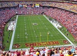
FedExField is a football stadium for the Washington Redskins of the NFL in the neighboring CDP of Summerfield and has a Landover postal address.[11][12] See also Raljon, Maryland.
The Prince George's Sports & Learning Complex is also in Summerfield CDP,[13] located on approximately 80 acres (320,000 m2) adjacent to FedExField.[14]
Government
Prince George's County Police Department headquarters, which is also District 3 Station,[15][16] is in the Palmer Park area in Landover CDP.[4][6]
The U.S. Postal Service operates the Landover Post Office in the CDP.[6][17]
Education
Public education
Landover is a part of the Prince George's County Public Schools system.[6]
Elementary schools serving sections of the Landover CDP include: Columbia Park, Dodge Park, Cooper Lane, Gladys Noon Spellman, Highland Park, and William Paca.[18] Middle schools serving sections of the Landover CDP include: G. James Gholson, Kenmoor, and Charles Carroll.[19] Senior high schools serving sections of the Landover CDP include: Fairmont Heights, Charles Herbert Flowers, DuVal, and Bladensburg.[20] The schools serving the 1990 CDP are:[21] Cooper Lane and Gladys Noon Spellman elementaries,[18] Charles Carroll Middle,[19] and Bladensburg High.[20]
When desegregation busing began in 1972, PG County school officials bused many black children in Landover to schools with large numbers of white students in other areas of the county. Since then many schools in the Landover area had closed. David Nakamura of the Washington Post stated that many Landover residents believed that desegregation busing contributed to the socioeconomic decline of Landover. In 1998 the busing program was abolished due to a settlement in federal court.[22]
Matthew Henson Elementary School was previously in the CDP.[23] It was scheduled to close in 2009.[24] In 2012 EXCEL Academy agreed to open a charter school in the former Henson space,[25] and it moved from its previous campus in Riverdale.[26]
Other area schools:
- Kenmoor Elementary School
- Palmer Park Elementary School
- Columbia Park Elementary School
- John Carroll Elementary School - closed in 2009[24]
- Cora L. Rice Elementary School
- Thomas Pullen Creative & Performing Arts Academy
Colleges and universities
Landover had career-based colleges, such as Fortis College,[27] that offer programs including bio-technician, medical assisting, and medical coding and billing.
Infrastructure
Transportation
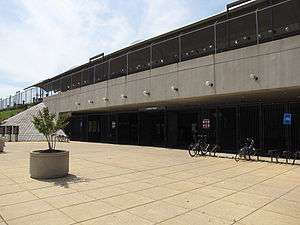
Landover is one of the few regions in the Washington, D.C. area that is served directly by two separate Washington Metro rail lines. Landover is served by both the Orange and Blue lines (many DC area suburbs are not served directly by Metrorail at all). The Landover Washington Metro station serves the northern portion of Landover on the Orange Line. The Landover Metro Station is also the primary metro station that serves the Landover area. The Morgan Boulevard Metro station, constructed in 2004, serves the southern portion of Landover on the Blue Line and is the main rail terminus providing access to FedExField, which is home to the Washington Redskins in addition to many other sporting and entertainment events. Landover also has a special Metrobus Division also houses many metrobuses that serve routes in Prince George's County, Maryland.
In addition to the Landover and Morgan Boulevard Metro Stations that primarily serve the Landover area, Landover residents have access to other metro stations nearby, such as the New Carrollton Metro Station, Cheverly Metro Station, Largo Town Center Metro Station, and Addison Road-Seat Pleasant Metro Station.
I-495/95, the Capital Beltway, crosses U.S. Route 50 in Landover. The Beltway also has junctions with Maryland Route 202 (Landover Road) and Brightseat Road, which leads directly to FedExField.
Shopping
| Historical population | |||
|---|---|---|---|
| Census | Pop. | %± | |
| 1970 | 5,597 | — | |
| 1980 | 5,374 | −4.0% | |
| 1990 | 5,052 | −6.0% | |
| 2010 | 23,078 | — | |
| source:[2][28][29] | |||
Landover was the home of Landover Mall, owned and operated by Lerner Enterprises. Built in 1972, it was the first enclosed mall in the Washington, D.C. metropolitan area to house four high-end retail anchor stores: Garfinkel's, Hecht's (owned by the May company), Woodward and Lothrop (popularly known as Woodies), and Sears. The mall also housed a multiplex movie theater located in the basement of the northeast corridor of the building. Located at the Capital Beltway and Landover Road, the mall neighbored the towns of Palmer Park, Ardmore, Glenarden, and Largo. Palmer Park was the hometown of Olympic boxing champion Sugar Ray Leonard.[30] Garfinkel's closed in 1990, Woodies closed in 1995 and was replaced with a J.C. Penney store that lasted from 1996 to 2001, and Hecht's closed in 2002 with the opening of the Bowie Town Center located in Bowie. The entire mall officially closed in 2003 and was demolished in 2006, with the exception of Sears. Sears closed in 2014 and was later demolished.
With the arrival in 1997 of FedExField, the home stadium for the Washington Redskins, the mall's parking lot is used for overflow parking. In 2007, according to the Washington Post,[31] Prince George's County officials were in the midst of developing plans to transform the area where Landover Mall once stood. County officials propose to build luxury townhouses, trendy stores, and office buildings. The goal of the project is to transform the area into a residential and cultural hub that replicates the Bowie Town Center, and The Boulevard at the Capital Centre; the latter is in Lake Arbor CDP and has a Largo postal address.[32][33] Woodmore Towne Centre, featuring Costco and Wegmans, opened in 2010 in nearby Glenarden.
Parks and recreation
The Prince George's County Department of Parks and Recreation operates the Kentland Community Center and the Palmer Park Community Center.[34][35]
References
- ↑ U.S. Geological Survey Geographic Names Information System: Landover, Maryland
- 1 2 "Profile of General Population and Housing Characteristics: 2010 Demographic Profile Data (DP-1): Landover CDP, Maryland". U.S. Census Bureau, American Factfinder. Retrieved December 20, 2011.
- ↑ "Profile for Landover, Maryland, MD". ePodunk. Retrieved August 25, 2012.
- 1 2 "1990 COUNTY BLOCK MAP" (index map) Prince George's County. U.S. Census Bureau. Retrieved on September 9, 2018. The CDPs of Landover, Dodge Park, Kentland, and Palmer Park are shown on pages 13, 14, 17, and 18.
- ↑ "CENSUS 2000 BLOCK MAP: GREATER LANDOVER CDP." U.S. Census Bureau. Retrieved on September 9, 2018.
- 1 2 3 4 "2010 CENSUS - CENSUS BLOCK MAP: Landover CDP, MD." U.S. Census Bureau. Retrieved on September 1, 2018.
- ↑ "Geographic Identifiers: 2010 Demographic Profile Data (G001): Landover CDP, Maryland". U.S. Census Bureau, American Factfinder. Retrieved December 20, 2011.
- ↑ "Facility Locations". Giant Food. Retrieved on September 6, 2011. "8301 Professional Place, Suite 115 Landover, MD 20785."
- ↑ National Park Service (2010-07-09). "National Register Information System". National Register of Historic Places. National Park Service.
- ↑ "Harlem Renaissance Festival". Festival Media Corporation. Retrieved August 24, 2012.
- ↑ "2010 CENSUS - CENSUS BLOCK MAP: Summerfield CDP, MD" (PDF). U.S. Census Bureau. Retrieved 2018-09-07.
- ↑ "FedExField." State of Maryland Office of Tourism Development. Retrieved on September 7, 2018. "1600 FedEx Way, Landover, MD 20785" - See also parking map from Washington Redskins website
- ↑ "Fedexfield Parking and Directions." Washington Redskins. Retrieved on September 7, 2018. "[...]Prince George’s County Sports Complex located at 8001 Sheriff Rd, Hyattsville MD 20785."
- ↑ Prince George's Sports & Learning Complex
- ↑ "Winter/Spring PAL Basketball Clinic." Government of Prince George's County. Retrieved on September 20, 2018. "Location: Police Headquarters Address: 7600 Barlowe Road Landover, MD 20785 "
- ↑ "District 3 Station - Landover." Prince George's County Police Department. Retrieved on September 9, 2018. " 7600 Barlowe Road Landover, MD 20785 ". Beat map
- ↑ "LANDOVER." U.S. Postal Service. Retrieved on September 11, 2018. "3312 DODGE PARK RD HYATTSVILLE, MD 20785-9997"
- 1 2 "NEIGHBORHOOD ELEMENTARY SCHOOLS AND BOUNDARIES SCHOOL YEAR 2018-2019." Prince George's County Public Schools. Retrieved on September 1, 2018.
- 1 2 "NEIGHBORHOOD MIDDLE SCHOOLS AND BOUNDARIES SCHOOL YEAR 2018-2019." Prince George's County Public Schools. Retrieved on September 1, 2018.
- 1 2 "NEIGHBORHOOD HIGH SCHOOLS AND BOUNDARIES SCHOOL YEAR 2018-2019." Prince George's County Public Schools. Retrieved on September 1, 2018.
- ↑ "1990 COUNTY BLOCK MAP" (index map) Prince George's County. U.S. Census Bureau. Retrieved on September 9, 2018. Landover CDP is shown on page 13.
- ↑ Nakamura, David (2000-02-27). "Pr. George's School Splits the Classes". Washington Post. Retrieved 2018-09-02.
- ↑ Home page. Matthew Henson Elementary School. May 16, 2001. Retrieved on September 7, 2018. "Matthew Henson Elementary/Montessori School 7910 Scott Road Landover, Maryland 20785"
- 1 2 Preliminary Subregion 4 Master Plan and Proposed Sectional Map Amendment. Maryland-National Capital Park and Planning Commission. Chapter 9, Public Facilities. p. 261 (PDF p. 3/28). Retrieved on September 7, 2018.
- ↑ Brownback, Abby (2012-05-21). "Riverdale charter school to move into vacant Landover elementary building". The Gazette. Retrieved 2018-09-07.
- ↑ Leaderman, Daniel (2010-08-19). "New principal of Riverdale charter school wants to build strong community ties". The Gazette. Retrieved 2018-09-07.
- ↑ Fortis College - Landover
- ↑ "CENSUS OF POPULATION AND HOUSING (1790-2000)". U.S. Census Bureau. Retrieved 2010-07-17.
- ↑ Not enumerated separately in 2000. Merged with Dodge Park, Palmer Park and Kentland to form Greater Landover
- ↑ In the late 1980s, crime began to rise in the surrounding areas and frightened shoppers eventually helped fuel the mall's rapid decline. The movie theater was the first to close, followed by three of the mall's anchor stores in the 1990s.
- ↑ Ovetta Wiggins (July 9, 2007). "Landover May Be Next On Revival Bandwagon". Retrieved May 27, 2015.
- ↑ "2010 CENSUS - CENSUS BLOCK MAP (INDEX): Lake Arbor CDP, MD." U.S. Census Bureau. Retrieved on September 1, 2018. Pages: 1 and 2.
- ↑ Contact Us." The Boulevard at the Capital Centre. Retrieved on September 9, 2018. "Boulevard at the Capital Centre 900 Capital Centre Boulevard Largo, MD 20774"
- ↑ "Kentland Community Center." Prince George's County Department of Parks and Recreation. Retrieved on September 20, 2018. "Kentland Community Center 2413 Pinebrook Avenue Landover, MD 20785"
- ↑ "Palmer Park Community Center." Prince George's County Department of Parks and Recreation. Retrieved on September 20, 2018. "Palmer Park Community Center 7720 Barlowe Road Landover, MD 20785"
External links
![]()