Upper Falls, Maryland
| Upper Falls, Maryland | |
|---|---|
| Unincorporated community | |
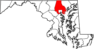
 Upper Falls, Maryland Location within the State of Maryland  Upper Falls, Maryland Upper Falls, Maryland (the US) | |
| Coordinates: 39°26′14″N 76°24′12″W / 39.43722°N 76.40333°WCoordinates: 39°26′14″N 76°24′12″W / 39.43722°N 76.40333°W | |
| Country |
|
| State |
|
| County |
|
| Time zone | UTC-5 (Eastern (EST)) |
| • Summer (DST) | UTC-4 (EDT) |
| ZIP codes | 21156 |
| GNIS feature ID | 587979 |
Upper Falls is an unincorporated community in Baltimore County, Maryland, United States.[1] southeast of Kingsville. Upper Falls has a post office with ZIP code 21156.[2]
References
External links
- St. Stephen's Church founded 1841
- Salem United Methodist Church founded 1847
- Upper Falls Casino (1896) on the southeast corner of Bradshaw & Raphel Roads.
- Huber's Family Produce Farm
- Upper Falls School (circa 1890) at 11614 & 11616 Franklinville Road
This article is issued from
Wikipedia.
The text is licensed under Creative Commons - Attribution - Sharealike.
Additional terms may apply for the media files.