Shepperd, Maryland
| Shepperd, Maryland | |
|---|---|
| Unincorporated community | |
 | |
| Coordinates: 39°35′36″N 76°34′09″W / 39.59333°N 76.56917°WCoordinates: 39°35′36″N 76°34′09″W / 39.59333°N 76.56917°W | |
| Country |
|
| State |
|
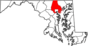
| County |
|
| Elevation | 199 m (653 ft) |
| Time zone | UTC-5 (Eastern (EST)) |
| • Summer (DST) | UTC-4 (EDT) |
| Area code(s) | 410 & 443 |
| GNIS feature ID | 591270[1] |
Shepperd is an unincorporated community in Baltimore County, Maryland, United States. Shepperd is located at the junction of Maryland Route 138 and Maryland Route 562 13.4 miles (21.6 km) north-northeast of Towson.[2]
References
- ↑ "Shepperd". Geographic Names Information System. United States Geological Survey.
- ↑ Maryland General Highway Statewide Grid Map: Jarrettsville Map No. B-13A (PDF) (Map). Maryland Department of Transportation. 2012. Retrieved March 8, 2013.
This article is issued from
Wikipedia.
The text is licensed under Creative Commons - Attribution - Sharealike.
Additional terms may apply for the media files.