White Hall, Baltimore County, Maryland
| White Hall, Maryland | |
|---|---|
| Unincorporated community | |
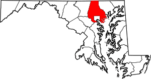
 White Hall, Maryland Location within the U.S. state of Maryland  White Hall, Maryland White Hall, Maryland (the US) | |
| Coordinates: 39°37′18″N 76°37′43″W / 39.62167°N 76.62861°WCoordinates: 39°37′18″N 76°37′43″W / 39.62167°N 76.62861°W | |
| Country |
|
| State |
|
| County |
|
| Time zone | UTC-5 (Eastern (EST)) |
| • Summer (DST) | UTC-4 (EDT) |
White Hall is an unincorporated community which straddles Baltimore County and Harford County, Maryland, United States.[1] The town's post office is on the NCR Trail and the Gunpowder River. Ivory Mills was listed on the National Register of Historic Places in 1997.[2]
References
This article is issued from
Wikipedia.
The text is licensed under Creative Commons - Attribution - Sharealike.
Additional terms may apply for the media files.