IND Queens Boulevard Line
| IND Queens Boulevard Line | |
|---|---|
    | |
| Overview | |
| Type | Rapid transit |
| System | New York City Subway |
| Locale | New York City |
| Termini |
50th Street Jamaica–179th Street |
| Daily ridership | 467,779 (2015, weekday)[lower-alpha 1] |
| Operation | |
| Owner | City of New York |
| Operator(s) | New York City Transit Authority |
| Character | Underground |
| Technical | |
| Track gauge | 4 ft 8 1⁄2 in (1,435 mm) standard gauge |
The IND Queens Boulevard Line, sometimes abbreviated as QBL,[2] is a line of the B Division of the New York City Subway in Manhattan and Queens, New York City, United States. The line, which is underground throughout its entire route, contains 23 stations. The core section between 50th Street in Hell's Kitchen, Manhattan, and 169th Street in Jamaica, Queens, was built by the Independent Subway System (IND) in stages between 1933 and 1940, with the Jamaica–179th Street terminus opening in 1950. As of 2015, it is among the system's busiest lines, with a weekday ridership of over 460,000 people.
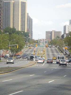
The Queens Boulevard Line's eastern terminus is the four-track 179th Street station. The line continues westward then northwest as a four-track line with the local tracks to the outside of the express tracks. The Queens Boulevard Line merges with the IND Archer Avenue Line east of Briarwood and with Jamaica Yard spurs east of Forest Hills–71st Avenue. The express tracks and the local tracks diverge at 65th Street in Jackson Heights and merge again at 36th Street in Sunnyside. West of 36th Street, the IND 63rd Street Line splits off both pairs of tracks, entering Manhattan via the 63rd Street Tunnel. At Queens Plaza in Long Island City, the line narrows to two tracks, with the local tracks splitting into the 60th Street Tunnel Connection and the IND Crosstown Line. From there, the express tracks of the line provide crosstown service across Manhattan under 53rd Street before turning southwest at Eighth Avenue, ending at the 50th Street station. The two-track section west of Queens Plaza is also known as the IND 53rd Street Line.
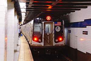
The Queens Boulevard line is served by four overlapping routes. The E train serves the section between 50th Street and Briarwood, normally running express. The F runs express from 36th Street to 71st Avenue and local east of 71st Avenue to 179th Street. The M and R serve local stops on the route west of 71st Avenue, with the M diverging from the line west of Fifth Avenue/53rd Street and the R splitting west of Queens Plaza. The E and F serve the line at all times, while the M runs on the line during weekdays only and the R runs on the line at all times except late nights. During evenings and weekends, the E runs local between 71st Avenue and Briarwood, and E trains make all local stops west of 71st Avenue during late nights to provide local service along the line. The routes experience frequent overcrowding during weekdays, and the Queens Boulevard line has among the highest rush-hour train frequencies in the system. A proposed upgrade to the line, to replace its signals with a communications-based train control system, would add capacity to the line.
The line's construction in the 1920s and 1930s promoted housing growth along the Queens Boulevard corridor and stimulated the urbanization of central Queens. However, there are multiple provisions for spur routes along the Queens Boulevard line that were never built. The most notable of these proposals was the IND Second System, which would have provided a spur to Maspeth from the Jackson Heights–Roosevelt Avenue station; another spur to the Rockaways east of 63rd Drive–Rego Park via the Rockaway Beach Branch; a third spur east of Briarwood along the former Van Wyck Boulevard to South Ozone Park; and an extension of the line eastward past 179th Street. Other proposals included a "super express bypass" that would use the right-of-way of the Long Island Rail Road's Main Line to bypass all stations between 36th Street and 71st Avenue, as well as a spur from the Woodhaven Boulevard station northeast to Queens College via the Long Island Expressway.
Route
The IND Queens Boulevard Line begins with a large storage yard consisting of two levels with four tracks each south of 185th Street and Hillside Avenue. Once the tracks from the lower level merge with the tracks on the upper level, there is the first station Jamaica–179th Street (E and F trains), and the line continues as a four-track subway under Hillside Avenue.[3] Just after curving north under the Van Wyck Expressway, a flying junction joins the two-track Archer Avenue Line (E train) to the local and express tracks. Soon after, the line turns west under Queens Boulevard.[4]
East of Kew Gardens–Union Turnpike, another flying junction ties the eastward tracks to Jamaica Yard. The other side of the wye curves west to become a lower level of the subway just west of Kew Gardens–Union Turnpike. After passing through 75th Avenue, those tracks join the local and express tracks at another flying junction.[4]
At Forest Hills–71st Avenue, the M and R trains begin their westward routes. West of here, the line (now carrying the E, F, M, and R trains) runs under Queens Boulevard until it turns north onto Broadway after Grand Avenue–Newtown. Near Jackson Heights–Roosevelt Avenue, an abandoned trackless tunnel for the IND Second System branches off into an unused upper part of the station which is used for storage.[5] At the intersection of Broadway and Northern Boulevard, west of the line's Northern Boulevard station, the express tracks turn west under Northern Boulevard. The local tracks take a longer route, remaining under Broadway, then turning south onto Steinway Street and west again onto Northern Boulevard, where they rejoin the express tracks.[4][6] This is only one of two areas in the subway where the express tracks diverge from the local tracks (the other being the IND Culver Line between Seventh Avenue and Church Avenue.)[2][7]
As the line leaves 36th Street, the two-track IND 63rd Street Line (F train) splits from both sets of tracks at a flying junction, running to Manhattan under 41st Avenue. The Queens Boulevard Line continues under Northern Boulevard to Queens Plaza (E, M, and R trains) before line splitting into three parts at another flying junction. The express tracks (E and M trains) continue towards Manhattan under 44th Drive, while the local tracks split two ways, with the 60th Street Tunnel Connection (R train) turning northwest and the IND Crosstown Line (no regular service) remaining under Jackson Avenue (Northern Boulevard south of Queens Plaza). From this point on, the Queens Boulevard Line has only two tracks.[4]
The line continues west through the 53rd Street Tunnel under the East River into Manhattan. After Lexington Avenue–53rd Street, the westbound tracks rise above the eastbound tracks. A flying junction after Fifth Avenue/53rd Street, ties the westbound tracks into the southbound local tracks of the IND Sixth Avenue Line, which begin here as a merge of these connection tracks and the IND 63rd Street Line. At that junction, the Sixth Avenue express tracks turn west under 53rd Street, just to the south of the Queens Boulevard Line. The two lines share platforms at Seventh Avenue, but no connecting tracks are present.[4]
Then the Queens Boulevard Line turns south below the IND Eighth Avenue Line with separate lower-level platforms at 50th Street. Then the tracks split to join the local and express tracks of the Eighth Avenue Line north of 42nd Street–Port Authority Bus Terminal. At that station, a special lower platform formerly served a single southbound track from the Queens Boulevard Line, merging with both southbound tracks of the Eighth Avenue Line south of the station;[4][8][9] the long-disused platform was demolished in June 2013 to make way for the extension of the IRT Flushing Line.[10]
Services
The following services use part or all of the IND Queens Boulevard Line:[11]
| Time period[11] | Section of line[11] | |||
|---|---|---|---|---|
| Weekdays | Weekends | Late nights | ||
|
full line (limited rush hour trips) south of Briarwood (other times) | |||
|
north of 36th Street | |||
|
no service | between Fifth Avenue/53rd Street and Forest Hills–71st Avenue (weekdays) | ||
|
no service | between Queens Plaza and Forest Hills–71st Avenue (all except late nights) | ||
During daytime hours, the portion of the line between 36th Street and Forest Hills–71st Avenue is served by four services: the E, F, M, and R.[11] The M operates via Sixth Avenue and 53rd Street to Queens Plaza before making local stops to Forest Hills–71st Avenue on weekdays.[12] The R enters Queens Boulevard from the Broadway Line and the 60th Street Tunnel before making local stops to Forest Hills–71st Avenue at all times except late nights.[12] The F train joins the IND Queens Boulevard Line from the 63rd Street Line and runs express to Forest Hills–71st Avenue before making local stops to Jamaica–179th Street at all times.[12] The E train runs from the Eighth Avenue Line and 53rd Street to Queens Boulevard before making express stops along the line (except evenings and weekends when it makes all stops east of Forest Hills–71st Avenue and during late night hours when it runs local on the entire line) to the Archer Avenue Line east of Briarwood.[11][12] Limited rush hour E trains also run express to Jamaica–179th Street.[11]
The entire line is patrolled by NYPD Transit Bureau District 20, headquartered at Briarwood.[13]
History
Construction
The Queens Boulevard Line, also referred to as the Long Island City−Jamaica Line, Fifty-third Street−Jamaica Line, and Queens Boulevard−Jamaica Line prior to opening,[7][14][15] was one of the original lines of the city-owned Independent Subway System (IND), planned to stretch between the IND Eighth Avenue Line in Manhattan and 178th Street and Hillside Avenue in Jamaica, Queens.[7][15][16]
As originally proposed in 1925, the line's junction with the IND Crosstown Line in Long Island City would have been a T-junction, allowing trains from Manhattan to travel south to Brooklyn via the Crosstown line.[16] A map from June of that year shows a proposed alternate routing for the Queens Boulevard Line,[17] that would have had the line turn via Kew Gardens Road after the Union Turnpike station instead of continuing via Queens Boulevard. After proceeding via Kew Gardens Road the line would have turned via Hillside Avenue.[18] The proposed route via Kew Gardens Road was supported by Queens Borough President Maurice Connolly because it would have served Richmond Hill as well. He also pointed out that there was considerable opposition to building a subway line in front of Maple Grove Cemetery.[19] The map also shows a two-track line continuing from the Van Wyck Boulevard station to 94th Avenue (Atlantic Avenue) in Richmond Hill via Van Wyck Boulevard (today's Van Wyck Expressway).[18] During construction only bellmouths were built for the line, however they were eventually used for the IND Archer Avenue Line. As documented by the map, the Queens Boulevard Line, as originally planned, would have had the express trains travel on a more direct route, via Broadway and Queens Boulevard, while the local trains would take a less direct route hitting larger population centers. There were to be two such instances, however only one was actually completed. The first one, which was not constructed, would have gone through Winfield (now Woodside), west of the existing Elmhurst Avenue station, and the local tracks would have diverged, continuing via Queens Broadway before turning onto 69th Street (Fisk Avenue), rejoining the express tracks at Broadway in Woodside. The second instance, the one that was built, was planned to have the local tracks continue via Broadway west of the 65th Street station, and then it would turn south via Steinway Street before rejoining the express tracks at the 36th Street station. The express tracks here would take the more direct route, via Northern Boulevard.[18]
Originally, the BOT did not plan for a 50th Street station on the Queens Boulevard Line. This station was to have only been served by Eighth Avenue trains heading north toward Washington Heights. The Eighth Avenue Association petitioned the BOT for an additional stop at 50th Street. On November 21, 1926, it was announced that the BOT had agreed to construct a stop at this location for the Queens Boulevard Line.[20]
On February 26, 1927, the New York City Board of Estimate awarded and approved a $10,481,550 contract to the Patrick McGovern Company. Ground was broken at Vernon Boulevard and 44th Drive in Long Island City on April 2, 1927. The first contract for work entirely within Queens was given to the Atwell-Gustin-Morris Company by the New York City Board of Transportation on December 14, 1927. The contract covered the section of the line under Jackson Avenue between the junction with the under-construction Crosstown Line near Queen Street and 44th Drive. The section between Arch Street and Steinway Avenue was awarded to the W.G.T. Construction Company, which required moving the support pillars for the elevated IRT Flushing Line to the sides of the street. Triest Construction Company was awarded the next segment, which was between Queen Street and the intersection of Northern Boulevard and 37th Street. The following section was awarded to J.F. Cogan Company, which was required to build the section between the intersection of Steinway Street and Broadway and the intersection of 53rd Street and Northern Boulevard. The remainder of the line was called Route 108, and it was divided into six sections. The first section, between 53rd Street and Pettit Place via Broadway went to Atwell-Gustin-Morris Company, while the section between along Broadway and Queens Boulevard from Pettit Place and 55th Avenue went to George H. Flynn Company. The sections between 55th Avenue and 64th Road and from 64th Road to 71st Road went to Arthur A. Johnson. The final two sections were from 71st Road to Union Turnpike, and from 137th Street to Hillside Avenue.[21]
The two tubes of the 53rd Street Tunnel under the East River began construction in spring 1927, and were fully excavated between Queens and Manhattan in January 1929, with a ventilation shaft built on Welfare Island (today's Roosevelt Island).[22] On October 4, 1928, the Board of Estimate approved the construction of the Queens Boulevard Line.[23]
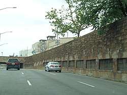
Construction on the line began in December 1928, and the whole line cost $58,000,000.[24] During the line's construction, several intersections of Queens Boulevard with major roads were grade separated, in a similar manner to Grand Concourse in the Bronx during the building of the IND Concourse Line around that same time.[15][25] At adjacent intersections with Woodhaven Boulevard and Horace Harding Boulevard (now the Long Island Expressway) in Elmhurst, Queens Boulevard's main road was depressed into underpasses.[25][26] In Kew Gardens, Union Turnpike and the Interboro Parkway (now the Jackie Robinson Parkway) were depressed below Queens Boulevard at the level of the Union Turnpike station's mezzanine.[27] From the mezzanine at Union Turnpike an entrance was built from the Interboro Parkway, allowing passengers from buses and automobiles to be dropped off here instead of from Queens Boulevard. The subway from Long Island City to Roosevelt Avenue and 74th Street was completed by April 1932.[21]
During the 1920s and 1930s, in conjunction with the subway construction project, Queens Boulevard was widened with up to twelve lanes in some places, and a right-of-way of 200 feet (61 m) in width was created.[28] With the widening, Queens Boulevard was wide enough for the construction of a four track subway line without serious disruption of surface travel, with the area alongside the boulevard not built up in many places. More often than not in some places, billboards would be visible instead of buildings. During the construction of the line, electric utility service was temporarily provided by a wooden pole line. Once the construction of the line was completed, the utility service was underground, and the Queens Boulevard trolley line was replaced by bus service (today's Q60), in part due to competition with the newly constructed subway line.[29] Because the construction of the Queens Boulevard Line utilized the cut-and-cover tunneling method, Queens Boulevard had to be torn up and in order to allow pedestrians to cross, temporary bridges were built over the trenches.[30] Like other IND lines, many stations' mezzanines stretched the full length and width of their stations, and are now considered to be overbuilt.[31]
On December 18, 1931, it was announced that the completion of the Queens Boulevard Line to Roosevelt Avenue was delayed until January 1, 1933. Previously, it has been announced that the line would open in 1931 or 1932.[32] On January 18, 1933, Chairman of the Board of Transportation announced that work on the first section of the line would be completed by September. In addition, Delaney submitted the capital outlay program for the year, which called for the completion of the extension of the line to 177th Street and Hillside Avenue on January 1, 1935.[33] The line was not completed by January 1 because the funding necessary for the final outstanding contract, which was for the installation of transformers and switch houses, was not registered until January by the Controller. In addition, one of the contractors, the L. I. Waldman Company, fell behind schedule. As a result, the company was fined and ordered to increase its labor force to complete the project on schedule. In March the September opening date was moved to August.[34][35]
Building boom and the growth of communities
The construction of the Queens Boulevard subway line offered the possibility of quick commutes to the central business district in Midtown Manhattan. In the late 1920s, speculators, upon learning the route of the proposed line, quickly bought up property on and around Queens Boulevard, and real estate prices soared, and older buildings were demolished in order to make way for new development.[30][37] In order to allow for the speculators to build fifteen-story apartment buildings, several blocks were rezoned.[38] They built apartment building in order to accommodate the influx of residents from Midtown Manhattan that would desire a quick and cheap commute to their jobs.[30][39] Since the new line had express tracks, communities built around express stations, such as in Forest Hills and Kew Gardens became more desirable to live. With the introduction of the subway into the community of Forest Hills, Queens Borough President George U. Harvey predicted that Queens Boulevard would become the "Park Avenue of Queens".[30] With the introduction of the subway, Forest Hills and Kew Gardens were transformed from quiet residential communities of one-family houses to active population centers.[36] Following the line's completion, there was an increase in the property values of buildings around Queens Boulevard.[40] For example, a property along Queens Boulevard that would have sold for $1,200 in 1925, would have sold for $10,000 in 1930.[41] The population of Forest Hills in 1930 was 18,000, having increased to 100,000 in 1965.[42]
The construction boom was not limited to express stations, with fifteen-story apartment buildings built by Cord Meyer, an eighty-family apartment house built by the Rego Park Construction Corporation, and 300 one-family homes built along Woodhaven Boulevard by Pherbus Kaplan, all surrounding the 63rd Drive local station. These development companies all sought out to continue to increase the value of their properties in anticipation of the opening of the subway.[43]
Queens Boulevard, prior to the construction of the subway was just a route to allow people to get to Jamaica, running through farmlands. Since the construction of the line, the area of the thoroughfare that stretches from Rego Park to Kew Gardens has been home to apartment buildings, and a thriving business district that the Chamber of Commerce calls the "Golden Area".[42]
In Elmhurst, almost all of the century-old buildings in the heart of the village were destroyed for the construction of the subway. Land was taken on the west side of the Broadway to avoid the demolition of the Saint James Episcopal Church and the Reformed Church. Many nineteenth century residences and the Wandowenock Fire Company buildings had to be torn down. To allow the subway line to curve into Queens Boulevard from Broadway, the northeast corner of the two streets was removed, in addition to some stores and an old Presbyterian chapel. New buildings were built behind a new curb line once the subway was completed, bringing a new face to Elmhurst. The introduction of the subway stimulated local growth in Elmhurst. Commercial buildings and apartment houses replaced existing structures.[21][44]
From 1940 to 1950, in large part because of the construction of the Queens Boulevard Line, the population of Queens dramatically increased by 248,678, of which, 210,000 lived in areas alongside the new line and the buses that connected to it. By 1940, there were 27.5 square miles of vacant land alongside the line that could be used for housing, compared with only 8 in Brooklyn, 4 in the Bronx, and none in Manhattan.[45]
Opening and expansion
The first section of the line, west from Roosevelt Avenue to 50th Street, opened on August 19, 1933 at 12:01 a.m.[21] E trains ran local to Hudson Terminal (today's World Trade Center) in Manhattan, while the GG (predecessor to current G service) ran as a shuttle service between Queens Plaza and Nassau Avenue on the IND Crosstown Line.[6][46][47] Initially trains ran on four to six-minute headways during rush hours.[48] Later that year, a $23 million loan was approved to finance the remainder of the line, along with other IND lines.[49]
In 1934 and 1935, construction of the extension to Jamaica was suspended for 15 months and was halted by strikes.[50] Construction was further delayed due to a strike in 1935, instigated by electricians opposing wages paid by the General Railway Signal Company.[51] In August 1936, construction to Forest Hills was expected to be completed by the end of the year. The tracks were installed all the way to 178th Street, and the stations to Union Turnpike were completed. However, the stops to the east still needed to be tiled, have stairways, turnstiles and lighting installed. Only two additional contracts remained to be put up for bid, both the results of last minute changes. The first of the two changes was for finishing the Ely Avenue station which did not open with the initial segment to Roosevelt Avenue. The second of the two entails the eastern terminal of the line. Initially, express trains were planned to terminate at a station at 178th Street. However, the plans were changed to terminate the express trains at Parsons Boulevard, requiring the installation of switches. Since construction of the tunnel was already completed in this section, a section of tunnel wall had to be removed. Since the line's new terminal would be at 169th Street, the tracks at 178th Street would be used to turn back trains. This change led to protests from the Jamaica Estates Association.[50]
On November 19, 1936, Mayor Fiorello La Guardia announced that the line's extension to Union Turnpike would open on December 31, 1936.[52] Accordingly, the line was extended east from Roosevelt Avenue to Union Turnpike on that date.[53][54][21]
On April 9, 1937, Mayor La Guardia announced that the operation of the $14,4000,000 extension to Jamaica and express service would begin on April 24. The extension to Hillside Avenue and 178th Street, with a terminal station at 169th Street opened as planned on April 24, 1937.[6][53][55] Express service was inaugurated during rush hours, with E trains making express stops from 71st–Continental Avenues to Queens Plaza. The express service operated between approximately 6:30 and 10:30 a.m. and from 3:00 p.m. to 7:00 p.m.[56] Express service was also provided on Saturdays between 6:30 a.m. and 4:00 p.m.. During rush hours, GG trains were extended from Queens Plaza, taking over the local. During non-rush hours local service was provided by EE trains which operated between 169th Street and Church Avenue in Brooklyn.[57] The sections of the line east of Roosevelt Avenue were built by the Public Works Administration.[56]
This extension was celebrated with a ribbon-cutting ceremony at the Parsons Boulevard station and with a parade along Hillside Avenue.[58] The initial headway for express service was between three and five minutes.[59] 23rd Street–Ely Avenue station opened as an in-fill station on August 28, 1939.[60] Upon its extension into Jamaica, the line drew Manhattan-bound passengers away from the nearby BMT Jamaica Line subway and the Long Island Rail Road.[61]
From April 1939 to October 1940, the Queens Boulevard Line served the 1939 New York World's Fair via the World's Fair Railroad. The World's Fair line ran via a connection through the Jamaica Yard and through Flushing Meadows–Corona Park along the current right-of-way of the Van Wyck Expressway.[53][62] After calls from public officials such as Queens Borough President George Harvey to make the line a permanent connection to Flushing and northern Queens, the line was demolished in 1941.[46]
After LaGuardia Airport opened on February 21, 1940, the Roosevelt Avenue station became an important transfer point to buses to the airport, including the privately-owned Q33.[6]
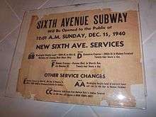
On December 15, 1940, F trains began running via the newly opened IND Sixth Avenue Line, also running express west of 71st–Continental Avenues. 169th Street and Parsons Boulevard were both used as terminal stations during this time, with the E terminating at one station and the F at the other.[63][64][65] This setup was instituted to prevent congestion at both stations.[66]
The existing 169th Street station provided an unsatisfactory terminal setup for a four track line, and this required the turning of F trains at Parsons Boulevard, and no storage facilities were provided at the station. Therefore, the line was going to be extended to 184th Place with a station at 179th Street with two island platforms, sufficient entrances and exits, and storage for four ten-car trains. The facilities would allow for the operation of express and local service to the station.[66] Construction on the extension started in 1947 and was projected to be completed in 1949.[67][68] The extension was completed later than expected and opened on December 11, 1950. This extension was delayed due to the Great Depression and World War II. Both E and F trains were extended to the new station.[69]
Later years

In 1953, the platforms were lengthened at 75th Avenue and Sutphin Boulevard to 660 feet to allow E and F trains to run eleven car trains. The E and F began running eleven-car trains during rush hours on September 8, 1953. The extra train car increased the total carrying capacity by 4,000 passengers. The lengthening project cost $400,000.[71] The operation of eleven-car trains ended in 1958 because of operational difficulties. The signal blocks, especially in Manhattan, were too short to accommodate the longer trains, and the motormen had a very small margin of error to properly platform the train. It was found that operating ten-car trains allowed for two additional trains per hour to be scheduled.[72]
Because local service was only offered by the GG trains which only ran into Brooklyn, riders were forced to transfer at express stations to reach Manhattan. This caused overcrowding and delays. The Board of Transportation had first proposed a connection between the Queens Boulevard Line and the 60th Street Tunnel in 1940. Fifteen years later, on December 1, 1955, a connection to the 60th Street Tunnel opened, allowing trains from the BMT Broadway Line to serve Queens Boulevard as an additional local from 71st−Continental. This connection was one of the most important links in the system, correcting the 1930s error of insufficient capacity for Queens–Manhattan traffic.[46]:241 Service was initially provided by QT Broadway−Brighton trains (predecessor to the Q train).[64][73] This service would be replaced by RR trains in 1961, a new EE train in 1967, and N trains in 1976.[64] The now-R train was rerouted back to the line in 1987, to provide trains from the route direct access to the Jamaica Yard.[64][74][75]
In December 1988, the Archer Avenue Lines opened, utilizing existing provisions east of the Briarwood station. The E was rerouted to its current terminus at Jamaica Center.[74][76] In December 2001, the connection to the IND 63rd Street Line (built along with the Archer Avenue subway), was opened and F trains were rerouted into it, away from the 53rd Street tunnel. The new peak-hour V train was created to replace the F via 53rd Street while running local on Queens Boulevard; consequently, the G was truncated to Court Square during peak hours.[70][77][78] Starting in August 2007 after a series of severe summer storms, the MTA began installing decorative ventilation grates along the Hillside Avenue section of the line, and sealing other grates, both in order to combat flooding. At the time, the Hillside Avenue subway was considered the most flood-prone area in the subway system, due to its location at the bottom of the terminal moraine which runs across Long Island.[79][80]:15, 27, 44−55 Additional grates were later installed along Broadway and Steinway Street at the west end of the line.[81]
In 2010, budget constraints within the MTA led to service reductions on the line. On April 19, 2010, G service was permanently truncated to Court Square at all hours; thus Crosstown Line trains, which originally were the sole trains to serve the Queens Boulevard local tracks, no longer ran on the line at all.[70] On June 27, 2010 V service was eliminated, and the M train was extended via the Chrystie Street Connection to replace it.[70][82]
Congestion on the line during peak hours has existed for much of the line's history,[76][70][83] and as of 2015, the stations along the line had a combined 467,779 entries, making it among the system's busiest.[1] As a result of overcrowding, the MTA is seeking to automate the line, with phase one equipping the tracks from 50th Street/8th Avenue and 47th–50th Streets–Rockefeller Center to Kew Gardens–Union Turnpike with communications-based train control.[2][70] It had previously been proposed to reverse-signal the line, to allow three of the line's four tracks to run in a single peak direction.[83] The $205.8 million contract for the installment of phase one was awarded in 2015 to Siemens and Thales. Planning for phase one started in 2015, with major engineering work to follow in 2017.[84] In January 2017, L.K. Comstock & Company Inc. was selected to fulfill a $223.3-million contract to upgrade existing signals and install communications, fiber-optic, and CBTC infrastructure for the new signal system.[85] The total cost for the entire Queens Boulevard Line is estimated at over $900 million.[86] The automation of the Queens Boulevard Line means that the E and F services will be able to run 3 more trains during peak hours (it currently runs 30 tph). This will also increase capacity on the local tracks of the IND Queens Boulevard Line.[86] However, as the line hosts several services, installation of CBTC on the line is more complex than on the Flushing and Canarsie lines.[87] The core of phase 1 would be completed by 2020 or 2021.[88]:18
The 2015–2019 MTA Capital Plan called for the Queens Boulevard Line's Northern Boulevard, 67th Avenue, and Parsons Boulevard stations, along with 30 others, to undergo a complete overhaul as part of the Enhanced Station Initiative. Updates would include cellular service, Wi-Fi, USB charging stations, interactive service advisories and maps, improved signage, and improved station lighting.[89][90]
Provisions for expansion
IND Second System
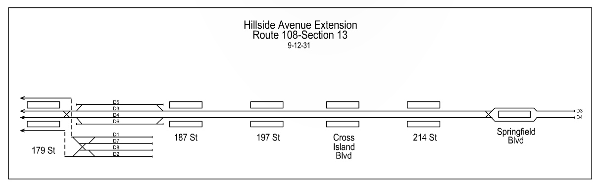
The Queens Boulevard Line was originally planned to extend farther along Hillside Avenue into eastern Queens.[91] The line would have gone at least to the intersection of Hillside, Springfield Boulevard and Braddock Avenue (the latter two both formerly part of Rocky Hill Road) in Queens Village, with later plans to go as far as Little Neck Parkway in Bellerose near the Nassau County border.[46][53][92] The extension to Springfield Boulevard, which on contract drawings was referred to as Route 108-Section 13, would have been a two track extension of the D3 and D4 express tracks, with five stations, at 187th Street, 197th Street, Cross Island Boulevard (today's Francis Lewis Boulevard), 214th Street, and the terminal at Springfield Boulevard. All of these stations, with the exception of Springfield Boulevard, would have had two side platforms.[93] Hillside Avenue was widened in the 1930s between 218th Street and 229th Street, in order to accommodate construction of the proposed Springfield Boulevard station and to accommodate an underpass for Hillside Avenue underneath Springfield Boulevard and Braddock Avenue.[94][95] Six station entrances would have been provided at Springfield Boulevard and Braddock Avenue. The station would have stretched as far east as 88th Avenue. The two tracks would have continued to 229th Street.[96] As part of the extension of the line to 179th Street in 1950, provisions were made to extend this line farther east via Hillside Avenue. East of the 179th Street there are two four track levels both used as train storage. The upper level was intended to be extended eastward, while the lower level was always intended to be used to relay and store trains. The tracks on the upper level are longer than the lower level tracks and the upper level tracks have a wooden partition at the bumper blocks. The tracks continue until 184th Street.[66]
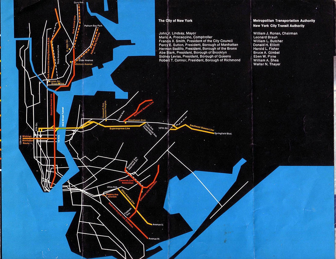
Several stations along the line also have provisions for other extensions as part of the IND Second System. The Roosevelt Avenue station has an additional upper level platform and bellmouth provisions east of the station, which would have gone to a Queens crosstown line to the Rockaways.[5][7] The 63rd Drive station has similar bellmouths, which would have fed directly into the inactive portion of the Long Island Rail Road's former Rockaway Beach Branch near its former junction with the LIRR Main Line (Whitepot Junction).[97][98] One stop west, the Woodhaven Boulevard station has provisions to be converted into an express station.[99] East of the Briarwood station, there were additional trackways built for an extension down Van Wyck Boulevard (today the Van Wyck Expressway) to Rockaway Boulevard, near the current site of John F. Kennedy International Airport.[7][50][92] None of these proposals were ever funded, and only the Briarwood bellmouths were used for future expansion, while the Rockaway line was connected instead to the IND Fulton Street Line.[46][53][76]
Program for Action
When proposed in the mid-1960s under the MTA's Program for Action, the Archer Avenue and 63rd Street subway lines were two parts of a major planned expansion of Queens Boulevard line service.[46][76] The 63rd Street tunnel would have facilitated service between the Queens Boulevard line and the Second Avenue Subway, via bellmouths west of Roosevelt Island which turn south towards Midtown and Lower Manhattan. These turnouts may be used for the third and fourth phases of the Second Avenue Subway.[100][101] The proposed connection to the LIRR Rockaway Beach Branch resurfaced, with proposed branch lines along other LIRR lines to outer Queens areas without rapid transit service.[46] Expected to be completed by the mid-1970s and early 1980s,[102][103] these plans (the most important of which are outlined below) were derailed by the 1970s fiscal crisis, which delayed the completion of the Archer Avenue and 63rd Street lines.[46][76][78]
"Super-express" line
The Archer Avenue and 63rd Street lines were planned to be connected by a "super-express" bypass of the Queens Boulevard line,[76][103][70] The bypass would have used the outer two of the six trackways of the LIRR Main Line (formerly used by the Rockaway Beach Branch), which are currently unused, and would have allowed trains to travel at speeds of up to 70 miles per hour. It would stretch from the 63rd Street Line east of 21st Street–Queensbridge, with the possibility of access to the 60th and 53rd Street tunnels. At its east end, it would have left the LIRR right-of-way near Whitepot Junction and ran under Yellowstone Boulevard to the Queens Boulevard Line near 71st Avenue station. The 71st Avenue station would have been converted into a bi-level or tri-level station, with the super express tracks using the lower level(s) built south of the current station, before rejoining the main line Queens Boulevard tracks.[46][103][100]
There were also plans for an intermediate stop at the current Woodside LIRR station, and an additional 63rd Street line station at Northern Boulevard adjacent to Queens Plaza. The bypass and proposed Woodside station would have necessitated the widening of the LIRR Main Line right-of-way onto private property west of Winfield Junction, where the Main Line merges with the Port Washington Branch, and reorganization of the track layout in the Sunnyside Yards.[93][104] Later proposals suggested routing the bypass directly to the Archer Avenue line via the LIRR Montauk Branch (which no longer has passenger service).[100][105]
While plans to construct the bypass existed as late as 1985, the connection to the Queens Boulevard line at Northern Boulevard was built as an alternative to the bypass.[78][105] A bellmouth was built at the end of the tunnel should construction on the bypass ever commence.[106]
Northeast Queens line
Another less publicized plan around this time was a branch line diverging from the Queens Boulevard mainline near Woodhaven Boulevard, and running along the Long Island Expressway (LIE) corridor to Kissena Boulevard at Queens College, and later to Fresh Meadows and Bayside. This "Northeastern Queens" line, or Route 131-C, would have been built in conjunction with the planned widening of the expressway. The subway tracks would have been placed under the expressway or its service roads, or in the median of a widened LIE in a similar manner to the Congress Branch of the Chicago "L".[98][103][100] The Woodhaven Boulevard station, using existing provisions, would be converted to an express station. Three new stations would have been built during the first phase of the line, at 99th Street near LeFrak City, at Main Street, and a terminal station at Kissena Boulevard. At Main Street there would have been three tracks, and two island platforms. East of the terminus at Kissena Boulevard, there would have been two levels of layup tracks, allowing for an extension further east.[93] A similar line along the corridor had been proposed in the 1939 IND Second System plan as an extension of the BMT Broadway Line east of the 60th Street Tunnel, when the road was called Horace Harding Boulevard prior to the construction of the expressway.[46][92]
Southeast Queens line
The most important of the proposed lines along LIRR branches was a "Southeast Queens" extension of the Archer Avenue subway along the Locust Manor branch to Springfield Gardens, which was the original intention of the Queens Boulevard extension to Archer Avenue. This would have used an existing provision east of Jamaica Center, and necessitated the installation of two dedicated subway tracks, construction of new stations and/or the conversion of existing facilities along the right-of-way.[103][100][102]
Station listing
| Station service legend | |
|---|---|
| Stops all times | |
| Stops all times except late nights | |
| Stops late nights only | |
| Stops late nights and weekends only | |
| Stops weekdays only | |
| Stops rush hours in the peak direction only | |
| Time period details | |
| Station is compliant with the Americans with Disabilities Act | |
| Station is compliant with the Americans with Disabilities Act in the indicated direction only | |
| Elevator access to mezzanine only | |
| Neighborhood (approximate) |
Station | Tracks | Services | Opened | Transfers and notes | |
|---|---|---|---|---|---|---|
| Queens | ||||||
| Jamaica | Jamaica–179th Street | all | E |
December 10, 1950[69] | Q3 bus to JFK Airport | |
| 169th Street | local | F |
April 24, 1937[55] | Q3 bus to JFK Airport | ||
| Parsons Boulevard | all | E |
April 24, 1937[55] | |||
| Sutphin Boulevard | local | F |
April 24, 1937[55] | Q44 Select Bus Service | ||
| IND Archer Avenue Line (E | ||||||
| Briarwood | Briarwood | local | E |
April 24, 1937[55] | Q44 Select Bus Service | |
| connecting tracks to Jamaica Yard | ||||||
| Kew Gardens | Kew Gardens–Union Turnpike | all | E |
December 31, 1936[54] | Q10 bus to JFK Airport | |
| Forest Hills | 75th Avenue | local | E |
December 31, 1936[54] | ||
| connecting tracks to Jamaica Yard; former connection to IND World's Fair Line | ||||||
| Forest Hills–71st Avenue | all | E |
December 31, 1936[54] | |||
| Rego Park | 67th Avenue | local | E |
December 31, 1936[54] | ||
| 63rd Drive–Rego Park | local | E |
December 31, 1936[54] | |||
| Elmhurst | Woodhaven Boulevard | local | E |
December 31, 1936[54] | Q52/Q53 Select Bus Service | |
| Grand Avenue–Newtown | local | E |
December 31, 1936[54] | Q53 Select Bus Service | ||
| Elmhurst Avenue | local | E |
December 31, 1936[54] | Q53 Select Bus Service | ||
| Jackson Heights | Jackson Heights–Roosevelt Avenue | all | E |
August 19, 1933[47] | IRT Flushing Line (7 Q47 bus to LaGuardia Airport (Marine Air Terminal only) Q53 Select Bus Service Q70 Select Bus Service to LaGuardia Airport | |
| Woodside | 65th Street | local | E |
August 19, 1933[47] | ||
| express tracks go underneath (E | ||||||
| Northern Boulevard | local | E |
August 19, 1933[47] | |||
| express tracks diverge (E | ||||||
| Astoria | 46th Street | local | E |
August 19, 1933[47] | ||
| Steinway Street | local | E |
August 19, 1933[47] | |||
| express tracks rejoin (E | ||||||
| Long Island City | 36th Street | local | E |
August 19, 1933[47] | ||
| IND 63rd Street Line splits (F | ||||||
| Queens Plaza | all | E |
August 19, 1933[47] | |||
| local tracks split to IND Crosstown Line (no regular service) and 60th Street Tunnel Connection (R | ||||||
| Court Square–23rd Street | express | E |
August 28, 1939[60] | IND Crosstown Line (G IRT Flushing Line (7 | ||
| Manhattan | ||||||
| 53rd Street Tunnel | ||||||
| Midtown Manhattan | Lexington Avenue–53rd Street | express | E |
August 19, 1933[47] | IRT Lexington Avenue Line (4 | |
| Fifth Avenue/53rd Street | express | E |
August 19, 1933[47] | |||
| connection to IND Sixth Avenue Line (M | ||||||
| Seventh Avenue | express | E |
August 19, 1933[47] | IND Sixth Avenue Line (B | ||
| 50th Street | express | E |
August 19, 1933[47] | IND Eighth Avenue Line (A | ||
| merges with IND Eighth Avenue Line (A | ||||||
Footnotes
References
- 1 2 "Facts and Figures: Average Weekday Subway Ridership 2012–2017". Metropolitan Transportation Authority. July 12, 2018. Retrieved July 12, 2018.
- 1 2 3 "Capital Program Oversight Committee Meeting: July 2015" (PDF). New York City: Metropolitan Transportation Authority. July 2015. Archived from the original (PDF) on September 6, 2015. Retrieved August 11, 2015.
- ↑
- "Trial Run to Jamaica on Subway Tomorrow: Section From Kew Gardens to 169th Street Will Open to Public in Two Weeks" (PDF). nytimes.com. The New York Times. April 9, 1937. Retrieved June 30, 2015.
- "Subway Extension In Queens Is Voted" (PDF). nytimes.com. The New York Times. August 2, 1946. Retrieved June 30, 2015.
- Verhovek, Sam Howe (November 21, 1988). "For Shelter, Homeless Take the E Train". nytimes.com. The New York Times. Retrieved July 15, 2015.
- "Hillside Avenue Extension, Route 108-Section 13". Retrieved July 10, 2016.
- 1 2 3 4 5 6 Dougherty, Peter (2018). Tracks of the New York City Subway 2018 (16th ed.). Dougherty.
- 1 2 3 Martin, Douglas (November 17, 1996). "Subway Planners' Lofty Ambitions Are Buried as Dead-End Curiosities". nytimes.com. The New York Times. Retrieved June 27, 2015.
- 1 2 3 4 Kramer, Frederick A. (1990). Building the Independent Subway. Quadrant Press. ISBN 978-0-915276-50-9.
- 1 2 3 4 5 6
- Duffus, R.L. (September 22, 1929). "OUR GREAT SUBWAY NETWORK SPREADS WIDER; New Plans of Board of Transportation Involve the Building of More Than One Hundred Miles of Additional Rapid Transit Routes for New York". The New York Times. Retrieved August 19, 2015.
- Board of Transportation of the City of New York Engineering Department, Proposed Additional Rapid Transit Lines And Proposed Vehicular Tunnel, dated August 23, 1929
- ↑ "New IND Platform Will Open Monday" (PDF). nytimes.com. The New York Times. August 23, 1952. Retrieved June 30, 2015.
- ↑ Ingraham, Joseph C. (June 20, 1952). "New IND Platform at 8th and 42d To Expedite Service From Queens" (PDF). nytimes.com. The New York Times. Retrieved June 30, 2015.
- ↑ Donohue, Pete (June 20, 2009). "Abandoned No More: 2nd Life Drilled into Old 7 Subway Platform". New York Daily News. Retrieved January 30, 2010.
- 1 2 3 4 5 6 "Subway Service Guide" (PDF). Metropolitan Transportation Authority. June 25, 2017. Retrieved July 1, 2017.
- 1 2 3 4 "Subway Map" (PDF). Metropolitan Transportation Authority. January 18, 2018. Retrieved January 18, 2018.
- ↑ "NYPD – District 20". www.nyc.gov. Retrieved August 4, 2016.
- ↑ "QUEENS SUBWAY WORK AHEAD OF SCHEDULE: Completion Will Lead to Big Apartrnent Building, Says William C. Speers". The New York Times. April 7, 1929. Retrieved September 1, 2015.
- 1 2 3 "Queens Lauded as Best Boro By Chamber Chief". Brooklyn Daily Eagle. September 23, 1929. p. 40. Retrieved October 4, 2015 – via Newspapers.com.
- 1 2 New York Times, New Subway Routes in Hylan Program to Cost $186,046,000, March 21, 1925, page 1.
- ↑ "1_8aaaf683001d5e21891cb425b64de612-1". Flickr – Photo Sharing!.
- 1 2 3
- "Possible routing of queens blvd line via kew gardens rd". Flickr – Photo Sharing!.
- "1_8aaaf683001d5e21891cb425b64de612". Flickr – Photo Sharing!.
- Nordman, Guy (October 20, 1927). "Rapid Transit Factor Key To Quick Growth Of Industrial Queens: Fifty-third Street Line and Brooklyn Crosstown Subway Plans, Now Under Way by City, Forecast Still Vaster Developments in Future" (PDF). The Daily Star. p. 3B. Retrieved August 21, 2016 – via Fulton History.
- ↑ "Movement To Change Subway To Richmond Hill". The Richmond Hill Record. August 28, 1925. p. 1. Retrieved April 24, 2018.
- ↑ "NEW SUBWAY STOP PLANNED; In 8th Av., Between 49th and 51st Streets on Queens Line". The New York Times. 1926-11-22. ISSN 0362-4331. Retrieved 2018-03-21.
- 1 2 3 4 5 Seyfried, Vincent F. (1995). Elmhurst : from town seat to mega-suburb. Vincent F. Seyfried.
- ↑ "L.I. City-Jamaica Subway To Open Between Plaza and Manhattan Next Year; City Will Extend Service With Completion of Each Section; Sullivan Reveals Plans of Board of Transportation" (PDF). Long Island Daily Star. Fultonhistory.com. March 15, 1930. p. 1. Retrieved July 27, 2016.
- ↑ "$17,146,500 VOTED FOR NEW SUBWAYS; Estimate Board Appropriates More Than $9,000,000 for Lines in Brooklyn. $6,490,000 FOR THE BRONX Smaller Items for Incidental Work --Approves the Proposed Queens Boulevard Route". The New York Times. October 5, 1928. ISSN 0362-4331. Retrieved August 4, 2016.
- ↑ "More Subway Links To Open". The New York Sun. August 17, 1933. p. 7. Retrieved April 24, 2018.
- 1 2 "PLANS ARE CHANGED FOR QUEENS SUBWAY: Traffic Crossings at Nassau and Woodhaven Boulevards Altered to Avoid Congestion. VIADUCT PROJECT DROPPED Main Driveway to Be Depressed, Side Routes to Be at Grade-- New Bids Due Soon. How Plans Were Changed. Elimination Plans Received". The New York Times. June 22, 1930. Retrieved September 1, 2015.
- ↑ "State and City Plans For Long Island Seen As Boost to Realty". Brooklyn Daily Eagle. January 24, 1932. p. 44. Retrieved November 3, 2015 – via Newspapers.com.
- ↑ "Highway Program Aids Long Island Growth" (PDF). nytimes.com. The New York Times. April 27, 1930. Retrieved June 27, 2015.
- ↑
- "Queens Boulevard Express Highway (NY 25, unbuilt)". www.nycroads.com. Retrieved August 4, 2016.
- "Office of the President, Borough of Queens, Topographical Bureau Map Showing Roadway Treatment of Queens Boulevard From Van Dam St. To Hillside Ave. In Connection With The Proposed Improvement New York, January 31, 1922". Flickr. Retrieved August 4, 2016.
- "Office of the President, Borough of Queens, Topographical Bureau Map Showing Roadway Treatment of Queens Boulevard From Van Dam St. To Hillside Ave. In Connection With The Proposed Improvement New York, January 31, 1922". Flickr. Retrieved August 4, 2016.
- "Office of the President, Borough of Queens, Topographical Bureau Map Showing Roadway Treatment of Queens Boulevard From Van Dam St. To Hillside Ave. In Connection With The Proposed Improvement New York, January 31, 1922". Flickr. Retrieved August 4, 2016.
- "Office of the President, Borough of Queens, Topographical Bureau Map Showing Roadway Treatment of Queens Boulevard From Van Dam St. To Hillside Ave. In Connection With The Proposed Improvement New York, January 31, 1922". Flickr. Retrieved August 4, 2016.
- "Office of the President, Borough of Queens, Topographical Bureau Map Showing Roadway Treatment of Queens Boulevard From Van Dam St. To Hillside Ave. In Connection With The Proposed Improvement New York, January 31, 1922". Flickr. Retrieved August 4, 2016.
- "Office of the President, Borough of Queens, Topographical Bureau Map Showing Roadway Treatment of Queens Boulevard From Van Dam St. To Hillside Ave. In Connection With The Proposed Improvement New York, January 31, 1922". Flickr. Retrieved August 4, 2016.
- "Office of the President, Borough of Queens, Topographical Bureau Map Showing Roadway Treatment of Queens Boulevard From Van Dam St. To Hillside Ave. In Connection With The Proposed Improvement New York, January 31, 1922". Flickr. Retrieved August 4, 2016.
- "Office of the President, Borough of Queens, Topographical Bureau Map Showing Roadway Treatment of Queens Boulevard From Van Dam St. To Hillside Ave. In Connection With The Proposed Improvement New York, January 31, 1922". Flickr. Retrieved August 4, 2016.
- "Office of the President, Borough of Queens, Topographical Bureau Map Showing Roadway Treatment of Queens Boulevard From Van Dam St. To Hillside Ave. In Connection With The Proposed Improvement New York, January 31, 1922". Flickr. Retrieved August 4, 2016.
- "Office of the President, Borough of Queens, Topographical Bureau Map Showing Roadway Treatment of Queens Boulevard From Van Dam St. To Hillside Ave. In Connection With The Proposed Improvement New York, January 31, 1922". Flickr. Retrieved August 4, 2016.
- ↑
- "Queensborough Bridge Centennial". New York Division Bulletin. Electric Railroaders Association. 52 (3): 1–5. March 2009. Retrieved January 1, 2016.
- "Hylan Jitney Bus In Elmhurst Crash Overturns; 27 Hurt: Locked Wheels With Touring Car in queens Boulevard Jam. Both Cars Wrecked". Brooklyn Daily Eagle. August 30, 1920. Retrieved January 2, 2016 – via Newspapers.com.
- 1 2 3 4 Hirshon, Nicholas; Romano, Foreword by Ray (January 1, 2013). Forest Hills. Arcadia Publishing. ISBN 978-0-7385-9785-0.
- ↑
- Marks, Seymour (January 19, 1959). "The Phantom Subway: Ideal Spot to Park Underground" (PDF). Long Island Star-Journal. Fultonhistory.com. p. 1. Retrieved August 12, 2016.
- Marks, Seymour (January 19, 1959). "The Phantom Subway: Ideal Spot to Park Underground" (PDF). Long Island Star-Journal. Fultonhistory.com. p. 2. Retrieved August 12, 2016.
- ↑ "SUBWAY OPENING DELAY AGAIN HIT BY E. A. DANGLER". Daily Star. January 4, 1932. p. 14. Retrieved April 24, 2018.
- ↑ "City Will Open New Subway This Fall". Long Island Daily Press. January 19, 1933. Retrieved April 24, 2018.
- ↑ "New Queens Subway To Open In August, Is Latest Official Promise". Daily Star. March 20, 1933. p. 1. Retrieved April 24, 2018.
- ↑ "New Queens Subway Ready For Service In August, Is Latest Word; Work Now Going Ahead At Top Speed". Daily Star. March 20, 1933. p. 12. Retrieved April 24, 2018.
- 1 2
- "DEMAND IS NOTED FOR QUEENS HOMES; Sales in Many Areas Exceed Summer Expectations of Developers; JAMAICA SECTION ACTIVE; Buying Interest Reported at Kew Gardens—Open Roslyn Community Today Kew Gardens Activity Open Home Center at Roslyn". The New York Times. July 18, 1937. ISSN 0362-4331. Retrieved April 26, 2016.
- Myers, Steven Lee (June 14, 1992). "Life Beyond the Subway Is Subject to Its Own Disruptions". The New York Times. ISSN 0362-4331. Retrieved April 26, 2016.
- "FOREST HILLS IS ACTIVE; Renting Is Heaviest in Years There, Broker Reports". The New York Times. September 11, 1938. ISSN 0362-4331. Retrieved April 26, 2016.
- "NEW QUEENS SUBWAY STIMULATING GROWTH; Work Now Under Way to Kew Gardens—Many Home Communities Well Populated". The New York Times. April 26, 1931. ISSN 0362-4331. Retrieved April 26, 2016.
- "SUBWAY LINK AIDS REALTY ACTIVITYY; Broker Notes the Expansion of Housing Facilities in Queens District". The New York Times. March 7, 1937. ISSN 0362-4331. Retrieved April 26, 2016.
- ↑
- "New Subway Spurs Building on Queens Boulevard: Home Construction to $2,000,000 Value Now Going On, Says Boelsen" (PDF). New York Daily Star. April 17, 1930. p. 2. Retrieved August 2, 2016 – via Fulton History.
- "Million-Dollar Queens Borough Sale; Western Syndicate Buys Vacant Plots; Properties on the Line of the Jamaica Subway, Now Under Construction, and All Have Frontages on Queens Boulevard, Where Building Is Active". The New York Times. November 25, 1928. ISSN 0362-4331. Retrieved August 4, 2016.
- "BLOCK FRONT SOLD IN LONG ISLAND CITY; Queens Boulevard Parcel Will Be Improved With Stores and Apartments. ELMHURST SITES TRADED Builders and Investors Active Along Route of Proposed Subway to Jamaica". The New York Times. May 24, 1928. ISSN 0362-4331. Retrieved August 4, 2016.
- "SEES BIG CHANGES COMING IN QUEENS; Borough Has Bright Possibilities for Development, Says Fred G. Randall. TRAFFIC IS CHIEF FACTOR Queens Boulevard Areas Showing Marked Activity—Realty Values Advancing". The New York Times. May 19, 1929. ISSN 0362-4331. Retrieved August 4, 2016.
- ↑ "QUEENS TO HAVE 15-STORY HOUSE; Tall Structure for New Residential Development in ForestHills Area.NEAR BOULEVARD SUBWAYSeveral Blocks Rezoned for High Buildings Between Jamaicaand Kew Gardens. Apartment Height's Increase". The New York Times. March 23, 1930. ISSN 0362-4331. Retrieved April 26, 2016.
- ↑ Copquin, Claudia Gryvatz (January 1, 2007). The Neighborhoods of Queens. Yale University Press. ISBN 0-300-11299-8.
- ↑
- "SUBWAY LINK AIDS REALTY IN QUEENS; Civic Leaders Urge Careful Planning for the Future Growth of District. APARTMENT TREND SEEN Rising Values Are Predicted for the Forest Hills and Kew Gardens Areas. Views Future With Optimism Cites New Responsibilities SUBWAY LINK AIDS REALTY IN QUEENS Changing Conditions Seen Sales in Rego Park". The New York Times. January 3, 1937. ISSN 0362-4331. Retrieved April 26, 2016.
- "FOREST HILLS RENTALS; Demand There and in Kew Gardens Higher Than Last Year". The New York Times. July 11, 1937. ISSN 0362-4331. Retrieved April 26, 2016.
- ↑ "RESIDENTIAL AREAS IN QUEENS EXPAND; Plans Are Announced for New Garden Apartment House in Jackson Heights. MANY SMALL HOMES BUILT Queens Boulevard Values Rise-- Construction Activity Reported in Woodhaven Section. Queens Boulevard Values Rise". The New York Times. May 11, 1930. ISSN 0362-4331. Retrieved August 4, 2016.
- 1 2 Dougherty, Philip H. (March 10, 1965). "Queens Boulevard, Once Just a Good Route to Jamaica, Is Becoming a 'Golden Area'; Urban Togetherness". The New York Times. ISSN 0362-4331. Retrieved August 4, 2016.
- ↑ "QUEENS BOULEVARD READY FOR BUILDING; Subway Completion There Will Stimulate Large Housing Improvements". The New York Times. March 9, 1930. ISSN 0362-4331. Retrieved August 4, 2016.
- ↑ Seyfried, Vincent F.; Asadorian, William (January 1, 1991). Old Queens, N.Y., in Early Photographs. Courier Corporation. ISBN 978-0-486-26358-8.
- ↑ "QUEENS POPULATION GREW WITH SUBWAY; 248,678 Gain From 1940 to '50 Followed Opening of Land Areas Along 8th Avenue Line". The New York Times. July 1, 1951. ISSN 0362-4331. Retrieved April 4, 2018.
- 1 2 3 4 5 6 7 8 9 10 Raskin, Joseph B. (November 1, 2013), The Routes Not Taken: A Trip Through New York City's Unbuilt Subway System, Fordham University Press, ISBN 978-0-8232-5369-2
- 1 2 3 4 5 6 7 8 9 10 11 12
- "TWO SUBWAY UNITS OPEN AT MIDNIGHT; Links in City-Owned System in Queens and Brooklyn to Have 15 Stations" (PDF). The New York Times. August 18, 1933. Retrieved November 7, 2015.
- "New Queens Subway Service Will Be Launched Tonight; Tunnel From Manhattan Open to Jackson Heights; Service Will Eventually Be Extended Through To Jamaica" (PDF). Long Island Daily Press. Fultonhistory.com. August 18, 1933. p. 20. Retrieved July 27, 2016.
- "New Queens Tube To Open Saturday: Brooklyn-Long Island City Link of City Line Also to Be Put in Operation" (PDF). New York Evening Post. Fultonhistory.com. August 17, 1933. p. 18. Retrieved July 27, 2016.
- ↑ "New Subway Opens Tomorrow Queens Boulevard Route to Manhattan Starts at 12:01 A. M.–Special Run Being Made Today". The Richmond Hill Record. August 18, 1933. p. 8. Retrieved November 19, 2017.
- ↑ "Unfinished Sections of Subway Lines To Be Completed" (PDF). The New York Sun. Fultonhistory.com. December 13, 1933. p. 47. Retrieved July 30, 2016.
- 1 2 3 Neufeld, Ernest (August 23, 1936). "Men Toil Under Earth to Build Subway" (PDF). Long Island Daily Press. Fultonhistory.com. p. 2 (Section 2). Retrieved August 12, 2016.
- ↑
- "500 More Quit Subway Work On Boulevard: General Strike Order Issued Today; 72 Walk Out in Jamaica" (PDF). Long Island Daily Press. Fultonhistory.com. April 2, 1935. p. 2. Retrieved July 30, 2016.
- "Aldermen Probe Strike on Subway" (PDF). Long Island Daily Press. Fultonhistory.com. April 3, 1935. p. 4. Retrieved July 30, 2016.
- ↑ "Kew Gardens–Times Square Ride to Be 33 Minutes". Long Island Daily Press. November 20, 1936. p. 1. Retrieved April 24, 2018.
- 1 2 3 4 5 Roger P. Roess; Gene Sansone (August 23, 2012). The Wheels That Drove New York: A History of the New York City Transit System. Springer Science & Business Media. pp. 416–417. ISBN 978-3-642-30484-2.
- 1 2 3 4 5 6 7 8 9
- "PWA Party Views New Subway Link: Queens Section to Be Opened Tomorrow Is Inspected by Tuttle and Others" (PDF). nytimes.com. The New York Times. December 30, 1936. Retrieved June 27, 2015.
- "Reproduction Poster of Extension to Union Turnpike – Kew Gardens". Flickr – Photo Sharing!. Retrieved April 26, 2016.
- 1 2 3 4 5
- "Subway Link Opens Soon: City Line to Jamaica Will Start About April 24" (PDF). nytimes.com. The New York Times. March 17, 1937. Retrieved June 27, 2015.
- "Trial Run to Jamaica on Subway Tomorrow: Section From Kew Gardens to 169th Street Will Open to Public in Two Weeks" (PDF). nytimes.com. The New York Times. April 9, 1937. Retrieved June 30, 2015.
- 1 2 "Trains Testing Jamaica Link Of City Subway". The Brooklyn Daily Eagle. April 10, 1937. p. 3. Retrieved April 24, 2018.
- ↑ "Jamaica Will Greet Subway". The New York Sun. April 23, 1937. p. 8. Retrieved April 24, 2018.
- ↑ "LaGuardia Heads Speakers Marking Subway Opening Ceremonies Planned Saturday Celebrating Hillside Avenue Extension". North Shore Daily Journal. April 23, 2017. p. 3. Retrieved November 19, 2017.
- ↑ "TRANSIT LINK OPEN TODAY; 8th Ave. Line Extended to Jamaica—Celebration Arranged". The New York Times. April 24, 1937. ISSN 0362-4331. Retrieved August 4, 2016.
- 1 2
- "Subway Station Opens Aug. 28" (PDF). The New York Times. August 5, 1939. Retrieved October 4, 2015.
- "ELY SUBWAY STOP TO OPEN; Queens Station on City-Owned Line Begins Service Tomorrow" (PDF). The New York Times. August 26, 1939. Retrieved October 4, 2015.
- ↑ "New Lines Shift City Travel". Brooklyn Daily Eagle. Newspapers.com. July 8, 1937. Retrieved October 31, 2016.
- ↑ "TO BUILD FAIR SUBWAY P. T. Cox Co. Wins Award for Extending Independent System The first contract for the World's Fair spur from the Queens Boulevard line of the Independent Subway System was awarded yesterday by the Board of Transportation to the lowest bidder, the P. T. Cox Contracting Company, at the bid price of $308,770" (PDF). nytimes.com. The New York Times. October 27, 1937. Retrieved July 6, 2015.
- ↑ "Independent Subway Services Beginning in 1932". thejoekorner.com. August 21, 2013. Retrieved August 2, 2015.
- 1 2 3 4 Sparberg, Andrew J. (October 1, 2014). From a Nickel to a Token: The Journey from Board of Transportation to MTA. Fordham University Press. ISBN 978-0-8232-6190-1.
- ↑
- Linder, Bernard (December 2008). "Sixth Avenue Subway Service Changes". New York Division Bulletin. Electric Railroaders' Association. 51 (12): 2–4. Retrieved August 6, 2016.
- "New 6th Ave. Tube Will Be Boon to Queens Residents". Brooklyn Daily Eagle. December 8, 1940. p. 10. Retrieved October 4, 2015 – via Newspapers.com.
- 1 2 3 Report including analysis of operations of the New York City transit system for five years, ended June 30, 1945. New York City: Board of Transportation of the City of New York. 1945.
- ↑ "Subway Ground Broken: Mayor Officiates at Site of Extension in Queens". The New York Times. March 6, 1947. Retrieved August 12, 2016.
- ↑ Report for the three and one-half years ending June 30, 1949. New York City Board of Transportation. 1949.
- 1 2
- "New Subway Link Opening in Queens" (PDF). nytimes.com. The New York Times. December 12, 1950. Retrieved June 30, 2015.
- "Subway Extension In Queens Is Voted" (PDF). nytimes.com. The New York Times. August 2, 1946. Retrieved June 30, 2015.
- 1 2 3 4 5 6 7
- "Review of F Line Operations, Ridership, and Infrastructure" (PDF). nysenate.gov. MTA New York City Transit Authority. October 7, 2009. Archived from the original (PDF) on May 31, 2010. Retrieved July 28, 2015.
- "Review of the G Line" (PDF). mta.info. Metropolitan Transportation Authority. July 10, 2013. Retrieved August 2, 2015.
- ↑ Ingalls, Leonard (August 28, 1953). "2 Subway Lines to Add Cars, Another to Speed Up Service" (PDF). New York Times. Retrieved January 25, 2016.
- ↑ "16-Point Plan Can Give Boro Relief NOW". Long Island Star–Journal. August 10, 1962. Retrieved April 24, 2018.
- ↑ "Straphangers Sit As Tunnel Opens". The New York Times. December 2, 1955. Retrieved February 28, 2010.
- 1 2 Alternatives Analysis/Supplemental Draft Environmental Impact Statement for the Queens Subway Options Study. United States Department of Transportation, Metropolitan Transportation Authority, Urban Mass Transit Administration. May 1990. Retrieved August 13, 2016.
- ↑
- "Shifts on N and R Lines Are Planned in Queens". The New York Times. October 16, 1986. p. B10. Retrieved July 29, 2016.
- "N and R Service changes". subwaynut.com.
- 1 2 3 4 5 6 Johnson, Kirk (December 9, 1988). "Big Changes For Subways Are to Begin". nytimes.com. The New York Times. Retrieved July 14, 2015.
- ↑
- O'Neill, Natalie (April 13, 2012). "History shows it's not the G train 'extension' — it's the G train renewal". The Brooklyn Paper. Retrieved August 2, 2015.
- "E, F Detour in 2001, F trains via 63 St, E no trains running, take R instead". The Subway Nut. Retrieved October 20, 2011.
- 1 2 3 Kennedy, Randy (May 25, 2001). "Panel Approves New V Train but Shortens G Line to Make Room". The New York Times. Retrieved March 20, 2010.
- ↑ Dunlap, David W. (September 19, 2008). "New Subway Grates Add Aesthetics to Flood Protection". The New York Times. Retrieved February 14, 2017.
- ↑ "August 8, 2007 Storm Report" (PDF). Metropolitan Transportation Authority. September 20, 2007. Archived from the original (PDF) on October 29, 2007. Retrieved October 27, 2007.
- ↑ John Hill (2011). Guide to Contemporary New York City Architecture. W.W. Norton & Company. pp. 233, 237. ISBN 978-0-393-73326-6. Retrieved 13 October 2017.
- ↑
- "Memorandum: Modifications to 2010 NYC Transit Service Reductions" (PDF). mta.info. MTA New York City Transit Authority. March 19, 2010. Retrieved August 23, 2015.
- Grynbaum, Michael M. (March 19, 2010). "Under a New Subway Plan, the V Stands for Vanished". The New York Times. Retrieved March 20, 2010.
- "2010 NYC Transit Service Reductions" (PDF). mta.info. Metropolitan Transportation Authority. January 27, 2010. Archived from the original (PDF) on November 25, 2010. Retrieved August 2, 2015.
- 1 2
- Levine, Richard (February 7, 1987). "M.T.A. Proposes Opening 63d Street Tunnel in '89". The New York Times. Retrieved October 20, 2011.
- Final Environmental Impact Statement for the 63rd Street Line Connection to the Queens Boulevard Line. Queens, New York, New York: Metropolitan Transportation Authority, United States Department of Transportation, Federal Transit Administration. June 1992. Retrieved July 23, 2016.
- ↑ "MTA | news | $205.8M in Contracts Approved to Install Communications-Based Train Control System". www.mta.info. Retrieved August 6, 2016.
- ↑ Wanek-Libman, Mischa (January 5, 2017). "MTA awards L.K. Comstock Queens Boulevard Line signaling contract". Retrieved January 31, 2017.
- 1 2 Pages 11–12
- ↑ "Advanced Signaling Makes the Most Out of Old Subways, But Can New York Handle It?". Retrieved August 6, 2016.
- ↑ "Capital Program Oversight Committee Meeting" (PDF). mta.info. Metropolitan Transportation Authorityaccessdate=September 15, 2017. July 2017.
- ↑ "MTA Will Completely Close 30 Subway Stations For Months-Long "Revamp"". Gothamist. Archived from the original on August 1, 2016. Retrieved July 18, 2016.
- ↑ "MTAStations" (PDF). governor.ny.gov. Government of the State of New York. Retrieved July 18, 2016.
- ↑ "QUEENS INTERLACED WITH NEW ARTERIES: New Boulevards, Parks and Parkways Important Factors in Growth of Borough". nytimes.com. The New York Times. May 13, 1928. Retrieved July 8, 2015.
- 1 2 3 Project for Expanded Rapid Transit Facilities, New York City Transit System, dated July 5, 1939.
- 1 2 3 4 "Mysteries of the Queens Boulevard Subway". September 23, 2015. Retrieved July 10, 2016.
- ↑
- "1931 Hillside Av Widening Queens Village Bellerose SUBWAY Map NYC New York Map – #494116324". Worthpoint. December 17, 2013. Retrieved February 5, 2017.
- "Hillside Avenue Widening at Springield [sic] Boulevard and 219th Street for the future extension of the Hillside Avenue Subway". Flickr. October 1, 2015. Retrieved February 5, 2017.
- "Hillside Avenue Widening at Springield [sic] Boulevard and 219th Street for the future extension of the Hillside Avenue Subway". Flickr. October 1, 2015. Retrieved February 5, 2017.
- "Hillside Avenue Widening at Springield [sic] Boulevard and 219th Street for the future extension of the Hillside Avenue Subway". Flickr. October 1, 2015. Retrieved February 5, 2017.
- ↑ "In The Matter Of The Widening of Hillside Avenue Queens Boro. Petition For Relief From Assessment". November 19, 1937. Retrieved August 9, 2018.
- ↑
- "Route 108 Section 13 Springfield Boulevard Station June 19, 1931". New York City Board of Transportation. June 19, 1931. Retrieved August 9, 2018.
- "Route 108 Section 13 Springfield Boulevard Station June 19, 1931". New York City Board of Transportation. June 19, 1931. Retrieved August 9, 2018.
- "Route 108 Section 13 Springfield Boulevard Station June 19, 1931". New York City Board of Transportation. June 19, 1931. Retrieved August 9, 2018.
- ↑ "City Plans to Buy New Subway Link: Would Take Over Rockaway Branch of Long Island to Connect With Queens" (PDF). nytimes.com. The New York Times. December 23, 1933. Retrieved June 30, 2015.
- 1 2 Kihss, Peter (April 13, 1967). "3 Routes Proposed to Aid Growing Queens Areas" (PDF). nytimes.com. The New York Times. Retrieved June 27, 2015.
- ↑ "The Express Stop That Never Was". ltvsquad.com. LTV Squad. June 2, 2015. Retrieved June 27, 2015.
- 1 2 3 4 5
- "Full text of "Metropolitan transportation, a program for action. Report to Nelson A. Rockefeller, Governor of New York."". Internet Archive. November 7, 1967. Retrieved October 1, 2015.
- "1970s NYC Subway Map That Never Was – Business Insider". Business Insider. June 18, 2013.
- Burks, Edward C. (March 20, 1970). "Board Approves Downtown Subway Route and East Side Loop" (PDF). The New York Times. Retrieved September 26, 2015.
- Queens Subway Options Study, New York: Environmental Impact Statement. United States Department of Transportation, Metropolitan Transportation Authority, Urban Mass Transit Administration. May 1984. pp. 83–. Retrieved July 10, 2016.
- ↑
- "Second Avenue Subway Final Environmental Impact Statement (FEIS): Track Diagram, North of 55th Street" (PDF). mta.info. Metropolitan Transportation Authority. Retrieved August 27, 2015.
- 2nd Avenue Subway – Tentative track plan, Manhattan portion, nycsubway.org
- 1 2 Burks, Edward C. (October 24, 1973). "Work Begun on Queens Subway Extension" (PDF). The New York Times. Retrieved September 26, 2015.
- 1 2 3 4 5
- "New Line May Get Double Trackage: Transit Unit Studies Shift on Queens Super-Express" (PDF). The New York Times. February 21, 1971. Retrieved September 26, 2015.
- Program for Action maps from thejoekorner.com
- "1968 NYCTA Expansion Plans (Picture)". Second Avenue Sagas. Retrieved October 31, 2016.
- 1 2
- Burks, Edward C. (June 6, 1976). "Shortage of U.S. Funds May Delay Subway Link" (PDF). The New York Times. Retrieved September 27, 2015.
- Erlitz, Jeffrey (February 2005). "Tech Talk". New York Division Bulletin. Electric Railroaders Association. 48 (2): 9–11. Retrieved July 10, 2016.
- Burks, Edward C. (July 29, 1976). "New Subway Line Delayed 5 or 6 Years" (PDF). The New York Times. Retrieved September 27, 2015.
- 1 2 Daley, Suzanne (November 1, 1984). "63D ST. SUBWAY TUNNEL: MORE SETBACKS FOR A TROUBLED PROJECT". The New York Times. Retrieved September 27, 2015.
- ↑ "MTA 63rd Street Connector". Metropolitan Transportation Authority. Archived from the original on October 30, 2014. Retrieved October 1, 2015.
External links
Route map:

- nycsubway.org — IND Queens Boulevard Line
| Current services |
| ||||||||||
|---|---|---|---|---|---|---|---|---|---|---|---|
| Defunct services |
| ||||||||||
| Unused labels | |||||||||||
| Stations |
| ||||||||||
| Divisions | |||||||||||
| Other lists | |||||||||||
| History |
| ||||||||||
| Infrastructure | |||||||||||
| Arts and culture | |||||||||||
| Miscellaneous | |||||||||||
| Other rapid transit in NYC |
| ||||||||||
Crossings of the East River | ||||
|---|---|---|---|---|
| ||||