Interstate 495 (New York)
| ||||
|---|---|---|---|---|
| Long Island Expressway | ||||
|
Map of Long Island with I-495 highlighted in red | ||||
| Route information | ||||
| Maintained by NYSDOT, NYCDOT, MTAB&T, and PANYNJ | ||||
| Length | 71.02 mi[1] (114.30 km) | |||
| Existed | 1958[2] – present | |||
| Major junctions | ||||
| West end | Queens–Midtown Tunnel portal in Murray Hill | |||
|
| ||||
| East end |
| |||
| Location | ||||
| Counties | New York, Queens, Nassau, Suffolk | |||
| Highway system | ||||
| ||||
.svg.png)
Interstate 495 (I-495), locally called the Long Island Expressway (LIE) or the Expressway, is an auxiliary Interstate Highway in the U.S. state of New York. It is jointly maintained by the New York State Department of Transportation (NYSDOT), the New York City Department of Transportation (NYCDOT), MTA Bridges and Tunnels (MTAB&T), and the Port Authority of New York and New Jersey (PANYNJ).
Spanning approximately 71 miles (114 km) along a west–east axis, I-495 traverses Long Island from the western portal of the Queens–Midtown Tunnel in the New York City borough of Manhattan to CR 58 in Riverhead in the east. I-495 intersects with I-295 in Bayside, Queens, through which it connects with I-95. A roughly 5-mile (8.0 km) gap in official Interstate designation exists within Queens, between I-278 in Long Island City and I-678 in Corona; this section of highway is officially designated as New York State Route 495 (SR 495), despite being signed as an Interstate Highway throughout.[3]
The Long Island Expressway designation, despite being commonly applied to I-495 in full, technically refers to the stretch of highway between Nassau and Suffolk counties. The section from the Queens–Midtown Tunnel to Queens Boulevard is known as the Queens–Midtown Expressway, and the section between Queens Boulevard and the Queens-Nassau county line is known as the Horace Harding Expressway. The service roads which run parallel to either side of the expressway in Queens are signed Horace Harding Expressway and Horace Harding Boulevard; from the Queens–Nassau line to Sills Road, they are designated as the unsigned New York State Route 906A and New York State Route 906B.
Route description
New York City
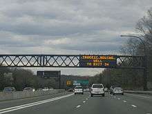
The expressway begins at the western portal of the Queens–Midtown Tunnel in the Murray Hill section of Manhattan. The route heads eastward, passing under FDR Drive and the East River as it proceeds through the Triborough Bridge and Tunnel Authority-maintained tunnel to Queens. Once on Long Island, the highway passes through the tunnel's former toll plaza and becomes known as the Queens–Midtown Expressway as it travels through the western portion of the borough. A mile after entering Queens, I-495 meets I-278 (the Brooklyn–Queens Expressway) at exit 17. At this point, I-495 becomes the unsigned highway NY 495, although it is still signed as an Interstate Highway. It continues as a limited-access expressway, on a generally easterly path, to the Rego Park neighborhood, where it connects to New York State Route 25 (NY 25, named Queens Boulevard) and becomes the Horace Harding Expressway. NY 495 heads northeast through Corona to Flushing Meadows–Corona Park, intersecting both the Grand Central Parkway and the Van Wyck Expressway (I-678) within the park limits, where unsigned NY 495 ends and I-495 officially resumes. Because the interchanges in this area are close together, the highway employs two sets of collector/distributor roads through this area: one between 69th and 99th Streets, and one between the Grand Central Parkway and I-678.[4]
_4.JPG)
The expressway continues east, veering to the southeast to bypass Kissena Park before curving back to the northeast to meet the Clearview Expressway (I-295) at the northern edge of Cunningham Park. Past I-295, I-495 passes by the "Queens Giant", the oldest and tallest tree in the New York metropolitan area. The tree, located just north of I-495 in Alley Pond Park, is visible from the highway's westbound lanes. To the east, the freeway connects to the Cross Island Parkway at exit 31 in the park prior to exiting the New York City limits, crossing into Nassau County, and becoming the Long Island Expressway (LIE).[4]
Although the Long Island Expressway name officially begins outside the New York City border, almost all locals and most signage use "the Long Island Expressway" or "the LIE" to refer the entire length of I-495.[6] The service roads of I-495 are called the "Queens–Midtown Expressway" between the Brooklyn–Queens Expressway and Queens Boulevard, and the "Horace Harding Expressway" between Queens Boulevard and the Nassau County line. They are generally signed as such like any other city streets. It is common to refer to the service roads by these names in local usage, for instance when referring to the location of a building along the road. Current guide signs (and Queens residents) simply refer to it as the Long Island Expressway.
The Horace Harding Expressway section follows the path of Horace Harding Boulevard (also previously called Nassau Boulevard),[7][8] which was named for Horace J. Harding (1863–1929), a finance magnate who directed the New York, New Haven and Hartford Railroad and the New York Municipal Railways System. Harding used his influence to promote the development of Long Island's roadways, lending strong support to Robert Moses's "great parkway plan". Harding also urged construction of a highway from Queens Boulevard to the Nassau County Line, in order to provide better access to Oakland Country Club, where he was a member. After his death, the boulevard he helped build was named for him. Horace Harding was not related to the former President Warren G. Harding.[9]
Nassau and Suffolk counties
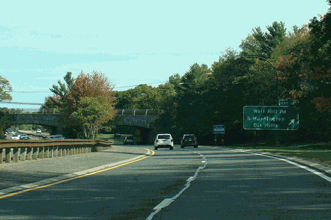
Heading into Nassau County, the expressway sports a High-Occupancy Vehicle Lane (HOV), which begins at exit 33 and runs to central Suffolk County. In its run through Nassau, it is the only major east–west highway that does not interchange with the Meadowbrook or Wantagh state parkways, both of which end to the south at the adjacent Northern State Parkway, which parallels the LIE through the county. The two highways meet three times, although it actually crosses only once at exit 46 near the county line. I-495 does, however, interchange with the Seaford–Oyster Bay Expressway (NY 135) as the east–west parkways do, and often has heavy traffic. In Suffolk County, the LIE continues its eight-lane configuration with the HOV lane to exit 64 (NY 112). At this point, the HOV lane ends and the highway narrows to six lanes; additionally, the concrete Jersey barrier gives way to a wide, grassy median, the asphalt road surface is replaced by a concrete surface, and the expressway is no longer illuminated by streetlights, reflecting the road's location in a more rural area of Long Island.[4]
From NY 112 east, the expressway runs through more rural, woodland areas on its trek towards Riverhead. Exit 68 (William Floyd Parkway) marks the terminus of the service roads, which are fragmented by this point. Exit 70 (CR 111) in Manorville is the last full interchange, as it is the last interchange that allows eastbound traffic on, and the first to allow westbound off. After exit 71 (NY 24 / Nugent Drive), the expressway begins to narrow as it approaches its eastern terminus. Until 2008, just before exit 72 (NY 25), the three eastbound lanes narrowed to two, which in turn narrowed almost immediately to a single lane at exit 73, which lies 800 feet (240 m) east of exit 72. As of 2008, of the two lanes, one lane is designated for exit 72 and the other is for exit 73, which ends the squeeze into a single lane that formerly existed at exit 73. At exit 73, all traffic along the expressway is diverted onto a ramp leading to eastbound CR 58, marking the east end of the route.[4]
History
Construction
Queens–Midtown Expressway
The Long Island Expressway was constructed in stages over the course of three decades. The first piece, the Queens–Midtown Tunnel linking Manhattan and Queens, was opened to traffic on November 15, 1940.[10] The highway connecting the tunnel to Laurel Hill Boulevard was built around the same time and named the "Midtown Highway".[11][12] The tunnel, the Midtown Highway, and the segment of Laurel Hill Boulevard between the highway and Queens Boulevard all became part of a realigned NY 24 in the mid-1940s.[12][13] Parts of this highway were built on the right of way of a streetcar line that extended from Hunters Point to southern Flushing.[14] In 1945, $60 million in funding was allocated toward a plan to upgrade roads in the New York City area. The plan included building the Queens-Midtown Expressway from the Midtown Tunnel to Queens Boulevard, and the Horace Harding Expressway from Queens Boulevard to the New York City border.[15]
In the early 1950s, work began on an eastward extension of the Midtown Highway. The road was completed between 48th and 58th Streets in February 1955,[16] at which point it became known as the "Queens–Midtown Expressway".[17][18] In November 1955, the highway was extended east by 3.2 miles to the junction of Queens (NY 24 and NY 25) and Horace Harding (NY 25D) Boulevards.[19] However, NY 24 initially remained routed on Laurel Hill Boulevard (by this point upgraded into the Brooklyn–Queens Expressway) and Queens Boulevard.[20]
Horace Harding Expressway and western Nassau
The LIE was built over much of Horace Harding Boulevard within Eastern Queens and Power House Road within western Nassau County. Prior to the LIE's construction, the route was designated as NY 25D. In May 1951, the New York City Board of Estimate approved the widening of Horace Harding Boulevard and Power House Road to 260 feet, and constructing an expressway in the road's median at a cost of $25 million.[21] The New York State Department of Public Works later modified the highway's route in the vicinity of Little Neck Parkway, near the Queens-Nassau border. At Little Neck Parkway, Horace Harding Boulevard continues northeast and then eastward, whereas the LIE takes a more southerly path. This modification was enacted because of complaints from nearby residents.[22] In 1955, New York State Governor Thomas E. Dewey approved plans for a 64-mile (103 km) extension of the LIE between the Queens-Nassau border and Riverhead in Suffolk County.[23]
Work began on the Horace Harding Expressway in 1955, but soon encountered delays because of weather conditions, construction worker strikes, and difficulties in building across existing roads and swampy land.[24] The highway had been extended east to Parsons Boulevard in Pomonok, Queens, by 1959, where the highway abruptly terminated and barriers funneled traffic onto the service road. Soon after, the highway was extended to Peck Avenue in Bayside.[25]
Meanwhile, in eastern Queens, a 1.5-mile (2.4 km) section of the highway in the vicinity of Alley Pond Park, between 224th Street in Bayside and the New York City border in Little Neck, was completed in September 1957. The highway segment reduced the need for cars to use West Alley Road, a winding road that traversed the park.[26] In September 1958, the first section of the LIE outside New York City, a 5-mile (8.0 km) segment from the city border to Roslyn, was opened to traffic.[27] The section of the LIE west of the Clearview Expressway was designated as I-495 in October 1958.[2] The following year, in September 1959, a short eastern extension of the highway in Roslyn was opened, allowing eastbound LIE traffic to continue onto the eastbound Northern State Parkway via a short ramp, and vice versa for westbound traffic. By this time, the LIE was continuous between Bayside and Roslyn, although the portion of the LIE near the Clearview Expressway (I-295) was not completed.[28]
By early 1960, the LIE saw more than 120,000 vehicles per day, although congestion frequently built up at Bayside where there was a gap in the LIE. The marshy land in the vicinity of Flushing Meadows–Corona Park created cracking on the expressway's pavement.[29] The 0.9-mile (1.4 km) segment of the LIE near the Clearview interchange, between Peck Avenue and 224th Street, was opened in August 1960.[30]
Segment east of Roslyn
After the opening of the Clearview interchange, the Long Island Expressway was open between Manhattan and Roslyn and entirely designated as NY 24. The old surface alignment of NY 24 south of the expressway became NY 24A.[31] The LIE was extended east from the Northern State Parkway split to NY 106/107 in Jericho by 1960,[31][32] and was then opened to South Oyster Bay Road in Syosset in December 1960.[33] A 5-mile extension of the LIE to NY 110 in Melville opened in August 1962, bringing the highway into Suffolk County.[34] A further 3.5-mile (5.6 km) extension from NY 110 to Deer Park Road opened in October of that year.[35] Around the same time, NY 24 was removed from the LIE and reassigned to its former surface alignment to the south while the portion of the freeway east of the Clearview Expressway became NY 495.[32][36]
Over one-third of the LIE across Suffolk County—from Melville to Veterans Memorial Highway (now NY 454) near Islandia—was opened to traffic c. 1963.[36][37] Two more sections—from Islandia to exit 61 in Holbrook and from William Floyd Parkway to exit 71 near Riverhead—were completed in the mid-1960s.[38][39] The gap in the freeway between Holbrook and William Floyd Parkway was filled by 1971[40] while the last 2 miles (3.2 km) of the LIE from exit 71 to CR 58 were opened to traffic on June 28, 1972.[41]
Unbuilt subway line
A New York City Subway line along the Long Island Expressway corridor had been proposed in the 1929 and 1939 IND Second System plans as an extension of the BMT Broadway Line east of the 60th Street Tunnel, when the LIE was called Nassau Boulevard and later Horace Harding Boulevard prior to the construction of the expressway.[42][43][44]
Another line was proposed in 1968 as part of the Program for Action. It would have split from the IND Queens Boulevard Line west of the Woodhaven Boulevard station and go to Kissena Boulevard via a right-of-way parallel and adjacent to the LIE.[45] In Phase I, it would go to Kissena Boulevard at Queens College, and in Phase II, to Fresh Meadows and Bayside.[42] This "Northeastern Queens" line would have been built in conjunction with the planned widening of the expressway. The subway tracks would have been placed under the expressway or its service roads, or in the median of a widened LIE in a similar manner to the Blue Line of the Chicago "L".[45][42][46][47][48] It had been previously proposed to run the line from the 63rd Street tunnel under Northern Boulevard to Flushing (near the current Main Street station), then south under Kissena and Parsons Boulevards to meet with the LIE at Queens College.[48]
The LIE line was approved in July 1968,[49] By 1973, the final design for the Northeast Queens LIE line was published.[42] However, later that year, the LIE line was canceled because New York state voters had declined a $3.5 billion bond measure that would have paid for five subway extensions, including the LIE line. This was the second time that voters declined a bond issue to finance this extension, with the first being on November 2, 1971 for $2.5 billion.[50]
Extensions
Across Manhattan
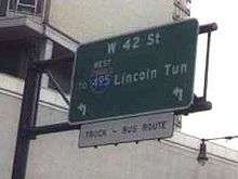
Plans for I-495 called for it to extend across Manhattan on the Mid-Manhattan Expressway to the tunnel, which it would follow into New Jersey and connect to I-95 in Secaucus. The I-495 designation was assigned to the New Jersey approach to the tunnel in anticipation of the Mid-Manhattan Expressway being completed.[38] However, the project was cancelled and the Mid-Manhattan Expressway was officially removed from I-495 on January 1, 1970.[51] The New Jersey stretch of I-495 became Route 495 in 1979.[52]
Manhattan Borough President Samuel Levy first proposed the Mid-Manhattan Expressway connector in 1936.[53] The plan called for an expressway link crossing midtown Manhattan near 34th Street, then, as now, a heavily traveled crosstown surface street. The original idea was a pair of two-laned tunnels, the Mid-Manhattan Expressway or M.M.E. (sometimes called the Mid-Manhattan Elevated Expressway) connecting the West Side Highway on Hudson River and the Franklin D. Roosevelt East River Drive on the East River. By 1949, Robert Moses, New York City Parks Commissioner and Arterial Coordinator, proposed a six-lane elevated expressway along 30th Street. The expressway was to have two exits, to connect to the West Side Highway and the Lincoln Tunnel on the west side of Manhattan, and also to the Queens–Midtown Tunnel and FDR Drive on the east side of the island.[54] It would be constructed within a 100-foot (30 m)-wide right-of-way immediately south of 30th Street. The viaduct would require substantial demolition of high-rise buildings within Midtown Manhattan. To cover the costs of construction, Moses suggested charging tolls on the new roadway, which was estimated to cost $26 million to construct plus another $23 million for the land needed for the project.[55]
A later proposal had the roadway situated ten stories above valuable commercial real estate. Air rights above the expressway would be sold and new high-rise buildings would be constructed above the expressway; buildings would be constructed below the viaduct as well. One fanciful variation involved running the roadway through the Empire State Building itself, occupying the sixth and seventh floors.[56][57]
In 1963, plans for the expressway were finalized, and it received the I-495 designation. Beginning from its elevated connections to 12th Avenue (NY 9A) or the West Side Elevated Highway, the Mid-Manhattan Expressway would mostly follow 30th Street east of Ninth Avenue. The expressway would travel east as a six-lane elevated route, ten stories above the city streets to allow for commercial development both above and below the skyway deck. At Second Avenue, it would swing north for connections with the East River or FDR Drive. Between First and Second Avenues, ramps would be constructed to provide access to the Queens–Midtown Tunnel.
In December 1965, Moses canceled his plans for the Mid-Manhattan Expressway due to opposition from the city government, which wanted to build a crosstown tunnel instead.[58] The Mid-Manhattan Expressway project was ultimately canceled and the I-495 designation removed from the expressway on January 1, 1970.[59] In 1971, New York Governor Nelson Rockefeller removed state plans for the Mid-Manhattan Expressway, along with about a dozen other highway plans including I-78 through New York City, of which another crosstown highway known as the Lower Manhattan Expressway (LOMEX) was part.[60]
Across Suffolk County
Long Island, meanwhile, lobbied to extend I-495 east over NY 495. The extension took place in the early 1980s, at which time the NY 495 signs were taken down and I-495 was extended to the east end of the LIE. The section of I-495 in the vicinity of the Lincoln Tunnel was redesignated as NY 495 at this time. The extension of I-495 to Riverhead makes the highway a spur, which should have an odd first digit according to the Interstate Highway System's numbering scheme. Even first digits are usually assigned to bypasses, connectors, and beltways, as I-495 was prior to the 1980s.[2] A proposed Long Island Crossing would have extended the LIE across Long Island Sound to I-95 in either Guilford, Connecticut, Old Saybrook, Connecticut, or Rhode Island via a series of existing and man-made islands, but a lack of funding as well as public opposition led to the demise of these proposals.[61]
CR 48 in Suffolk County was originally intended to become part of the North Fork extension of the Long Island Expressway.[62][63]
Improvements
From 1994 to 2005, High-occupancy vehicle lanes (HOV) were added to I-495. Beginning with a small section in Western Suffolk County, the lanes were added in subsequent sections until their completion on June 30, 2005. There is one HOV lane in each direction, in the median of the highway. They now run from exit 31 Cross Island Parkway to exit 64 at Medford in central Suffolk County.[2] From 6:00 am to 10:00 am and from 3:00 pm to 8:00 pm Monday through Friday, the HOV lanes are limited to buses, motorcycles, and Clean Pass vehicles without occupancy requirement and passenger vehicles with at least two occupants. Trailers and commercial trucks are always prohibited therein.[64]
I-495 lacked proper lighting along its route in Nassau and Suffolk counties for many years. Because of this, motorists would be driving into complete darkness after crossing the Queens-Nassau border. Despite constant requests from Nassau local officials, no immediate plans were made. Finally, in 1980, the first streetlights were installed in eastern Nassau county. The final streetlights were installed between exits 39 and 40 in 2002 in Nassau County.[2]
Proposed interchanges and service roads
As the Long Island Expressway was being built across Long Island, it was specifically designed to accommodate certain topographical conditions and proposed interchanges. Exit 30 was originally a partial cloverleaf interchange with the Cross Island Parkway. Eastbound exit 30S was for Easthampton Boulevard with a connecting ramp to the southbound Cross Island Parkway. Exit 31 was originally a westbound only interchange for Douglaston Parkway;[65] it was later combined with the exit for the Little Neck Parkway. Exit 39A was intended for the proposed extension of the Wantagh State Parkway near Powell Road in Old Westbury. It was intended to be a full Y interchange with an east-to-southbound-only off-ramp and a north-to-westbound-only on-ramp running beneath Powell Road.[66][67]
Exit 40 originally had only same-directional off-ramps under the expressway providing access to realigned sections of NY 25. When exit 41 was originally constructed, it had no south-to-west connecting ramp. Westbound access to the expressway was provided at the nearby exit 40 on-ramp at NY 25.[68] An alternate design for exit 42 called for it to be similar to the one proposed for NY 135 and Bethpage State Parkway,[69] and westbound exit 46 was originally a partial cloverleaf.[70][71] Exit 47 was intended for the extension of the Bethpage State Parkway near Washington Avenue in Plainview. This was to be a partial cloverleaf with southbound-only off-ramps and northbound-only on-ramps in both directions. The west-to-southbound ramp would also have an additional connecting ramp to a two-way frontage road for a development and an industrial area near exit 46.[72] Exit 47 is now intended as a truck inspection site between exits 46 and 48.
The original rights-of-way for the service roads between exits 48 and 49 were intended to weave around the steep Manetto Hills area of the main road, rather than running parallel to the road as it does today. The land between the service road and the main road was reserved for housing developments. The right-of-way for the original westbound service road still weaves through the development on the north side of the road.[62] Exit 49 was originally a cloverleaf interchange with the outer ramps connecting to the service roads at a point closer to NY 110. This was in preparation for NY 110's formerly proposed upgrade into the Broad Hollow Expressway. After the project was canceled in the 1970s, the west-to-northbound on-ramp was moved to nearby CR 3 (Pinelawn Road), and the original ramp was replaced with a park and ride. Other outer ramps were eventually moved further away from NY 110.
Exit 52 (Commack Road/CR 4) was intended to be moved west to an interchange with the formerly proposed Babylon–Northport Expressway (realigned NY 231) in the vicinity of the two parking areas. These ramps would have been accessible from the service roads. The westbound off-ramp and service road at exit 54 (Wicks Road/CR 7) originally terminated at Long Island Motor Parkway, east of Wicks Road. The westbound on-ramp was squeezed between the northwest corner of the Wicks Road bridge and exit 53. Excessive weaving between exits 52, 53, and 54 caused NYSDOT to reconstruct all three interchanges into one, and replace the west-to-southbound off-ramp to Sagtikos State Parkway with a flyover ramp.[73] Exit 55A was meant to be a trumpet interchange for the Hauppauge Spur of NY 347, between Long Island Motor Parkway (exit 55) and NY 111 (exit 56). The service roads were intended to go around the interchange, rather than run parallel to the main road. Ramps on the east side of Motor Parkway and west side of NY 111 would be eliminated as part of the interchange's construction. Between exits 57 and 58, there was a proposed extension of Northern State Parkway.[74][75]
Prior to the construction of the interchange with CR 97 (Nicolls Road), exit 62 was for Morris Avenue and Waverly Avenue eastbound, and Morris Avenue westbound.[76][77] Between exits 63 and 64, the eastbound service road was intended to weave around a recharge basin and replace a local residential street. Residents would have lived on both sides of the service road, similar to the segment between exits 59 and 60.[78] Exit 68 was originally planned to be built as a cloverleaf interchange without collective-distributor roads.[79] Additionally in the 1970s, Suffolk County Department of Public Works proposed an extension of East Main Street in Yaphank (CR 102) that would have terminated at the west end of this interchange.[80]
In the 1960s and 1970s, the Suffolk County Planning Department considered extending CR 55 to the Grumman Calverton Naval Air Base between exits 70 and 71. This would have provided an additional interchange known as exit 70A. Exit 71 itself was intended to be a cloverleaf interchange with CR 94 (Nugent Drive) and the Hamptons Spur of the Long Island Expressway.[81] After the Hamptons Spur proposal was cancelled, the plans for exit 71 were altered to call for a complete diamond interchange.
Exit list
| County | Location | mi[1][82] | km | Exit | Destinations | Notes |
|---|---|---|---|---|---|---|
| Manhattan | Murray Hill | 0.00 | 0.00 | 34th–35th Streets / Second Avenue – Downtown 37th Street – Crosstown Third Avenue / 38th–41st Streets – Uptown | Westbound exits from the Queens–Midtown Tunnel | |
| Second Avenue / 34th Street–40th Streets | Eastbound entrances to the Queens–Midtown Tunnel | |||||
| East River | 1.01 | 1.63 | Queens–Midtown Tunnel ($8.50 toll[83]) | |||
| Queens | Hunters Point | 1.43 | 2.30 | 13 | Borden Avenue – Pulaski Bridge | Eastbound exit and entrance |
| 1.53 | 2.46 | 14 | Eastbound exit and westbound entrance; western terminus of NY 25A | |||
| Long Island City | 2.09 | 3.36 | 15 | Van Dam Street – Ed Koch Queensboro Bridge | Westbound exit and entrance | |
| 2.34 | 3.77 | 16 | Hunters Point Avenue / Greenpoint Avenue – Ed Koch Queensboro Bridge | Westbound exit and eastbound entrance | ||
| 2.61 | 4.20 | 17W | Exits 35W-E on I-278; access via service roads; unsigned transition between I-495 and NY 495 | |||
| 17E | Westbound exit is via exit 17W and 48th Street | |||||
| Maspeth | 3.47 | 5.58 | 18 | Maurice Avenue | Eastbound exit is part of exit 17 | |
| Elmhurst | 4.30 | 6.92 | – | 69th Street / Grand Avenue | Westbound exit and eastbound entrance; part of exit 19 | |
| 5.27 | 8.48 | 19 | No eastbound entrance from Woodhaven Boulevard | |||
| 5.58 | 8.98 | 20 | Junction Boulevard | Westbound exit and eastbound entrance | ||
| Corona | 6.91 | 11.12 | 21 | 108th Street | Westbound exit is part of exit 22A | |
| 7.25 | 11.67 | 22A | Signed eastbound as exits 22A (east) and 22B (west); exits 10W-E on G.C. Parkway; no commercial vehicles | |||
| 7.35 | 11.83 | 22B | Signed eastbound as exits 22C (I-678 south), 22D (I-678 north), 22E (C.P. Blvd); exits 12W-E on I-678; unsigned transition between NY 495 and I-495 | |||
| Flushing | 8.45 | 13.60 | 23 | Main Street | ||
| 9.10 | 14.65 | 24 | Kissena Boulevard | Eastbound access to 164th Street | ||
| Fresh Meadows | 10.02 | 16.13 | 25 | Utopia Parkway / 164th Street / 188th Street | Signed for 188th Street eastbound and 164th Street westbound | |
| 11.04 | 17.77 | 26 | Francis Lewis Boulevard | Eastbound exit and westbound entrance | ||
| Bayside | 11.43 | 18.39 | 27 | Signed as exits 27S (south) and 27N (north); exits 4W-E on I-295 | ||
| 11.93 | 19.20 | 28 | Oceania Street / Francis Lewis Boulevard | Westbound exit and eastbound entrance; also provides access to 188th Street | ||
| 12.31 | 19.81 | 29 | Springfield Boulevard | |||
| 12.91 | 20.78 | 30 | East Hampton Boulevard / Douglaston Parkway | Eastbound exit only | ||
| Oakland Gardens | 13.27 | 21.36 | 31S | Exits 30W-E on Cross Island Parkway; no commercial vehicles | ||
| 31N | Westbound exit and eastbound entrance; no commercial vehicles | |||||
| Little Neck | 14.25 | 22.93 | 32 | Little Neck Parkway / Douglaston Parkway | ||
| Nassau | Lake Success | 15.43 | 24.83 | 33 | Lakeville Road (CR 11) / Community Drive (CR 11A) – Great Neck | |
| – | HOV 2+ Lane east | Western terminus of HOV lane | ||||
| North Hills | 16.37 | 26.34 | 34 | New Hyde Park Road (CR 5B) | ||
| 17.57 | 28.28 | 35 | Shelter Rock Road (CR 8) – Manhasset | Westbound exit is via exit 36 | ||
| 18.43 | 29.66 | 36 | Searingtown Road (CR 101) – Port Washington | |||
| Roslyn Heights | 18.95 | 30.50 | 37 | Willis Avenue – Mineola, Roslyn | ||
| East Hills | 20.14 | 32.41 | 38 | Eastbound exit and westbound entrance; exit 29A on Northern Parkway; no commercial vehicles | ||
| Old Westbury | 20.31 | 32.69 | 39 | Glen Cove Road (CR 1) – Hempstead, Glen Cove | ||
| Jericho | 24.07 | 38.74 | 40 | Signed as exits 40W (west) and 40E (east) | ||
| 25.23 | 40.60 | 41 | Signed as exits 41S (south) and 41N (north) | |||
| 26.05 | 41.92 | 42 | Same-directional exit ramps only; entrance ramps located west of exit 46; no commercial vehicles | |||
| Syosset | 43A | Robbins Lane | Westbound exit and eastbound entrance | |||
| 27.07 | 43.56 | 43 | South Oyster Bay Road (CR 9) – Bethpage, Syosset | |||
| 27.83 | 44.79 | 44 | Signed as exits 44S (south) and 44N (north) eastbound; exits 13W-E on NY 135 | |||
| Plainview | 28.17 | 45.34 | 45 | Manetto Hill Road – Plainview, Woodbury | Eastbound exit and westbound entrance | |
| 28.95 | 46.59 | 46 | Sunnyside Boulevard – Plainview | |||
| 29.65 | 47.72 | Truck inspection station (eastbound only) | ||||
| Nassau–Suffolk county line | Plainview–Melville hamlet line | 29.68 | 47.77 | 48 | Round Swamp Road (CR 110) – Old Bethpage, Farmingdale | |
| Suffolk | Melville | 31.82 | 51.21 | 49 | Signed as exits 49S (south) and 49N (north) | |
| Dix Hills | 34.25 | 55.12 | 50 | Bagatelle Road – Dix Hills, Wyandanch | ||
| 35.87 | 57.73 | 51 | ||||
| 38.56 | 62.06 | 52 | Westbound exit is part of exit 53 | |||
| Brentwood | 39.28 | 63.22 | 53 | Exits S1W-E on Sagtikos Parkway; no commercial vehicles | ||
| 54 | Access is now via exit 53 | |||||
| 41.72 | 67.14 | 55 | ||||
| Hauppauge | 42.66 | 68.65 | 56 | |||
| Islandia | 44.30 | 71.29 | 57 | |||
| 45.64 | 73.45 | 58 | Old Nichols Road – Central Islip, Nesconset | |||
| Ronkonkoma | 47.50 | 76.44 | 59 | |||
| 48.19 | 77.55 | 60 | ||||
| Holbrook | 49.62 | 79.86 | 61 | |||
| Holtsville | 51.24 | 82.46 | 62 | |||
| Farmingville | 53.04 | 85.36 | 63 | |||
| Medford | 54.29 | 87.37 | 64 | |||
| – | HOV 2+ Lane west | Eastern terminus of HOV lane | ||||
| 55.44 | 89.22 | 65 | ||||
| Yaphank | 57.41 | 92.39 | 66 | |||
| 58.55 | 94.23 | 67 | ||||
| 60.17 | 96.83 | 68 | Signed westbound as exits 68S (south) and 68N (north) | |||
| Manorville | 64.05 | 103.08 | 69 | Wading River Road (CR 25) – Wading River, Center Moriches | ||
| 65.25 | 105.01 | 70 | Northern terminus of CR 111; no westbound signage for NY 27 | |||
| Calverton | 69.27 | 111.48 | 71 | Eastbound exit and westbound entrance; northbound terminus of NY 24 | ||
| 70.75 | 113.86 | 72 | Eastbound exit and westbound entrance | |||
| 71.02 | 114.30 | 73 | ||||
1.000 mi = 1.609 km; 1.000 km = 0.621 mi
| ||||||
Mid-Manhattan Expressway (canceled)
If built, the Mid-Manhattan Expressway would have the following exits:[54]
| mi | km | Destinations | Notes | |||||
|---|---|---|---|---|---|---|---|---|
| 0.00 | 0.00 | Continuation into New Jersey | ||||||
| 0.20 | 0.32 | |||||||
| 1.50 | 2.41 | |||||||
| 1.65 | 2.66 | Continuation into Queens | ||||||
1.000 mi = 1.609 km; 1.000 km = 0.621 mi
| ||||||||
See also
- 495 Productions - Reality show production company named for the highway
- L.I.E. - 2001 film whose title is based on the initials of the highway
References
- 1 2 "2008 Traffic Volume Report for New York State" (PDF). New York State Department of Transportation. June 16, 2009. pp. 239–241. Archived from the original (PDF) on September 27, 2012. Retrieved January 31, 2010.
- 1 2 3 4 5 Anderson, Steve. "Long Island Expressway". NYCRoads. Archived from the original on 2010-04-02. Retrieved March 18, 2010.
- ↑ New York State Department of Transportation (January 2017). Official Description of Highway Touring Routes, Bicycling Touring Routes, Scenic Byways, & Commemorative/Memorial Designations in New York State (PDF). Archived (PDF) from the original on 2017-01-10. Retrieved January 15, 2017.
- 1 2 3 4 Google (2018-04-21). "I-495, New York" (Map). Google Maps. Google. Retrieved 2018-04-21.
- ↑ Popik, Barry. "Entry from June 29, 2011 World's Longest Parking Lot (Long Island Expressway". Archived from the original on 2013-09-29. Retrieved 27 October 2013.
- ↑ "Long Island Expressway". Historical Sign Listings. New York City Department of Parks and Recreation. November 27, 2001. Archived from the original on 2012-10-10. Retrieved April 22, 2012.
- ↑ "PLANS ARE CHANGED FOR QUEENS SUBWAY: Traffic Crossings at Nassau and Woodhaven Boulevards Altered to Avoid Congestion. VIADUCT PROJECT DROPPED Main Driveway to Be Depressed, Side Routes to Be at Grade-- New Bids Due Soon. How Plans Were Changed. Elimination Plans Received". The New York Times. June 22, 1930. Archived from the original on 2015-09-28. Retrieved 1 September 2015.
- ↑ "Highway Program Aids Long Island Growth" (PDF). nytimes.com. The New York Times. April 27, 1930. Retrieved 27 June 2015.
- ↑ Walsh, Kevin (November 2013). "NYC STREETS FEATURING FULL NAMES". Forgotten NY. Archived from the original on 2015-04-05. Retrieved 14 June 2015.
- ↑ "$58,000,000 Tunnel to Queens Opened". The New York Times. November 16, 1940. p. 1. Archived from the original on 2018-04-20. Retrieved October 11, 2009.
- ↑ New York (Map). Cartography by General Drafting. Esso. 1940.
- 1 2 New York with Pictorial Guide (Map). Cartography by General Drafting. Esso. 1942.
- ↑ Official Highway Map of New York State (Map) (1947–48 ed.). Cartography by General Drafting. State of New York Department of Public Works.
- ↑ "Queens Trolley in the 1930s: Future Sites of the Long Island Expressway" https://www.youtube.com/watch?v=s449jDBcyWM
- ↑ "ROAD PLAN ALLOTS 60 MILLION TO CITY; Agreement Reached on Terms of Legislation at Albany by Moses and Board Plans for Construction Also on Deegan Boulevard". The New York Times. 1945-02-20. Archived from the original on 2018-06-21. Retrieved 2018-06-21.
- ↑ "Queens Expressway Link Open". The New York Times. 1955-02-26. Archived from the original on 2018-06-21. Retrieved 2018-06-21.
- ↑ New York (Map). Cartography by Rand McNally and Company. Sunoco. 1952.
- ↑ New York with Special Maps of Putnam–Rockland–Westchester Counties and Finger Lakes Region (Map) (1955–56 ed.). Cartography by General Drafting. Esso. 1954.
- ↑ "3 ROAD LINKS TO OPEN; Parts of Big Highway System to Go Into Use Nov. 5". The New York Times. 1955-10-13. Archived from the original on 2018-06-21. Retrieved 2018-06-21.
- ↑ New York with Special Maps of Putnam–Rockland–Westchester Counties and Finger Lakes Region (Map) (1957 ed.). Cartography by General Drafting. Esso. 1956.
- ↑ "PLAN BOARD ADOPTS EXPRESS WAY ROUTE; 8-Mile Section Across Queens to Nassau County Line to Be Financed by State". The New York Times. 1951-05-24. Archived from the original on 2018-06-21. Retrieved 2018-06-21.
- ↑ "NASSAU ROAD ROUTE SET; Horace Harding Expressway Link to Cut Through Deepdale Club". The New York Times. 1952-07-26. Retrieved 2018-06-21.
- ↑ "Dewey Speeds L. I. Expressway; Approves Bill to Add 64 Miles; GOVERNOR SPEEDS L. I. EXPRESSWAY". The New York Times. 1954-03-28. Archived from the original on 2018-06-21. Retrieved 2018-06-21.
- ↑ Stengren, Bernard (1958-06-10). "ROAD CREWS WORK ON 3 'KNOTS' HERE; Queens and Brooklyn Snarls to Be Unraveled by '60, Some Experts Predict". The New York Times. Archived from the original on 2018-06-21. Retrieved 2018-06-21.
- ↑ Godbout, Oscar (1959-08-15). "PERILOUS DETOUR IN QUEENS TO END; Work on L. I. Expressway to Eliminate Barrier That Caused 31 Accidents". The New York Times. Archived from the original on 2018-06-21. Retrieved 2018-06-21.
- ↑ "L. I. Expressway Opens Queens Link Tomorrow". The New York Times. 1957-09-24. Archived from the original on 2018-06-21. Retrieved 2018-06-21.
- ↑ "NEWS FROM THE FIELD OF TRAVEL". The New York Times. 1958-09-28. Archived from the original on 2018-06-21. Retrieved 2018-06-21.
- ↑ "L. I. EXPRESSWAY TO OPEN 2 LINKS; Stretch at Roslyn and New Northern State Access to Go Into Use Tuesday". The New York Times. 1959-09-26. Archived from the original on 2018-06-21. Retrieved 2018-06-21.
- ↑ Stengren, Bernard (1960-02-07). "L.I. EXPRESSWAY 2D BUSIEST HERE; 120,616 Vehicles Use Artery Daily -- Bottlenecks Are Problems in Bayside". The New York Times. Archived from the original on 2018-06-21. Retrieved 2018-06-21.
- ↑ "18-Month Bottleneck Is Ended On L.L. Expressway at Clearview". The New York Times. 1960-08-13. Archived from the original on 2018-06-21. Retrieved 2018-06-21.
- 1 2 New York and New Jersey Tourgide Map (Map). Cartography by Rand McNally and Company. Gulf Oil Company. 1960.
- 1 2 New York and Metropolitan New York (Map) (1961–62 ed.). Cartography by H.M. Gousha Company. Sunoco. 1961.
- ↑ "L.I. Expressway Link Opened". The New York Times. 1960-12-16. Archived from the original on 2018-06-21. Retrieved 2018-06-21.
- ↑ "EXPRESSWAY LINK IS OPENED ON L.I.; New 5-Mile Section Extends Highway to Route 110 in Suffolk County". The New York Times. 1962-08-16. Archived from the original on 2018-07-05. Retrieved 2018-07-05.
- ↑ "EXPRESSWAY ADDS 3 %-MILE SECTION; Huntington Link Completes Half of Long Island Road". The New York Times. 1962-10-04. Retrieved 2018-07-05.
- 1 2 New York with Sight-Seeing Guide (Map) (1962 ed.). Cartography by General Drafting. Esso. 1962.
- ↑ New York Happy Motoring Guide (Map) (1963 ed.). Cartography by General Drafting. Esso. 1963.
- 1 2 New York (Map). Cartography by Rand McNally and Company. Mobil. 1965.
- ↑ New York (Map) (1969–70 ed.). Cartography by General Drafting. Esso. 1968.
- ↑ New York Thruway (Map). Cartography by Rand McNally and Company. New York State Thruway Authority. 1971.
- ↑ Eichel, Larry (June 29, 1972). "It's the End of the Road for the LIE". Newsday. New York City.
- 1 2 3 4 Raskin, Joseph B. (November 1, 2013), The Routes Not Taken: A Trip Through New York City's Unbuilt Subway System, Fordham University Press, ISBN 978-0-8232-5369-2
- ↑ Project for Expanded Rapid Transit Facilities, New York City Transit System, dated July 5, 1939
- ↑ Duffus, R.L. (September 22, 1929). "OUR GREAT SUBWAY NETWORK SPREADS WIDER; New Plans of Board of Transportation Involve the Building of More Than One Hundred Miles of Additional Rapid Transit Routes for New York" (PDF). The New York Times. Retrieved August 19, 2015.
- 1 2 "Regional Transportation Program". Metropolitan Transportation Authority. Retrieved July 26, 2016.
- ↑ "New Line May Get Double Trackage: Transit Unit Shift on Queens Super-Express" (PDF). The New York Times. February 21, 1971. Retrieved September 26, 2015.
- ↑ Program for Action maps Archived 2017-06-30 at the Wayback Machine. from thejoekorner.com
- 1 2 Kihss, Peter (April 13, 1967). "Study is Started for New Subways: 3 Routes Proposed to Aid Growing Queens Areas" (PDF). nytimes.com. The New York Times. Retrieved June 27, 2015.
- ↑ "Number One Transportation Progress An Interim Report". thejoekorner.com. Metropolitan Transportation Authority. December 1968. Archived from the original on 2016-08-29. Retrieved August 19, 2016.
- ↑ 1968–1973, the Ten-year Program at the Halfway Mark. Metropolitan Transportation Authority. 1973.
- ↑ State of New York Department of Transportation (January 1, 1970). Official Description of Touring Routes in New York State (PDF). Archived (PDF) from the original on 2009-03-26. Retrieved June 25, 2010.
- ↑ "Route 495 Straight Line Diagram" (PDF). Internet Archives WayBack Machine. New Jersey Department of Transportation. 2006. Archived from the original (PDF) on March 21, 2006. Retrieved September 13, 2014.
- ↑ "CROSSTOWN TUNNEL DEMANDED BY LEVY; $28,000,000 Bore Through Bed Rock Would Link New Traffic Tubes to Queens and Jersey". The New York Times. 1936-09-24. ISSN 0362-4331. Archived from the original on 2018-03-27. Retrieved 2018-03-26.
- 1 2 Anderson, Steve. "Mid-Manhattan Expressway (I-495, unbuilt)". NYCRoads. Archived from the original on 2013-04-01. Retrieved April 29, 2013.
- ↑ Ingraham, Joseph C. (December 30, 1949). "Mid-City Toll Road Backed By Moses". The New York Times. p. 1. Archived from the original on 2018-03-27. Retrieved April 4, 2010.
- ↑ Radlauer, Steve. Non-Driving New Yorker. New York Magazine. New York Media, LLC. p. 76. Retrieved 2018-07-05.
- ↑ Mansfield, H. (2004). The Bones of the Earth. Shoemaker Hoard. p. 127. ISBN 978-1-59376-040-3. Retrieved 2018-07-05.
- ↑ Ingraham, Joseph C. (December 29, 1965). "3d Midtown Tube to Start Soon, Moses Says, Shelving Road Plan; Midtown Tube to Start Soon, Moses' Says, Shelving Road Plan". The New York Times. Archived from the original on 2018-07-05. Retrieved April 21, 2018.
- ↑ State of New York Department of Transportation (January 1, 1970). Official Description of Touring Routes in New York State (PDF). Archived (PDF) from the original on 2009-03-26. Retrieved June 25, 2010.
- ↑ Vines, Francis X. (March 25, 1971). "Lower Manhattan Road Killed Under State Plan". The New York Times. ISSN 0362-4331. Archived from the original on 2018-06-13. Retrieved March 19, 2018.
- ↑ Anderson, Steve. "Eastern Long Island Sound Crossings". NYCRoads. Archived from the original on 2010-04-09. Retrieved March 18, 2010.
- 1 2 Atlas of Suffolk County, New York (Map). Hagstrom Map. 1969.
- ↑ Atlas of Suffolk County, New York (Map). Hagstrom Map. 1973.
- ↑ "HOV Lane Information". MetroPool Long Island. Archived from the original on 2010-10-25. Retrieved November 6, 2010.
- ↑ Saltzman, Jeff. "LIE/Cross Island Interchange Reconstruction 2001". Archived from the original on 2009-05-16. Retrieved June 25, 2010.
- ↑ Anderson, Steve. "Wantagh State Parkway". NYCRoads. Archived from the original on 2009-04-27. Retrieved March 18, 2010.
- ↑ "Long Island Expressway near proposed Wantagh Parkway Extension (WikiMapia)". Retrieved 4 October 2014.
- ↑ "Long Island Expressway & Jericho Turnpike Interchange (WikiMapia)". Retrieved 4 October 2014.
- ↑ Map of Nassau County, Long Island, New York (Map). Hagstrom Map. 1940. Retrieved June 25, 2010.
- ↑ "Long Island Expressway and Sunnyside Boulevard (Original exit 46)". Retrieved 4 October 2014.
- ↑ NY 135/LIE Interchange project – Recommended Modified Alternative (Map). New York State Department of Transportation. Archived from the original on February 28, 1997. Retrieved June 25, 2010.
- ↑ "Long Island Expressway at the vicinity of formerly proposed Bethpage State Parkway Interchange (WikiMapia)". Retrieved 4 October 2014.
- ↑ Vincent, Stuart (March 30, 1988). "Unsnarling a Dangerous Interchange; Remedies eyed for Commack troublespot". Newsday. New York City.
- ↑ Anderson, Steve. "Northern State Parkway". NYCRoads. Archived from the original on 2010-03-25. Retrieved March 18, 2010.
- ↑ Map of proposed interchange (Map). Suffolk County Department of Public Works. 1963. Archived from the original on 2007-11-29. Retrieved 2007-09-20.
- ↑ Aerial Photo by Lockwood, Kessler & Bartlett, Incorporated Consulting Engineers of Syosset, New York (Pre-1971 Nicolls Road)
- ↑ Street Map of Lake Ronkonkoma, Holbrook, Farmingville, and Vicinity (Map). Mooney, Frank J. 1971–72.
- ↑ [1975 NYSDOT Map (but other evidence exists)]
- ↑ Proposed Park and Ride Center at Yaphank (Map). Suffolk County Department of Planning.
- ↑ "County Road System – County of Suffolk, New York" (PDF). Suffolk County Department of Public Works. December 29, 2005. Archived (PDF) from the original on 2009-03-20. Retrieved June 25, 2010.
- ↑ Proposed Park and Ride Center at Calverton (Map). Suffolk County Department of Planning.
- ↑
- "New York County Inventory Listing" (CSV). New York State Department of Transportation. August 7, 2015. Retrieved September 5, 2017.
- "Queens County Inventory Listing" (CSV). New York State Department of Transportation. August 7, 2015. Archived from the original on 2018-06-28. Retrieved September 5, 2017.
- "Nassau County Inventory Listing" (CSV). New York State Department of Transportation. August 7, 2015. Archived from the original on 2018-01-11. Retrieved September 5, 2017.
- "Suffolk County Inventory Listing" (CSV). New York State Department of Transportation. August 7, 2015. Retrieved September 5, 2017.
- ↑ "MTA Bridges and Tunnels Crossing Charges". Metropolitan Transportation Authority. December 30, 2010. Archived from the original on 2017-04-26. Retrieved January 14, 2011.
External links
| Wikimedia Commons has media related to |
- Interstate 495 at Alps' Roads • New York Routes
- Interstate 495 - New York (AARoads.com)
- I-495 (Greater New York Roads)
- Long Island's Official Online Community & LIE Relief Site
- Long Island Expressway @ NYC Road Geek
| ||