Maspeth, Queens
| Maspeth | |
|---|---|
| Neighborhood of Queens | |
 Maspeth Savings Bank | |
|
Location within New York City | |
| Coordinates: 40°42′54″N 73°48′18″W / 40.715°N 73.805°WCoordinates: 40°42′54″N 73°48′18″W / 40.715°N 73.805°W | |
| Country |
|
| State |
|
| County | Queens |
| Settlement | 1642 |
| Founded by | Dutch settlers |
| Named for | Maspat Indians |
| Population (2010 Census) | |
| • Total | 30,516[1][2] |
| Ethnicity[3][2][4] | |
| • White | 59.2% |
| • Hispanic | 26.6% |
| • Asian | 12.0% |
| • Black | 0.8% |
| • Other | 1.4% |
| Economics[2][4] | |
| • Median income | $92,075 |
| ZIP code | 11378 |
| Area code(s) | 718, 347, 929, and 917 |
Maspeth is a residential and commercial community in the borough of Queens in New York City. It was founded in the early 17th century by Dutch and English settlers. Neighborhoods sharing borders with Maspeth are Woodside to the north; Sunnyside to the northwest; Greenpoint, Brooklyn to the west; East Williamsburg, Brooklyn to the southwest; Fresh Pond and Ridgewood to the south; and Middle Village and Elmhurst to the east.
History
The name "Maspeth" is derived from the name of Mespeatches Indians, one of the 13 main Indian tribes that inhabited Long Island. It is translated to mean "at the bad waterplace" relating to the many stagnant swamps that existed in the area.[5]
The area known today as Maspeth was chartered by New Netherlanders and British settlers in the early 17th century. The Dutch had purchased land in the area known today as Queens in 1635, and within a few years began chartering towns. In 1642, they settled Maspat, under a charter granted to Rev. Francis Doughty, making Maspeth the first English settlement in Queens;[6] the deed that was signed between the Native Americans and the settlers was the first one signed on Long Island. As part of the deed's signature, the "Newtown Patent" granted 13,000 acres (5,300 ha) to settlers.[7] Conflicts with the Maspat tribe forced many settlers to move to what is now Elmhurst in 1643.[8] The settlement was leveled the following year in an attack by Native Indians, and the surviving settlers returned to Manhattan.
In 1652, settlers ventured back to the area, settling an area slightly inland from the previous Maspat location. This new area was called Middleburg, and eventually developed into what is now Elmhurst, bordering Maspeth. Originally, 28 English Quakers had founded the village of Maspeth, which had sizable water and milling industries along Newtown Creek and Maspeth Creek.[7] Two storekeepers, Nathanial Hazard and Francis T. White, sold food and clothes at the Maspeth Town Docks, at what is now 56th Terrace and Rust Street, by the late 18th century. After the American Revolutionary War, villagers repaved roads with crushed oyster shells or wooden planks.[7]
Columbusville was the name formerly applied to a section of Maspeth. It was a development of Edward Dunn that took place on 69th Place (originally known as Firth Avenue) between Grand Avenue and Caldwell Avenue during 1854–55, and was subsequently absorbed into Maspeth. The name fell into disuse in the 1890s.[9]
Following waves of immigration during the 19th century, Maspeth was home to a shanty town of Boyash (Ludar) Gypsies between 1925 and 1939, though this was eventually bulldozed.[10]
Zoning
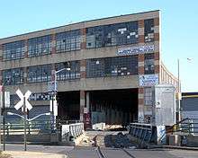
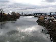
The area consisting of 43rd Street through 58th Street, including the former Furman Island, is industrial lowlands, and from 60th Street to 74th Street is residential.[11] The Phelps Dodge Corporation was present from 1920 to 1983, during which matter from their premises contaminated Newtown Creek, which separates northern Brooklyn from western Queens and serves barge traffic. In the 2000s, politicians started to make efforts to clean up the Newtown and Maspeth Creeks.[11] Freight train traffic moves on the Long Island Rail Road Montauk Branch and the lightly-used Bushwick Branch, both of which are used by the LIRR, New York and Atlantic Railway, and Conrail; in addition, the LIRR Bay Ridge Branch, a freight-only railway branch, separates the neighborhood from Elmhurst and Middle Village.[12] A new West Maspeth rail freight station has been proposed in connection with a Cross-Harbor Rail Tunnel to diminish truck traffic across New York City. It is opposed by residents who do not want more trucks in Maspeth.[13]
The Elmhurst gas tanks were formerly located in the area and were demolished in 2001.[14] The Maspeth gas tanks were also located in the area until they were demolished.[12]
Single and multi-family dwellings make up most of Maspeth as there are few apartment buildings, except for the Ridgewood Gardens co-ops along 65th Place. Houses in Maspeth range from 400–600 thousand dollars.[13] One particularly notable group of houses in the area is a cluster of 2- and 3-story orange and yellow brick buildings located between Grand Avenue, 79th Street, and Calamus Avenue; they were made for the Mathews Company and built in 1930 by Louis Allmendinger.[12]
Much of the area's commerce is situated along Grand Avenue.[11]
Cemeteries take up another large part of this small neighborhood, although they are separated from residential areas for the most part. The Mount Olivet Cemetery, the largest cemetery in the neighborhood, is located on a high hill in Maspeth and used to be an outer-borough vacation site. Mount Olivet Cemetery was planned on March 26, 1850, when James Maurice held a meeting at his Maspeth house to discuss the formation of the cemetery. Notable interments in the cemetery include cosmetics magnate Helena Rubinstein Courielli and sixteen victims of the 1911 Triangle Shirtwaist Factory fire.[7]
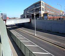
The neighborhood, which is nearly isolated by the industrial areas and cemeteries surrounding it, is described by some residents as having a small-town feeling. It is bisected by the Long Island Expressway (locally known as the LIE), though the two parts of Maspeth are connected by several crossings across the expressway.[13] There are many community organizations, which have, among other things, preserved the neighborhood's small-town-like character; for example, they blocked the construction of a Home Depot at the site of what is now the Elmhurst Park.[11]
Communal locations
The Maspeth Town Hall community center is located on 72nd Street.[13] A one-room schoolhouse between 1897 and 1932, it was then occasionally used by a local girls' club and the Works Progress Administration until 1936. It was a New York City Police Department precinct until 1971. The building was renovated and made into a community center in 1972.[15]
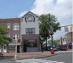
Other neighborhood institutions include the local Chamber of Commerce, the Lions Club, and the Maspeth Federal Savings Bank.[13]
Parks and plazas
A September 11 memorial has been erected at 69th Street and Grand Avenue to commemorate the local FDNY Squad 288 and HAZMAT 1 firehouse's casualties from the September 11 attacks on the World Trade Center, which were the largest of any FDNY unit.[15][16] The monument, adjacent to the LIE, faces the World Trade Center site, where the One World Trade Center can be seen. An annual memorial ceremony is held at the monument on September 11.[17] The Walk of Honor, unveiled on Memorial Day 2006, is also in the square, and honors activists and visionaries who lived in the area.[7]
Public parks, operated by the New York City Department of Parks and Recreation, include the Frontera Park at 69th Street and the LIE,[18] as well as Principe Park at Maurice and 54th Avenues.[19]
The smallest park in New York City, Luke J. Lang Square, is located at the triangle caused by the intersection of Fresh Pond Road, 59th Road, and 61st Street.[20] The park, which honors a local resident who died in World War I, occupies 0.001 acres (0.00040 ha) of land.[21] Luke J. Lang Square consists of hedges, but formerly contained "a flagpole, several benches, and three Norway maples."[22] Another very small park, Garlinge Triangle at Grand and 57th Avenues, honors other residents who died in World War I.[22] It is named after Private Walter A. Garlinge, the first Maspeth resident to die during the war.[23]
Maspeth is also home to the Metropolitan Oval, a playing field for soccer players, which contains a view of the Manhattan skyline.[24]
At Grand Avenue and the LIE, a plaque to "Horse Cars Rest Stop" exists. There used to be a horse cart barn at Brown Place, one block east of Grand Avenue.[12] It is now Peter Charles Park, a small pocket park.[25] When the LIE was built in the 1950s, it also demolished many streets; the construction of the LIE left many small triangular plazas behind, such as at 57th Road and 73rd Place, where the "Quick Brown Fox Park", another pocket park, is located. The park is named after a story about a quick brown fox.[12]
Points of interest
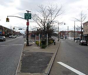
A sign at the intersection of Flushing, Grand, and Maspeth Avenues marks the place where streetcar lines (now the B57, Q58, Q59 bus routes) used to split.[12][15]
On the front yard of the Church of the Transfiguration on Perry Avenue, a replica of a Lithuanian roadside shrine has stood since 1981.[12][15]
St. Saviour’s Church, built in 1847 at Rust Street and 57th Drive, was located on land formerly owned by lawyer and politician James Maurice.[12][15] After a 1970 arson, it was cleaned up. However, by 2005, developers bought the church in order to demolish it, since the New York City Landmarks Preservation Commission had refused to landmark the church. This was largely opposed; however, its facade was torn apart, disassembled, and stored at All Faiths Cemetery by 2008. Despite community effort, led by the Juniper Park Civic Association, to make a park on the site, by 2011, the church's former site had become warehouses,[26] while provisions for a new site for the church in All Faiths Cemetery had been approved.[27]
The Ridgewood Gardens apartment/co-op complex, on a hill known as the Ridgewood Plateau,[28] was built on 72 acres (29 ha) woods owned by James Maurice and donated to the Episcopal Church in 1850. Maurice Woods was bounded by Maurice Avenue, Jay Avenue, 66th Street, and Borden Avenue. 53rd Avenue went down a slope to 64th Street. The apartment complex was built later.[12] It is notable for a step street that descends the hill, as well as for a very old, graffiti-covered lamppost on that street.[28]
James Maurice used to live at a home at 1 Hill Street. It was sold in 1909.[15]
The house where Anton Fausner’s wheelwright and wagonmaker’s shop was located is on Grand Avenue just south of the LIE. Later, an auto shop, Maspeth Auto Parts, was located in that building. In 2006, that house was torn down and replaced by a bank.[12][29] The wheelwright was patronized by farmers from Long Island who stayed at the Queens County Hotel, built in 1851 along Grand Avenue, on their way to the markets.[15]
The Maspeth Theater, the neighborhood's largest theater in the 1920s, was built in 1924 at Grand Avenue and 69th Street by Straus and Strausberg, with 1,161 seats. It was owned by three companies before closing in 1965. Notable performers included Judy Garland.[12][15] There were also many other theaters in Maspeth in the 1920s.[12]
A former Maspeth supermarket, Wielback's Grocery—one of the oldest in the area—then became Griff's Hardware. In 2000, the building became Griff's Laundry, a laundromat that closed less than ten years later and was slated for demolition.[15] The building was notable for a neon sign on its facade.[30]
At Clinton Hall, a 1920s-built venue that had interior balconies and a large chandelier, there is now a laboratory and industrial offices. It is named after a mansion built by Judge Joseph Sackett. Sackett had built a wood-framed mansion behind the hall; later, New York Governor DeWitt Clinton planned the Erie Canal. The lands of the Sackett-Clinton House, as the mansion was called, were turned into a park by 1910, and the mansion burned down in 1933.[15]
The Clinton Diner, at Maspeth and Maurice Avenues, was built in 1935 and is a truck stop that appeared in the movie Goodfellas, as well as in other movies. The Queens Head Tavern, nearby, was an American Revolutionary War-era tavern and was used as a stagecoach stop later on.[15]
Notable streets
- Fresh Pond Road goes south to Myrtle Avenue and was named after a former pond named "Fresh Pond".[12]
- Flushing Avenue goes west to downtown Brooklyn.
- Grand Avenue used to be a winding road before being straightened.[12]
- Maspeth Avenue is discontinuous in the area because of the Newtown Creek and because of the location of the former Maspeth tanks.[12]
- Maspeth Plank Road, a no-longer-extant road made of planks of wood, went from Williamsburg to Newtown, and crossed the English Kills.[12]
- Melvina Place, off Maspeth Avenue, is named after a small section of Maspeth, which was to the east of the approximate intersection of Maspeth Plank Road and Rust Street.[12]
- North Hempstead Plank Road, present-day 57th Avenue, split off of Grand Avenue at Mazeau Street and extended to Corona; the road was named after North Hempstead, New York, now in Nassau County, which split from Queens in 1898. 57th Avenue has a lot of old houses dating from the 1850s, as well as some former barns that were later repurposed for other uses, such as for garages.[12]
Demographics
Most people who live in Maspeth are of Polish, Italian, or Irish descent.This is reflected in the many businesses in the neighborhood like Irish pubs and Italian and Polish specialty stores and markets.[13] Many people of Eastern European, German, Chinese, or Hispanic origin (mostly Puerto Ricans from nearby Ridgewood) have also moved to the area.[4][12][11]
Based on data from the 2010 United States Census, the population of Maspeth was 30,516, an increase of 1,600 (5.5%) from the 28,916 counted in 2000. Covering an area of 818.44 acres (331.21 ha), the neighborhood had a population density of 37.3 inhabitants per acre (23,900/sq mi; 9,200/km2).[1]
The racial makeup of the neighborhood was 59.2% (18,080) White, 0.8% (253) African American, 0.1% (31) Native American, 12.0% (3,676) Asian, 0.0% (1) Pacific Islander, 0.4% (115) from other races, and 0.8% (245) from two or more races. Hispanic or Latino of any race were 26.6% (8,115) of the population.[3]
Education
New York City Department of Education operates public schools.
- IS 73, The Frank Sansivieri Intermediate School, is a zoned middle school.[31]
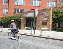
- PS 58, The School of Heroes, was dedicated in 2002 in honor of the victims of the September 11 attacks at the site of the original Finast supermarket.[32] It is named one of the best schools in Maspeth for its wide range of extracurricular activities and programs.
- PS 153, Maspeth Elementary School[33]
- Maspeth High School is the first public high school in Maspeth. It opened on September 6, 2012. It was originally located in Middle Village.[34]
Private schools in the area include:
- Holy Cross R.C. Church—Maspeth: Polish School and CCD classes on the weekends.
- Saint Stanislaus Kostka School (Nursery–8 Catholic School under the auspices of the Roman Catholic Diocese of Brooklyn)[35]
- Martin Luther High School (9–12 private school)[36]
Transportation
Maspeth is devoid of direct transit connections to Manhattan, as there are no New York City Subway stations and no express bus stops in Maspeth. Local buses provide connections to the subway, but off-peak service on these buses is often unreliable.[37][38] Local bus routes include:
- B57 bus along Flushing Avenue[39]
- Q18 bus along primarily 65th Place and 69th Street[39]
- Q39 bus along primarily 58th Street, Grand Avenue, and Fresh Pond Road[39]
- Q47 bus along Calamus Avenue and 69th Street[39]
- Q58 bus along Grand Avenue and Fresh Pond Road[39]
- Q59 bus along Grand Avenue[39]
- Q67 bus along primarily Metropolitan Avenue, 69th Street, and the Long Island Expressway[39]
The narrow Grand Street Bridge carries Grand Street eastward across the English Kills and Newtown Creek from Williamsburg where it becomes Grand Avenue, Maspeth's main street for dining and business. Grand Avenue continues eastward to end at Queens Boulevard in Elmhurst.[12] There is also access to I-278, the Brooklyn-Queens Expressway and I-495, the Long Island Expressway. The former crosses the Newtown Creek on the Kosciuszko Bridge.[40]
Notable people
- June Blum (1929–2017), artist.[41]
- Hermine Braunsteiner (1919–1999), female camp guard at Ravensbrück and Majdanek concentration camps, and the first Nazi war criminal to be extradited from the United States to face trial in Germany.[42]
- Joe Massino (born 1943) former boss of the Bonnano crime family was raised in Maspeth
- John J. Pesch (1921–2010), national director of the Air National Guard from 1974 to 1977.[43]
- Vincent Piazza (born 1976), film, television and stage actor best known for his roles in the television series Boardwalk Empire, the 2007 film Rocket Science and as Tommy DeVito in the film adaptation of Jersey Boys.[44]
- Philip Rastelli (1918–1991), mobster and former boss of the Bonanno crime family.[45]
- Richard Vetere (born 1952), playwright and author of The Third Miracle, which is set in Maspeth.[46]
References
- 1 2 Table PL-P5 NTA: Total Population and Persons Per Acre - New York City Neighborhood Tabulation Areas*, 2010, Population Division - New York City Department of City Planning, February 2012. Accessed June 16, 2016.
- 1 2 3 Data Access and Dissemination Systems (DADS). "American FactFinder – Community Facts". census.gov.
- 1 2 Table PL-P3A NTA: Total Population by Mutually Exclusive Race and Hispanic Origin - New York City Neighborhood Tabulation Areas*, 2010, Population Division - New York City Department of City Planning, March 29, 2011. Accessed June 14, 2016.
- 1 2 3 "Maspeth, New York, NY Population & Demographics". areavibes.com.
- ↑ "History of Maspeth". queensnewyork.com.
- ↑ "Maspeth, Queens County, New York". rootsweb.com.
- 1 2 3 4 5 "History of Maspeth". Maspeth Chamber of Commerce. Retrieved May 7, 2015.
- ↑ "Maspeth – A Tour of New Netherland". nnp.org. Archived from the original on June 8, 2012.
- ↑ Jackson, Kenneth T., ed. (1995), The Encyclopedia of New York City, New Haven: Yale University Press, ISBN 0300055366 , p.26}
- ↑ "The Ludar". smithsonianeducation.org.
- 1 2 3 4 5 Gregory Beyer (May 4, 2008). "Yes, Manhattan's Over There. What of It?". The New York Times. Retrieved May 8, 2015.
- 1 2 3 4 5 6 7 8 9 10 11 12 13 14 15 16 17 18 19 20 Walsh, Kevin (April 2002). "MASPETH, Queens". Forgotten NY. Retrieved May 7, 2015.
- 1 2 3 4 5 6 Lisa Fraser (March 25, 2015). "City Living: Maspeth is a caring community bordering a thriving industrial zone". AM New York. Retrieved May 7, 2015.
- ↑ Hevesi, Dennis (September 20, 1993). "Memory-Filled Tanks; Queens Loses 2 Roadside Landmarks". The New York Times. Retrieved March 24, 2008.
The Elmhurst tanks — those 200-foot monoliths that stood sentinel to the changing landscape of Queens and as harbingers of hair-tearing delay on the highway to Manhattan — are down, deflated forever, their skeletal remains waiting to be dismantled.
- 1 2 3 4 5 6 7 8 9 10 11 Walsh, Kevin; Wilkinson, Christina. "Forgotten New York Tour of Maspeth". Juniper Park Civic Association. Retrieved May 8, 2015.
- ↑ Kayla Borg (October 9, 2009). "Somber 9/11 Memorial in Maspeth". Queens Ledger. Retrieved January 26, 2012.
- ↑ "9/11 Memorial in Maspeth". Queens Ledger. August 23, 2011. Retrieved January 26, 2012.
- ↑ "Frontera Park". NYC Parks. Retrieved May 7, 2015.
- ↑ "Frank Principe Park". NYC Parks. Retrieved May 7, 2015.
- ↑ "Luke J. Lang Square". New York City Department of Parks and Recreation. Retrieved 2017-08-03.
- ↑ Schlossberg, Tatiana (2015-04-07). "New York Today: Striving for Success". City Room. Retrieved 2017-08-03.
- 1 2 Dailey, Jessica (September 22, 2016). "New York City's 20 tiniest parks, mapped". Curbed NY. Retrieved 2017-08-03.
- ↑ "Garlinge Triangle". New York City Department of Parks and Recreation. Retrieved 2017-08-03.
- ↑ Malone, Michael (2004). "Best full soccer field in the middle of a residential neighborhood – METROPOLITAN OVAL". Village Voice. Archived from the original on 2005-03-24.
- ↑ "Peter Charles Park: History". NYC Parks. Retrieved May 7, 2015.
- ↑ Walsh, Kevin (July 2005). "ST. SAVIOUR'S CHURCH, Maspeth". Forgotten NY. Retrieved May 8, 2015.
- ↑ "St. Saviour's Saved". New York Landmarks Conservancy. Archived from the original on May 18, 2015. Retrieved May 8, 2015.
- 1 2 "Coming Soon: Another House Too Narrow", Queens Crap (January 31, 2007). Accessed May 8, 2015.
- ↑ "'Old Maspeth' Gallery", Maspeth Chamber of Commerce
- ↑ Marlock, Ron (February 19, 2015). "Griff's Hardware was a Maspeth icon". Queens Chronicle. Retrieved May 8, 2015.
- ↑ IS 73 The Frank Sansivieri Intermediate School
- ↑ PS 58
- ↑ PS 153
- ↑ "Maspeth High School :: Salve!". maspethhighschool.org.
- ↑ "About Our School". ststansschool.org.
- ↑ Pat Cheeweewat. "Martin Luther High School – Welcome to Martin Luther School!". martinluthernyc.org.
- ↑ "Overlooked Boroughs Technical Report" (PDF). Regional Plan Association. 2015-02-10. Retrieved 2015-10-13.
- ↑ Stringer, Scott M. (November 2017). "The Other Transit Crisis: How to Improve the NYC Bus System" (PDF). Office of the New York City Comptroller Scott M. Stringer. p. 22. Retrieved March 9, 2018.
- 1 2 3 4 5 6 7 "Queens Bus Map" (PDF). Metropolitan Transportation Authority. December 2017. Retrieved April 24, 2018.
- ↑ Google (May 8, 2015). "Maspeth, NY" (Map). Google Maps. Google. Retrieved May 8, 2015.
- ↑ June Blum, Brooklyn Museum. Accessed June 15, 2016. "June Blum was born in Maspeth, New York, in 1929."
- ↑ Martin, Douglas. "A Nazi Past, a Queens Home Life, an Overlooked Death", The New York Times, December 2, 2005. Accessed June 15, 2016. "At the time she was discovered, Mrs. Ryan was living as the wife of an electrical construction worker in Maspeth, where she was known for her scrupulous housecleaning and friendly manner."
- ↑ Krenke, Lt. Col. Ellen. "Former ANG director passes away at 88", National Guard of the United States, January 13, 2010. Accessed June 15, 2016. "Pesch was born in Maspeth, N.Y., in 1921."
- ↑ Rennison, Billy. "Vincent Piazza dishes on going from Queens to the 'Boardwalk'", Queens Courier, September 14, 2012. Accessed May 22, 2016. "Vincent Piazza — born in Middle Village before moving to neighboring Maspeth shortly thereafter, where his family still lives — grew up watching the films of Martin Scorsese, never imagining he would one day be directed by the film giant."
- ↑ Greater Astoria Historical Society. "How a Maspeth boy became ‘The Last Don’", TimesLedger, January 24, 2016. Accessed June 15, 2016. "One of three boys raised in Maspeth, Massino claimed he was a juvenile delinquent by age 12 and he was a high school dropout at age 15."
- ↑ Sheridan, Dick. "HOME, SWEET HOME BORO NATIVE WRITES ABOUT WHAT HE KNOWS & LOVES", New York Daily News, November 8, 1999. Accessed December 31, 2016. "People and places he recalls from his growing-up years in Maspeth -- where his mother and one of his two brothers still live -- appear in many of his works, including How to Get a Date in Queens and Gangster Apparel."
External links
| Wikimedia Commons has media related to Maspeth, Queens. |