Saharanpur
Saharanpur is a city and a municipal corporation in the Indian state of Uttar Pradesh. It is the administrative headquarters of Saharanpur district.
Saharanpur | |
|---|---|
   | |
 Saharanpur Location in Uttar Pradesh, India  Saharanpur Saharanpur (India) | |
| Coordinates: 29.964°N 77.546°E | |
| Country | |
| State | Uttar Pradesh |
| District | Saharanpur |
| Government | |
| • MP | Haji Fazlur Rehman (BSP) |
| • Mayor | Sanjeev Walia (BJP) |
| Population (2011) | |
| • Total | 705,478 |
| Languages | |
| • Official | Hindi, Urdu, Punjabi |
| Time zone | UTC+5:30 (IST) |
| PIN | 247001/02 |
| Telephone code | 0132 |
| Vehicle registration | UP-11 |
| Sex ratio | 1000/898 ♂/♀ |
| Website | saharanpur |
Saharanpur city grew in a region named after a Sufi Saint Shah Haroon Chishti. It was founded by Sah Ranbirsingh, a Jain nobleman,[1] who laid the foundations of the present-day city on the site of an army cantonment.
Saharanpur is declared as one amongst the 100 Smart Cities by MOUD as a part of Smart Cities Mission.
History
Medieval period
During the reign of Shamsu’d-Din Iltutmish (1211–36), the region became a part of the Delhi Sultanate. At that time, most of the area remained covered with forests and marshlands, through which the Paondhoi, Dhamola and Ganda Nala rivers flowed. The climate was humid and malaria outbreaks were common. Muhammad bin Tughluq, the Sultan of Delhi (1325–1351), undertook a campaign in the northern doab to crush the rebellion of the Shivalik kings in 1340, when according to local tradition he learned of the presence of a sufi saint on the banks of the Paondhoi River. After visiting the sage, he ordered that henceforth this region would be known as 'Shah-Haroonpur', after the Sufi Saint Shah Haroon Chishti.[2] The simple but well-preserved tomb of this saint is situated in the oldest quarter of Saharanpur city, between the Mali Gate/Bazar Dinanath and Halwai Hatta. By the end of the 14th century, the power of the Sultanate had declined and it was attacked by Emperor Timur (1336–1405) of Central Asia. Timur had marched through the Saharanpur region in 1399 to sack Delhi and people of the region fought his army unsuccessfully. A weakened Sultanate was later conquered by the Central Asian Mogul king Babur (1483–1531).
Mughal period
During the Mughal period, Akbar (1542–1605), Saharanpur became an administrative unit under the Province of Delhi. Akbar bestowed the feudal jagir of Saharanpur to the Mughal treasurer, Sah Ranveer Singh, an Agrawal Jain[1] who laid the foundations of the present-day city on the site of an army cantonment. The nearest settlements at that time were Shekhpura and Malhipur. Saharanpur was a walled city, with five gates: The Hathi Gate the Sarai Gate, the Mali Gate, the Buria Gate, and the Lakhi Gate. The city was divided into the neighbourhoods of Nakhasa Bazar, Shah Behlol, Rani Bazar and Lakhi Gate. The ruins of Shah Ran Veer Singh's old fort can still be seen in the Chaudharian locality of Saharanpur, not far from the better known 'Bada-Imam-bada'. He also built a large Jain temple in Muhallah/Toli Chaundhariyan,[3] it is now known as the 'Digamber-Jain Panchayati Mandir'.
The Sayyids and Rohillas
Mughal emperors Akbar and later Shah Jehan (1592–1666) bestowed the administrative pargana of Sarwat on Muslim Sayyid families. In 1633 one of them founded a city and named it and the surrounding region Muzaffarnagar, in honour of his father, Sayyid Muzaffar Ali Khan. The Sayyids ruled the area until the 1739 invasion by Nadir Shah. After his departure, anarchy prevailed across the entire doab with the region ruled or ravaged in succession by Rajputs, Tyagis, Brahmins, and Jats. Taking advantage of this anarchy, the Rohillas took control of the entire Trans-Gangetic region.
Ahmad Shah Durrani, the Afghan ruler who invaded Northwestern and Northern India in the 1750s, conferred the territory of Saharanpur as Jagir on Rohilla chief Najaf Khan, who assumed the title of Nawab Najeeb-ud-Daula and took up residence in Saharanpur in 1754. He made Gaunsgarh his capital and tried to strengthen his position against Maratha Empire attacks by entering an alliance with the Hindu Gurjar chieftain Manohar Singh. In 1759, Najeeb-ud-Daula issued a Deed of Agreement handing over 550 villages to Manohar Singh, who became the Raja of Landaura. Thus the Rohillas and the Gurjars now controlled Saharanpur.
Maratha rule (1757–1803 AD)
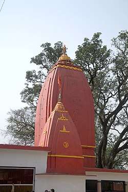
In 1757, the Maratha army invaded the Saharanpur region, which resulted in Najeeb-ud-Daula losing control of Saharanpur to the Maratha rulers Raghunath Rao and Malharao Holkar. The conflict between Rohillas and Marathas came to an end on 18 December 1788 with the arrest of Ghulam Qadir, the grandson of Najeeb-ud-Daula, who was defeated by the Maratha general Mahadaji Scindia. The most significant contribution of Nawab Ghulam Qadir to Saharanpur city is the Nawab Ganj area and the Ahmedabadi fortress therein, which still stands. The death of Ghulam Qadir put an end to the Rohilla administration in Saharanpur and it became the northernmost district of the Maratha Empire. Ghani Bahadur Banda was appointed its first Maratha governor. The Maratha Regime saw the construction of the Bhuteshwar Temple and Bagheshwar Temple in Saharanpur city. In 1803, following the Second Anglo-Maratha War, when the British East India Company defeated the Maratha Empire, Saharanpur came under British suzerainty.
British colonial period (1803–1947 AD)
When India rebelled in 1857 against the foreign Company's occupation, now referred to as the First War of Indian Independence, the Saharanpur and the present-day Muzaffarnagar Districts were part of that uprising. The center of freedom fighters' operations was Shamli, a small town in the Muzaffarnagar region which was liberated for some time. After the uprising failed, British retribution was severe. Death and destruction were particularly directed against the Muslims of the region, whom the British considered as the main instigators of the rebellion; Muslim society was devastated beyond recognition. When social reconstruction started, the cultural and political history of Muslims began to revolve around Deoband and Aligarh. Maulana Muhammad Qasim Nanotvi and Maulana Rashid Ahmad Gangohi, both proponents of the reformer Shah Waliullah's ideology for social and political rejuvenation, established a school in Deoband in 1867. It found popularity and global recognition as the Darul Uloom. Its founders' mission was twofold: to raise and spread a team of scholars able to awaken the religious and social consciousness of Muslims through peaceful methods and to make efforts, through them, to educate Muslims in their faith and culture; and to bring about a feeling of nationalism and national unity by promoting the concept of Hindu-Muslim unity and a united India. Muslim scholars in the city of Saharanpur were active supporters of this ideology and went on to establish the Mazahirul Uloom Saharanpur theological seminary six months later.
Royal Family
In 1845 Nawab Rao Wazir-ud-din khan became the member and voter of Mughal Darbar at Red fort Delhi due to his cordial relation with Mugal Emperor Bahadur Shah Zafar. He was the richest person of district Saharanpur with 52 thousand bega land and lord of 57 villages like Shaikhpura, Landohra, Tapri, Piragpur, Yousfpur, Badshapur, Harhati, Nazirpura, Santgarh, Lakhnor, Subri, Pathri, etc., of district Saharanpur. British governor's had a good relation with Rao Wazir-ud-din and title Badsha-e-Waqt (the king of his Period ) was bestowed to him. He died in 1895 at Sheikpura Qudeem (Saharanpur). He had two son's Nawab Rao Mashooq Ali khan and Nawab Rao Ghafoor Muhammad Ali Khan. Rao Ghafoor Muhammad Ali Khan had only seven children out of seven his elder son Nawab Rao Maqsood Ali khan was a great person. He was highly educated. He got his education from Aligarh Muslim University and University of Oxford. He was an intellectual and a spiritual person. Due to his kindness and amiable nature he was popular among people. He proved his resourcefulness and abilities by saving the poor from famine and loss of crops. He became the disciple of Sufi Hazrat Sheik Bahauddin a descendant of Tipu Sultan. He spread Sufism across the Saharanpur region. He was a great scholar and Many books in English and Persian were written by him but all his work lost after his death. He was a great Nawab of Saharanpur. He was the lord of a large property in the Saharanpur region and in Dehradun. He worked for the welfare and upliftment of people and donated to poor farmers and land for Madarsa's and Darga's. Due to his Phalinthrophist work Nawab Maqsood Ali khan was awarded by the Viceroy of India Lord Irwin at Dehradun. Brother's of him migrated to Pakistan and England. He died in 1973 at Sheikpura Qudeem and left behind his sons Rao Ghulam Muhi-ud-Din Khan, Rao Zamir Haider khan,Rao Yaqoob khan. Rao Gulam Hafiz khan.
Geography
Saharanpur is located at 29.97°N 77.55°E,Falling Rain Genomics, Inc – Saharanpur about 140 kilometres (87 mi) south-southeast of Chandigarh, 170 kilometres (110 mi) north-northeast of Delhi, 65 kilometres (40 mi) north-northeast of Shamli and about 61 kilometres (38 mi) south-west of Dehradun. It has an average elevation of 269 metres (883 ft). Saharanpur is a part of a geographical doab region. Saharanpur district join four states together Himachal Pradesh, Uttar Pradesh, Uttarakhand and Haryana.
Demographics
Provisional 2011 census data indicates that Saharanpur has a population of 705,478, out of which males were 371,740 and females were 333,738. The literacy rate was 76.32 per cent.[4]
Places of interest
The Saharanpur Botanical Gardens, known as the Company Garden and once the preserve of the British East India Company, is one of the oldest existing gardens in India, dating to before 1750. Then named Farahat-Bakhsh, it was originally a pleasure ground set out by a local chief, Intazam ud-ullah. In 1817, it was acquired by the British East India Company[6] and placed under the authority of the District Surgeon. Joseph Dalton Hooker says of this Botanical Garden that "Amongst its greatest triumphs may be considered the introduction of the tea-plant from China, a fact I allude to, as many of my English readers may not be aware that the establishment of the tea-trade in the Himalaya and Assam is almost entirely the work of the superintendents of the gardens of Calcutta and Seharunpore.[7] In 1887, when the Botanical Survey of India was set up to reform the country's botanical sciences, Saharanpur became the center for the survey of the northern Indian flora. The Garden is seen historically as being second only to the Calcutta Gardens for its contribution to science and economy in India. Under private auspices today, it is full of greenery and has many different kinds of plants and flowers.[8]
Saharanpur falls on the route of the proposed 1,839-kilometre (1,143 mi) Eastern Dedicated Freight Corridor project, funded by the World Bank.[9]
References
- Desk, India TV News (16 November 2012). "India's Agrawal community: Its history and prominent personalities". Indiatvnews.com. Retrieved 28 October 2019.
- History The Imperial Gazetteer of India, v. 21, p. 369. 1909.
- Madhu Jain, O. C. Handa, and Omacanda Handa, Wood Handicraft: A Study of Its Origin and Development in Saharanpur, Indus Publishing (2000), pp. 22–24. ISBN 81-7387-103-5
- "Urban Agglomerations/Cities having population 1 lakh and above" (PDF). Provisional Population Totals, Census of India 2011. Retrieved 7 July 2012.
- "Saharanpur Religion Census 2011". Office of the Registrar General and Census Commissioner, India.
- Sharad Singh Negi, Biodiversity and its conservation in India 2nd revised ed. New Delhi, Indus Publishing (2008) ISBN 978-81-7387-211-2
- "Joseph Dalton Hooker, Himalayan Journals, or Notes of a Naturalist ..., Kew (1854), vol. I, p. 5.
- Saharanpur Botanic Garden
- Eastern Dedicated Freight Corridor Archived 8 August 2011 at the Wayback Machine
External links
| Wikimedia Commons has media related to Saharanpur. |