Dehradun
Dehradun (/ˌdɛərəˈduːn/), also rendered Dera Doon,[7][8] is the winter capital and most populous city in the Indian state of Uttarakhand. It is the administrative headquarters of the eponymous district. Part of the Garhwal region, it lies along National Highway 7 with the distance of 236 kilometres (147 mi) north of India's capital New Delhi and is served by Dehradun railway station and Jolly Grant Airport. The city stands at an elevation of approximately 447 metres (1,467 ft) above sea level. Dehradun is governed by municipal corporation which comes under Dehradun Municipal Corporation. Main languages spoken in the city are Hindi, Garhwali, Kumaoni, Jaunsari, and Nepali.
Dehradun Dera Doon | |
|---|---|
       Clockwise from top: Forest Research Institute, Buddha Temple at Clement Town, Robber's Cave, Indian Military Academy, The Doon School, Dehradun Skyline at night and Dehradun Ghantaghar. | |
| Nickname(s): Doon | |
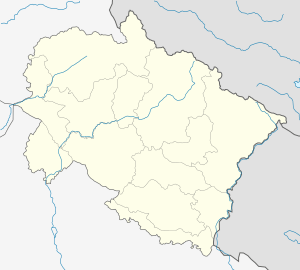 Dehradun Location in Uttarakhand  Dehradun Dehradun (India)  Dehradun Dehradun (Asia) | |
| Coordinates: 30.318°N 78.029°E | |
| Country | |
| State | |
| District | Dehradun |
| Founded | 1676 |
| Municipality | 1867 |
| Government | |
| • Type | Mayor–Council |
| • Body | Dehradun Municipal Corporation |
| • Mayor | Sunil Uniyal 'Gama' (BJP) |
| • Municipal Commissioner | Vinay Shankar Pandey,[1] IAS |
| Area | |
| • City | 300 km2 (100 sq mi) |
| Elevation | 447 m (1,467 ft) |
| Population (2011)[2] | |
| • City | 578,420 |
| • Density | 1,900/km2 (5,000/sq mi) |
| • Metro | 714,223 |
| Languages | |
| • Official | Hindi[4] |
| • Regional | Garhwali, English |
| • Additional official | Sanskrit[5][6] |
| Time zone | UTC+5:30 (IST) |
| PIN | 248001 |
| Telephone code | +91-135 |
| Vehicle registration | UK-07 |
| Website | nagarnigamdehradun dehradun |
Also known as the ‘Adobe of Drona’, Dehradun has been an important center for Garhwal rulers which was captured by the British. During the days of British Raj, the official name of the town was Dehra.[9] Dehradun is made up of two words “dehra+doon”-‘dehra ‘ is derived from the word “dera”, meaning home, and “doon” is a term for the valley that lies between the himalayas and the shivalika. The city is also regarded as Devbhoomi ("Land of the Gods"). Often referred as gateway to Mussorie, the city was ruled in turns by Sikhs, Mughals and Gurkhas before coming under the reign of British. Uttarakhand police is the main law enforcement agency in the city.
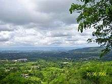
Dehradun is located in the Doon Valley on the foothills of the Himalayas nestled between the river Ganges on the east and the river Yamuna on the west. The city is noted for its picturesque landscape and slightly milder climate and provides a gateway to the surrounding region. It is well connected and in proximity to Himalayan tourist destinations such as Mussoorie, and Auli and the Hindu holy cities of Haridwar and Rishikesh along with the Himalayan pilgrimage circuit of Chota Char Dham. Dehradun is also known for its Basmati rice and bakery products.
Dehradun is a notable academic and research hub and is home to Indian Military Academy, Rashtriya Indian Military College, Uttarakhand Ayurveda University, Forest Research Institute, Wadia Institute of Himalayan Geology, and Indira Gandhi National Forest Academy. According to the combined survey based on health, infrastructure, economy, education and safety; conducted by Dainik Jagran and KPMG, Dehradun is the safest to live in.
Etymology
Dehradun is made up of two words: Dehra is derived from the word Dera, meaning camp or temporary settlement. Dun or Doon in Garhwali language refers to a valley that lies between the middle Himalayas and the "Shivaliks". Other prominent Doon valleys are Kotli Doon, Patli Doon and Pinjore Doon. When Ram Rai, son of Guru Har Rai, came to this region with his followers, he established a camp here for them. Around this time, the modern city of Dehradun started to develop. This is when the word Dehra was linked to Dun, and thus the city was named Dehradun. In Skanda Purana, Dun is mentioned as a part of the region called Kedarkhand, the abode of Shiva. In ancient India during the Mahabharata epic era, Dronacharya the great teacher of Kauravas and Pandavas, lived here hence the name, "Dronanagari" (lit. city of Drona).[10][11] Some historians believe that the word Dehra can be regarded as a term for camping.[12]
History

The history of the city of Uttarakhand, Dehradun (nicknamed "Doon Valley") is linked to the story of Ramayana and Mahabharata. It is believed that after the battle between Ravana and Lord Rama, Lord Rama and his brother Lakshmana visited this site. Also, known as 'Dronanagari' on the name of Dronacharya, legendary Royal guru to the Kauravas and Pandavas in the epic Mahabharata, is believed to have been born and resided in Dehradun.[13] Evidences such as ancient temples and idols have been found in the areas surrounding Dehradun which have been linked to the mythology of Ramayana and Mahabharata. These relics and ruins are believed to be around 2000 years old. Furthermore, the location, the local traditions and the literature reflect this region's links with the events of Mahabharata and Ramayana. Even after the battle of Mahabharata, the Pandavas had influence on this region as the rulers of Hastinapura with the descendants of Subahu ruled the region as subsidiaries. Likewise, Rishikesh is mentioned in the pages of history when Lord Vishnu answered the prayers of the saints, slaughtered the demons and handed the land to the saints. The adjoining place called Chakrata has its historical impression during the time of Mahabharata.
In the seventh century this area was known as Sudhanagara and was described by the Chinese traveller Huen Tsang. Sudhanagara later came to be recognized as Kalsi. Edicts of Ashoka have been found in the region along the banks of river Yamuna in Kalsi indicating the wealth and importance of the region in ancient India. In the neighboring region of Haripur, ruins were discovered from the time of King Rasala which also reflect the region's prosperity. Before the name of Dehradun was used, the place is shown on old maps as Gurudwara (a map by Webb, 1808) or Gooroodwara (a map by Gerard, 1818). Gerard's map names the place as "Dehra or Gooroodwara". Surrounding this original Sikh temple were many small villages that are now the names of parts of the modern city.
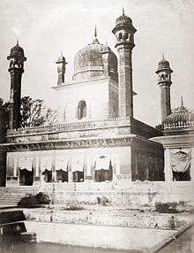
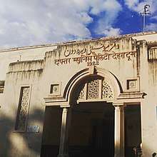
Dehradun itself derives its name from the historical fact that Ram Rai, the eldest son of the Seventh Sikh Guru Har Rai, set up his "Dera" (camp) in "dun" (valley) in 1676. This 'Dera Dun' later on became Dehradun.
The Mughal Emperor Aurangzeb was highly impressed by the miraculous powers of charismatic Ram Rai. He asked the contemporary Maharaja of Garhwal, Fateh Shah to extend all possible help to Ram Rai. Initially a Gurudwara (temple) was built in Dhamawala. The construction of the present building of Darbar Shri Guru Ram Rai Ji Maharaj was completed in 1707. There are portraits of gods, goddesses, saints, sages and religious stories on the walls. There are pictures of flowers and leaves, animals and birds, trees, similar faces with pointed noses and big eyes on the arches which are the symbol of the colour scheme of Kangra-Guler art and Mughal art. High minarets and round pinnacles are the models of the Muslim architecture. The huge pond in the front measuring 230 x 80 feet had dried up for want of water over the years. People had been dumping rubbish; it has been renovated and revived.
Dehradun was invaded by Mahmud of Ghazni during his campaigns into India followed by Timur in 1368, Rohilla chief Najib ad-Dawlah in 1757 and Ghulam Qadir in 1785. In 1806 Nepalese King Prithvi Narayan Shah united many of the Indian territories that now fell under places such as Almora, Pathankot, Kumaon, Garhwal, Sirmur, Shimla, Kangra and Dehradun.
On the western front Garhwal and parts of Himachal Pradesh up to Punjab and on the eastern front the state of Sikkim up to Darjeeling became parts of Nepal for a brief period until the British East India Company went on war from 1814 to 1816. The war ended with signing of the Treaty of Sugowli where almost a third was ceded to British East India company. The British got Dehradun in 1816 and colonised Landour and Mussoorie in 1827–1828.
Jawaharlal Nehru, India's first prime minister, was quite fond of the city and often visited. He spent his last few days here before passing away in Delhi in 1964.[14] Another leader from the independence movement, Rash Behari Bose, who was one of the key organisers of the Ghadar conspiracy and, later, the Indian National Army was based in Dehradun in his early days before he was forced to move to Japan in 1915 to continue the freedom struggle.
Post independence Dehradun and other parts of Garhwal and Kumaon were merged with United Provinces which was later renamed the state of Uttar Pradesh. In 2000, Uttarakhand state (earlier called Uttaranchal) was created from the northwestern districts of Uttar Pradesh under the Uttar Pradesh Reorganisation Act 2000. Dehradun was made its interim capital.
Afghan Connection
Dehradun's Afghan connection dated back to the First Anglo-Afghan War, after which the Afghan Emir Dost Mohammad Khan (Emir of Afghanistan) was exiled by the British to Dehra Dun.[15] He stayed in Mussoorie for over 6 years. The Balahissar ward under the Mussoorie municipality has been named after the palace of Dost Mohammad. The famous Dehradooni Basmati was brought along by him from Kunar Province in Afghanistan and it continues to be counted as a delicacy of the valley.[15][16] Forty years later, after the Second Anglo-Afghan War, his grandson, Mohammad Yaqub Khan, was sent to exile to India in 1879. Just like his grandfather, he choose Doon valley as his abode. Yakoob became the first Afghan to formally settle in Dehradun. The present Mangla Devi Inter College, was once the Kabul Palace where Yakoob spent a few years of his life. The extended family and servants of the King were also relocated to Dehradun[17]
The Afghan royal family maintained a presence in Dehra Dun. It was the birthplace of the second to last King of Afghanistan, Mohammed Nadir Shah. Two quaint palaces – the Kabul Place in Dehradun and Balahissar Palace in Mussoorie – stand testimony to this connection with Afghanistan. They were built by these Afghan rulers in exile in India in the early part of the 20th Century and are palaces are a miniature replica of the palatial structures owned by the kings in Afghanistan. The Balahissar Palace has now been turned into Mussoorie's Wynberg Allen School. Doon-based heritage enthusiast Ghanshyam told the Times of India, "The police station at Karanpur used to be the royal guard room of Yakoob way back in 1879. The electrical office located at the Survey Chowk was the royal servant quarters."[15]
Today the descendants of the former royalty, Yakub Khan and his grandson Sardar Azim Khan's family have integrated with the mainstream of Dehra Dun life.[18] The Doon connection was revived when Zahir Shah, the last king of Afghanistan, while undergoing treatment in New Delhi during the last years of his life expressed a desire to meet his Doon cousins but the meeting could not take place as the family members were away.[18]Ashraf Ghani, the current President of Afghanistan has mentioned that his grandmother grew up in Dehra Dun. "I speak of Tagore because I was raised on Tagore by my grandmother who lived in Dehradun...," Dr Ghani said while talking about India's vision and the remarkable transformation.[19] Dehra Dun is also being selected to be the second "home" ground of the Afghan cricket team.[20]
Geography
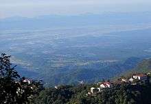
The city of Dehradun mainly lies in Doon Valley and is at a varying height from 410 m in Clement Town to above 700 m at Malsi which is 15 km from the city. However, the average elevation is 450 m above sea level. Malsi is the starting point of Lesser Himalayan Range that extends to Mussoorie and beyond. Jaunsar-Bawar hills in Dehradun district rises to 3700m above sea level. The hilly region of Mussoorie goes up to a height of 1870–2017 metres above sea level. Its geomorphological and meteorological characteristics, makes it prone to a number of natural hazards. Beside earthquake, the city is frequently devastated by landslides, cloudbursts, flash-floods, cold waves and hailstorms.
The Doon valley contains the settlements including Raiwala, Rishikesh, Doiwala, Harrawala, Dehradun, Herbertpur, Vikasnagar, Sahaspur, Selaqui, Subhash Nagar and Clement Town. The district contains Rajaji National Park which is home to several elephants, Benog Wildlife Sanctuary at Mussoorie & Asan Conservation Reserve (Asan Barrage). The Doon Valley has the Terai and Bhabar forests within it as well as the Shivalik hills and Lesser Himalayan Range containing hill stations such as Mussoorie and Chakrata. The district is bordered by the Himalayas in the north, Rajaji Range of the Sivalik Hills to the south, the river Ganges to the east, and the Yamuna river to the west. Towns in the foothills of the mountain ranges include Sahastradhara, Lakhamandal, Gautam Kund, Chandrabani, Kalsi and Dakpathar.
This district is divided into two major parts: the main city Dehradun surrounded by Shivalik and the Jaunsar-Bawar, which is in the foothills of Himalayas. In the north and northwest it borders on the district of Uttarkashi and Tehri Garhwal, in the east and southeast by Pauri Garhwal and Ganges river, in the west, it is bordered by Shimla and Sirmaur districts of Himachal Pradesh, Yamunanagar district of Haryana and the Tons and Yamuna rivers. To the south are Haridwar and Uttar Pradesh's Saharanpur district.
It is between latitudes 29 °58' N and 31°2'N and longitudes 77° 34' E and 78° 18'E.[21] This district consists of six tehsils – Dehradun, Chakrata, Vikasnagar, Kalsi, Tiuni and Rishikesh – six community development blocks – Vis, Chakrata, Kalsi, Vikasnagar, Sahaspur, Rajpur and Doiwala – 17 towns and 764 villages. Out of these 746 villages are inhabited; 18 are uninhabited.[22]
Climate
The climate of Dehradun is humid subtropical. It varies greatly from tropical to severe cold depending upon the altitude of the area. The city being hilly, temperature variations due to difference in elevation are considerable. In the hilly regions, the summer is pleasant. But in the Doon, the heat is often intense and summer temperatures can reach up to 44 °C for a few days and a hot wind called Loo blows over North India. Winter temperatures drops below freezing point and are usually between 1 and 20 °C and fog is quite common like plains. Although the temperature in Dehradun can reach below freezing during severe cold snaps,[23] this is not common. The area receives an average annual rainfall of 2073.3 mm. Most of the annual rainfall in the city is received during the months from June to September, July and August being rainiest. During the monsoon season, there is often heavy and protracted rainfall. Dehradun and other plains areas of Uttarakhand see almost as much rainfall as coastal Maharashtra and more than Assam. Agriculture benefits from fertile alluvial soil, adequate drainage and plentiful rain.
Climate data for Dehradun (1981–2010, extremes 1901–2012) | |||||||||||||
|---|---|---|---|---|---|---|---|---|---|---|---|---|---|
| Month | Jan | Feb | Mar | Apr | May | Jun | Jul | Aug | Sep | Oct | Nov | Dec | Year |
| Record high °C (°F) | 28.6 (83.5) |
31.2 (88.2) |
37.2 (99.0) |
40.8 (105.4) |
43.1 (109.6) |
43.9 (111.0) |
40.6 (105.1) |
37.2 (99.0) |
36.6 (97.9) |
36.1 (97.0) |
30.6 (87.1) |
27.4 (81.3) |
43.1 (109.6) |
| Average high °C (°F) | 19.8 (67.6) |
22.1 (71.8) |
26.8 (80.2) |
32.3 (90.1) |
34.8 (94.6) |
34.2 (93.6) |
30.7 (87.3) |
30.0 (86.0) |
29.9 (85.8) |
28.8 (83.8) |
25.3 (77.5) |
21.5 (70.7) |
28.0 (82.4) |
| Average low °C (°F) | 6.2 (43.2) |
8.4 (47.1) |
12.5 (54.5) |
16.8 (62.2) |
20.6 (69.1) |
22.7 (72.9) |
23.1 (73.6) |
22.6 (72.7) |
20.8 (69.4) |
15.6 (60.1) |
10.8 (51.4) |
7.2 (45.0) |
15.6 (60.1) |
| Record low °C (°F) | −1.1 (30.0) |
−1.1 (30.0) |
2.2 (36.0) |
7.2 (45.0) |
11.3 (52.3) |
13.1 (55.6) |
13.2 (55.8) |
18.0 (64.4) |
14.3 (57.7) |
8.4 (47.1) |
2.8 (37.0) |
0.0 (32.0) |
−1.1 (30.0) |
| Average rainfall mm (inches) | 41.5 (1.63) |
58.2 (2.29) |
53.1 (2.09) |
34.5 (1.36) |
61.5 (2.42) |
231.7 (9.12) |
642.5 (25.30) |
686.4 (27.02) |
298.3 (11.74) |
44.4 (1.75) |
7.7 (0.30) |
23.8 (0.94) |
2,183.5 (85.96) |
| Average rainy days | 2.9 | 3.9 | 3.6 | 2.9 | 4.5 | 9.6 | 20.5 | 21.5 | 11.9 | 2.2 | 0.5 | 1.5 | 85.7 |
| Average relative humidity (%) (at 17:30 IST) | 65 | 56 | 45 | 34 | 37 | 53 | 78 | 82 | 76 | 65 | 67 | 69 | 61 |
| Source: India Meteorological Department[24][25] | |||||||||||||
Demographics
As per provisional reports of Census India, population of Dehradun in 2011 was 578,420;[2] male and female are 303,411 and 275,009 respectively. Natives of Uttarakhand form the majority of Dehradun's population. Total number of slums in Dehradun city & its out growth numbers 32,861 in which population of 158,542 resides. This is around 27.58% of total population of Dehradun city & its outgrowth which is 574,840. The sex ratio of the city is 906 per 1000 males.[2] and child sex ratio of is 873 girls per 1000 boys, lower than the national average. There are 31,600 boys and 27,580 are girls.[2] The child forms 10.59% of total population of Dehradun City. The number of children of age under six in Dehradun city is 59,180 as per figure from Census India report on 2011.
Hindi, the official state language, is the primary language in Dehradun. English is also used, particularly by defence wing and the white-collar workforce. Other major regional languages are Garhwali, which is spoken by 23%, Kumaoni 20%, Jaunsari 1.3% and Nepali 1.1%.[28] Additionally, two non-native Sino-Tibetan languages are also spoken: Kulung (otherwise native to Nepal) and Tibetan. Hindus form the majority of Dehradun's population; Muslims compose a large minority. According to provisional results of the 2011 national census, Hinduism is majority religion in Dehradun city with 82.53% followers. Islam is the second most practiced religion in the city with approximately 11.75% following it. Sikhism by 3.5%, Christianity is followed by 1.06%, Jainism by 0.63%, and Buddhism by 0.29%. Around 0.01% stated 'Other Religion', approximately 0.24% stated 'No Particular Religion'.
Literacy rate of Dehradun at 89.32 percent, is the highest in the region. Male literacy is 92.65 percent and female literacy is 85.66 percent.[2] For 2001 census same figure stood at 85.87 and 71.20. As per census 2011, total 463,79 people are literate in Dehradun of which males and females are 251,832 and 211,959 respectively.[2]
Government and public services
Civic Administration
Dehradun City falls in Garhwal Division of State Uttarakhand and is headed by the divisional commissioner of Dehradun, who is an Indian Administrative Service (IAS) officer of high seniority. The district magistrate and collector of Dehradun report to the divisional commissioner as well.
City Government
The municipal commissioner is the appointed head of the local government institutions (the municipal corporation) in the division, in charge of infrastructure development in his division, and is also responsible for maintaining law and order in the division. The mayor is the elected head[29] of Nagar Nigam Dehradun.
Nagar Nigam Dehradun also called Dehradun Municipal Corporation, the local government of the city. It oversees the city's civic infrastructure which comes under Dehradun Urban Agglomeration. Nagar Nigam is responsible for urban planning and urban management functions, amongst others. This corporation consists of 100 wards and is headed by a mayor who presides over a deputy mayor and 99 other corporators representing the wards. The corporation originated in 1998. Prior to December 2003 this body was known as Dehradun Municipal Council and after revamping the municipality the Dehradun Municipal Corporation came into existence in 2003. Other urban entities involved in civic services and city governance and management include parastatals like the Mussoorie Dehradun Development Authority (MDDA), Special Area Development Authority (SADA), Jal Sansthan, and Jal Nigam among others.
State Government
As capital of the state of Uttarakhand, Dehradun houses important state government facilities such as the offices of the local governing agencies, the Vidhan Sabha (the home of the Uttarakhand state legislature), and Raj Bhavan (the residence of the governor of Uttarakhand). Most government establishments and institutions are housed in the city. The Dehradun district has one parliamentary constituency- Tehri Garhwal and elects ten Members of the Legislative Assembly (MLAs) to the state legislature.
Dehradun city receives potable water from two primary sources- surface water and ground water to meet its supply needs.[30] The water supply of Dehradun is operated and maintained by Uttarakhand Jal Sansthan (UJS). Electricity in Dehradun is regulated through the Uttarakhand Power Corporation Limited (UPCL), while water supply and sanitation facilities are provided by the Uttarakhand Peyjal Sansadhan Vikas Evam Nirman Nigam. Fire services are handled by the Uttarakhand Fire and Emergency Services. State-owned Bharat Sanchar Nigam Limited, or BSNL, as well as private enterprises, among them Vodafone, Bharti Airtel, Reliance, Idea Cellular, and Tata Teleservices are the leading telephone and cell phone service providers in the city.
Dehradun is one of the "Counter Magnets" of the National Capital Region (NCR) being developed as an alternative centre of growth to help ease the migration and population explosion in the Delhi metropolitan area and to establish a smart city at Dehradun.[31]
Healthcare
The healthcare facilities in Dehradun consist of private and public hospitals, formal and informal service providers as well as secondary and tertiary healthcare with single clinic doctors. In spite of having special status under the National Health Mission, the city is facing healthcare crisis due to shortage of medical manpower in the state and financial constraints. Hospitals and medical centres in the Dehradun are plagued by non-functioning equipment in the operating theatre and insufficient number of labour rooms.[32] Hospitals in the city include the Doon Hospital, Uttaranchal Ayurvedic Hospital, Combined Medical Institute (CMI) Hospital, Luthra Hospital, and Government Hospital Premnagar (managed by the state government).
Places of interest
There are a number of small towns and tourist sites in Dehradun District.
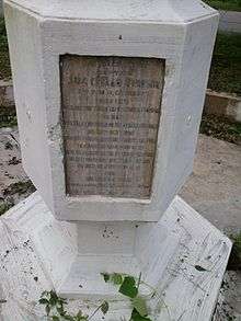
Khalanga War Memorial
The Battle of Nalapani was the first battle of the Anglo-Nepalese War of 1814–1816, fought between the forces of the British East India Company and Nepal, then ruled by the House of Gorkha. The battle took place around the Nalapani fort, near Dehradun, which was placed under siege by the British between 31 October and 30 November 1814.
Maa Bala Sundari Mandir
There are various temples of Maa Bala Sundari Devi situated in India and this is one such temple. The main temple is in Trilokpur, Himachal Pradesh. This Mata Temple is situated approximately 3 km South-West Direction of Sudhowala. This great temple is situated inside a forest. Gaur Brahmin of sudhowala are Pandits (Brahman) of this temple.
Dehradun International Cricket Stadium
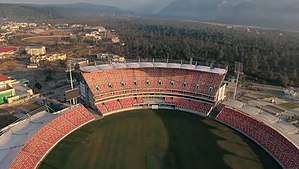
Rajiv Gandhi International Cricket Stadium, Dehradun is a multi-purpose stadium in the Raipur area of Dehradun, Uttarakhand.[33] It is the first international level stadium in the state.
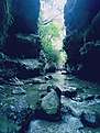
Robbers Cave
Robber's Cave (locally known as Guchhupani), is a river cave formation in Himalaya, located approximately 8 km from the centre of Dehradun City in Uttarakhand state of India. Believed to be the hideout of the famous Sultana Daku and his band of dacoits. The cave formation has thus been named Robber's Cave.
The cave is about 600 metres long, divided into two main parts. The cave has a highest fall of about 10 metres. In the central part there is a fort wall structure which is now broken.[34] It consists of an extremely narrow gorge formed in a conglomerate limestone area on Doon Valley's Dehra plateau.[35]
It is a natural cave formation where rivers flows inside the cave. The place is a tourist site and is maintained by Uttarakhand State. Local bus services are available up to Anarwala village, from where it is a kilometre's trek away.[34][36]
Lacchiwala Picnic Spot
It is a popular tourist destination specially during summers. It is well known for its forest scenic beauty, man-made water pools and bird watching. It is now known as Nature Park.
Tapkeshwar Temple
It is a temple of pashupati Lord Shiva. It is situated beside a forest on the bank of the Asan river and the main deity (Shivalinga) is housed in a natural cave. According to the holy epic Mahabharata, Guru Drona is said to have resided in this cave for a period of time. The temple's natural cave is named Drona cave after him.[37] Water trickles down the ceiling of the cave and drops on the Shivalinga creating a magnificent image.
Dehradun Zoo
Formerly known as Malsi Deer Park, the main objectives of Dehradun Zoo are conservation of wild animals, developing an education centre and a rescue centre for wild animals. It is located on the foothills of Shivalik Range on the Mussoorie Road. It is about 10 km away from Dehradun and 23 km from Mussoorie.
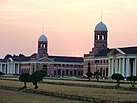
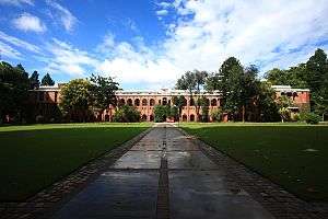
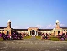
Forest Research Institute
Forest Research Institute or 'FRI' is an institution in the field of forest research in India. The institute is one of the oldest and biggest forest-based training institutes in India. The institute is known for its research work and wonderful architecture that dates to British Raj. FRI is affiliated to the Forest Research Institute University and is approved by the University Grants Commission (UGC). The aim of the institution is to accomplish the needs of the Indo-Gangetic plains of Punjab, Haryana, Chandigarh, Delhi and western Uttar Pradesh, as well as the U.P. Himalayas.[38]
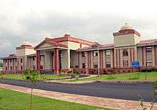
Regional Science Center
Regional Science Center (RSC) is located within the campus of Uttarakhand Council of Science and Technology (UCOST) at Vigyan Dham, Suddhowala on the outskirts of Dehradun. The Uttarakhand Regional Science Center is developed by National Council for Science Museum (NCSM) in collaboration with the UCOST. The Regional Science Center is a popular destination for school educational tours and hosts a science museum, planetarium, a 3D theatre, science gallery and scientific law based interactive exhibits.[39]
Education
Schools
Schools in Dehradun are classified as aided, unaided and Government schools. The government schools are run directly by the Uttarakhand Board of School Education and follow the syllabus prescribed by the state government. The schools are affiliated with CBSE, Indian Certificate of Secondary Education (ICSE), CISCE. The language of instruction in the schools is either English or Hindi.
Uttarakhand Board of School Education is responsible for administer courses of instructions, text books, and to conduct examinations for secondary school students of the state. The board was set up in 2001 and is headquartered in Ramnagar.
Notable educational institutions in Dehradun include Ann Mary School, Brightlands School, The Asian School, Cambrian Hall, Colonel Brown Cambridge School, Convent of Jesus and Mary, The Doon School, Ecole Globale International Girls' School, Marshall School, Rashtriya Indian Military College, SelaQui International School, St Joseph's Academy, Dehradun, St. Thomas' College, Summer Valley School, Welham Boys School, Welham Girls School. Several Indian and international luminaries have attended these schools. In addition to these schools there are many other state board schools located in the city.[40] Since Dehradun has many central Government offices, there are as many as 12 Kendriya Vidyalayas also in the city.[41]
Higher education and research
After completing their secondary education, students typically enroll in schools that have a higher secondary facility and are affiliated with the Directorate of higher education, the ICSE, or the CBSE. The colleges are each affiliated with a university or institution based either in Uttarakhand or elsewhere in India. In recent times, Dehradun has enormously evolved as a pivot location for higher education in India. Premier research institute based in Dehradun are the Forest Research Institute, Dehradun Institute of Technology (DIT), Indian Institute of Remote Sensing, Indian Institute of Petroleum, Himgiri Zee University, Wildlife Institute of India, Instruments Research and Development Establishment and Wadia Institute of Himalayan Geology. Colleges and Universities located in Dehradun are Hemwati Nandan Bahuguna Uttarakhand Medical Education University, Uttaranchal University, Doon University, Institute of Chartered Financial Analysts of India University, Dehradun, University of Petroleum and Energy Studies, Swami Rama Himalayan University, Graphic Era University and Uttarakhand Technical University.
The Forest Research Institute campus hosts the Indira Gandhi National Forest Academy (IGNFA), the staff college that trains officers selected for the Indian Forest Service (IFS). Wildlife Institute of India (WII) is an autonomous institution under the Ministry of Environment Forest and Climate change, Government of India which carries out wildlife research.
Dehradun also has good medical facilities being host of four medical colleges. Shri Guru Ram Rai Institute of Medical & Health Sciences affiliated to Hemwati Nandan Bahuguna Uttarakhand Medical Education University Himalayan Institute of Medical Sciences affiliated to Swami Rama Himalayan University doon medical college subharthi university caters to the population of Dehradun and nearby hilly areas.
National Institute for Empowerment of People with Visual Disabilities[42] (NIEPVD) plays a key role in helping blind people. It is the first such institute in India and the first press for Braille script in the country[43] which provides education and service to the blind children. Dehradun houses organisations like the Latika Roy Foundation[44] for people with disabilities to access education, employment, and full inclusion in the community. The ASK Foundation, an educational charity, is also located in Dehradun.[45]
Notable scholars who were born, worked or studied in Dehradun include former prime minister Rajiv Gandhi, scientists Manju Bansal & Chandramukhi Basu, writer William McKay Aitken, poet Kanwal Ziai, German-British botanist Dietrich Brandis, footballer Anirudh Thapa, and DICCI member Rajesh Saraiya.
Economy
.jpg)
The main source of economy in Dehradun is its tourist places. The city's economy is enhanced by the presence of nearby national parks, mountain peaks and historical sites. Dehradun has a per capita income close to $2400 (per 2012 figures: national average $800). It has enjoyed strong economic growth in the last 20 years. Dehradun has experienced a commercial and information technology upswing, amplified by the establishment of software technology parks of India (STPI).[46] and SEZs (Special economic zones) throughout. Regional offices of Genpact, Spice Digital, Serco, Aptara and IndiaMART are present in Dehradun. A number of manufacturing units are present in the Selaqui area.
The largest profession in Dehradun is agriculture. Staple foods are rice and dal with raita, curd and salad. Dehradun is known for its lychees and for growing the world's finest basmati rice.
It hosts training institutions of national importance such as the Indian Military Academy, Indira Gandhi National Forest Academy (IGNFA), Zoological Survey of India (ZSI). It is home to national foundations such as the Ordnance Factory Dehradun, Instruments Research and Development Establishment (IRDE), Defence Electronics Application Laboratory (DEAL) and other defence establishments. Other institutions include the Indian Institute of Petroleum, National Institute for Visually Handicapped, Central Soil and Water Conservation Research & Training Institute, Oil and Natural Gas Corporation (Keshav Dev Malviya Institute of Petroleum Exploration, Institute of Drilling Technology), Uttarakhand Space Applications Centre, Survey of India, Wadia Institute of Himalayan Geology, Forest Survey of India (FSI), Indian Council of Forestry Research and Education (ICFRE), Indian Institute of Remote Sensing, Wildlife Institute of India, Forest Research Institute (FRI), Army Cadet College and the Rashtriya Indian Military College (RIMC).[47]
Major defence production establishments include the Ordnance Factory Dehradun, the Opto Electronics Factory of the Ordnance Factories Board, Defence Electronics Application Laboratory and Instruments Research and Development Establishment of the Defence Research and Development Organisation which manufactures products for the Indian Armed Forces. Many of these are located in the Raipur area. The Ordnance Factory estate is located in the middle of mountains.
The state government has announced construction of a film city in Dehradun.[48]
Tourism
Tourist destinations[49] include the Dehradun Zoo, Kalanga Monument, Chandrabani, Himalayan Gallary cum Regional Science Centre Guchhupani, Forest Research Institute, Tapovan, Lakshman Siddha Peeth,[50] Tapkeshwar Temple, Santala Devi Temple, Mindrolling Monastery, Prakasheshwar Mahadev Temple,[51] Sai Mandir,[52] Central Braille Press[53] and Wadia Institute of Himalayan Geology.[54]
The tourist destinations can be divided into four or five areas: nature, sports, sanctuary, museums and institutions. The nearby hill stations are well known for their natural environment,[55] temples for its faith dimensions, sanctuary for animal and bird lovers. Hill stations include Mussoorie, Sahasradhara, Chakrata, and Dakpathar. Famous temples include Tapkeshwar, Lakhamandal and Santala Devi.
In sports tourism, the Doon Ice Rink at Maharana Pratap Sports Complex, Raipur is the first full-sized ice arena in India.[56][57] It has hosted ice skating competitions and ice hockey tournaments, including the IIHF Challenge Cup of Asia.[58]
Maa Bala Sundari Mandir is a Hindu temple located in Sudhowala near Dehradun. It is dedicated to the Hindu goddess Maa Bala Sundari, also known as Bal Roop of Maa Vaishno Devi, a manifestation of the Hindu Mother Goddess Mahalakshmi.[59] The words "maa" and "mata" are commonly used in India for "mother", and thus are often used in connection with Maa Bala Sundari. The temple or Bhawan is 3.5 km from Sudhowala and various modes of transportation are available from Sudhowala, including ponies, electric vehicles and palkis operated by 2 or 4 persons. Many pilgrims visit from the northern Indian states to get the blessings of Mahmaya Bala Sundari. A trust is also run by Mandir Maa Bala Sundari Trust, Sudhowala.
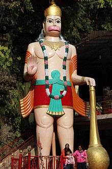 Hanuman Idol at Tapkeshwar Temple
_in_Malsi_Deer_Park_(photo_-_Jim_Ankan_Deka).jpg) An Indian monkey in Malsi Deer Park
An Indian monkey in Malsi Deer Park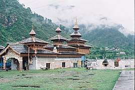 Hanol Temple
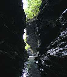 Robbers Cave, Dehradun
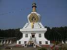
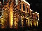
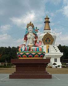
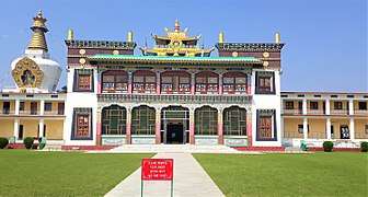 Front view of Buddha Temple Dehradun Uttarakhand
 Santala Devi Temple Dehradun
Transport
Airway
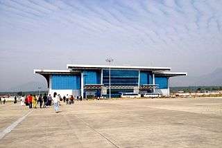
Dehradun is served by Dehradun Airport, also known as Jolly Grant Airport (IATA: DED, ICAO: VIDN), which began its commercial operations in on 30 March 2008. The airport is 27 kilometres (17 mi) from the city centre and lies in Doiwala. The nearest international airport is in New Delhi. As of now Air India, Air India Express, Alliance Air, IndiGo, SpiceJet, and Vistara operate flights from Dehradun to Mumbai, Varanasi, Delhi, Ahmedabad, Jaipur, Allahabad, Bangalore, Hyderabad, Indore, Kolkata and several other cities. Over 1,325,931 passengers passed through the airport in 201–20, making it the 38th busiest airport in India. There is also a helicopter service from Dehradun to Chinyalisour a town in Uttarkashi district and Gauchar.[60][61] There are direct flights from Mumbai and Srinagar and a direct 50-minute flight from Lucknow to Dehradun. The airport is to be developed as an international airport.[62]
Railway
Dehradun railway station is the city's largest train station. Part of the Northern Railways (NR) zone, railway station was established in year 1899 by Britishers, it is the last station on the Northern railway line in the area. Some of the important express trains operating from the Dehradun Junction railway station are Dehradun Jan Shatabdi Express runs between New Delhi Junction and Dehradun station, the Dehradun Express runs between Bandra Terminus and Dehradun station, the Varanasi Dehradun Express that runs between Varanasi Junction and Dehradun, the Dehradun Amritsar Express, the Doon Express that runs between Dehradun and Howrah Junction a distance of 1,557 kilometres (967 mi), the Mussoorie Express which runs between Dehradun and Delhi Junction, the intra state Kathgodam Express connects Kathgodam and Dehradun, the Nanda Devi Express connects Kota Junction to Dehradun, and the Kochuveli Dehradun Superfast Express which runs over a distance of 3,459 kilometres (2,149 mi) and connects with Kochuveli, serving the 9 states of Kerala, Karnataka, Goa, Maharashtra, Gujarat, Rajasthan, Delhi, Uttar Pradesh & Uttarakhand. The Indian Railway Stations Development Corporation (IRSDC) is working on the redevelopment of existing railway stations to turn them into world-class travel hubs.
Roads
Dehradun lies on National Highway 7, which connects it to states Punjab, Haryana, Himachal Pradesh. There are two sets of major roads in Dehradun city, one along NE-SW (Rajpur main road) and the other along NW-SE (Raipur, Kaulagarh and Chakrata) directions and they in turn are connected to other minor road network. The road density is high in the central part of the city around bus stand and railway station. The Uttarakhand Transport Corporation (UTC), a public sector passenger road transport corporation is a major constituent of the transport system in Uttarakhand operates intracity and intercity bus service. There are also private transport operators operating approximately 3000 buses on non-nationalised routes along with a few interstate routes. Other modes of travel for local inter-city transportation are public transportation buses, auto rickshaws, cycle rickshaws and Vikram vehicles (often blamed for pollution and noise).
Culture
After becoming the capital, there has been continuous growth in education, communication and transport. As the state capital, Dehradun is home to many government institutions.
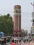
Buses are identified with blue bars. There are autorickshaws which are often used for transportation but blamed for pollution and noise. The evening buzz of Rajpur road is an attraction. The city centre is easily recognised by the Clock Tower (Ghanta Ghar), a structure with six functioning clocks. The statue of San Dijen placed in Shanti Niketan contributes to the beauty of the city. Dehradun has been home to artists and writers including Stephen Alter, Nayantara Sahgal, Allan Sealy, Ruskin Bond and also to country singer Bobby Cash.
Dehradun was home to freedom fighters whose names are engraved in gold on the Clock Tower. It was called "The Gray City" in the initial days because ex-Army officers and VIPs considered this place ideal for residence after retirement.[63]
Woolen blankets are typical of this region and worn by people living at high altitude. Women wear saris with full-sleeve blouses along with angora jackets. Girls wear full skirts with scarfs covering their head and shoulders; more recently, they have adopted modern wear like salwar suits. In villages and to a lesser extent in towns, men wear the traditional dhoti, angarakha and langoti. The way dhotis are worn represents backgrounds and castes: short dhotis represent low status whereas long dhotis represent high. It is more common in urban areas for men to wear shirts and trousers, jeans and kurta-pyjamas. In winter, men usually dress in jackets, hats and overcoats. Hemp is grown in great quantities in this region, so its yarn is frequently used as lining.
There are fairs (melas) throughout the year. Notable fairs include Magh Mela, held on 14 January and Jhanda Mela in March, a fair for the Hindu community, that attracts Hindus from all over India and abroad.
Media
Most of the media houses in Uttarakhand are based in Dehradun. Among Dehradun's widely circulated Hindi-language newspapers are Dainik Tribune, Shah Times, Uttarakhand Aaj, Dainik Jagran, Gorkha Sandesh, Hindustan Rashtriya Sahara, Divya Himgiri, and Amar Ujala. The Dehradun Street and The Garhwal Post are two major English-language newspapers that are produced and published from the city. Other popular English-language newspapers published and sold in Dehradun include The Himachal Times, Deccan Herald, The Times of India, and Hindustan Times.
All India Radio, the national state-owned radio broadcaster, has AM radio stations in the city. All India Radio also airs an FM radio station known as AIR North. Dehradun has five FM stations including, AIR Dehradun, Radio Dehradun (community radio station), Red FM 93.5, Radio Zindagee, Hello Doon (NIVH) and Himagiri Ki Awaaz.[64] There is a Doordarshan Kendra in the city and provides state-owned free-to-air terrestrial channel DD Uttarakhand. A a mix of Hindi, English, and other regional channels are accessible via cable subscription, direct-broadcast satellite service or Internet-based television. Direct-to-Home (DTH) entertainment services in Dehradun include Videocon d2h, DD Direct+, Dish TV, Reliance Digital TV, Airtel digital TV and Tata Sky.
Sport
The high mountains and rivers of Uttarakhand attract many tourists and adventure seekers. It is also a favourite destination for adventure sports, such as paragliding, sky diving, rafting and bungee jumping.[65] The first indoor ice rink in India that meets the size requirements for ice hockey, figure skating, short track and rink bandy was built in Dehradun.[56]
As in the rest of India, cricket is popular among city youth and is played on grounds. Cricket Association of Uttarakhand, which regulates cricket in Uttarakhand, is also based in the city. The multi-purpose Rajiv Gandhi International Cricket Stadium, which has a capacity of 20,000 as of 2016, is the first international level stadium in the state.[33] It is home to the Uttarakhand cricket team and Afghanistan cricket team. A Mega Sports Complex is situated in the Raipur area of Dehradun.
Since, the formation of the state in 2000, the state suffered a blow to its sport facilities as Uttar Pradesh had the entire infrastructure for sports. Uttarakhand had hosted very few matches of Ranji Trophy. Due to lack of infrastructure the player started moving to different states. In November 2012, Former Chief Minister of Uttarakhand Vijay Bahuguna laid the foundation of the stadium hoped that the stadium would bring Dehradun on the international cricket map. On 16 December 2016, Chief Minister Harish Rawat inaugurated the stadium along with Rajeev Shukla (the IPL chairperson). The stadium has a seating capacity of 25,000 people, along with flood lights facility for conducting day-night matches. The stadium is built on a 23-acre site and was selected as the second home ground for the Afghanistan cricket team in India.
Some Other Cricket Grounds are:
- Doon School Ground
- RIMC Cricket Ground
- Abhimanyu Cricket Academy Ground
- MPSC Cricket Ground
- Rangers College Cricket Ground
- Survey of India Cricket Ground
- Doon Cricket Academy Ground
- Tanush Cricket Academy Ground
Architecture
After Dehradun was made the capital of Uttarakhand, there was a construction boom, especially in residential property. Modern buildings have gradually supplanted older architectural styles including those related to the British colonial rule of India. Important older buildings still upstanding include the Clock Tower, Forest Research Institute, CNI College, Morrison Memorial Church, Inamullah Building, Jama Masjid, Osho Meditation Centre, Indian Military Academy and Darbar Sahib.
People from Dehradun
- Amardeep Jha (Indian film actress)
- Anirudh Dave (Indian television actor)
- Anirudh Agarwal (Actor)
- Ali Abbas Zafar (Indian film director)
- Archana Puran Singh (Indian television presenter)
- Asha Negi (Indian television actress)
- Deepa Sahi (Indian actress)
- Deepak Dobriyal (Indian film actor)
- Hemant Pandey (Film actor)
- Himani Shivpuri (Indian actress)
- Jubin Nautiyal (Indian Playback Singer)
- K. N. Singh (Character actor)
- Madhurima Tuli (Indian actress)
- Nirmal Pandey (Indian actor)
- Nitin Sahrawat (Actor,Environmentalist)
- Raghav Juyal (Indian dancer)
- Saira Banu (Indian film actress)
- Shivangi Joshi (Indian television actress)
- Sonam Bisht ( Indian Television Actress)
- Sudhanshu Pandey (Indian model)
- Tom Alter (Indian actor)
- Udita Goswami (Indian actress)
- Vikas Gupta (Producer and Bigg Boss contestant)
- Vir Das (Indian actor)
- Anirudh Thapa (Indian football player)
See also
| Wikimedia Commons has media related to Dehradun. |
| Wikivoyage has a travel guide for Dehradun. |
- Dehradun Municipal Corporation
- List of cities in Uttarakhand and Himachal Pradesh by population
- Garhwal Division
- Doiwala
- Haridwar
- Roorkee
- Rishikesh
References
- Jha, Prashant (12 May 2019). "DMC to start registration of cattle in Dehradun | Dehradun News - Times of India". The Times of India. Retrieved 9 October 2019.
- "Provisional Population Totals, Census of India 2011; Cities having population 1 lakh and above" (PDF). Office of the Registrar General & Census Commissioner, India. Retrieved 26 March 2012.
- "Provisional Population Totals, Census of India 2011; Urban Agglomerations/Cities having population 1 lakh and above" (PDF). Office of the Registrar General & Census Commissioner, India. Retrieved 26 March 2012.
- "52nd REPORT OF THE COMMISSIONER FOR LINGUISTIC MINORITIES IN INDIA" (PDF). nclm.nic.in. Ministry of Minority Affairs. p. 47. Archived from the original (PDF) on 25 May 2017. Retrieved 16 January 2019.
- "Sanskrit is second official language in Uttarakhand". Hindustan Times. 19 January 2010. Retrieved 28 January 2020.
- "Sanskrit second official language of Uttarakhand". The Hindu. 21 January 2010. Retrieved 28 January 2020.
- Vohra, Akshita. "Dera Doon Restorations". timesofindia. Retrieved 5 October 2019.
- Chopra, Jaskiran. "Ram Rais Dera". dailypioneer.com. Retrieved 5 October 2019.
- "Dehra". Encyclopædia Britannica. 7. 1911.
- History of Dehradun
- Natural Resource Management By B. W. Pandey (ed. By) Page 226 ISBN 81-7099-986-3 Mittal Publications, India Language English (31 March 2005)
- The History of Sikh Gurus ISBN 81-8382-075-1 page 112 Chapter 8
- "A Brief History of Dehradun". District Institute of Education and Training, Dehradun. Archived from the original on 19 May 2007.
- "How Nehru spent his last four days". Mid-day.com. Retrieved 8 December 2014.
- "Tracing Doon's Afghan connect - Times of India". The Times of India.
- Myths and Realities of Security & Public Affairs https://books.google.com/books?id=AJUkBQAAQBAJ&pg=PA195&dq=afghanistan+dehradun&hl=en&sa=X&ved=0ahUKEwjAnsnu0ufZAhWP2VMKHZDeCFgQ6AEISzAG#v=onepage&q=afghanistan%20dehradun&f=false
- Malalai Joan of Arc of Afghanistan and the Victors of Maiwand: The Second Anglo-Afghan War 1878-1882https://books.google.com/books?id=9ZsuDgAAQBAJ&pg=PT184&dq=afghanistan+dehradun&hl=en&sa=X&ved=0ahUKEwjAnsnu0ufZAhWP2VMKHZDeCFgQ6AEIKTAA#v=onepage&q=afghanistan%20dehradun&f=false
- "The Tribune, Chandigarh, India - Dehradun Plus". www.tribuneindia.com.
- "Tagore's 'Kabuliwala' has given us a brand: Afghan President Ashraf Ghani". 28 April 2015.
- "Dehradun likely to be Afghanistan's second home ground - Times of India". The Times of India.
- "Altitude". Dehradun. Archived from the original on 2 June 2008. Retrieved 26 March 2011.
- "Important District Indicators". Dehradun. Archived from the original on 21 July 2011. Retrieved 26 March 2011.
- "Cold Wave Claims 29 Lives in North India". Outlook india.com. 8 January 2013. Archived from the original on 13 December 2013. Retrieved 8 December 2014.
- "Station: Dehra Dun Climatological Table 1981–2010" (PDF). Climatological Normals 1981–2010. India Meteorological Department. January 2015. pp. 233–234. Archived from the original (PDF) on 5 February 2020. Retrieved 15 February 2020.
- "Extremes of Temperature & Rainfall for Indian Stations (Up to 2012)" (PDF). India Meteorological Department. December 2016. p. M25. Archived from the original (PDF) on 5 February 2020. Retrieved 15 February 2020.
- Government of India. "2011 Census". Census of India. Retrieved 26 August 2015.
- "Census India, 2001, Religious composition by district". Retrieved 12 May 2015.
- "Census of India Website : Office of the Registrar General & Census Commissioner, India". censusindia.gov.in. Retrieved 28 August 2018.
- "Nagrika - What is a City Government?". Nagrika. Retrieved 29 June 2020.
- "Understanding Water Flows in Dehradun" (PDF). Development Alternatives. Retrieved 7 June 2020.
- Bhushan, Ranjit. "Counter Magnets of NCR". Mydigitalfc.com. Retrieved 1 September 2010.
- Shekhawat, Rahul Singh (3 May 2019). "Uttarakhand healthcare crisis: Citizens face shortage of doctors, crumbling infrastructure as BJP's PPP model fails to deliver". Firstpost. Network 18. Retrieved 6 June 2020.
- "4930-rajiv-gandhi-international-cricket-stadium-dehradun-uttarakhand". Archived from the original on 3 March 2016. Retrieved 9 July 2014.
- "Robber's Cave (Guchhupani)". Dehradun. Archived from the original on 14 December 2007.
- Singh, Surendra (1995). Urbanization in Garhwal Himalaya: a geographical interpretation. M.D. Publications. p. 27. ISBN 81-85880-69-7.
- "Robbers Cave". MapsofIndia.com.
- "Tapkeshwar Temple Dehradun - How to Reach Tapkeshwar Mahadev Mandir". www.euttaranchal.com.
- Joshi, Bhartendu (15 March 2018). "FRI or Forest Research Institute". Bugyal Valley.
- UCOST, Uttarakhand. "Regional Science Center". ucost.in/blog/rsc/. Retrieved 8 January 2019.
- "St. Joseph Academy". St. Joseph Academy. Retrieved 7 March 2019.
- "Kendriya Vidyalayas in Dehradun - KVs in Dehradun - Kendriya Vidyalaya". euttaranchal.com. 19 March 2013. Retrieved 13 September 2018.
- "National Institute for Empowerment of People with Visual Disabilities" (in German).
- "Post Graduate Professional Certificate Course in Special Education Distance Education Programme (PGPC-SEDE)". Rehabilitation Council of India. Archived from the original on 23 February 2011. Retrieved 26 March 2011.
- "Latika Roy Foundation". Latikaroy.org. Retrieved 8 December 2014.
- "Home Tuition – Home". Askfound.org. Archived from the original on 16 July 2014. Retrieved 8 December 2014.
- "STPI homepage". Dehradun.stpi.in. Archived from the original on 27 December 2014. Retrieved 8 December 2014.
- "Dehradun Map". MapsofIndia.com. Retrieved 30 January 2018.
- न्यूज डेस्क (16 January 2019). "उत्तराखंड: यहां 50 एकड़ जमीन पर बनेगी फिल्म सिटी, शूटिंग के लिए मिलेंगी बेहतर लोकेशन" (in Hindi). Amar Ujala. Retrieved 17 January 2019.
- "Dehradun Attractions – Things to do in Dehradun". Dehradunlive.in. Archived from the original on 17 February 2015. Retrieved 17 February 2015.
- "Laxman Siddha Temple Dehradun - How To Reach Laxman Siddh Temple". euttaranchal.com. Retrieved 4 May 2016.
- "Shiv Mandir Kuthal Gate Mussoorie Road Dehradun - Prakasheswar Mahadev Temple Dehradun". euttaranchal.com. Retrieved 4 May 2016.
- "Sai Mandir Rajpur Road Dehradun - How To Reach Sai Darbar Temple". euttaranchal.com. Retrieved 4 May 2016.
- Central Braille Press – the first braille printing press of India Archived 27 September 2013 at the Wayback Machine, Withjim.in
- "इनका आकर्षण है खास" [They have special charm] (in Hindi). देहरादूनएक्सकर्शन्स [Dehradun Expresscans]. Archived from the original on 2 June 2008. Retrieved 26 March 2011.
- "Namaste Dehradun-Natural Beauty of Dehradun – Namaste Dehradun". Namastedehradun.com. Retrieved 8 December 2014.
- Sandeep Rana. "Nation's biggest ice-skating rink draws players from across country". Archived from the original on 24 May 2013.
- "First ice arena for India". 19 March 2010. Archived from the original on 17 December 2013.
- "STATISTICS". IIHF. Retrieved 8 December 2014.
- What Is Hinduism? - Maa Bala Sundari. HINDUISM TODAY Magazine. 2007. ISBN 9781934145272.
- https://www.timesnownews.com/india/article/uttarakhand-helicopter-service-dehradun-to-uttarkashi-heli-service/551018
- https://timesofindia.indiatimes.com/city/dehradun/gauchar-chinyalisaur-to-be-air-connected-with-doon-in-feb/articleshow/73814419.cms
- https://timesofindia.indiatimes.com/city/dehradun/jolly-grant-to-be-developed-as-intl-airport/articleshow/71746200.cms
- "देहरादून" [Dehradun] (in Hindi). Archived from the original on 21 September 2008. Retrieved 26 March 2011.
- "Dehradun radio stations". ASIAWAVES: Radio and TV Broadcasting in South and South-East Asia. Retrieved 9 June 2020.
- "The Tribune, Chandigarh, India : Latest news, India, Punjab, Chandigarh, Haryana, Himachal, Uttarakhand, J&K, sports, cricket". Archived from the original on 24 May 2013. Retrieved 6 May 2015.