Laurens County, South Carolina
Laurens County is a county located in the U.S. state of South Carolina. As of the 2010 census, its population was 66,537.[1] Its county seat is Laurens.[2]
Laurens County | |
|---|---|
 Laurens County Courthouse in February 2012 | |
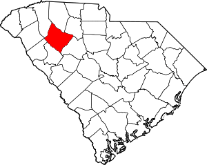 Location within the U.S. state of South Carolina | |
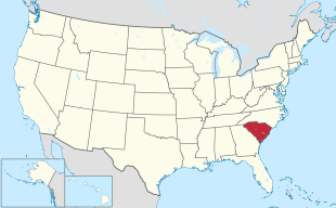 South Carolina's location within the U.S. | |
| Coordinates: 34°29′N 82°01′W | |
| Country | |
| State | |
| Founded | 1785 |
| Seat | Laurens |
| Largest city | Laurens |
| Area | |
| • Total | 724 sq mi (1,880 km2) |
| • Land | 714 sq mi (1,850 km2) |
| • Water | 10 sq mi (30 km2) 1.4%% |
| Population (2010) | |
| • Total | 66,537 |
| • Estimate (2018) | 66,994 |
| • Density | 92/sq mi (35/km2) |
| Time zone | UTC−5 (Eastern) |
| • Summer (DST) | UTC−4 (EDT) |
| Congressional district | 3rd |
| Website | www |
Laurens County is included in the Greenville-Anderson-Mauldin, SC Metropolitan Statistical Area.
History
Laurens County was formed in 1785. It was named after Henry Laurens, the fifth president of the Continental Congress.
One of nine modern counties of the Colonial Ninety-Six District, Laurens County hosted more "official" (i.e. officially recognized and contemporaneously documented by competent governments) battles than did half of the original colonies. The Battle of Musgrove Mill was the first time during the American Revolution that regular soldiers of Great Britain were defeated in battle by militia.
Those battles in modern Laurens County were:
- Fort Lindley/Lindler
- Widow Kellet's Block House
- Musgrove's Mill
- Farrow's Station
- Duncan Creek Meeting House
- Indian Creek
- Hammond's Store
- Fort Williams (not to be confused with Williamson's fort some 25 miles south in Greenwood County)
- Cedar Springs (begun in Cross Anchor SC, then an old-fashioned "Hoss Chase" of fifty eight miles through four counties and ended in NC after about 30 hours!)
- Mud Lick Creek
- Hayes' Station. (Joe Goldsmith, State Historian, SC Soc., Sons of the American Revolution)
Geography
According to the U.S. Census Bureau, the county has a total area of 724 square miles (1,880 km2), of which 714 square miles (1,850 km2) is land and 10 square miles (26 km2) (1.4%) is water.[3]
Adjacent counties
- Spartanburg County - north
- Union County - northeast
- Newberry County - southeast
- Greenwood County - south
- Abbeville County - southwest
- Anderson County - west
- Greenville County - northwest
Major highways
.svg.png)
.svg.png)


National protected area
- Sumter National Forest (part)
Demographics
| Historical population | |||
|---|---|---|---|
| Census | Pop. | %± | |
| 1790 | 9,337 | — | |
| 1800 | 12,809 | 37.2% | |
| 1810 | 14,982 | 17.0% | |
| 1820 | 17,682 | 18.0% | |
| 1830 | 20,863 | 18.0% | |
| 1840 | 21,584 | 3.5% | |
| 1850 | 23,407 | 8.4% | |
| 1860 | 23,858 | 1.9% | |
| 1870 | 22,536 | −5.5% | |
| 1880 | 29,444 | 30.7% | |
| 1890 | 31,610 | 7.4% | |
| 1900 | 24,311 | −23.1% | |
| 1910 | 26,650 | 9.6% | |
| 1920 | 42,560 | 59.7% | |
| 1930 | 42,094 | −1.1% | |
| 1940 | 44,185 | 5.0% | |
| 1950 | 46,974 | 6.3% | |
| 1960 | 47,609 | 1.4% | |
| 1970 | 49,713 | 4.4% | |
| 1980 | 52,214 | 5.0% | |
| 1990 | 58,092 | 11.3% | |
| 2000 | 69,567 | 19.8% | |
| 2010 | 66,537 | −4.4% | |
| Est. 2018 | 66,994 | [4] | 0.7% |
| U.S. Decennial Census[5] 1790-1960[6] 1900-1990[7] 1990-2000[8] 2010-2013[1] | |||
2000 census
As of the census[9] of 2000, there were 69,567 people, 26,290 households, and 18,876 families living in the county. The population density was 97 people per square mile (38/km²). There were 30,239 housing units at an average density of 42 per square mile (16/km²). The racial makeup of the county was 71.57% White, 26.23% Black or African American, 0.28% Native American, 0.15% Asian, 0.05% Pacific Islander, 0.95% from other races, and 0.78% from two or more races. 1.94% of the population were Hispanic or Latino of any race.
There were 26,290 households out of which 32.50% had children under the age of 18 living with them, 51.10% were married couples living together, 15.60% had a female householder with no husband present, and 28.20% were non-families. 24.60% of all households were made up of individuals and 9.80% had someone living alone who was 65 years of age or older. The average household size was 2.55 and the average family size was 3.01.
In the county, the population was spread out with 25.30% under the age of 18, 9.20% from 18 to 24, 28.50% from 25 to 44, 23.80% from 45 to 64, and 13.20% who were 65 years of age or older. The median age was 36 years. For every 100 females, there were 93.60 males. For every 100 females age 18 and over, there were 89.70 males.
The median income for a household in the county was $33,933, and the median income for a family was $39,739. Males had a median income of $30,402 versus $21,684 for females. The per capita income for the county was $15,761. About 11.60% of families and 14.30% of the population were below the poverty line, including 19.60% of those under age 18 and 13.50% of those age 65 or over.
As of December 2017, the county unemployment rate was 4.4%.[10]
2010 census
As of the 2010 United States Census, there were 66,537 people, 25,525 households, and 17,707 families living in the county.[11] The population density was 93.2 inhabitants per square mile (36.0/km2). There were 30,709 housing units at an average density of 43.0 per square mile (16.6/km2).[12] The racial makeup of the county was 70.4% white, 25.4% black or African American, 0.3% Asian, 0.2% American Indian, 0.1% Pacific islander, 2.3% from other races, and 1.3% from two or more races. Those of Hispanic or Latino origin made up 4.1% of the population.[11] In terms of ancestry, 11.8% were American, 9.8% were Irish, 9.6% were German, and 8.8% were English.[13]
Of the 25,525 households, 32.9% had children under the age of 18 living with them, 46.6% were married couples living together, 17.2% had a female householder with no husband present, 30.6% were non-families, and 26.1% of all households were made up of individuals. The average household size was 2.51 and the average family size was 3.00. The median age was 39.9 years.[11]
The median income for a household in the county was $37,529 and the median income for a family was $45,769. Males had a median income of $36,807 versus $26,799 for females. The per capita income for the county was $18,757. About 14.1% of families and 19.2% of the population were below the poverty line, including 31.0% of those under age 18 and 14.6% of those age 65 or over.[14]
Education
There are three public school districts in the county. Laurens County District 55 covers what is generally the northeastern half of the county while District 56 covers the southwestern half. The Ware Shoals area is covered by the multi-county Greenwood County District 51. There are two public high schools in the county: Laurens (in Dist. 55) and Clinton (in Dist. 56.)
Public K-12 education includes Hickory Tavern Elementary, Ford Elementary, Gray Court-Owings, E.B. Morse, Hickory Tavern Middle, Laurens Middle, and Sanders Middle.
Private K-12 education includes Laurens Academy.
Presbyterian College, located in Clinton, is a four-year liberal-arts school founded in 1880.
Politics
During the 1870 South Carolina gubernatorial election, Joseph Crews was a county election commissioner in Laurens County, and in that capacity had ordered all ballot boxes to be set up in the county seat. This disadvantaged rural voters, but enabled him and the state militia to oversee the election process and to mobilize black voters. However, armed whites attacked the black militia and disarmed them; some were wounded, others murdered. "Like companies of Confederate cavalry", "heavily armed whites" pushed away black voters--until Federal troops came from twenty miles away, with Crews, and took the ballot boxes.[15] but was murdered by Democrats[16] in the run-up to the 1876 South Carolina gubernatorial election.[15]
Until 1948, Laurens County was a Democratic Party stronghold similar to the rest of the Solid South, with Democratic presidential candidates receiving near-unanimous margins of victory in most years. The twenty years from 1948 to 1968 were a highly transitional time for the politics of South Carolina & Laurens County, largely in part due to the Democratic Party's increasing support for African-American civil rights & enfranchisement. South Carolinian Dixiecrat Strom Thurmond won the county in 1948, while Democrats won it back from 1952-1960. Barry Goldwater's opposition to the Civil Rights Act led the county to turn Republican for the first time ever in 1964, which it remained for Richard Nixon's two electoral victories. The county flipped back to the Democratic column to support Jimmy Carter from neighboring Georgia in 1976 & 1980, the last Democrat to win the county. From 1984 on, the county has been consistently Republican in presidential elections, often by wide margins of victory.
| Year | Republican | Democratic | Third parties |
|---|---|---|---|
| 2016 | 63.3% 16,816 | 33.5% 8,889 | 3.2% 861 |
| 2012 | 58.0% 14,746 | 40.6% 10,318 | 1.4% 352 |
| 2008 | 58.3% 15,334 | 40.3% 10,578 | 1.4% 370 |
| 2004 | 60.7% 14,466 | 38.6% 9,205 | 0.7% 158 |
| 2000 | 59.3% 12,102 | 38.8% 7,920 | 1.9% 388 |
| 1996 | 48.7% 8,057 | 42.6% 7,055 | 8.7% 1,435 |
| 1992 | 48.5% 8,347 | 38.6% 6,638 | 12.9% 2,215 |
| 1988 | 62.0% 9,731 | 37.8% 5,930 | 0.3% 41 |
| 1984 | 64.5% 9,729 | 35.2% 5,312 | 0.3% 45 |
| 1980 | 42.8% 6,036 | 55.7% 7,856 | 1.4% 201 |
| 1976 | 41.3% 5,300 | 58.0% 7,440 | 0.7% 91 |
| 1972 | 74.5% 8,141 | 24.2% 2,650 | 1.3% 142 |
| 1968 | 39.8% 4,813 | 24.9% 3,016 | 35.3% 4,279 |
| 1964 | 53.8% 5,081 | 46.2% 4,365 | |
| 1960 | 42.1% 3,299 | 58.0% 4,547 | |
| 1956 | 20.7% 1,377 | 56.1% 3,726 | 23.2% 1,545 |
| 1952 | 47.9% 3,400 | 52.1% 3,697 | |
| 1948 | 2.6% 69 | 19.5% 513 | 77.9% 2,047 |
| 1944 | 1.8% 38 | 93.4% 1,924 | 4.8% 98 |
| 1940 | 1.5% 40 | 98.5% 2,697 | |
| 1936 | 0.4% 13 | 99.6% 3,069 | |
| 1932 | 0.5% 13 | 99.4% 2,750 | 0.1% 4 |
| 1928 | 2.2% 44 | 97.6% 1,989 | 0.2% 4 |
| 1924 | 0.3% 6 | 99.5% 2,105 | 0.2% 4 |
| 1920 | 1.5% 35 | 98.5% 2,263 | |
| 1916 | 0.7% 14 | 98.7% 1,895 | 0.6% 12 |
| 1912 | 0.4% 6 | 98.5% 1,566 | 1.1% 18 |
| 1904 | 2.7% 50 | 97.2% 1,779 | 0.1% 1 |
| 1900 | 1.9% 30 | 98.1% 1,540 |
2016 presidential election
| Party | Candidate | Votes | % | |
|---|---|---|---|---|
| Republican | Donald Trump | 16,770 | 63.3% | |
| Democratic | Hillary Clinton | 8,845 | 33.4% | |
| Libertarian | Gary Johnson | 373 | 1.4% | |
| Independent | Evan McMullin | 200 | 0.8% | |
| Green | Jill Stein | 124 | 0.5% | |
| Constitution | Darrell Castle | 122 | 0.5% | |
| American | Peter Skewes | 40 | 0.2% | |
| Total votes | 26,474 | 100% | ||
Communities
Cities
- Clinton
- Fountain Inn (mostly in Greenville County)
- Laurens (county seat)
Towns
- Cross Hill
- Gray Court
- Ware Shoals (mostly in Greenwood, partly in Abbeville Counties)
- Waterloo
Census-designated places
Unincorporated communities
- Barksdale
- Hickory Tavern
- Kinards (partly in Newberry County)
- Madden
- Owings
Notable people
- James Adair, (c.1709–c.1783), historian, resided in Laurens County in later life.[18]
- Andrew Johnson, 17th President of the United States, worked as a tailor in Laurens during the 1820s.
- William Y. Thompson (born 1922), historian, resided in Clinton from 1950-1955.
- William Dunlap Simpson, 78th Governor of South Carolina and Chief Justice of the South Carolina Supreme Court from 1880-1890.
- Pat Cannon, United States Representative from Florida; raised in Laurens County.[19]
- Matthew Nelson (born 1986). Fastest one-legged 400m tractor pull.
See also
References
- "State & County QuickFacts". United States Census Bureau. Archived from the original on June 6, 2011. Retrieved November 25, 2013.
- "Find a County". National Association of Counties. Retrieved 2011-06-07.
- "2010 Census Gazetteer Files". United States Census Bureau. August 22, 2012. Retrieved March 18, 2015.
- "Population and Housing Unit Estimates". Retrieved July 30, 2019.
- "U.S. Decennial Census". United States Census Bureau. Retrieved March 18, 2015.
- "Historical Census Browser". University of Virginia Library. Retrieved March 18, 2015.
- Forstall, Richard L., ed. (March 27, 1995). "Population of Counties by Decennial Census: 1900 to 1990". United States Census Bureau. Retrieved March 18, 2015.
- "Census 2000 PHC-T-4. Ranking Tables for Counties: 1990 and 2000" (PDF). United States Census Bureau. April 2, 2001. Retrieved March 18, 2015.
- "U.S. Census website". United States Census Bureau. Retrieved 2011-05-14.
- "Monthly Unemployment Rates Ranked By County". www.eascinc.com. Retrieved 2018-03-13.
- "DP-1 Profile of General Population and Housing Characteristics: 2010 Demographic Profile Data". United States Census Bureau. Archived from the original on 2020-02-13. Retrieved 2016-03-11.
- "Population, Housing Units, Area, and Density: 2010 - County". United States Census Bureau. Archived from the original on 2020-02-13. Retrieved 2016-03-11.
- "DP02 SELECTED SOCIAL CHARACTERISTICS IN THE UNITED STATES – 2006-2010 American Community Survey 5-Year Estimates". United States Census Bureau. Archived from the original on 2020-02-13. Retrieved 2016-03-11.
- "DP03 SELECTED ECONOMIC CHARACTERISTICS – 2006-2010 American Community Survey 5-Year Estimates". United States Census Bureau. Archived from the original on 2020-02-13. Retrieved 2016-03-11.
- Ginsberg, Benjamin (April 12, 2010). Moses of South Carolina: A Jewish Scalawag during Radical Reconstruction. JHU Press. pp. 71, 102–103, 133, 136 – via Google Books.
- Bellesiles, Michael A. (2010). 1877: America's Year of Living Violently. The New Press. p. 31. ISBN 9781595585943.
- Leip, David. "Dave Leip's Atlas of U.S. Presidential Elections". uselectionatlas.org. Retrieved 2018-03-13.
- Who Was Who in America, Historical Volume, 1607-1896. Chicago: Marquis Who's Who. 1963.
- "Cannon, Arthur Patrick (Pat), (1904 - 1966)". Biographical Directory of the United States Congress. Retrieved September 4, 2012.
External links


- Laurens County website Portal style website, Government, Business, Library, Recreation and more
- Laurens County Economic Development and Chamber of Commerce
- ACCESS 15, Laurens County Public, educational, and government access (PEG) cable TV channel
- Laurens County, South Carolina DNA Project
- Selected Historical Information about Laurens County
- City-Data.com Comprehensive Statistical Data and more about Laurens County
- Laurens County History and Images
Places adjacent to Laurens County, South Carolina | ||||||||||
|---|---|---|---|---|---|---|---|---|---|---|
| ||||||||||
Municipalities and communities of Laurens County, South Carolina, United States | ||
|---|---|---|
| Cities | Map of South Carolina highlighting Laurens County | |
| Towns | ||
| CDPs | ||
| Unincorporated communities | ||
| Footnotes | ‡This populated place also has portions in an adjacent county or counties | |
| Authority control |
|
|---|