Ladson, South Carolina
Ladson is a census-designated place (CDP) in Berkeley, Charleston and Dorchester counties in the U.S. state of South Carolina. The population was 13,790 at the 2010 census.[3] It is named in honour of the Ladson family, one of the oldest planter and merchant families in the Charleston area; one of its members was lieutenant governor James Ladson.
Ladson, South Carolina | |
|---|---|
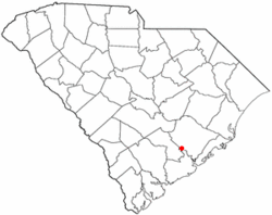 Location of Ladson, South Carolina | |
| Coordinates: 33°0′34″N 80°6′20″W | |
| Country | United States |
| State | South Carolina |
| Counties | Berkeley, Charleston, Dorchester |
| Area | |
| • Total | 7.0 sq mi (18.2 km2) |
| • Land | 7.0 sq mi (18.2 km2) |
| • Water | 0.0 sq mi (0.0 km2) |
| Elevation | 49 ft (15 m) |
| Population (2010) | |
| • Total | 13,790 |
| • Density | 1,963/sq mi (758.1/km2) |
| Time zone | UTC−5 (Eastern (EST)) |
| • Summer (DST) | UTC−4 (EDT) |
| ZIP code | 29456 |
| Area code(s) | 843, 854 |
| FIPS code | 45-39220[1] |
| GNIS feature ID | 1246274[2] |
Geography
Ladson is located in southwestern Berkeley County, northern Charleston County, and southeastern Dorchester County at 33°0′34″N 80°6′20″W (33.009563, -80.105553).[4] It is bordered to the southwest by the town of Summerville, to the south by the city of North Charleston, to the east by the city of Goose Creek, and to the northwest by Sangaree, a census-designated place.
U.S. Route 78 and Interstate 26 run parallel through Ladson, with Exit 203 providing access from I-26. Downtown Charleston is 20 miles (32 km) to the southeast, and Columbia is 97 miles (156 km) to the northwest.
According to the United States Census Bureau, the CDP has a total area of 7.0 square miles (18.2 km2), all land. This is a decrease from 8.6 square miles (22.3 km2) at the 2000 census, due to annexations of portions of the area into Summerville and North Charleston.
Demographics
At the 2000 census there were 13,264 people, 4,571 households, and 3,560 families in the CDP. The population density was 1,540.9 people per square mile (594.8/km²). There were 4,863 housing units at an average density of 564.9 per square mile (218.1/km²). The racial makeup of the CDP was 71.70% White, 22.06% African American, 0.97% Native American, 2.04% Asian, 0.07% Pacific Islander, 1.30% from other races, and 1.86% from two or more races. Hispanic or Latino of any race were 2.97%.[1]
Of the 4,571 households 44.3% had children under the age of 18 living with them, 56.4% were married couples living together, 15.8% had a female householder with no husband present, and 22.1% were non-families. 15.9% of households were one person and 3.0% were one person aged 65 or older. The average household size was 2.90 and the average family size was 3.22.
The age distribution was 30% under the age of 18, 9.7% from 18 to 24, 33.7% from 25 to 44, 20.7% from 45 to 64, and 4.9% 65 or older. The median age was 31 years. For every 100 females, there were 99.3 males. For every 100 females age 18 and over, there were 96.4 males.
The median household income was $41,589 and the median family income was $44,726. Males had a median income of $31,290 versus $23,524 for females. The per capita income for the CDP was $16,482. About 7.1% of families and 9.8% of the population were below the poverty line, including 13.5% of those under age 18 and 9.3% of those age 65 or over.
References
- "U.S. Census website". United States Census Bureau. Retrieved 2008-01-31.
- "US Board on Geographic Names". United States Geological Survey. 2007-10-25. Retrieved 2008-01-31.
- "Geographic Identifiers: 2010 Demographic Profile Data (G001): Ladson CDP, South Carolina". U.S. Census Bureau, American Factfinder. Archived from the original on February 12, 2020. Retrieved April 7, 2014.
- "US Gazetteer files: 2010, 2000, and 1990". United States Census Bureau. 2011-02-12. Retrieved 2011-04-23.
Municipalities and communities of Berkeley County, South Carolina, United States | ||
|---|---|---|
| Cities | 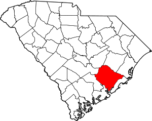 Map of South Carolina highlighting Berkeley County | |
| Towns | ||
| CDPs | ||
| Other unincorporated communities | ||
| Footnotes | ‡This populated place also has portions in an adjacent county or counties | |
Municipalities and communities of Charleston County, South Carolina, United States | ||
|---|---|---|
| Cities | 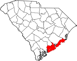 Map of South Carolina highlighting Charleston County | |
| Towns | ||
| CDP | ||
| Unincorporated communities |
| |
| Ghost town | ||
| Footnotes | ‡This populated place also has portions in an adjacent county or counties | |
Municipalities and communities of Dorchester County, South Carolina, United States | ||
|---|---|---|
| City | 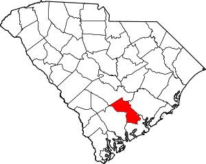 Map of South Carolina highlighting Dorchester County | |
| Towns | ||
| Unincorporated community | ||
| Ghost town | ||
| Footnotes | ‡This populated place also has portions in an adjacent county or counties | |
| Authority control |
|---|