Taylors, South Carolina
Taylors is a census-designated place (CDP) in Greenville County, South Carolina, United States. The population was 21,617 at the 2010 census. Taylors is the Greenville/Spartanburg area's largest suburb although it is not incorporated as a city. It is part of the Greenville–Mauldin–Easley Metropolitan Statistical Area.
Taylors, South Carolina | |
|---|---|
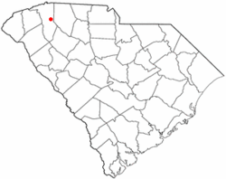 Location of Taylors, South Carolina | |
| Coordinates: 34°54′48″N 82°18′39″W | |
| Country | United States |
| State | South Carolina |
| County | Greenville |
| Government | |
| • Type | Town Administrator: Cory Holtzclaw Esquire |
| Area | |
| • Total | 10.9 sq mi (28.1 km2) |
| • Land | 10.9 sq mi (28.1 km2) |
| • Water | 0.0 sq mi (0.0 km2) |
| Elevation | 932 ft (284 m) |
| Population (2010) | |
| • Total | 21,617 |
| • Density | 1,983.2/sq mi (5,136.5/km2) |
| Time zone | UTC−5 (Eastern (EST)) |
| • Summer (DST) | UTC−4 (EDT) |
| ZIP code | 29687 |
| Area code(s) | 864 |
| FIPS code | 45-71395[1] |
| GNIS feature ID | 1251128[2] |
| Website | https://sites.google.com/view/taylorssc/home |
History
The Southern Bleachery and Print Works in the Taylors Mill was listed on the National Register of Historic Places in 2012.[3]
Geography
Taylors is located at 34°54′48″N 82°18′39″W (34.913236, -82.310817).[4] The Enoree River flows through the community, and during the late nineteenth and early twentieth centuries, Chick Springs served as the focus of a small Upstate South Carolina resort community.
According to the United States Census Bureau, the CDP has a total area of 10.9 square miles (28 km2), all land.
Demographics
| Historical population | |||
|---|---|---|---|
| Census | Pop. | %± | |
| 1950 | 1,518 | — | |
| 1960 | 1,071 | −29.4% | |
| 1970 | 6,831 | 537.8% | |
| 1980 | 15,801 | 131.3% | |
| 1990 | 19,619 | 24.2% | |
| 2000 | 20,125 | 2.6% | |
| 2010 | 21,617 | 7.4% | |
| U.S. Decennial Census | |||
At the 2010 census there were 21,617 people, 7,978 households, and 5,720 families living in the CDP. The population density was 1,853.7 people per square mile (715.5/km²). There were 8,550 housing units at an average density of 787.5 per square mile (304.0/km²). The racial makeup of the CDP was 81.59% White, 14.19% African American, 0.24% Native American, 1.52% Asian, 0.03% Pacific Islander, 1.11% from other races, and 1.31% from two or more races. Hispanic or Latino of any race were 2.91%.[1]
Of the 7,978 households 34.3% had children under the age of 18 living with them, 56.4% were married couples living together, 12.5% had a female householder with no husband present, and 28.3% were non-families. 23.4% of households were one person and 6.2% were one person aged 65 or older. The average household size was 2.52 and the average family size was 2.98.
The age distribution was 25.7% under the age of 18, 8.4% from 18 to 24, 31.5% from 25 to 44, 24.0% from 45 to 64, and 10.4% 65 or older. The median age was 36 years. For every 100 females, there were 93.8 males. For every 100 females age 18 and over, there were 89.4 males.
The median household income was $46,986 and the median family income was $55,241. Males had a median income of $39,458 versus $28,057 for females. The per capita income for the CDP was $21,463. About 6.8% of families and 8.0% of the population were below the poverty line, including 11.2% of those under age 18 and 6.6% of those age 65 or over.
Economy
Taylors is the global headquarters for Fatz, a fast casual Southern food restaurant with 43 locations.
Education
Taylors has a public library, a branch of the Greenville County Library System.[5]
References
- "U.S. Census website". United States Census Bureau. Retrieved 2008-01-31.
- "US Board on Geographic Names". United States Geological Survey. 2007-10-25. Retrieved 2008-01-31.
- "National Register of Historic Places Listings". Weekly List of Actions Taken on Properties: 7/23/12 through 7/27/12. National Park Service. 2012-08-03.
- "US Gazetteer files: 2010, 2000, and 1990". United States Census Bureau. 2011-02-12. Retrieved 2011-04-23.
- "Locations & Hours". Greenville County Library System. Retrieved 8 June 2019.
Municipalities and communities of Greenville County, South Carolina, United States | ||
|---|---|---|
| Cities |  Map of South Carolina highlighting Greenville County | |
| CDPs | ||
| Unincorporated communities | ||
| Footnotes | ‡This populated place also has portions in an adjacent county or counties | |
| Authority control |
|
|---|