Gantt, South Carolina
Gantt is a census-designated place (CDP) in Greenville County, South Carolina, United States. The population was 14,229 at the 2010 census.[3] It is part of the Greenville–Mauldin–Easley Metropolitan Statistical Area and a suburb of the city of Greenville.
Gantt, South Carolina | |
|---|---|
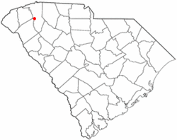 Location of Gantt, South Carolina | |
| Coordinates: 34°46′55″N 82°23′53″W | |
| Country | United States |
| State | South Carolina |
| County | Greenville |
| Area | |
| • Total | 9.93 sq mi (25.72 km2) |
| • Land | 9.91 sq mi (25.67 km2) |
| • Water | 0.02 sq mi (0.04 km2) |
| Elevation | 981 ft (299 m) |
| Population (2010) | |
| • Total | 14,229 |
| • Density | 1,435/sq mi (554.2/km2) |
| Time zone | UTC−5 (Eastern (EST)) |
| • Summer (DST) | UTC−4 (EDT) |
| FIPS code | 45-28375[1] |
| GNIS feature ID | 1222636[2] |
Geography
Gantt is located in west-central Greenville County at 34°46′55″N 82°23′53″W (34.781918, -82.397938).[4] It is bordered to the northeast by the city of Greenville and to the northwest by unincorporated Dunean.
Interstate 85 passes through the center of the community, with access from exits 44 through 46. I-85 leads northeast 30 miles (48 km) to Spartanburg and southwest 140 miles (230 km) to Atlanta. U.S. Route 25 passes through Gantt as White Horse Road, intersecting I-85 at Exit 44. US 25 leads north 6 miles (10 km) to Parker, a western suburb of Greenville, and south 46 miles (74 km) to Greenwood. Downtown Greenville is 6 miles to the north via US 25 and US 29.
According to the United States Census Bureau, the Gantt CDP has a total area of 9.9 square miles (25.7 km2), of which 0.02 square miles (0.04 km2), or 0.16%, are water.[3]
Demographics
At the 2000 census there were 13,962 people, 5,361 households, and 3,854 families living in the CDP. The population density was 1,387.5 people per square mile (535.9/km²). There were 5,793 housing units at an average density of 575.7 per square mile (222.3/km²). The racial makeup of the CDP was 33.86% White, 63.10% African American, 0.14% Native American, 0.34% Asian, 0.05% Pacific Islander, 1.40% from other races, and 1.10% from two or more races. Hispanic or Latino of any race were 3.00%.[1]
Of the 5,361 households 33.5% had children under the age of 18 living with them, 42.6% were married couples living together, 23.4% had a female householder with no husband present, and 28.1% were non-families. 24.1% of households were one person and 6.9% were one person aged 65 or older. The average household size was 2.60 and the average family size was 3.07.
The age distribution was 27.6% under the age of 18, 8.4% from 18 to 24, 28.8% from 25 to 44, 24.0% from 45 to 64, and 11.2% 65 or older. The median age was 36 years. For every 100 females, there were 89.7 males. For every 100 females age 18 and over, there were 84.3 males.
The median household income was $33,811 and the median family income was $39,280. Males had a median income of $31,184 versus $22,028 for females. The per capita income for the CDP was $20,106. About 11.7% of families and 13.9% of the population were below the poverty line, including 18.7% of those under age 18 and 12.1% of those age 65 or over.
References
- "U.S. Census website". United States Census Bureau. Retrieved 2008-01-31.
- "US Board on Geographic Names". United States Geological Survey. 2007-10-25. Retrieved 2008-01-31.
- "Geographic Identifiers: 2010 Demographic Profile Data (G001): Gantt CDP, South Carolina". American Factfinder. U.S. Census Bureau. Retrieved February 14, 2017.
- "US Gazetteer files: 2010, 2000, and 1990". United States Census Bureau. 2011-02-12. Retrieved 2011-04-23.
Municipalities and communities of Greenville County, South Carolina, United States | ||
|---|---|---|
| Cities | 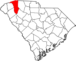 Map of South Carolina highlighting Greenville County | |
| CDPs | ||
| Unincorporated communities | ||
| Footnotes | ‡This populated place also has portions in an adjacent county or counties | |